WSB launches second Opportunity+ cohort

The targeted workforce training and development program aims to diversify AEC industry.

Design and consulting firm WSB today announced that the company has launched its second Opportunity+ cohort. Opportunity+ is the firm’s workforce training and development program designed to prepare participants for long-term careers in the civil engineering industry. The program, first launched in January 2020, is a free and fast-paced training course led by experts at WSB.

“We have a responsibility as leaders in the AEC industry to build diversity and opportunities for all people interested in civil engineering,” said Bret Weiss, WSB’s president and CEO. “I am thrilled to kick-off our next cohort and introduce our participants to the world of construction materials testing and surveying.”

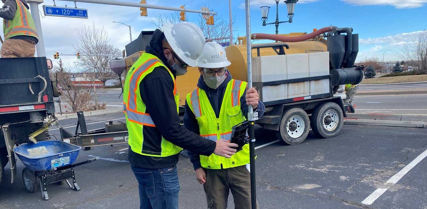
From January through April, eight program participants will receive accelerated training through evening and weekend sessions. The flexible schedule allows participants to continue working during the day while completing the hands-on program. Upon completion of the program, Opportunity+ participants will be trained in surveying and construction materials testing – two high-demand positions in civil engineering.

“Even though my dream was to pursue a career in an engineering-related field, I never had the opportunity after finishing my GED,” said Salvador Santibañez Sánchez, a member of this year’s Opportunity+ cohort. “I’m ready for a career change and I see this training as a great opportunity to put me on the right path of what I believe is my true calling, where I can use my skills and learn new ones.”

Nine cohort members completed the first Opportunity+ training class and received their certificates. WSB hired two program participants from the first Opportunity+ cohort. Through hiring partners and WSB’s own hiring practices, the intent is to place every cohort participant interested in pursuing a career in civil engineering following completion of the program.

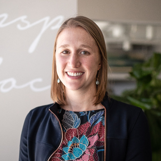
“I’m looking forward to launching our second cohort not only to help provide access to rewarding careers in the industry, but also to continue our efforts to build a more diverse workforce,” said Laura Rescorla, WSB engineer and program manager of Opportunity+. “It’s been a rewarding experience and we have another impressive cohort eager to explore new possibilities that may not have been accessible to them in the past.”

Program partners include Emerge Community Development, Eastside Employment xChange, City of Minneapolis, City of Saint Paul, Hennepin County and Ramsey County.

US Fish and Wildlife Service decide listing monarch butterfly is “warranted but precluded”

By Roxy Robertson, Environmental Scientist, WSB

The United States Fish and Wildlife Service (USFWS) recently announced their decision to list the monarch butterfly under the Endangered Species act is “warranted but precluded”. The USFWS will not issue a proposed rule to list the monarch officially until 2024 due to insufficient funding and personnel. The listing will be evaluated annually to determine its eligibility and listing decision may be expedited under a new administration.

What does the USFWS decision mean?
  • The “warranted but precluded” decision means that the USFWS has determined the monarch butterfly meets the definition of a threatened or endangered species, but the agency lacks the resources to take further action to list the species at this time.
  • Since monarch butterflies still face threats and decline, there is a strong likelihood that monarch conservationists will challenge and litigate the decision.
  • If litigation occurs, the USFWS could be ordered to prioritize the listing prior to 2024. This could result in a listing of the species within a short timeframe. If this occurs, partners enrolled in the Candidate Conservation Agreement for Monarch Butterfly on Energy and Transportation Lands (CCAA) are protected against regulatory actions that may occur following the listing decision.
Why is the CCAA important?
  • By enrolling in the CCAA, partners will be protected against any regulatory actions that may result from future listing. Enrollment avoids risks to planned projects that may impact monarchs and their habitat by giving assurance that no additional regulatory requirements will be imposed by the USFWS beyond the terms of the CCAA agreement.
  • The conservation efforts of enrolled partners will help to save the monarch species. This decision means that monarch butterflies are in trouble and unless the species experiences dramatic improvements in the next few years, a future listing of this species is certain.
  • Enrollment in the CCAA demonstrates the partner’s commitment to conservation of this species.

Learn more about the Candidate Conservation Agreement and how the listing decision will impact right of way on energy and transportation lands. 

Roxy is an environmental scientist and certified wetland delineator. She has a master’s degree in ecology and is a Certified Associate Ecologist. She has completed numerous wetland delineations and has experience with wetland monitoring, ecological restoration design, environmental site assessments, field research, biological surveys, ArcGIS mapping, and GPS Trimble.

[email protected] | 763.762.2844

What every community should know about asset management

Bart Fischer, Senior Public Administrator, WSB

Bart Fischer, Senior Public Administrator, discusses how asset management can lead to better decision making with WSB’s Director of GIS Services Justin Hansen.

Asset management is incredibly important, but not often valued to its full potential. Gathering data is great, but only if that data is used effectively.

I recently sat down with WSB’s Director of GIS Services, Justin Hansen to learn more about Asset Management to get his perspective on how communities can use it to their advantage.

BF: Asset management is a big topic – I often find it overwhelming. What is the main thing a community should understand about asset management and GIS?

JH: Asset management is incredibly undervalued. Solid asset management can lead to more informed decision-making, proactive and practical planning, improved capital planning decisions and better resource management.

BF: What is one of the most common issues you see when it comes to asset management within a city?

JH: I think asset management is misunderstood by some communities. Many cities will go out and purchase a system, but they struggle to realize the benefits of it. The system becomes something that is just being used for data input and nothing of true value. It may be assisting a city with their day-to-day support of operations, but they’re not using it to its full potential as an organizational-wide decision support platform.

BF: What is the solution to that problem?

JH: Education and planning. Take the time to educate key staff about asset management and how it can be applied to your city. Include staff across the city; not just public works and engineering. Develop an asset management strategy and plan for implementation. This helps develop organizational goals and allows the city to make a more educated decision on how to proceed with asset management.

Some communities may only need to start with a GIS-centric asset management approach where they utilize tools like WSB’s Datafi. Datafi gives cities an easy-to-use tool to manage field operations using GIS. Datafi can help change the culture at a city to understand the benefits of using technology in the field to assist with operations. Other communities will want to invest in full-blown asset management systems that meet their needs for approaches to asset management, operations and planning.

BF: How does streamlining asset management benefit a city?

Cities have an immense challenge around how they operate efficiently and effectively. Balancing the needs of residents, planning for future infrastructure improvements and preparing for the unexpected are benefits that come from a strong approach to asset management. Data gives staff ammunition to back-up a decision or a recommendation. It provides transparency and helps align priorities. 

BF: How have you seen cities be successful with Asset Management?

JH: Cities that have been successful with asset management have always built a culture that embraces using technology to manage operations. It’s hard to think outside of the status quo when you’re driving forward fast and furiously but investing in these systems now will better prepare communities for the future. Also, successful communities get engaged and communicate the impact that asset management has on their organization to their residents while also providing ways for their residents to participate through citizen request applications.

There’s been a lot of chatter about Smart Cities and Smart Communities recently, but what I find the most interesting is that many communities are already smart. They’re using GIS and asset management to make data-driven decisions. Leveraging data to make informed decisions is the core tenant of a smart community. Don’t be afraid to embrace it!

Bart Fischer has over two decades of experience in public administration. Throughout his tenure, he’s worked in five Minnesota communities as the city or assistant city administrator.  Bart joined our firm in 2019 as a senior public administrator and focuses on lending his public service expertise to our clients.

[email protected] | 651.286.8484

Justin Hansen has over 13 years of experience in managing GIS projects, staff, software development, solutions design, integration and implementation. Justin works closely with clients to implement GIS-based tools and related systems that maximize value and foster engagement.

[email protected] | 763.231.4846

Using Advanced Traffic Simulation Technology for Construction Staging and Maintenance of Traffic

By Do Nam, Sr. Traffic Operations Engineer, WSB

Construction operations on roadways disrupt normal traffic flow and generate undesirable delay. As traffic continues to increase throughout many metro areas, the Federal Highway Administration has been encouraging DOTs to be more proactive in their maintenance of traffic during construction. 

Good construction staging provides safe and efficient traffic operations throughout a project to minimize impacts on the community during construction. WSB has begun development of traffic models that simulate the flow of traffic under different staging scenarios. These traffic simulation models consider all available routes, how construction will impact these routes and how much additional time this will add for commuters. These models are being used to determine if there are improvements that need to be made on any surrounding routes to allow for better operations throughout construction.

This new approach is more proactive than past construction staging methods and is based upon data. By modeling actual construction conditions, we’re able to pinpoint where potential challenges may occur during construction and how to avoid them. Below is a list of potential benefits of construction staging and maintenance of traffic modeling using traffic simulation.

The benefits of advanced traffic simulation for construction staging and maintenance of traffic

  1. By understanding what the impacts to the community are, we can be more proactive in mitigating them.
  2. If we better understand what routes traffic will use, we can ensure that traffic controls are set up to accommodate additional traffic volumes.
  3. Limit changes can be evaluated.
  4. Informs decisions on critical maintenance items.
  5. Provides a public engagement tool for cities and residents.

Through advanced traffic simulation technology, we’ve been able to enhance construction staging plans resulting in better projects.

Do has been a civil engineer in the transportation field for over 25 years. His experience includes modeling, operational analysis, design and Intelligent Transportation Systems (ITS) of large-scale transportation projects in both the United States and Qatar. Do has successfully managed over 30 major transportation and research projects utilizing traditional macroscopic travel demand forecasting modeling and state-of-the-art microscopic traffic simulation modeling techniques.

[email protected] | 763.760.8090

WSB hires Melvin Harris to grow construction services in Houston area

Harris will lead the firm’s construction efforts in Texas.

Engineering and consulting firm WSB announced today that Melvin Harris is joining the organization as their director of construction engineering and inspection. Harris joins the firm’s Houston office where he will lead WSB’s efforts to build a strong construction inspection team in Texas.

“Melvin is technically solid and a significant strategic hire for our firm,” said Jay Kennedy, WSB’s vice president of Texas operations. “His experience working with the Texas Department of Transportation, his construction management knowledge and bridge inspection and management skills will set a foundation for growth and will allow us to expand our services to clients in the Houston area and beyond.”

Harris joins WSB with nearly ten years of experience working on high-profile construction projects in Texas. Throughout his career, he had the opportunity to work with the Texas Department of Transportation on large-scale infrastructure projects including the Grand Parkway Project and the US 290 Corridor Project.

Most recently Melvin held the position of Director of Construction Service Operations for Aguirre and Fields. During his tenure, he grew the team from 30 to 50+ members, standardized several inspection processes and implemented a safety program.

“I’m excited to join a firm with so much momentum and opportunity behind them,” said Harris. “My goal is to build a technically solid team that focuses on elevating the services we provide for our clients. The opportunities are endless and I’m looking forward to what the future holds for WSB’s construction services in Texas.”

As part of WSB’s construction team, Harris will support WSB’s clients in the heavy civil construction market. He will focus on the firm’s operations while working to strategically support growth. As a consulting engineering firm, WSB provides transportation planning and design, water/wastewater utility work and community planning services throughout the state of Texas.

Are you ready for Colorado’s new Digital As-Constructed Requirements?

By Nate Osterberg, Pipeline Inspector, WSB

Effective January 14, 2021, the Colorado Department of Transportation (CDOT) will mandate that all new permitted utility installations meet Digital As-Constructed Requirements (DAC) in accordance with the Utility Accommodation Code Rule 3.3.4.6.2.  New requirements under State Highway Accommodation Code, 2 CCR 601-18, Rule 3.3.4.6.2 Digital As-Constructed Requirements, Plan and Profile 3.3.4.3 mandate uniformity in utility mapping, as-builts and plan-and-profile submissions. Utility permits will begin stipulating this requirement soon.  Additionally, there are new Plan and Profile requirements for all Horizontal Directional Drilling (HDD) operations within CDOT’s Right of Way.

But what does this mean?

Essentially, this means that anyone working within CDOT’s Right of Way must perform a digital utility locate survey for any underground utilities – commonly known as Subsurface Utility Engineering (SUE).  The survey must be submitted using their chosen software. 

What is SUE?

SUE is an engineering practice used to obtain reliable underground utility information. Accurate and successful SUE practices benefit contractors, transportation departments and utility companies by limited the need for unnecessary utility relocations, avoiding unexpected conflicts and enhancing safety.

How do I do this digitally?

You combine the right tools with the right expertise. The digital world of 3D modeling can be intimidating, but a digital approach is actually more accurate, efficient and safe. Using mobile mapping software, utilities can be captured, recorded and displayed precisely accurately and seamlessly. 

Learn more about our complete Pipeline services or Utility Mapping and how to prepare for upcoming requirements.

Nate Osterberg has over 12 years of experience in the utility industry and specializes in utility inspection for WSB’s Pipeline group. Nate’s expertise lies in managing inspection staff technology implementation, scheduling and quality control in addition to CFR 192/195 inspection, damage prevention and GIS-based web mapping.

[email protected] | 612.202.2997

Nate Osterberg

25 stories for 25 years | Adam Gadbois

On October 5, 2020, WSB will celebrate our 25th year in business. Since 1995, we’ve added new service areas, expanded our reach and served our communities.  Throughout our tenure, our dedicated staff has been a constant.

In honor of our 25th year, we’ll be highlighting 25 stories of the people behind the projects.

Story 10 of 25

Adam Gadbois, Project Engineer | Joined WSB in 2013

What do you think is special about celebrating 25 years as a company? 
25 years is an important milestone for a company.  It’s an entire quarter of a century, but at the same time, it’s only a quarter of a century.  It seems like a long time and it is in a sense, when you look at how WSB has grown from five employees to now over 500.  But I like to compare it to a person turning 25. At 25, you’ve accomplished a lot from graduating high school, moving out of your childhood home, training for your career, starting a family and buying a home. But you’re still only 25, and there’s so much more to be done. When you look at how young WSB is, it’s invigorating and motivating.  WSB will continue to advance and grow in services, personnel and culture. Our staff have an opportunity to shape that growth as the years continue to pass.

In what ways have you been able to grow professionally at WSB?
I’ve received every opportunity to grow professionally at WSB.  Since the day I was hired as a construction inspector to my role now as a project engineer in the Municipal group, I’ve played a variety of roles that have advanced my construction, engineering, and management skills.  I’ve inspected for CenterPoint Energy for municipalities on roadways and new developments, I’ve assisted our Structures group, I’ve worked in MnDOT’s estimation department, I’ve helped draft plans and specifications in the Municipal group, I’ve joined professional organizations and attended technical trainings, I’ve led neighborhood meetings and presented at council meetings, and now I’m managing municipal projects and collaborating with many WSB staff across multiple groups.  I know this varied experience is also not unique to me. I’ll talk to colleagues and be shocked at the cool and unique work they are doing.  You grow by having varied experiences and not just performing monotonous tasks. WSB provides that opportunity for growth. 

What is one thing you want to tell the future leaders of WSB?   
Future leaders should know that our people, our staff, are the most important asset at WSB.  When they are encouraged to work on interesting projects they excel at their jobs, impress our clients and generate more work for the firm.  I know our current leaders know this to be true, so as long as our future leaders are paying attention, I know WSB’s leadership and talent pool will be strong going forward.

The future of Utility GIS: Understanding the Utility Network

By Alex Johnson, GIS Solution Architect, WSB

Organizations have been using GIS to manage utility assets for years. Historically, GIS has been utilized as a system-of-record for mapping and asset management within organizations tasked with managing utilities, pipeline and telecommunications. It’s not only important to know the where and what of your utility assets, but also their condition and how they relate to each other.

GIS has evolved into a system of engagement that creates easy access to your organization’s data and the ability to integrate it with asset management systems through the web. This provides organizations systems for recording that encourages easy access to data and data sharing. As GIS continuously advances, so does its ability to manage your utility infrastructure. The release of ESRI’s Utility Network provides a new fundamental approach to utility management; a smarter, faster, and more accurate way model your system.

The Utility Network gives organizations a full platform to manage their system that is based on industries like water, electric and natural gas. ESRI has created data models that simplify the data structure and provide a foundational platform for companies to start with.

These data models will:

  • Organize utility information into a cleaner and better structured database.
  • Provide a solid foundation and allow for customization to better meet the needs of each organization.
  • Give users a streamlined editing experience that extends beyond normal desktop applications and into mobile and web applications.

Quality data entry is key when editing an organization’s GIS database. The Utility Network focuses on data quality through enforcement of industry standard rules and allows organizations to set requirements for how data is entered and edited. These requirements are fully customizable to meet the needs of each individual client and give more control over data ensuring that quality information is being entered.

In addition to new data models, the Utility Network offers new features and functionality. Users can now view and interact with data in ways that resembles reality including new data concepts such as assemblies, containers, and associations. In earlier systems, GIS assets had to be snapped on top of each other to enforce connectivity. Now, assets can be spread apart and shown in a more logical and easier-to-view way while maintaining connectivity. These new formats allow building a GIS system that is more flexible, connected, and easier to understand.

Performing analysis of utility systems is nothing new to organizations, but with the Utility Network it has been greatly expanded. New tracing tools allow for more specific analysis; users can experience greater understanding of how their system works and improve decision making. These tools were built for the ArcGIS Pro environment, users can expect quicker responsiveness and greater data processing capabilities.

Preparedness is an important step to getting ready to migrate to the Utility Network.

  • It’s about more than simply preparing the data but ensuring the appropriate system architecture in place to allow for a smooth transition.
  • Confirm the existing GIS systems will accept these new data formats.
  • Become familiar with ArcGIS Pro, this new system was built specifically for it.

Since this is ESRI’s model for the next 15+ years it is important to start preparing now, proceeding with care will help ensure a successful transition. Navigating to the new Utility Network does not have to be a daunting process. Experts at WSB help by creating road maps to facilitate the smoothest possible transition into the future of utility management.

Alex Johnson is a GIS professional specializing in the ESRI’s ArcGIS Platform, database management, ESRI’s Collector & Survey123, and administrating web and feature services. He has created web mapping applications, developed database schemas for utilities, and converted numerous data formats into GIS for utilities and local government.

[email protected] | 651.380.7042

Six WSB staff members pass Professional Engineer exam

WSB is pleased to congratulate six team members who recently passed their Professional Engineer exam in Minnesota. The Principles and Practice of Engineering exam is an examination required to become a Professional Engineer in the United States. To become licensed, engineers must complete a four-year college degree, have at least four years of relevant work experience and pass two intensive competency exams.

According to the Society of Women Engineers, only 13 percent of engineers in the workforce today are women. We are proud to announce that five of WSB’s newest Professional Engineers are women.

Congratulations!

Kendra Fallon, PE

Kendra Fallon is part of WSB’s water resources team where she assists in the design, implementation and review of stormwater systems. She joined WSB nearly three years ago and has a master’s degree from the University of Minnesota in Civil Engineering with a focus on Environmental Engineering.

Mallori Fitzpatrick, PE

Mallori Fitzpatrick joined WSB’s transportation team nearly six year ago.  In her role, she focuses on traffic impact studies, analyzes crash data, forecasts traffic volumes, as well as signing, striping, and lighting design plans. She also writes Intersection Control Evaluation (ICE) reports and model traffic simulations.

Sheue Torng Lee, PE

Sheue Torng Lee is part of WSB’s pavement management team where she focuses on pavement design, forensics and management and cost-estimating. She has been with WSB for nearly four years.

Kelsey Peterson, PE

Kelsey has been with WSB since 2015.  She works closely with MnDOT to deliver Alternative Delivery projects while also being actively involved in the design and construction of design-bid-build projects with various local clients.  She is most recently the 4D/5D project design lead at WSB.

Laura Rescorla, PE

Laura Rescorla is part of WSB’s water resources team where she designs storm water systems and protects natural resources. In addition to her work as a civil engineer, Laura also leads WSB’s technical career pathway program called Opportunity+.

Philip Schanilec, PE

Philip has been part of WSB’s construction services team for four years.  He specializes in bridge construction, most recently assisting on the 35W River Bridge Replacement project in Burnsville, MN. He has assisted on several large-scale projects throughout the state including the TH 75 project in Moorhead and the Steele County Bridges Design Build project.