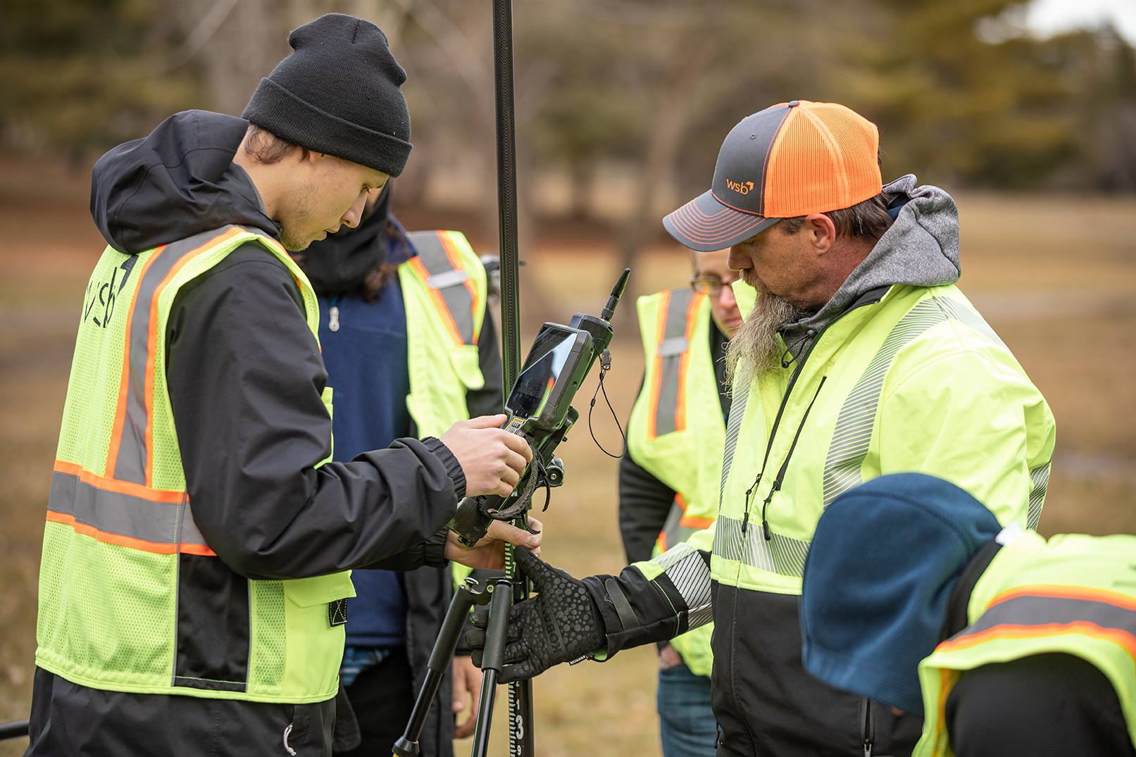
Opportunity+ is a free civil engineering career training program that opens up career opportunities for underrepresented persons in architecture, engineering, and construction (AEC) industry.
March 30, 2023
Design and consulting firm WSB announced today that the company’s fourth Opportunity+ class graduated 11 participants this month – the largest class to date. Opportunity+ is a workforce training and development program designed to prepare participants for long-term careers in the civil engineering industry.
“We build the places, spaces and systems that shape our world, and it’s so exciting to help program participants pursue careers in the exciting field of civil engineering,” said Bret Weiss, WSB’s president and CEO. “As we strive to build a workforce that accurately reflects the communities we serve, I’m proud to see the largest Opportunity+ cohort to date graduate. What’s more, this year, we placed a special emphasis on recruiting veterans to our program and helping translate their meaningful skills into training for a career in the Architecture, Engineering and Construction (AEC) industry.”
The Opportunity+ program prioritizes training a diverse participant pool to ensure every person has the opportunity for advancement in engineering. In the past, the program has focused on recruiting women and people of color. While still a major focus, this year, the program put an emphasis on recruitment efforts in the veteran community, with 56% of this year’s class identifying as veterans.
Over the course of January to April, program participants underwent intensive training through evening and weekend sessions designed to provide hands-on experience. The program’s flexible schedule enables participants to continue their daytime employment while completing the training. As a result of Opportunity+, participants are now fully equipped with the necessary skills to pursue a career as engineering technicians, a versatile position within the civil engineering industry that can lead to many different career paths.
By Dan Cazanacli, Project Manager, and Henry Meeker, Graduate Engineer, WSB
When designing drainage systems for renewable energy sites, many different surface water factors must be considered to ensure a well-constructed system. These factors include how floods can impact the site, how water damage affects equipment and access points, soil erosion, water regulations, and how runoff impacts the surrounding ecosystem.
Floods can cause both widespread and deep channelized flow across solar farms.
Designers need to understand how water will flow across the site in different flood scenarios. Many renewable energy sites are located near floodplains, which can make the design process even more complicated. To tackle these challenges, WSB engineers use sophisticated 2D hydraulic models to map the direction, depth, and speed of water flow across the site.
Stop water damage to critical site components.
A crucial part of the drainage systems design process is ensuring that water, in any scenario, can flow smoothly across the site without causing any damage or flooding to critical components, such as inverters or battery storage units. Designers use the results of the hydraulic models to find the best solutions for water flow and to place these critical components away from the main flow of water. The models are also used to identify areas where water flows too quickly. WSB develops erosion control measures in these situations, such as reinforcing road surfaces at low water crossings.
Plan for ground erosion around solar panel support piles.
Another important aspect of renewable energy site design is ensuring that the supports for the solar panels can withstand strong winds and flooding. Each site is unique, our engineers work closely with our clients to use the results of the hydraulic models to assess the potential scour depth, meaning the point in the ground where erosion could occur, around the support piles and identify the appropriate methodology to use. This determines the best depth for embedding them. The models can also be used to identify areas where water is flowing too quickly and to develop erosion control measures, such as rock stabilization.
Consider water quality and management regulations.
Designers also need to consider regulations around stormwater management, water quality, floodplains, wetlands, and critical species/habitats. Project timelines will be significantly delayed without proper planning and consideration of these factors. WSB works to minimize the impact of the site on these sensitive areas while ensuring that the project proceeds on schedule. This often involves working closely with local government units and obtaining the necessary permits.
Protect ecosystem health.
Designers must understand how solar panels interact with the surrounding vegetation and soil. Major institutions, like the University of Minnesota, are performing ongoing research into how panel runoff affects water infiltration and an ecosystem’s health that will be incorporated into designs. Designers can leverage these findings to optimize water quality benefits for the site, incorporating water quality basins, pollinator-friendly vegetation, and site-specific erosion control measures.
How WSB Can Help
Do you need help planning your solar project and navigating challenges around drainage water systems? WSB can help with your design, develop erosion control models, ensure protection of local ecosystems through sustainable solutions, and more.
Dan has 15 years of experience in water resources and geotechnical engineering in the private sector. Dan is now a project manager for WSB, and provides value to projects through his extensive background in hydrology and hydraulics, fluid mechanics, geomorphology, geology, soil mechanics, and groundwater flow. [email protected] | 612.201.0184
As a water resources graduate engineer with WSB, Henry works on a variety of stormwater management projects. His work on regional stormwater systems, roadway improvement projects, and stormwater treatment retrofits benefited from his technical knowledge which includes utility-scale solar drainage, hydrologic and hydraulic modeling, water quality modeling, floodplain modeling, best management practice design, watershed permitting, and stormwater conveyance systems. [email protected] | 612.258.8157
Will Provide Digital Integrator and Advisory Services for Construction Digital Twins Running in Bentley Infrastructure Cloud
Bentley Systems, Incorporated (Nasdaq: BSY), the infrastructure engineering software company, today announced a collaboration initiative with WSB to lead civil infrastructure owners and contractors to adopt and use infrastructure digital twins. WSB has launched a new digital construction management solution and advisory service, based on Bentley’s SYNCHRO, to help the civil infrastructure market overcome challenges of adopting model-based digital workflows and leveraging the power of construction digital twins. WSB is the first firm to join the Bentley Digital Integrator Program for construction to provide programmatic go-to-market support and knowledge transfer to eligible engineering and project delivery firms and system integrators creating and curating digital twins for their clients’ infrastructure assets.
SYNCHRO simplifies the delivery of infrastructure construction projects.
Construction work is too often based on 2D drawings, spreadsheets, and document-based workflows resulting in errors, waste, and rework that cause most projects to be over budget and schedule. Bentley and WSB will lead firms in transforming construction by adopting technology and digital delivery.
“Owners and construction firms realize that new digital workflows are needed to meet infrastructure demands. Applying these digital workflows successfully requires a deep understanding of technology, processes, and data,” said Carsten Gerke, senior vice president of strategic partnerships with Bentley Systems. “The Bentley Digital Integrator Program is built around combining technology with subject matter expertise for improved infrastructure. WSB joining the program provides a leapfrog opportunity for all our transportation users.”
Through a combination of industry-leading software, expertise, and innovation, Bentley and WSB’s digital construction management initiative is helping to shape the way infrastructure projects are delivered. Key services include enabling a single source of truth by connecting project, contract, and document management to the future of design—a 3D/4D/5D constructable model—as well as the ability to create constructable models from current 2D plan sets, which allows the transition to a single source of truth for all stakeholders. This initiative is committed to putting the industry-leading model-based construction management tool in the hands of those who build the work. WSB promotes advanced project delivery and knows how to apply the right technology and expertise to support their clients’ aspirations for a digital future.
“WSB is committed to delivering innovative, reliable, and secure solutions through the use of advanced technology. We believe the successful deployment of an operational 3D model drives transparency, maximizes return on investment, makes possible true lifecycle planning, and drives collaboration to connect and align all stakeholders,” said Jon Chiglo, chief operating officer of WSB. “We have an entire organization that is leading, creating, and innovating into our digital future. Our partnership with Bentley is an important part of this vision and we are excited to bring this digital construction management service to market.”
SYNCHRO, Bentley’s construction management software that supports the entire civil construction lifecycle with simple office-to-field workflows and gives firms insight into project performance, productivity, and financial health, is the foundation for WSB’s offering. SYNCHRO is the construction service of the Bentley Infrastructure Cloud leveraging digital twin technologies, powered by iTwin.
Together, Bentley and WSB are meeting the market where it is and providing the tools, training, education, and support required to make the digital leap. Project teams will realize the value of model-based digital delivery for better project efficiency and outcomes. Civil infrastructure owners and contractors will overcome barriers to technology adoption to drive efficiencies from preconstruction planning through construction execution. Skills will improve as more projects adopt model-based delivery, resulting in it becoming the common standard.
“Owners and construction firms realize that new digital workflows are needed to meet infrastructure demands, but they often face issues when determining how best to adopt technology,” said Rich Humphrey, vice president of construction with Bentley. “In civil infrastructure, they also face unique challenges related to the nature of the design information they receive, and the spatial logistics involved. Bentley with WSB is the perfect combination to enable project teams to resolve adoption hurdles and ensure that technology results in a step function improvement in the way projects are delivered from design through construction execution.”
About Bentley Systems
Bentley Systems (Nasdaq: BSY) is the infrastructure engineering software company. We provide innovative software to advance the world’s infrastructure – sustaining both the global economy and environment. Our industry-leading software solutions are used by professionals, and organizations of every size, for the design, construction, and operations of roads and bridges, rail and transit, water and wastewater, public works and utilities, buildings and campuses, mining, and industrial facilities. Our offerings, powered by the iTwin Platform for infrastructure digital twins, include MicroStation and Bentley Open applications for modeling and simulation, Seequent’s software for geoprofessionals, and Bentley Infrastructure Cloud encompassing ProjectWise for project delivery, SYNCHRO for construction management, and AssetWise for asset operations. Bentley Systems’ 5,000 colleagues generate annual revenues of more than $1 billion in 194 countries.
WSB, a design and consulting firm providing engineering, planning, environmental and construction services. Its staff improves the way people engage with communities, transportation, infrastructure, energy and our environment. WSB offers services in more than 30-complementary areas to seamlessly integrate planning, design and implementation. Its coast-to-coast client base is served from 15 offices in five states. WSB’s staff is inspired to look beyond today and capitalize on the opportunities of tomorrow. Guided by a strong vision and an authentic passion, WSB is a company that strives to forge ahead. To learn more, visit wsbeng.com.
March 13, 2023 Lori Johnson, Sr Professional Community Planner, WSB
From phone apps for garage doors and heating systems to new security tools like Ring doorbells, we use technology in our homes to make our lives easier. Now cities are also using technology in housing decisions to make the lives of residents better and improve their communities.
Smart city tools and data are key when cities think about housing, including when it comes to making constructive decisions, building homes, and identifying the greatest needs for community housing.
Here are some ways cities are getting smart about housing.
A Different Approach to Building Permits
Until recently, builders were sending in paper copies of everything they needed to obtain building permits. Architectural plans and site plans were required, and they often came into building departments on large paper rolls. Inspectors and planners were using paper plans to review for code compliance and very often had to move these large plans from office to office. Now, technology is making this process smarter, more accessible, more efficient, and eco-friendly.
There are several tech applications that cities can take advantage of for building permit issuance such as iMS and eTRAKiT. All building permits can be issued online, and everything is submitted and paid for electronically. The automation and productivity of issuing online building permits makes it faster and easier for builders to get started on homes – saving time and money.
Data-Driven Decision Making
With the use of online applications for building permit issuance, it also allows cities to collect information to make data-driven decisions. This means having access to information on home prices, location, types of construction, etc.
Additionally, this data can be mapped to see where there are deficiencies in certain types of housing and resources. From that, communities can identify where there is a need for additional affordable housing, what types of housing are needed in different neighborhoods or regions, and make future investment and resource allocation decisions. Moreover, as affordable housing is a need in most communities, smart tools and data are essential to help resolve critical shortages.
It’s not just city leaders that benefit from smart tools, but residents too. Technology allows homeowners and buyers to easily research addresses for past building permits, so they know what has been done to their home and when. There are also advantages when it comes to shopping for mortgages, allowing consumers to make educated purchase and remodeling decisions.
The Building Process in 3D
Smart technologies are also affecting the way new homes are constructed. Some modular home builders use 3D modeling to generate home plans. Builders can then create modular homes in temperature-controlled environments at a faster pace than regular home construction and with less physical labor. It also helps eliminate barriers like being able to build in snowy, cold climates for instance. This is making home building more affordable and efficient.
For city planners, the use of 3D modeling also comes into play when envisioning new housing types within communities. When planners are able to virtually see what the built environment will look like, they can make better recommendations to the community.
Looking Toward the Future
Integrating smart tools and tech into community building and planning allows cities to make smarter decisions. It can help identify and solve problems, tackle affordable housing shortages, and make processes more efficient and effective for builders and residents alike.
It is important to remember that the term “smart cities” does not always mean that all citizens need to use technology to make their built environments better. But it does mean that it helps decision makers make smart decisions and smarter cities. WSB has many ideas and resources available to help cities be a part of this smart city evolution. If you have questions, we are always here to help you plan for and implement smart city technologies.
Lori has more than 25 years of experience working in a municipal planning department, having worked her way up through the planning department at the City of Blaine to become their city planner. She has worked in all aspects of city planning activities including project management, site plan and application review, public participation and long range planning.
March 13, 2023 Andi Moffat, VP of Environmental Services, WSB
Major infrastructure and spending packages passed in the last year by the federal government, including the Inflation Reduction Act (IRA) and Infrastructure Investment and Jobs Act (IIJA), are assisting communities across the country build a more sustainable, equitable and environmentally friendly future. There is a significant influx of dollars going into communities across the nation, and now is the time to ensure you do not miss out on these meaningful funding opportunities.
Recently, the Environmental Protection Agency (EPA) announced eligibility requirements for its Climate Pollution Reduction Grant, and here is what community and tribal leaders should know about this grant program.
The Climate Pollution Reduction Grant
The new Climate Pollution Reduction grant consists of $5 billion in funds and is broken up into two different phases.
The first phase is a non-competitive planning phase where $250 million in grants will be made available to qualifying communities. This phase is all about collaborating across government entities, assessing greenhouse gas emissions, and climate planning.
States must submit a Notice of Intent to Participate to the EPA by March 31, 2023. The funding that State’s receive may be available for cities within those states for additional planning funding. Please watch for updates from your local State Pollution Control Agency.
Cities within Metropolitan Statistical Areas (MSA’s) designated in the grant guidance may also be eligible when coordinating across the MSA. The lead entity for the MSA will need to submit a Notice of Intent to Participate for grants by April 28, 2023.
Tribal communities must coordinate with their EPA Regional Office soon to indicate interest in this funding.
While this is a non-competitive grant, an application is required. States must submit the application by April 28, 2023. MSA’s must submit the application by May 31, 2023. Tribal Nations must submit the application by June 15, 2023.
The second phase of the grants will have $4.6 billion available for project implementation for the year 2024 and beyond. It is important to note that to qualify for the second phase grants, communities must have received or been covered by the first phase planning grant either directly from the EPA or covered by your State grant. Applicants must have a System for Award Management (SAM) number and be registered in Grants.gov to apply for the grants.
Funding Opportunities
City planners, sustainability coordinators and local leaders can support a wide variety of planning and implementation projects with this grant funding. Projects can fall under a number of categories including transportation systems, reducing greenhouse gas emissions, natural and working lands, resilient communities, and clean energy.
Additionally, each project must have a diversity, equity and inclusion connection, so it’s critical that applicants carefully consider and understand how these projects impact BIPOC and low-income communities, improve underserved neighborhoods, or incorporate an environmental justice lens in the project.
What To Do Right Now
This is a substantial and historic funding opportunity for communities and tribes, so be sure to submit a notice of intent by March 31 if a State, by April 28, 2023 if a large MSA, or to start coordination with your regional EPA Office if a Tribal Nation. Also check with your state Pollution Control Agency or equivalent as states will also receive funding.
If you are unsure where to start or how best to approach next stems, WSB is available for consultation, grant writing, and more. We can help partner with you to advance meaningful infrastructure and environmental improvement projects in your community.
Andi is a Vice President with more than 23 years of experience leading people and projects that include planning, environmental, energy, highway, natural resources, construction and development. She oversees our Environmental services and approaches her work with passion and positivity.
March 13, 2023 By Lucas Wandrie, Sr Wildlife Ecologist, WSB
Northern long-eared bats are suffering significant population declines due to a number of factors including white-nose syndrome and summer and winter habitat loss. As a result, the U.S. Fish and Wildlife Service (USFWS) recently changed the status of the northern long-eared bat from federally threatened to endangered. The change will go into effect on March 31, 2023. Projects that may impact individual northern long-eared bats or their habitat will no longer be protected under the 4(d) Rule. These impacts include tree removal and collisions with wind turbines.
The full extent of how this new endangered designation will affect project schedules or project feasibility is still unknown. However, before the status change takes effect and the USFWS releases the new northern long-eared bat determination key, there are some key items to consider.
What projects will be affected?
This change will apply to all projects within the northern long-eared bat’s range. If your project received a “No Effect” or “Not Likely to Affect” determination from the USFWS, it is still valid under the new restrictions. However, if your project received a “Likely to Adversely Affect” determination, coordination with the USFWS will have to be re-initiated.
Suitable habitat of the northern long-eared bat includes trees that have cavities, sloughing bark, and deep crevices. Additionally, trees that are three inches or more in diameter at approximately chest height are potentially suitable habitats. Furthermore, individual trees can be considered suitable habitat if they are within 1000 feet of another suitable habitat. Understanding the habitat suitability of your project area is essential to follow USFWS guidelines and to avoid and minimize the risk of northern long-eared bat take.
So, what does this mean for my project?
The new implications of the status change will likely result in stricter windows and thresholds for tree removal. Northern long-eared bat surveys such as habitat assessments, presence/probable absence surveys, and emergence surveys may be required before tree removal or the construction of wind farms. There may also be mandated requirements and mitigation efforts for project-specific incidental take permits or habitat conservation plans. Projects may also need to further coordinate with the USFWS based on the results of the determination key.
Not sure of how this new designation will impact your project or where to start?
At WSB, we conduct northern long-eared bat habitat assessments and surveys, complete incidental take permit applications, and develop habitat conservation plans to help your project move forward as smoothly as possible, while meeting the USFWS requirements.
Lucas has over 15 years of experience in wildlife ecology and consulting. His specialties include providing desktop and field-based wildlife services for wind and solar projects and has supported the successful completion of these projects in 34 states.
March 13, 2023 By Sean Delmore, Director of Traffic, WSB
Traffic signals are an often-overlooked aspect of everyday life. But when you stop at a traffic signal, did you ever also stop and think about how, where, and why these signals are used? Here are six things you may not know about traffic signals.
When is a traffic signal needed?
Communities thoughtfully decide where traffic signals are needed vs. roundabouts or stop signs. An Intersection Control Evaluation (ICE) is conducted to determine the appropriate method of traffic control, which includes a detailed signal warrant analysis. These studies measure the existing vehicular and non-motorized (pedestrian/bicycle) traffic volumes and evaluate crash history at the intersection. WSB traffic experts conduct these evaluations in partnership with communities and local governments to collect the necessary data and determine if a signal would help improve the traffic safety and operations of the area.
Traffic signals are typically designed to last more than 20 years with routine maintenance and designed to handle forecasted traffic volumes 20 years out. The federal government has requirements that must be followed when planning for the installation of new signals. These requirements include signal warrants that are found in the Manual on Uniform Traffic Control Devices (MUTCD).
What are the benefits of a traffic signal?
Efficiency and safety are the top benefits of traffic signals. Signals are designed to keep up the progression of heavy traffic while ensuring there are no undue delays to side streets. The signals imitate elements of human decision-making, such as when a pedestrian should cross a busy intersection or when it is safe for a vehicle to make a left turn. Removing that decision from the person and incorporating it into an automated system like the traffic signal increases the overall safety for vehicles and pedestrians.
The ability to efficiently manage traffic flow can also be a significant factor in the success of local businesses and the livability of an area for families. For instance, access management developed by signals reduces the chaos of vehicles entering and existing businesses onto the main corridor.
How do traffic signals communicate with emergency vehicles?
Traffic signals can change to the green phase for emergency vehicles allowing them to respond quickly and safely to incidents. Most emergency vehicles have an emitter on the dashboard that communicates with the traffic signal to safely end an opposing signal phase and bring up a green indication for the emergency vehicle. The technology also will extend the length of a green cycle if it is currently green for the direction an emergency vehicle is travelling.
Why do traffic signals always turn red for me?
Despite what we sometimes think, not all traffic signals turn red as you approach— in fact, it is just the opposite. Traffic signals have “dilemma zone protection,” which extends the length of a green light when a vehicle passes the back detection as it approaches the light. This keeps the light green to eliminate the human dilemma of whether to speed up or stop when the light turns yellow.
Additionally, sensors in the ground at the intersection detect cars as they approach. For example, in many signalized locations, a minor street with lower vehicle volumes won’t change to green unless a vehicle is waiting at the red light to maximize the efficiency of the major roadway.
What’s the latest innovation with traffic signals?
Flashing yellow arrows are one of the latest innovations in traffic signals. The flashing yellow arrow allows the driver to decide when it is appropriate to turn left, as opposed to controlling left-turns with green and red arrows. This feature on signals may also change based on the time of day. For example, the flashing yellow left turn arrow may be used on a Sunday night when traffic volumes are significantly lower. Then, during Monday morning rush hour, when traffic volumes increase substantially, the flashing yellow arrow will not be utilized, and the signal can offer a protected only phase because there is too great a risk posed to left turning vehicles trying to find an acceptable gap against the amount of oncoming traffic.
What’s on the horizon for traffic signals?
One element of future traffic signals being considered more and more in major metropolitan areas is incorporating pedestrians and cyclists into the signal system. Engineers are rethinking classic intersection designs to incorporate new technology such as Audible Pedestrian Signals (APS) & ADA compliant curb ramp improvements, as well as bicycle markings for improving safety and accessibility for all modes.
How WSB Can Help
If you have concerns or complaints about an intersection, WSB’s team of experts are here to help. We can perform an Intersection Control Evaluation or provide suggestions how to move traffic safely and efficiently through your community.
Sean has more than 28 years of transportation experience. He specializes in traffic operations, lighting, signing & striping, and signal design. He is a licensed Professional Traffic Operations Engineer and leads WSB’s Traffic Engineering Group. Prior to joining WSB, Sean served 17 years with MnDOT, where he worked mainly in the Metro and Central Office Traffic Engineering.
March 3, 2023 By Matt Indihar, Sr Project Manager, WSB
Did you know that the most effective way to manage pavement maintenance in your system is to plan five to ten years in advance? Many municipalities are forced into reactionary pavement maintenance projects. In these cases, decision makers are forced to spend their budgets repairing roads in the worst condition creating large, costly projects. This prevents resources from being allocated towards cost-effective treatments that focus on keeping pavements in good condition before they fail. To get ahead of reactionary maintenance and plan a roadway budget that maximizes the cost-effectiveness of each dollar spent, there needs to be accurate data on the condition of each pavement segment within a system. This provides the necessary information for a data driven pavement management and capital improvement plan to be implemented. Having a pavement network inspection done on a regular basis can bring clarity to condition trends, identify maintenance issues, and allow decision makers to be confident they are implementing the best possible pavement fix at the appropriate time.
Why is this important?
With all of the environmental factors and traffic loads that pavements are exposed to on a daily basis, deterioration is inevitable. With newer or better pavement, only a few distresses may be present so repair costs are lower. However, as pavements age their deterioration continues at an increasing rate. These damaged pavements are more expensive to maintain and may even require major rehabilitation. Knowing the current age, condition, and maintenance history for a pavement section can help determine the most cost effective fix for it based on where it is in its life cycle. Systematic pavement evaluations are one tool network managers can use to monitor their pavement and make the best use of maintenance and construction budgets.
What are pavement inspections and what do they do?
Pavement inspections provide scientific data about the existing conditions of a network of asphalt or concrete surfaces. The process involves a trained inspector evaluating the pavement and cataloging all distress by size, quantity, and severity. With this data, an overall Pavement Condition Index (PCI) can be calculated. This PCI number is a single value that is used to grade the condition of each pavement segment. From there, a report that contains analysis on the condition of the network and a series of recommended solutions for any deficiencies is generated. Additionally, the report may contain specific maintenance recommendations for each road, budget recommendations, trends in pavement conditions, and ideas on how to stretch a limited pavement budget to maximize the overall system condition.
What is the value of a pavement inspection?
A pavement inspection report is a key tool for decision makers to use when determining capital improvement plans and setting budgets. It provides data and rationale to support funding decisions on projects that can be shared with interested parties. The systematic method of determining roadway conditions ensures the most cost-effective and critical projects are being planned for without guessing or relying on personal opinions. In most cases, the cost of implementing pavement inspections pays for itself by optimizing the time and location of pavement repairs. Additional cost savings can be realized when planning the projects 5-10 years out so that similar projects types can be group into larger more cost effective projects.
WSB has the technology and expertise to develop a pavement management plan for your community. Contact us to learn more about a plan for your community.
Matt Indihar is a Sr Project Manager with over 10 years of experience in construction and project development. He leads our pavement management team and has been involved in making pavement decisions in over 50 municipalities, written research based reports on pavement management processes, and participated on technical advisory panels for pavement research and innovation.