By Jess Karls, Senior Director, Transportation Design, WSB
Roadway safety is often talked about in terms of driver behavior, but many of the most effective ways to reduce crashes start with everyday roadway design decisions. In day-to-day transportation planning and project delivery, safety improvements often come from practical choices built into routine projects. When safety is considered early, agencies can reduce both the number and severity of crashes while creating roadways that work better for everyone.
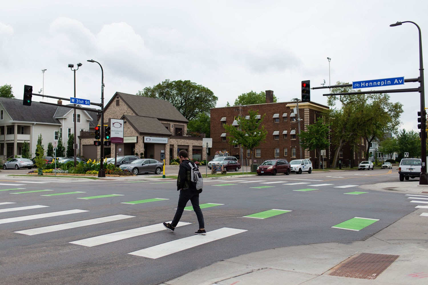
One of the biggest opportunities lies in speed management. Roadway layout, lane widths, and context sensitive speed limits all influence how fast people drive. Design features like narrow lanes, curb extensions, raised intersections, and other traffic calming measures help encourage safer speeds without relying solely on enforcement. When roadway design matches the surrounding land use, drivers naturally slow down and crashes become less severe.
Intersections and corridors also deserve special attention. Many crashes happen where traffic movements overlap or where vehicles interact with people walking or biking. Approaches such as roundabouts, improved turning layouts, more visible crosswalks, and separated pedestrian and bicycle facilities help reduce conflicts and make travel more predictable for all users.
Other roadway features quietly support safety every day. Elements like safety edges, rumble strips, better lighting, clear signage, and thoughtful access management help drivers stay oriented and reduce unnecessary conflict points. Together, these improvements create roadways that are more forgiving and better able to account for everyday mistakes.
Looking ahead, roadway safety continues to evolve as agencies adopt more proactive and data driven approaches. Rather than relying only on past crash data, communities are using real time information and systemwide tools to identify risks earlier. Technologies like adaptive signals and smart intersections are helping reduce conflicts in high-risk areas, while connected systems are beginning to provide real time alerts to drivers. Together, these efforts build on proven design strategies and reinforce a simple idea, safer outcomes happen when planning, data, and design work together.
WSB works with cities and states to bring these approaches into everyday transportation planning, design, and capital improvement programs. By using data to identify higher risk areas and applying proven safety strategies within routine projects, our teams help agencies stay ahead of safety challenges instead of reacting to them. From integrating new technologies to refining roadway design with a systemwide perspective, we support practical, cost-effective decisions that improve long term performance and protect the people who rely on these roads every day.
Jess Karls is Senior Director of Transportation Design at WSB, where she leads the delivery of innovative, context-sensitive roadway solutions for communities nationwide. With a focus on data-driven decision-making and integrated design, she partners with agencies to advance practical, scalable approaches that improve safety, enhance mobility, and support long-term system performance.
The Americans with Disabilities Act (ADA) is an incredibly important civil rights law that also provides a standard for which engineers can create safer roadways and communities. In 2010, the ADA Standards for Accessible Design provided a clearer minimum for what needs to be achieved for access friendly design. In August of 2023, the US Access Board improved upon those standards by issuing their Final Rule on the Public Right of Way Accessibility Guidelines (PROWAG). Meeting these standards not only provides greater access for people with disabilities, but also improves designs that better the entire community.
Benefits for All Community Members
ADA standards on walkways and street crossings do not just provide improved accessibility for people with disabilities. Rather, all community members benefit from inclusive designs, such as parents pushing children in strollers or children riding a scooter. By improving pedestrian crossings, like placing curb ramps in locations that shorten crosswalks, communities can both meet ADA compliance requirements and improve safety. When pedestrian travel is easier and safer for people with disabilities it is easier and safer for all pedestrians.
Beyond safety and mobility concerns, properly following ADA guidelines when installing curb ramps makes maintenance far easier. For instance, antiquated pedestrian curb ramps that do not fulfill ADA compliance standards are not always wide enough or aligned to accommodate snow removal vehicles. With accessibility, safety, and maintenance in mind, heightened attention to detail is required to ensure all community members are affected for the better.
Understanding Project Needs First-Hand
To best understand the needs of a project and how to ensure it aligns with ADA standards, looking at top-down maps only goes so far. A pre-design field walk grants a closer look at the work needing to be done, what design options are feasible, what are the impacts, and much more. This pre-design effort provides a deeper understanding of how to properly link project needs to ADA standards while mitigating risks in project delivery. Procuring first-hand knowledge of every crossing, curb ramp, neighboring utility, property line, and every other inch of a project will allow greater ease in matching the various guidelines and standards like PROWAG. Having a deep understanding of ADA guidelines with first-hand knowledge of a project can ensure accessibility, lower costs and mitigate risks.
What WSB Can Do To Help
WSB provides a knowledgeable team with experience analyzing and working on hundreds of projects to meet the requirements set out by the Americans with Disabilities Act. Through this experienced team, our clients, stakeholders and communities achieve safer and more accessible living. Thoughtful designs will also improve safety and maintenance operations for communities. The design of pedestrian infrastructure for ADA needs can have a sweeping, positive impact on community and WSB can help execute strategic accessible designs that work for everyone.
Gus is WSB’s expert in accessible pedestrian and bicycle facilities, with a traffic engineering background which allows him to blend pedestrian accessibility with safety and mobility. He uses best practices to achieve constructable and usable pedestrian facilities for a variety of project scopes across different environments.
By David Balmos, Vice President and Brad Tiemann, SR Project Manager
Relieving the gridlock.
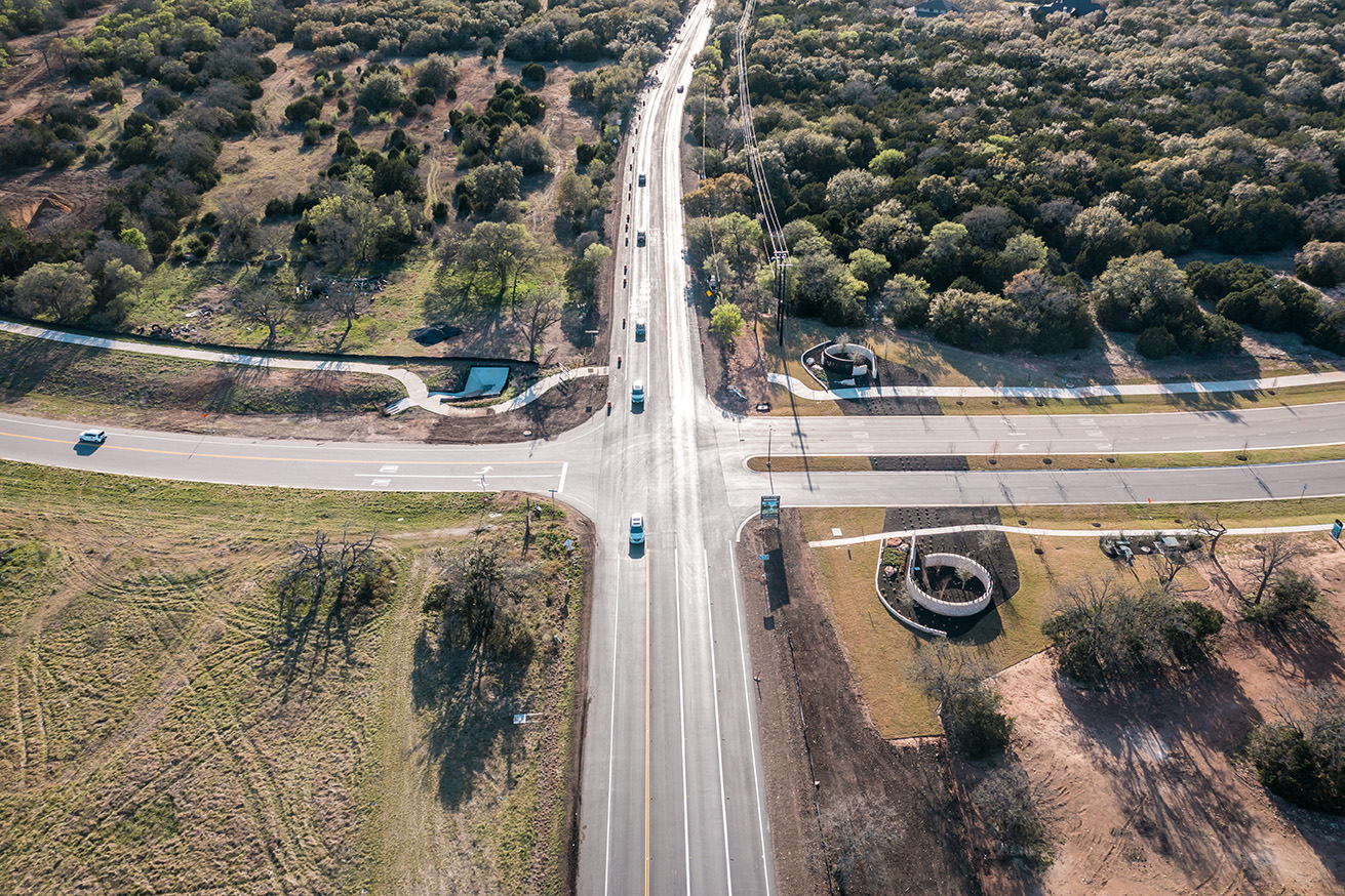
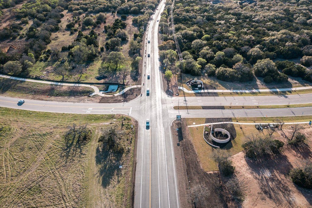
Located in Montgomery County, the 7th fastest growing county in the U.S., is the city of Magnolia, Texas. Well-known for its access to the Texas Piney Woods and sprawling magnolia trees, the city is nestled in the southwest part of the county and is situated along the heavily traveled FM 1488.
For years, the community has been managing severe congestion, safety issues and significant delays at the intersection of FM 1488 and FM 1774. As the city of Magnolia and the surrounding areas continue to experience record growth, the congestion has only worsened. Not only is traffic a concern, but vehicles heading east-west along the corridor need to travel over a railroad, creating another complication.
Solutions to the bottleneck.
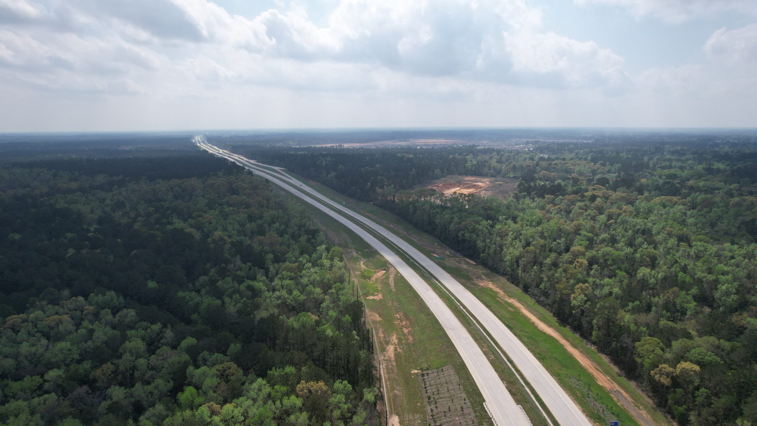
Many ideas have been vetted to alleviate the traffic – most of them resulting in substantial impacts to the historic downtown Magnolia. To ensure the community keeps its economic footing, a bypass around the town was proposed. The $114 million Magnolia Relief Route will include five miles of new four-lane roadways that will extend west from FM 1488, cross over a Union Pacific Railroad track, and connect with the Texas 249 tollway.
Accelerating the timeline.
The project has been on the Texas Department of Transportation’s (TxDOT) list for nearly a decade. To accelerate the timeline, WSB is delivering the project through 3D digital delivery. Digital delivery results in efficiencies, and speed that would not be possible through traditional design delivery methods. The timeline from schematic design to final will take less than eight months which will then allow the county and city to have plans finalized when funds become available.
Toll revenue and project funding.
The project will partly be funded through toll revenue from Texas 249, a state-operated toll road. FM 1488 will connect to Texas 249. In Texas, any new facility that brings traffic to the toll road is eligible to be funded out of the toll revenue. Additionally, $10 million was earmarked by Montgomery County as part of the required match in the 2015 road bond. The project is anticipated to be bid in 2024.
Services Provided
Design
Environmental Services
Cost Estimates
Union Pacific Railroad Permitting & Coordination
Surveying
Drainage Studies
By the Numbers
5 miles of new roadway
$114 million project
8 month accelerated timeline
Eliminates 15,000 vehicles each day from crossing the Union Pacific Railroad at-grade crossing.
As Vice President, David will be responsible for driving business and working across many markets in the region including the department of transportation, toll road authorities, county government agencies, transit authorities, port authorities and local municipalities. In addition, David will support projects in the private sector, working closely with land developers, commercial interests, oil and gas and pipeline transport.
Brad is a Senior Project Manager with 30 years of engineering experience in the design, construction and maintenance of transportation facilities. He has led the development, preparation and plan review (QA/QC) of more than 100 separate PS&E packages including urban arterials, municipal streets, rural highways and bridges. He has considerable experience with maintenance and construction for transportation facilities in Texas, and as a recent TxDOT retiree, Brad has a strong understanding of the Texas transportation system.
By Tina Brown, Sr Professional Engineer, and Jignesh Thakkar, Director of Traffic and ITS in Texas
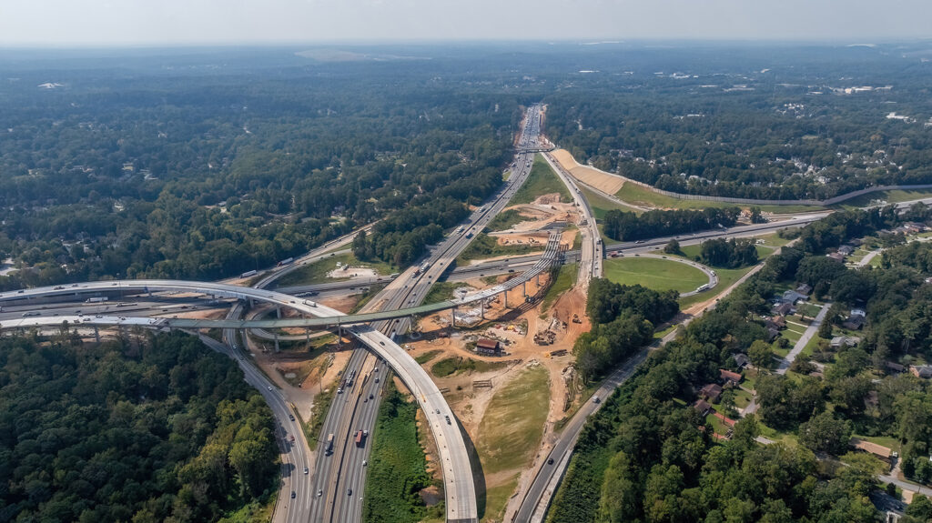
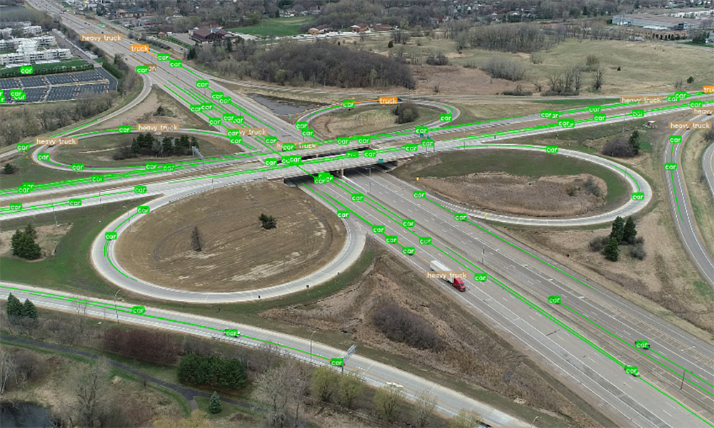
As Texas’ population grows and traffic increases, mobility and safety at intersections deteriorate. The strain on the current infrastructure, along with increasing construction and right-of-way (ROW) costs, highlights the need for early planning and exploration of innovative solutions. The application of alternative intersections and interchanges, to enhance traffic operations and prioritize safety, is becoming more popular throughout Texas.
Alternative Intersections and Interchanges Explained:
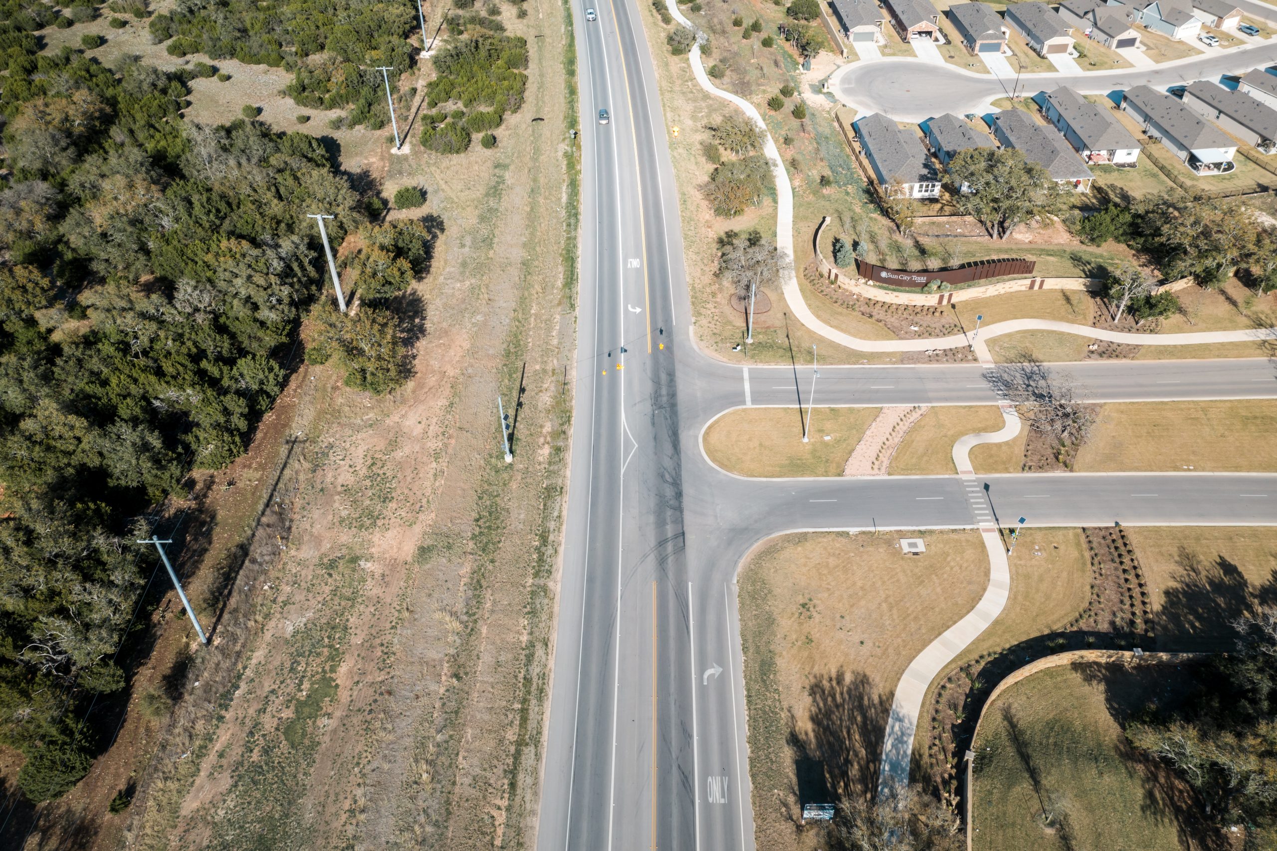
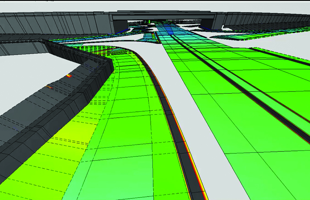
Alternative intersections and interchanges are innovative transportation designs that improve traffic flow, safety and efficiency. Unlike traditional intersections and interchanges that rely on conventional traffic signal or stop-controlled configurations, alternative designs introduce unique geometric layouts and operational strategies. By reimagining how vehicles interact, conflict points and intersection delays can be reduced, and pedestrian and cyclist safety can be enhanced, all while increasing overall capacity. These alternative designs may include roundabouts, diverging diamond interchanges (DDI), restricted crossing U-turn intersections (RCUT), and displaced left turn intersections (DLT).
These solutions are typically implemented in areas with high traffic volumes and delays and/or areas with high crash rates, providing practical solutions to address the transportation challenges.
Comprehensive Analysis of Alternative Intersections and Interchanges:
During the planning and development of alternative intersections and interchanges, WSB’s planners and engineers consider data such as turning movement volumes for both passenger vehicles and trucks; pedestrian and bicycle use; crash history; and existing geometry, traffic control devices and ROW to conduct preliminary traffic and safety assessments when determining viable alternatives.
Two main goals drive identification of alternative(s) – mobility and safety.
For mobility, the FHWA tool Capacity Analysis for Planning of Junctions (CAP-X) is used to determine the alternative’s performance related to improved traffic operations (Level of Service, travel time and vehicle throughput). The safety assessment includes the traditional KABCO scale analysis, as well as using the FHWA tool Safety Performance Intersection Control Evaluations (SPICE) to predict the safety performance (crash frequency and severity) of various alternatives and traffic controls.
Once the preferred alternative(s) are identified, additional detailed analysis is conducted to compile evaluation information and benefits of each. This includes an Intersection Control Evaluation (ICE) to further analyze and determine the appropriate configuration and traffic control. Detailed safety analysis is performed using FHWA data-driven analysis tools such as Interchange Safety Analysis Tool Enhanced (ISATe) and Interactive Highway Safety Design Model (IHSDM). The alternative(s) are then screened to determine a recommended alternative that fits within the project budget and accomplishes the goals for the project.
Stakeholder Engagement for Public Safety and User Awareness:
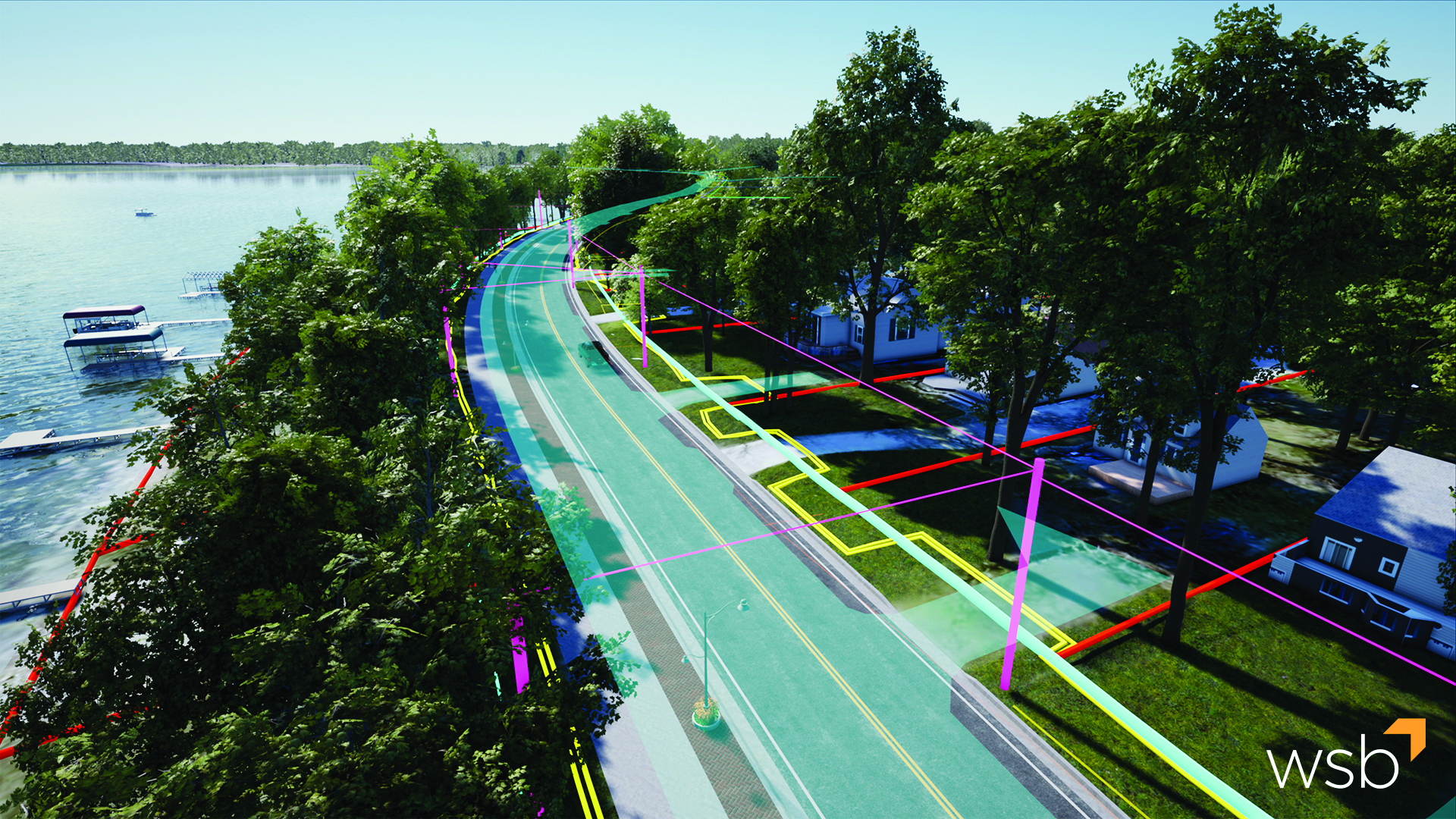
The biggest challenge with alternative intersections and interchanges is public perception and interaction. Each location has its challenges, and the solutions must be tailored to the local jurisdiction. The public and stakeholders are essential in determining a preferred alternative, and obtaining input early in the project development process is crucial. Public use of these transportation facilities can also be a challenge for those unfamiliar with the traffic patterns and movements associated with alternative intersections and interchanges. WSB develops 3D visualizations to help the public and stakeholders understand the proposed configuration and associated traffic patterns. Additionally, our engineers design clear and understandable signing and striping to help users safely navigate the lanes and turns.
Why WSB?
The future is bright for even more alternative intersections and interchanges to be added in Texas. WSB staff includes planners and engineers with extensive experience in alternative intersection and interchange analysis and design. In Texas, we have recently designed a roundabout at RM 1826/RM 967 in Driftwood, Texas, that has yet to be constructed and are also currently helping develop a single-lane roundabout directly in front of the City of McKinney’s new Municipal Complex.
In addition to the increased demand for alternative intersections and interchanges, technology advancement plays a key role, and WSB is at the forefront of advanced project delivery. WSB staff possess a high level of expertise in all project phases and use innovative technology in the design, construction and operation of all projects.
Tina has 35 years of engineering experience and has performed project management, planning and engineering design on numerous large-scale corridor transportation and bridge projects. Additionally, she was a construction inspector on two large roadway projects in the Austin area while directly employed by TxDOT. Her knowledge in traffic control plans, interchanges and much more enables her to curate exceptional plans that best fit the needs of clients and communities.
Jignesh has over 19 years of experience in traffic and transportation engineering services. He has managed numerous traffic engineering projects for medium to large-scale developments for public and private-sector clients. His extensive experience in transportation analysis, simulation and design software well-equips Jignesh for a variety of transportation projects.
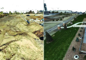
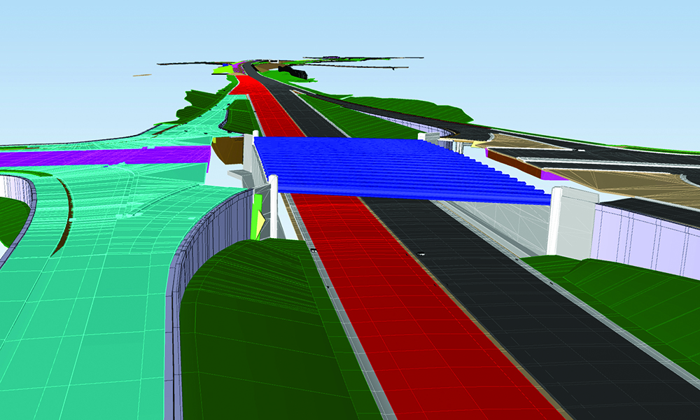
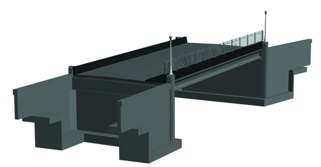
For many years, the AEC industry has been embracing advancements in the way we deliver projects. Paperless plans were the first step in this process. Fast forwarding to today, paperless plans have evolved one step further. People often refer to any digital plan set as paperless, but at WSB, we take our designs one step beyond paperless by creating 100% models. 100% models mean the entire project is created and designed in 3D.
100% models house data and design information from the entire project lifecycle, leaving owners and contractors with an accurate, detailed, data-based model to support asset management needs well into the future.
The development of DigitalPlus
WSB is committed to leading our industry in the use of cutting-edge tools to work smarter. As a firm, we’ve been at the leading edge of digital delivery efforts for many years. Our approach is unique and one that has been internationally recognized as a best practice in digital project delivery. To help tell this story, we created DigitalPlus.
DigitalPlus is the future of digital delivery. Through a combination of cutting-edge tools, expertise and a commitment to innovation, we are shaping the way our industry delivers projects. We believe in advanced project delivery, and we know how to apply the right technology and expertise to support our infrastructure needs. Through DigitalPlus, we are setting new standards, developing best practices and changing our industry’s approach to multidimensional digital design.
Why DigitalPlus
As engineers, we are motivated by the opportunities to design infrastructure projects that support our communities. The infrastructure around us has a significant impact on our daily lives. From drafting plan sets to public meetings, we live in the details and embrace the full process. We also embrace the advancements in our industry and how we can leverage technology to deliver better projects for our clients.
The benefits
Improve Quality
Sustainability
Enhanced Scheduling
Better Managed Risk
Relationship Management (Contractors | Owners)
Improve Cost
Increase Collaboration and Communication
What is DigitalPlus
A combination of expertise and cutting-edge tools.
Data Collection
Data is the foundation of any good project. We use several traditional data collection methods to gather data points that help paint a picture of the world around us. Good data is vital to the DigitalPlus process.
3D Design
Designing in 3D allows us to develop the project while providing a complete and accurate picture of the final product, significantly improving project outcomes.
4D / 5D
4D/5D modeling improves accuracy and efficiency by adding time and cost functions into design. The true power lies in the way a model can be used during preliminary design, final design and throughout construction.
Asset Management
Asset Management is the collection of an agency’s infrastructure assets and includes a plan for managing assets over the infrastructure’s lifespan. Through digital twins, assets can be managed virtually and accurately.
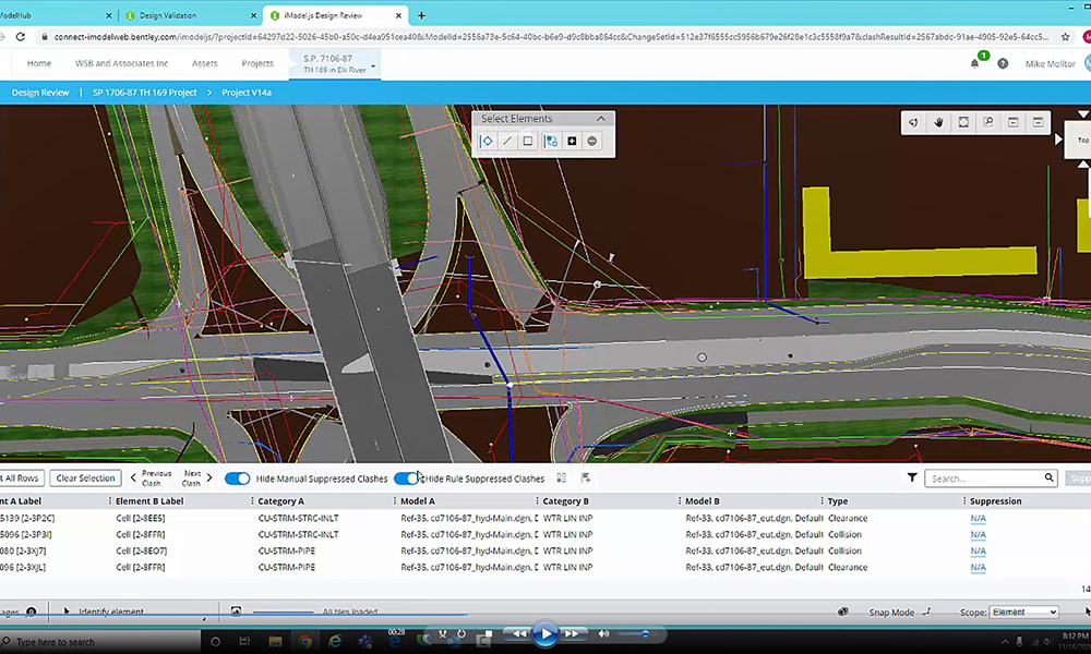
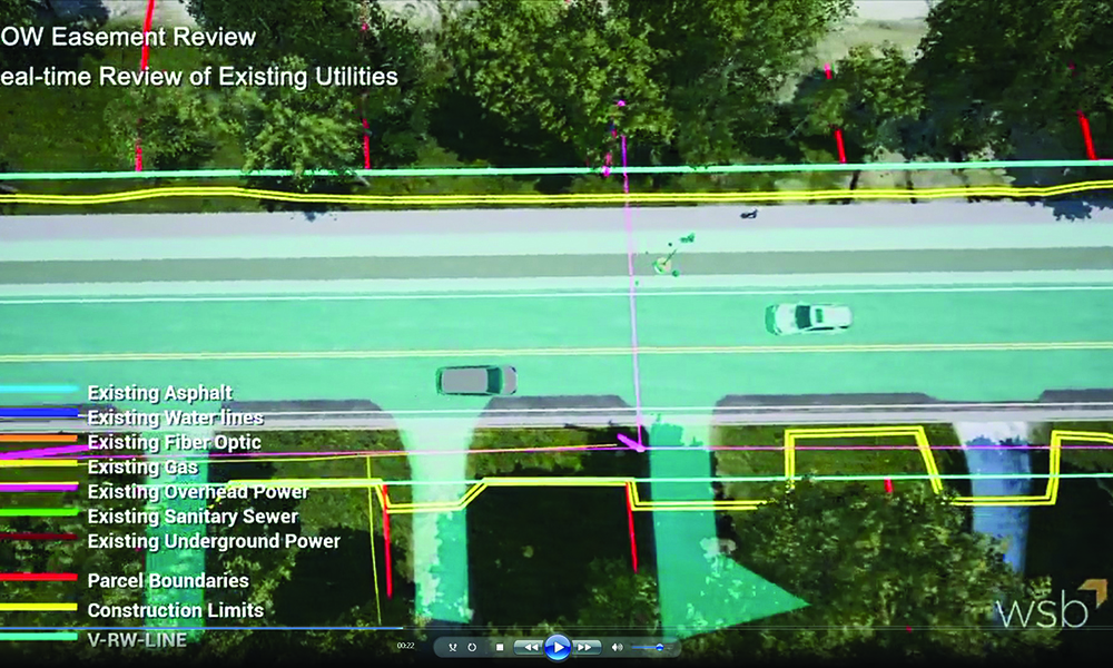
Utility Coordination
Digital delivery aids utility coordination by translating utility information into a 3D environment that can be compared with the design to identity and mitigate conflicts.
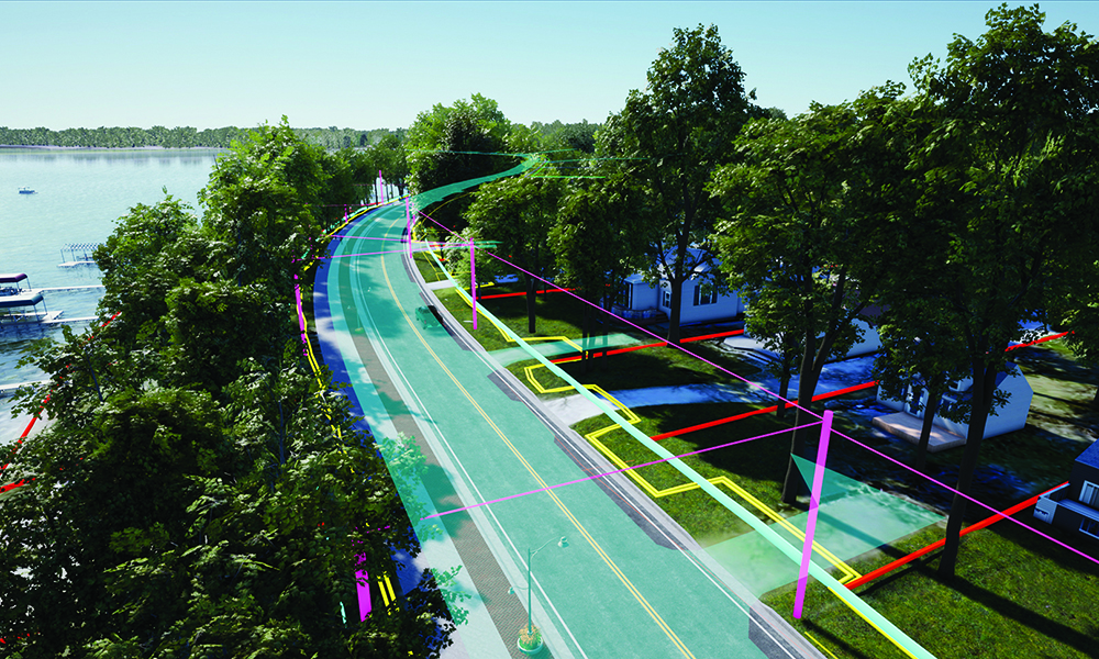
Visualization
Real-time 3D visualization has completely transformed site-specific review and public engagement efforts. Visualizations allow for active participation regardless of project scope and size.
Traffic Operations
Through simulation technology and trip-origin destination data, roadway designs are now guided by real-time and historical mobility movement data.
Integrated Project Delivery
A process, rather than a project that all starts with an idea. Through a combination of expertise and cutting-edge tools, land developers and owners identify opportunities and challenges before a project begins.
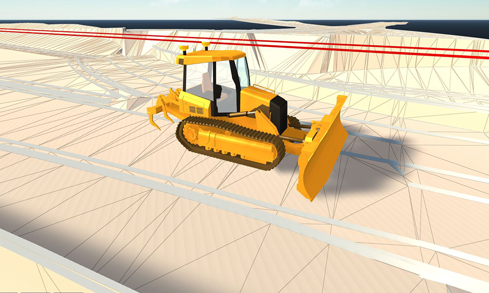
Machine Control Modeling
Using 3D models and GPS data, machine control modeling allows earthwork machinery to be accurately positioned. Design surfaces, grades and alignments are directly imported into construction equipment, resulting in increased accuracy and timelines.
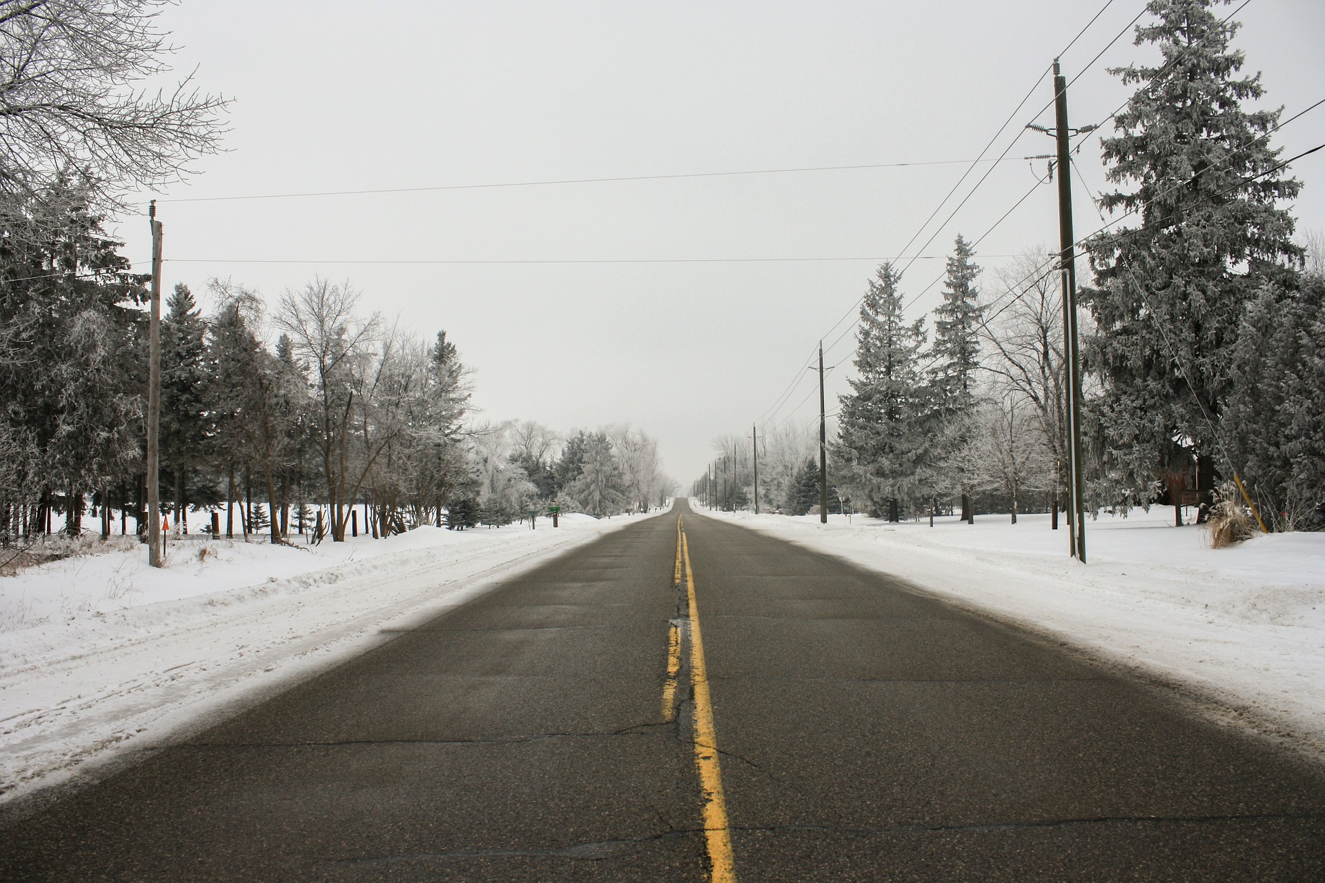
During long winter months, managing and improving infrastructure that is affected by snowfall becomes a top priority. Snow, combined with wind, creates dangerous conditions. Meteorologists have a system that predicts snowfall events and wind patterns, but many people don’t know the science behind snowdrift prevention. To help prevent dangerous driving conditions, engineers model and analyze snow drifts on roadways to determine how they’re impacted by winter weather. Today, snow drift challenges are solved by combining snow drift models with historical data to pin-point snow drift spots and create a more focused solution to mitigate the drift problem.
The benefits of a well-designed ditch
The width and depth of a ditch that borders a roadway can work to a commuter’s advantage and can reduce agency owners’ snowplow maintenance. Well-designed ditches prevent snow from blowing onto a roadway. Historical data and snow drift models help to determine the proper location and size of a ditch. Ditches are designed best when existing topography and right-of-way are both considered to create a well-balanced solution.
Living and structural snow fences
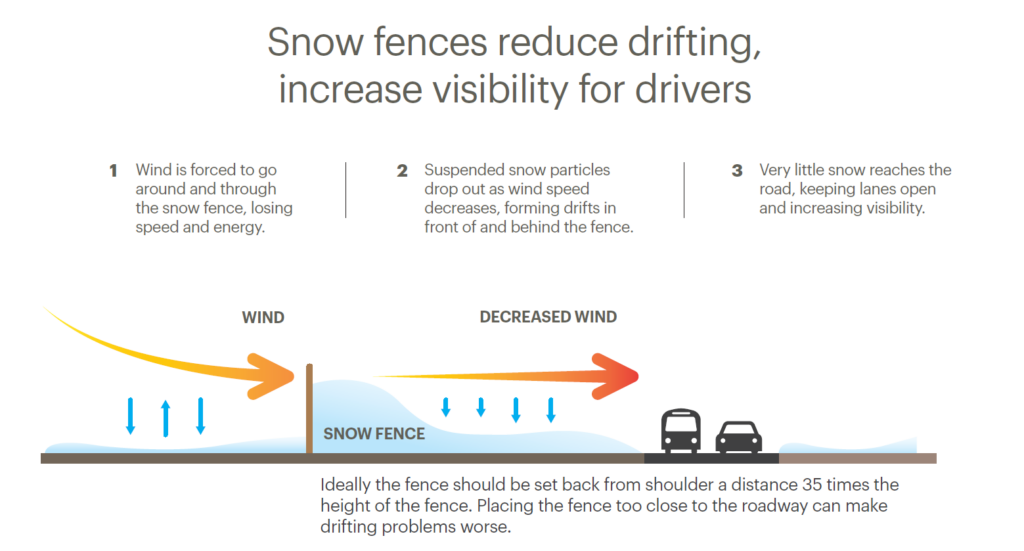
Snow fences became a leading solution to combating snowdrifts and keeping roads open after record snowfall and disastrous blizzards pounded the Midwest in the 1990s. Since then, roads that were often closed due to impassable snowdrifts are now kept open with a little help from nature and modern materials.
There are two types of snow fences – living and structural. A living snow fence is a group of trees or bushes planted strategically to catch drifting snow. The line of trees or shrubs prevents the snow from reaching sections of roads that tend to become blocked during or after storms, creating an effective barrier and increasing driver safety.
When living snow fences aren’t suited for a site, a structural snow fence is another option to consider. This is the preferred method when soil is too compacted, or the area doesn’t allow for shrubbery or trees due to maintenance complications.
The diagram below shows how a snow fence prevents snow from drifting.
Engineers automatically design roads for drainage, but snow should receive the same attention – particularly in states that experience winter weather for half the year. As you navigate your way through winter driving conditions, take notice of what surrounds you. The line of trees or the ditch next to you may just be helping keep the roadway clear.
DJ has been a quality manager and a senior project manager in transportation, both in preliminary and final design, for over 14 years. Prior to joining WSB, DJ was a design engineer and project manager for the Minnesota Department of Transportation (MnDOT) and has managed or been part of a wide range of designbid- build transportation projects.