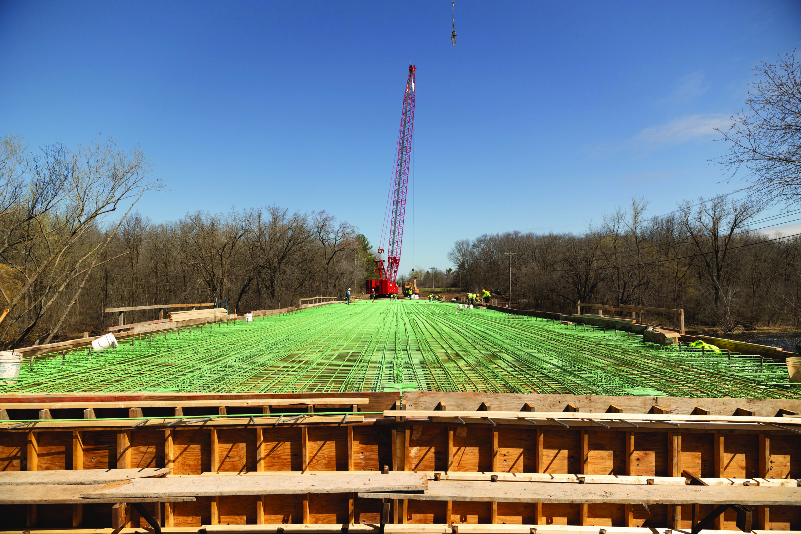
Snake River Bridge

Designing and Improving the Snake River Bridge

August 28, 2024
By Carl Osberg, PE, Director of Structures, WSB

Meeting Traffic Demands and Environmental standards with aesthetic sensitivity

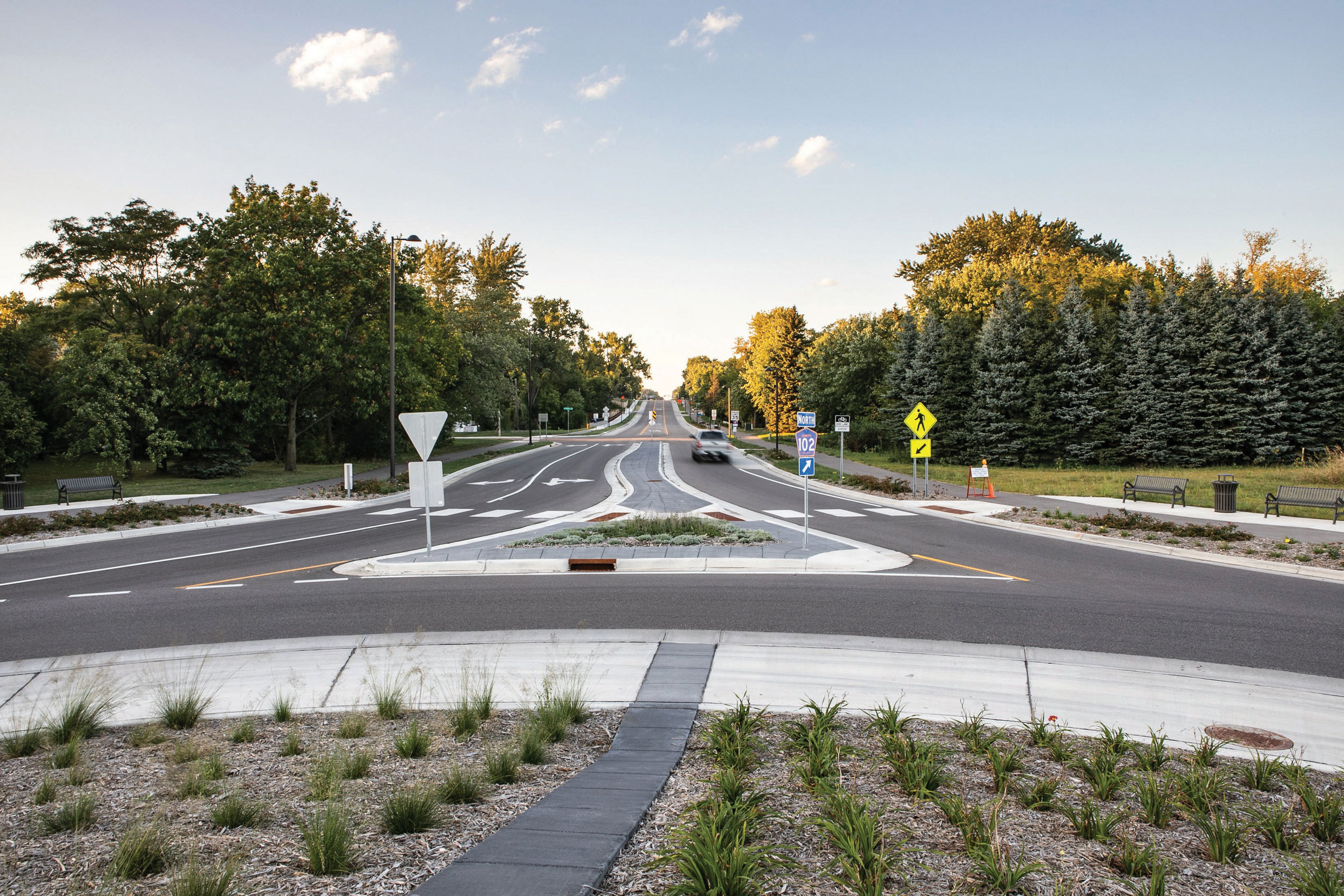
As with many instances of aging infrastructure, the bridge across the Snake River to the East of Pine City, MN reached a point in its lifespan where it needed to be redesigned and replaced. Construction projects like bridges require focused attention to a variety of elements to not only ensure the bridge is sound and long lasting, but also to ensure no concerns are created like blocking off access from boats or environmental concerns. The Snake River Bridge scheduled to be completed in the fall of 2024 provides a superb example of the many facets that make up bridge design.

Meeting Traffic Needs

One point of consideration for bridges are current and future traffic needs. Previously, if farm equipment needed to cross from both sides of the bridge there would be issues. With the newest designs, the addition of extra wide shoulders allows for traffic to flow whether by car or larger. Through traffic forecasting, a bridge design can meet the needs of the current levels of traffic and those estimated for up to 40 years of potential population growth in the area. This project’s analysis deemed additional lanes unnecessary so long as the extra wide shoulders were included. Ensuring the bridge is only as big as is needed will save considerable time and money.

Considering Environmental Data and Concerns

In bridge design, gathering hydraulic data about the river is imperative to ensure that not only will the bridge be able to handle expected seasonal water depths and the speed of the river’s flow, but also to ensure that any bridge design avoids negatively impacting the areas downstream. For example, the updated trail on either side of the bridge included designs for updated drainage ponds and piping to prevent the road and nearby residences from being affected during heavy rains.

When tearing down an existing bridge, care must be taken to ensure that the river is not polluted, and animal habitats are not unnecessarily impacted. Specifically for the Snake River project, remnants of an older bridge still remained and new designs included removal. For both environmental concerns and financial reasons, the Snake River Bridge was designed with the impetus of ensuring durability and expandability. Not only is the bridge made to last, but also if population growth surpasses estimates the bridge can be more easily expanded to fit the new needs rather than torn down and rebuilt again.

To meet environmental and safety concerns, plans for a path underneath the bridge were included in the design that will grant extra protection for drivers, pedestrians, and the local wildlife once the bridge is completed and put to use. Accessible paths allow for foot traffic of both people and animals to maneuver safely without needing to cross the street.

Reducing Costs

Steps were taken through data gathering and design to limit unnecessary costs. These aspects include adding contingencies in relation to the soil and bedrock. Through geotechnical data gathering, it was identified that there are high levels of bedrock close to the surface in the construction area. Building with bedrock is difficult and attention was given to include contingencies on how to handle different bedrock or soil conditions during construction to ensure the project does not stop and cost money and time. Additionally, to limit excess costs geotechnical data was able to be acquired by drilling through the old bridge and into the soil rather than using a barge. Using a barge for data gathering would have drastically increased costs.

A Completed Project With Aesthetic Appeal

Bridge designs like the one used for the Snake River Bridge meet the needs of the communities that use it, protect against environmental impacts to the water, soil and local animals, reduce costs, and provide a timetable to ensure the bridge will be constructed and reopened without delay. Even down to forgoing the usual plain rectangular shapes and including parabolic arches to for little additional funds to make the bridge more attractive and not stand out so much against the beautiful environment around it. Creating not only a finished usable bridge, but one that is attentive to the various needs of the community, the land it sits on, and the river it crosses are what bridge design is all about.

Carl is Director of Structures, and he brings a deep comprehension of MnDOT’s guidelines and protocols for bridge and transportation projects. His extensive experience includes leading studies, engaging with the public and stakeholders, assessing environmental impacts, and overseeing both preliminary and final design stages. Carl has a track record of designing over 70 bridges throughout Minnesota, along with a variety of other structures such as retaining walls, noise barriers, tunnels, and sign structures. His profound knowledge and proven expertise in structural design make him an essential leader, adept at guiding decisive actions and advancing significant projects.

[email protected] | 612.219.3524

Carl Osberg

Lessons from Texas: How Communities Can Create & Adapt Transportation Plans for Economic Growth & Population Booms

July 31, 2023

By Steve Lindsey, Director of Transportation Design, and Janna Rosenthal, Senior Transportation Planner

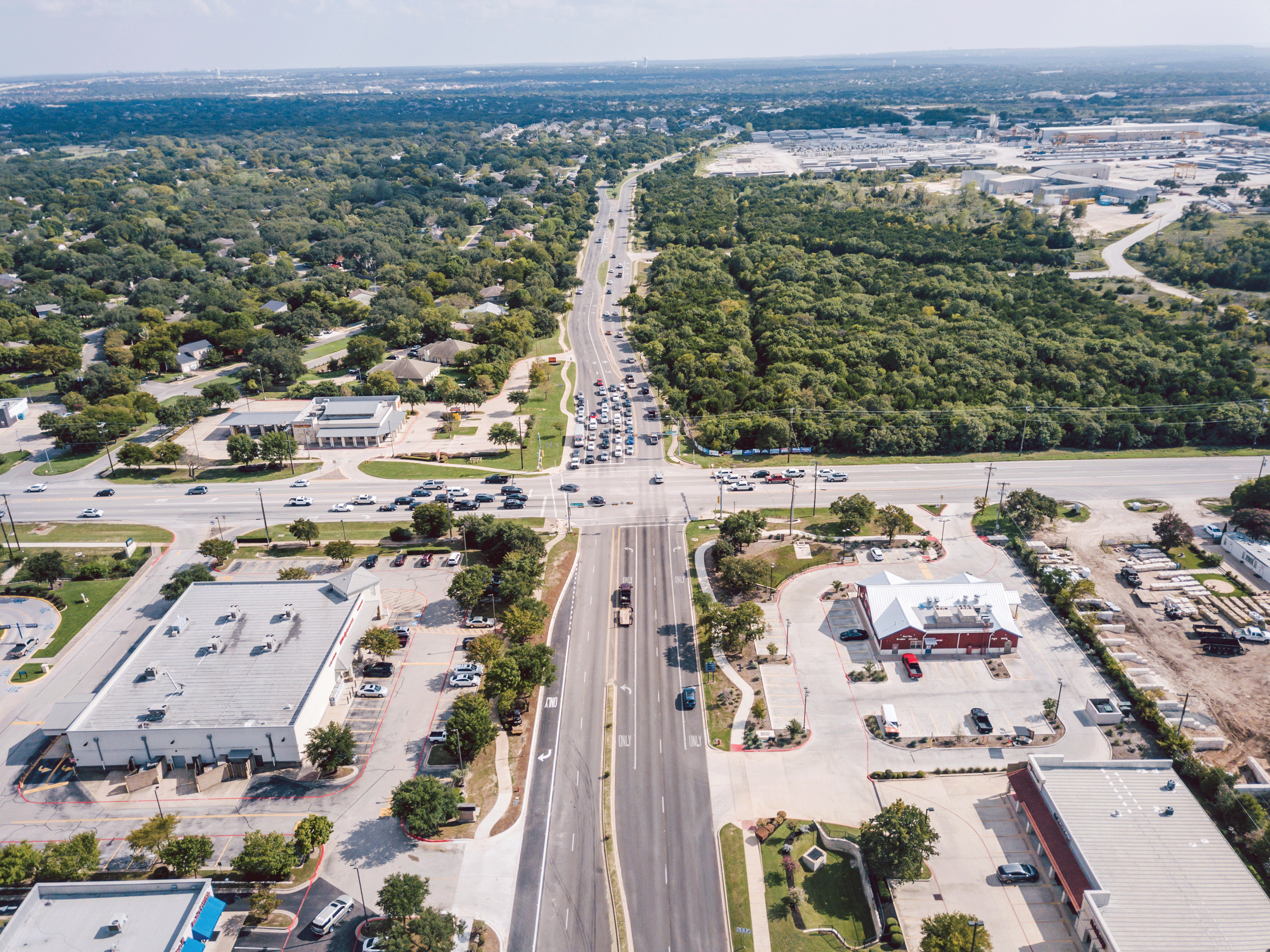
Central Texas’ population is growing rapidly with several of Austin’s suburbs ranking among the fastest growing cities in the country. Smaller and traditionally more rural communities and counties are seeing residents flock to their towns, driven by a variety of factors. Furthermore, businesses such as Samsung, Apple, and TESLA are heavily investing in the region, and large cities like Austin are continuing to grow.

As communities experience rapid growth, how can they update and adapt their transportation plans to minimize growing pains? How can planners continue to attract and maintain business investment and residents while ensuring that growth doesn’t outpace infrastructure capacity?

WSB’s Texas team is at the forefront of helping counties and communities create and execute comprehensive transportation plans that are flexible, nimble and take a long-term view of community growth and resident needs. Here are some lessons learned in Texas that apply to communities across the country experiencing rapid growth.  

What happens when a transportation plan doesn’t meet the needs of a community?

When cities and counties fail to adequately plan for and invest in transportation infrastructure, residents and businesses often experience negative repercussions. Insufficient transportation planning can lead to congestion, decreased mobility and accessibility, safety concerns, and can ultimately hamper further growth and investment in the community.

Community leaders must understand the relationship between transportation infrastructure and economic development and investment. Is there enough housing for workers? Are workers able to easily get to and from work without overly burdensome commutes? Are there public transportation options that meet the needs of residents and businesses? Plans must provide answers to these questions and factor in a variety of needs.

Transportation infrastructure is a major consideration for businesses who are looking to expand or relocate. Investors consider access to markets and local/regional transportation connectivity when deciding on the location of new ventures. When transportation plans fail to meet the needs of a community, they are less likely to attract and retain businesses, investment projects and industrial development. Transportation planning that supports growth means ensuring residents and visitors can travel the community freely, efficiently and safely.

How to craft a transportation plan that has a long-term vision.

Proactive transportation planning is essential to ensure that the community can support growth. Community leaders need to advance comprehensive transportation plans that have a broad, long-term vision for their community over the next several decades, while regularly reevaluating to see where changes need to be made and priorities may have shifted. As population growth and economic development accelerate, it is vital to evaluate the existing transportation infrastructure’s capacity to handle the growing demand. Identifying potential bottlenecks, road networks operating beyond their capacity, and inadequate public transit systems can prompt the need for changes in long-term transportation plans.

Long range transportation plans can also help reduce potential future conflicts. Identifying the location of future roadway corridors and incorporating them into development plans can minimize the need for residential and/or commercial displacements. A prime example of preparing transportation projects for the future is the work done in Williamson County— one of the fastest growing counties in the country. In preparation for population and economic growth, new location routes that are identified in the county’s Long Range Transportation Plan in undeveloped portions of the county are studied and designed. In doing so, the plan accommodates population expansion, allowing for continued growth and minimizing potential future conflicts.

At the end of the day, a plan should build a solid foundation for the future, and be flexible and nimble to accommodate emerging trends.

Understand the value of public engagement.

Not in my backyard! Communities are all too familiar with pushback from residents and local businesses when people feel community plans will negatively impact their home, neighborhood, business, or city. Lack of local connection and public input can worsen these issues when things like new roadways, zoning changes or other transportation investments are advanced. Proactive transportation planning allows for greater public engagement earlier in the process, helping reduce resident push-back in the long-term.

Furthermore, comprehensive planning can also foster better coordination between stakeholders and different areas of local government (like cities and counties), helping make processes run smoother and ensuring transportation visions are aligned and meet the needs of the region.

Plan for emerging technologies.

Booming populations aren’t the only thing that transportation planners are looking at – they are also exploring how emerging technologies will impact their plans. The electrification of vehicles requires planning for a robust and accessible charging infrastructure with strategically located charging stations along major corridors and at key destinations. Furthermore, autonomous vehicles are also an emerging technology that may dominate our roadways in future decades. Planning for emerging technologies and putting the proper infrastructure in place now will put communities ahead of the curve and reduce conflicts in the long-term.

How WSB can help.

WSB’s transportation team has meaningful expertise and can help your city, county or agency achieve its vision. Our experienced staff offers assistance in setting goals, creating and updating transportation plans, corridor planning and implementing transportation plans through roadway design and development.

Steve comes to WSB with over 22 years of experience in all phases of the transportation industry including schematic, environmental, GEC/program management, construction and plans, specification and estimates (PS&E). He has a history working with TxDOT divisions and districts around the state as well as municipal clients in central Texas. As director of transportation based out of Austin, Texas, Steve is helping grow WSB’s transportation practice and solidify WSB as a go-to firm throughout the entire state of Texas.

Janna has 10 years of experience as a transportation planner and is well-versed in the transportation consulting industry. She specializes in freight planning and corridor feasibility studies including developing goals and objectives, screening and evaluating projects, conditions and performance analysis, needs assessments, and stakeholder/public outreach. She routinely works in analyzing large data sets and presenting material in a context that is easily understood, and is trained in traffic noise analysis. She supports WSB through her large skill set and knowledge.

Metropolitan Council 2022 Regional Solicitation Grants

By Mary Gute, Sr Transportation Planner, WSB

The Metropolitan Council’s 2022 Regional Solicitation process is now open. Please review the information below if you are considering submitting a project application or are wondering if a project is a good fit for the program.

Overview

  • Due Date: April 14, 2022
  • Funding available in three main categories: roadways; bicycle and pedestrian Facilities1; and transit/travel demand management (TDM)2
  • Projects can only be submitted in one category
  • See the Metropolitan Council website for more information: https://metrocouncil.org/Transportation/Planning-2/Transportation-Funding/Regional-Solicitation.aspx

How much funding is available? Does this include new federal infrastructure funding?

The Metropolitan Council initially identified $180 million for the 2022 solicitation. With the new federal infrastructure bill, the Council anticipates an additional $10-$20 million will be available. It is likely that federal funding will augment the available Regional Solicitation funding in future years, but not confirmed.

What can funding be used for?

  • Up to 80% of construction costs; a 20% local match is required
  • Construction only; Funds CANNOT be used for studies, preliminary engineering/design, construction engineering, or right of way
  • Projects that are to be constructed in 2026 or 2027; applicants will be asked if their project(s) could be programmed earlier

What Makes for a Good Project?

Successful projects must meet all qualifying criteria. Projects meeting several prioritizing criteria and demonstrating a high level of project readiness will score higher.

Qualifying Criteria – RequiredPrioritizing CriteriaProject Readiness
• Consistency with regional plans
• Inclusion in local plan or program
• ADA compliance – ADA Transition Plan
• Accessible/open to the public
• Permanent improvement independent utility
• Role in regional transportation system & economy
• Project usage
• Equity and housing elements
• Infrastructure age
• Congestion reduction/air quality
• Safety
• Multimodal Elements/ Connections
• Risk Assessment
• Cost Effectiveness
• Public process with residents, interested stakeholders
• Project layout
• Review of Section 106 Historic Resources
• Right of way acquisition process, if applicable, or knowing no additional right of way is needed
• Railroad right of way agreement, if applicable

What is the likelihood of a project receiving funding?

This program is highly competitive with requests far exceeding available funding. In the 2020 solicitation, 130 project applications were submitted and 56 (43%) were funded. Projects were funded in all seven metro area counties, in twenty-six cities and townships.

What is the level of effort to complete an application? Is it worth it?

These applications are moderately complex. Some elements require considerable lead time (e.g., preparing a layout; public engagement activities, etc.). Applications started early are generally higher quality than those that are completed towards the end of the solicitation process.

Federal requirements must be met on selected projects (e.g., federal environmental documents, federal and state design, and construction requirements, etc.). WSB advises that applicants request at least $500,000 to make going through federal process(es) worthwhile for financial reasons.

If you are considering submitting a Regional Solicitation application or want to discuss whether a project is a good fit for the program, please contact Mary Gute.

1: To be competitive, multiuse trail and bicycle facility projects should be on the Regional Bicycle Transportation Network (RBTN); Safe Routes to School (Infrastructure), projects should be included in a completed Safe Routes to School Plan and/or engineering study.
2: Transit funding is usually awarded to transit agencies.

Mary has 20 years of progressively complex transportation planning and project management experience, gained from working on a variety of transportation projects for modes including roads/bridge, transit, and trails. Several these projects have included environmental documentation considerations – either pre-NEPA, or through NEPA and/or MEPA processes.

[email protected] | 612.741.7055

WSB Selected to Design TH 169, Rebuilding Gateway to Greater Minnesota

WSB is thrilled to partner with the Minnesota Department of Transportation (MnDOT) to provide final roadway and bridge design services for the Highway 169 (TH 169) Reconstruction Project.

TH 169 is a significant north-south highway in Minnesota. It serves rapidly developing communities and is a gateway to exploring recreational areas in Greater Minnesota. The highway is heavily traveled by both vehicles and pedestrians. Expanding the highway is intended to improve safety and reduce the average rate of collisions in the area.

Jody Martinson, vice president of transportation at WSB, anticipates this project will have a lasting impact and looks forward to delivering a safer commute for surrounding communities.

“This project is incredibly important to users of the TH 169 corridor,” said Martinson. “Being able to work side-by-side with MnDOT to improve the safety and mobility for motorists and pedestrians is extremely gratifying. WSB is excited to utilize technology and innovative solutions to improve the efficiency of design and construction.”

The reconstruction will address operational, infrastructure and mobility issues, all important elements considered when the project was selected for the Corridors of Commerce (CoC) program. The project will replace four signalized intersections with interchanges and consolidate access points, drastically improving safety and mobility. Local roadways will be reconstructed to create ADA accessible routes at the interchanges. The TH 169 project is expected to reduce roadway delay by more than 1,000 hours per day, eliminate $1.7 million in annual crash costs, and provide more reliable travel times for the public.

The project is also a CMGC project. As a CMGC (Construction Manager/General Contractor), the process will involve several stakeholders and team members throughout the design and construction process. The project will also require strong coordination and communication with MnDOT. Project manager, Peter Muehlbach formed an expert team to ensure the CMGC process is efficient, effective and economical for reconstruction.

“When fully utilized, the CMGC design process allows for a more collaborative work environment between designer and contractor,” said Muehlbach. “I am excited for the opportunity to make design decisions together with our MnDOT, Sherburne County, city of Elk River and Ames Construction partners.”

Additionally, the project team will leverage state-of-the-art and emerging technologies to provide sustainable solutions during the design phase. By utilizing modeling tools, WSB will streamline construction management, drainage and utility relocation processes.

Planning for the TH 169 Reconstruction Project is underway with final design set to begin this summer. Phased construction will begin in fall 2022 with project completion set for 2024.

A True Game Changer – Traffic modeling for a more reliable commute

By Jody Martinson, VP of Transportation, WSB

Our Traffic Operations team recently developed a large-scale traffic simulation model for the Minnesota Department of Transportation (MnDOT). The current model is used to track vehicle congestion on interstate 94 (I-94), including the 15-mile stretch of highway between Minneapolis and St. Paul, commonly known as one of the most congested corridors in Minnesota.

The I-94 corridor generally supports a high volume of traffic during morning and evening commute times. Travel patterns on this corridor are complicated due to the roadway geometrics and vary with each commuting experience. Drivers risk getting stuck in several hours of traffic congestion depending on their travel window.

Beyond day-to-day commuting traffic, Minnesota roadways have a large amount of freight traffic to consider.  WSB’s simulations help to better understand the origin and destination of freight flows as well as help better identify bottlenecks for freight traffic.  This is important as the freight industry is a vital component to the regional and state economy. When goods are free flowing, avoiding time consuming bottlenecks, the direct impact is noticeable, and Minnesota’s economy becomes stronger.   

The microsimulation tool uses geospatial, Federal Highway Association (FHWA), and other historical data to capture the speed and flow of highway traffic. State-of-the-art software allows us to monitor complex highway and arterial traffic conditions more efficiently while tracking the dynamic interactions between vehicles. Daily traffic congestion is tracked and recorded using heat mapping and other reporting tools. The interactive model depicts several modes of transportation operating during peak commuting hours. Collected data is analyzed for accuracy and applied to determine future transportation planning initiatives.

The true benefit of this technology is our ability to run a higher number of alternatives at a pace the industry has never experienced before.  We can now study ten times the alternatives in under half the time it took only a year ago.  It’s a true game changer for our industry.  And for our partners, they are reaching solutions sooner that are much more economical.  In doing so, we’re saving them valuable time and money.  Ultimately, we’re helping our clients ensure they are allocating their resources in the right places at the right time.

Moving forward, our goal is to continue to leverage the latest technology to identify operational deficiencies more quickly for our partners and help to develop future alternatives that support a more reliable commute.

As Vice President of Transportation, Jody oversees the management and operations of the WSB Transportation group. Jody is the former Assistant Commissioner of the Minnesota Department of Transportation (MnDOT) Operations Division and has over 25 years of experience in the delivery of major transportation projects, programs and management of existing infrastructure.

[email protected] | 612.214.7787

 Learn more about WSB’s Transportation Planning services and related projects.