Beyond Maps

December 18, 2023

By Justin Hansen, Director of GIS Services, WSB

How GIS is Driving the Future of Data for Clients

As technology evolves, so does the way we harness information. Geographic Information Systems (GIS) have emerged as a transformative technology, empowering organizations with location intelligence. At WSB, GIS isn’t just about maps; it’s about turning geospatial data into a powerful asset that fuels innovation and smart decision-making for clients. The work we do with integrating GIS with other systems provides a dynamic data-driven insights and action. 

Foster Data-Driven Asset Management and Community Engagement 

For government and municipal clients, GIS is a cornerstone technology. It doesn’t just create maps; it’s a system of record-enabling, efficient asset management. GIS is a system of engagement and can empower greater community insight. In Duluth, Minnesota we helped implement a GIS-driven app for citizens to report issues to the city like graffiti, downed signs or potholes. Appls like this bring maps, data and people together in real time.  

Drive Private Sector Solutions 

For commercial clients, GIS can help mitigate risk and drive informed decisions. For example, we collaborated with an insurance data analytics provider to infuse GIS into their products allowing them to offer a more cohesive approach to analyzing risk. GIS provides geospatial data-driven insights and predictive analytics that insurance carriers use to reduce risks and improve policyholder retention. This, in turn, empowers businesses to strategize effectively, minimizing potential losses and optimizing their operations. 

Enhance Safety and Prevent Damage 

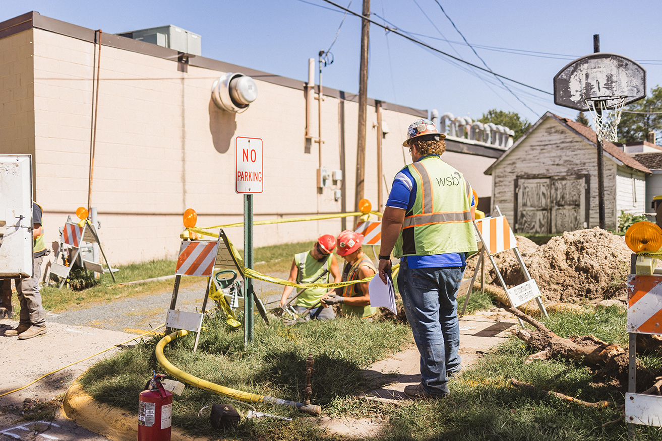
Energy companies leverage GIS to enhance safety and prevent damage. These technologies provide location intelligence tools that can pinpoint potential risks and vulnerabilities with infrastructure and operations. This proactive approach enables energy companies to make informed decisions that protect their assets and improve operational customer safety. 

Support Multi-Dimensional Projects and the Future of Data 

As project operations become more complex and interconnected via technology, so do the dimensions of data. Our GIS solutions are future-ready, supporting integrations with Building Information Modeling (BIM) for 4D and 5D projects that add time-based and cost-based elements to the geospatial data. This advanced approach enriches decision-making and creates pathways for enhanced project data delivery, from complex urban planning to construction sequencing – offering a new level of insight. 

In the rapidly evolving landscape of data utilization, GIS is the compass guiding us toward smarter decisions, efficient operations and sustainable growth. We’re not just pioneers in integrating GIS across organizations; we’re partners in leveraging its power to shape the future of diverse industries. From the public sector to the private domain, GIS isn’t just about maps anymore – it’s about transforming data into a strategic advantage. 

Justin is the Director of GIS Services and leads WSB’s Geographic Information Systems (GIS) group. He has over 15 years of experience managing GIS projects, staff, software development, solutions design, systems integration, and GIS implementation. Justin works closely with our clients to implement GIS-based tools and systems that meet their needs, provide maximum value, and foster engagement.

[email protected] | 763.231.4846

Damage prevention

Pipeline Integrity and the PHMSA Mega Rule – What You Need to Know

January 31, 2023

A vital part of a pipeline operator’s job is to ensure the integrity of pipelines always remain impenetrable and intact. The Pipeline and Hazardous Materials Safety Administration (PHMSA), in charge of regulating the pipeline industry, has recently developed new requirements concerning pipeline safety of gas transmission lines, adding layers of complexity and stringent new standards for operators. 

The new rule Repair Criteria, Integrity Management Improvements, Cathodic Protection, Management of Change, and Other Related Amendments (also known as RIN2) goes into effect on May 24, 2023, and operators are required to have their integrity management program updated and implemented by February 2024. Because there are so many new complexities and factors involved, operators need to act now to update their program and ensure they adhere to all new guidelines and regulations. 

What You Need to Know.

The latest rule specifies that pipeline operators of transmission lines in a regulated Integrity Management Plan update their requirements for repair criteria, assessment repair timelines, management of change procedures, expanded identification of potential threats to pipeline integrity (like a severe weather event), and more. 

Where to Place Your Focus and Resources.  

As operators review and update their integrity management programs, what are the best practices and things you need to review?

Start by focusing on data integration. PHSMA is requiring operators to incorporate more than forty specific pipeline potential threats into their risk assessments. Updating your integrity program to incorporate these changes is time intensive. New items like geohazard review, external forces, land movement, and water movement are all items to plan for and consider. Operators must start this process by May 24, 2023, and have all required integration complete by February 26, 2024.

Next, it’s important to update corrosion assessment requirements. PHSMA incorporated a standard assessment program that is more prescriptive than before, and corrosion assessments must be built to meet those strict industry standards. 

Finally, it’s important to conduct a geohazard review. Operators must now take into account external forces that may affect the integrity of the pipeline. WSB put together a more in-depth article on this topic, and you can find more information on geohazard reviews by clicking here. 

Don’t Delay, Act Now. 

With so much to do and less than one year to do it all, many operators will find it difficult to allocate the internal resources and time necessary to fulfill all the requirements. Updating the integrity management program takes time, and if you haven’t started, you may already find yourself falling behind. 

We have worked in the pipeline industry for over a decade and are available to help update plans, implement procedures, make risk assessments, and meet all requirements to ensure your program is in full compliance with the new rule. We have the team and the know-how to help guide pipeline integrity teams, no matter where you are in the process. 

Geospatial Data

Geospatial Data

January 11, 2023

The Foundation of Digital Delivery

Geospatial data is information that involves large sets of data gathered from a variety of diverse sources based on location. In the Architecture, Engineering and Construction (AEC) Industry, we depend on geospatial data to build and design infrastructure. Strong data is the foundation of any digital delivery project. Capturing geospatial data for infrastructure projects is the first step in the digital delivery workflow.

The five ways we gather thousands of accurate data points to improve design methods and increase speed and accuracy.

Reality Capture for 4D / 5D

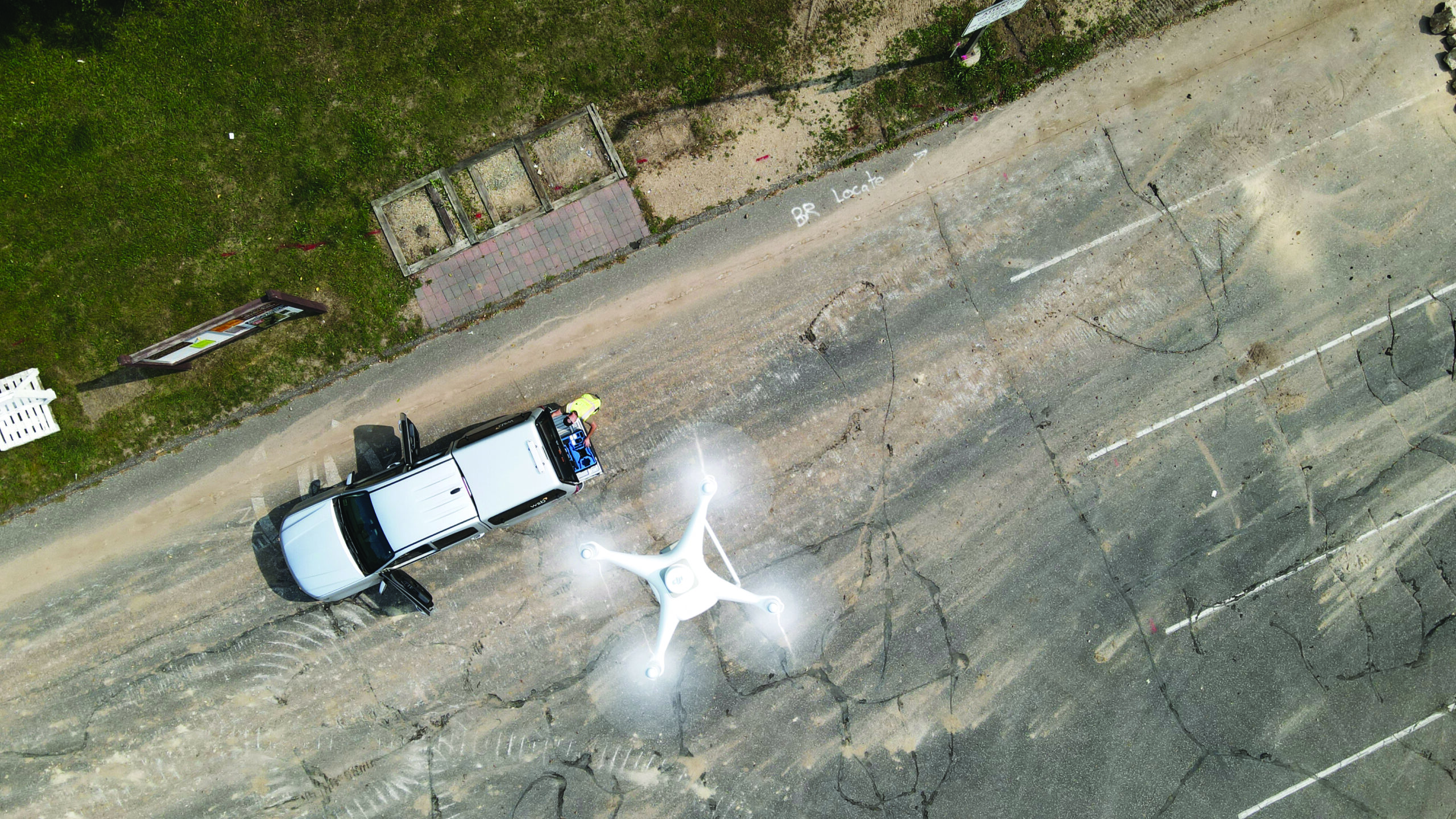
High resolution drones capture thousands of photos that overlap at different angles to create a geospatially accurate reality capture of an entire site. The reality capture contains accurate lengths, depths, and heights.  To increase accuracy, the geospatial data is tied to survey ground control points.  Once the data is processed, it can be input into many different design software, serving as the first step in digital delivery.

Interior/Indoor Scanning

Using a tripod and LIDAR scanner, we collect thousands of data points. The scanner is moved around to cover the entire area, capturing points along the way, and is then uploaded into BIM software. This information can be used to create a robust asset management system.

WSB 360 – Google Street View

WSB 360º captures high-resolution 360º imagery that is used to detect and map a variety of assets as they exist today. Google imagery is often missing or out-of-date. By driving a street or an alley, data is gathered within minutes and uploaded to Google Maps and StreetView.  This technology is also used to capture, map, and classify road assets including hydrants, signs, power poles, and streetlights.

Traditional Surveying

Traditional surveying is performed by survey crews using tools to make measurements. Some refer to this as the most accurate form of data collection because of the boots on the ground element. There are proven methods of verifying accuracy and conventional survey has been performed for hundreds of years.

Conventional Drone | 2D & 3D Reality Captures

With conventional drone data, we create 2D and 3D high-resolution imagery. This data serves as the foundation for 3D and 2D reality captures. 3D reality captures are developed when elevations are needed for digital design. 2D reality captures are developed when elevation isn’t necessary. In the past, satellite imagery was relied upon, which was often inaccurate and outdated. Through conventional drones, we can document a site accurately, in-depth, and within minutes.

Optimize your data

By Justin Hansen, Director of GIS Services, WSB

As the world continues to evolve through the advancement of technology, new opportunities and challenges arise that you may, or may not, know the best way to tackle. Staying abreast of new systems and solutions can be a daunting, even overwhelming, task.

At WSB, we use Geographic Information Systems (GIS) to improve the way organizations acquire, understand and use their data. A successful GIS program employs geospatial technology to improve the quality of services, positively impact the decision-making of a community, become a central location for all data and improve overall workflow. To help simplify it for you, we will share some of the most common issues that we encounter and provide some advice on how to handle them.

Unable to retrieve data quickly enough

A properly designed and managed GIS will allow you access to all your organizations information at the touch of a button. Through field to office integration software, your team can enter field data directly from the site of the work and make the data immediately available to you. If you need to be able to verify a critical utility repair in order to calm concerned residents, your team can document the nature of the problem, how and when it was repaired, and include supporting photos or documents.

Unable to locate needed documents

It is time to go paperless. There is no need to continue to store paper documents in your office. They take up unnecessary space, get disorganized and go missing. Have you ever needed to find an as-built in order to verify the location of utility lines and been unable to find the final version? Using a GIS will allow you to convert all your supporting documents into digital files, tag them to any relevant accounts or locations for easy retrieval, and support a greener way of conducting business.

My data is outdated

Using ledgers and spreadsheets to manage your data quickly becomes tedious, time consuming and inefficient. If your system for tracking data involves any of these methods, it is likely current data has not been entered more than once. Imagine you need to share results of a lift station’s most recent inspection, but the most current document you can find is 3 years old. This could create a serious problem if you are unable to provide accurate findings. To ensure your group is working with the most accurate data available, a GIS is an easy and organized way to allow anyone the ability to enter information, keep it all stored in one central location, and control access to sensitive data.

My team is not able to work together efficiently

Do you have people working from more than one location? Do you often find you are emailing the same spreadsheet to multiple people to add data? There must be a more efficient way for your team to work together, right? A GIS can allow everyone on your team the ability to access, edit, and report from your groups database without wondering which version is the most up to date. It can save you time and frustration, allowing your group to spend their valuable time on other projects.

Our GIS group has worked with many clients to find solutions to their data problems. If you find yourself wondering if there might be a better way, please contact us. We will help to determine which of our complimentary, introductory services can improve how your organization works.

Justin leads the GIS Solutions Team. He is an accomplished Solutions Architect with a broad subject matter and technical experience in enterprise GIS and asset management technology. Justin has over 12 years of experience in the GIS field and holds a Master of Geographic Information Science degree from the University of Minnesota.

5G and Small Cell Infrastructure

The things to know about the world’s newest technology disruptor.

Terms such as 5G and small cell infrastructure are buzz words in today’s ever-changing innovative landscape, but what does that mean for the communities we live and work in?  Federal mandates are constantly being updated and new technology is replacing ‘old’ technology quicker than many can keep track of.  What was once cutting-edge is becoming obsolete faster and faster.  As the world continues to rely on more data, the demand for access to that data continues to grow.  Our technology-reliant world is driving carriers to build more towers and access points throughout the world.  As these initiatives continue to grow, the communities we live and work in are starting to prepare. Small cell infrastructure and 5G preparation can look different depending on the type of community you live in and where you are in the United States.

Here are 10 things to know about small cell infrastructure. 
  1. What exactly is small cell infrastructure? The CTIA, an organization that advocates and represents the U.S. wireless communications industry, defines small cell as: Small radio equipment and antennas that can be placed on structures such as streetlights, the sides of buildings, or poles. They are about the size of a pizza box, and are essential for transmitting data to and from a wireless device.
  2. Today, the United State is at critical mass for data. We play more games, we use more apps and the tools that power our daily lives rely on application-driven data. 5G brings greater speed, lower latency and the ability to connect more devices at once.
  3. Federal mandates surrounding spectrum and capacity availability have been contentious throughout the years as politicians and communities gain more knowledge. The Federal Communications Commission (FCC) has developed a 5G FAST Plan, a comprehensive strategy to facilitate and accelerate the deployment of America’s high-speed internet access.
  4. While other countries around the globe are advancing their technology infrastructure, the United States is taking steps to lead the world in 5G. The FCC is committed to increasing spectrum availability, updating infrastructure policy to encourage the private sector to invest and modernizing outdated regulations that will promote digital opportunities for all Americans.
  5. Have we seen 5G before? Yes, several test markets have activated for large events, especially events that take place on a world-stage. States like California, New York, Colorado, Minnesota and Texas, all of which have high growth rates, have also been investing heavily in small cell infrastructure and 5G technology. Carriers are aggressively rolling this technology out in densely populated areas to more easily distribute data in high deployment areas. Additionally, large corporate headquarters are working closely with carriers to implement related projects and technologies.
  6. Big goals and big legislation are driving the 5G movement. We’re working closely with municipalities throughout the United States to help them understand the processes that will be required and affected by small cell infrastructure. 
  7. Small cell infrastructure is being implemented where the demand is highest. 5G not only increases coverage and speed but most importantly increases capacity, and that’s why carriers are focusing on densely populated areas first. 
  8. 5G will still come from large cellular towers, but small cell infrastructure will be placed to increase capacity and data availability. Tower companies are working closely with carriers to deliver alternative solutions.
  9. In 2017, the first federal mandate was implemented to say that cities around the country cannot say no to 5G infrastructure. The mandate states that cities and communities are not able to prevent 5G from happening, but they are able to set regulations that a carrier must abide by. The question is not whether communities will choose to participate, but rather if they’re prepared for it.
  10. Small cell infrastructure will affect everyone from the most urban environments to rural towns. Cities are developing ordinances to regulate how small cell infrastructure is implemented throughout their communities. Several cities are developing permits, planner reviews and regulations to ensure that small cell infrastructure is structurally sound, aesthetically-pleasing and are protecting historically significant landmarks.