Month: April 2025
By Sheue Torng Lee, Graduate Engineer, WSB
As a city leader you are responsible for many things; managing budgets, people, community needs, city assets, and the list goes on. What if there were a system in place for managing one of your largest assets, the city streets?
A pavement management program provides a systematic method of inspecting and rating the pavement condition of your roads; including the analysis of various maintenance and rehabilitation strategies. As part of the program, we use pavement forensics to identify the pavement structure and condition underneath the visible surface of the pavement. We look at the depths and condition of the pavement layers, signs of bonding or de-bonding, and distresses that may not be visible from the surface. Data collected from the pavement cores during forensics, provides a better understanding of the roadway sections and allows us to determine cost-effective and appropriate pavement rehabilitation techniques. The program is designed to help you get the most out of your available resources.
The collected data is used to evaluate funding needs and, in some cases, implement new funding tools such as franchise fees. We conduct analysis on various budget scenarios to help you forecast the funding required to maintain your network of roadways. The inspection results are useful for talking with residents and City Council Members regarding necessary road improvements and are vital in justifying the funding needed to maintain city streets as part of your Capital Improvement Plans.

A thorough pavement management plan can save you from expensive, and sometimes unnecessary, repairs. The data can help you to narrow down the areas that require preventive maintenance and rehabilitation. An effective program will emphasize maintaining streets that are in good condition to extend their service life, as preventive maintenance is less costly than rehabilitation.
However, when streets have deteriorated and demand more extensive repair, your pavement management program allows you to plan for those projects and minimize the risks of having to make extensive changes to the project. By successfully implementing a pavement management program, you can improve the overall performance and life of your roads, saving the city and taxpayers time and money.

Sheue Torng Lee started her career at MnDOT in the MnROAD section after graduation, where she was involved in research data analysis as well as helping MnROAD in developing technical report documents. Sheue works in pavement/asset management and pavement preventative maintenance, emphasizing in pavement design and forensics.
By Justin Hansen, Director of GIS Services, WSB
As the world continues to evolve through the advancement of technology, new opportunities and challenges arise that you may, or may not, know the best way to tackle. Staying abreast of new systems and solutions can be a daunting, even overwhelming, task.
At WSB, we use Geographic Information Systems (GIS) to improve the way organizations acquire, understand and use their data. A successful GIS program employs geospatial technology to improve the quality of services, positively impact the decision-making of a community, become a central location for all data and improve overall workflow. To help simplify it for you, we will share some of the most common issues that we encounter and provide some advice on how to handle them.
Unable to retrieve data quickly enough
A properly designed and managed GIS will allow you access to all your organizations information at the touch of a button. Through field to office integration software, your team can enter field data directly from the site of the work and make the data immediately available to you. If you need to be able to verify a critical utility repair in order to calm concerned residents, your team can document the nature of the problem, how and when it was repaired, and include supporting photos or documents.
Unable to locate needed documents
It is time to go paperless. There is no need to continue to store paper documents in your office. They take up unnecessary space, get disorganized and go missing. Have you ever needed to find an as-built in order to verify the location of utility lines and been unable to find the final version? Using a GIS will allow you to convert all your supporting documents into digital files, tag them to any relevant accounts or locations for easy retrieval, and support a greener way of conducting business.
My data is outdated
Using ledgers and spreadsheets to manage your data quickly becomes tedious, time consuming and inefficient. If your system for tracking data involves any of these methods, it is likely current data has not been entered more than once. Imagine you need to share results of a lift station’s most recent inspection, but the most current document you can find is 3 years old. This could create a serious problem if you are unable to provide accurate findings. To ensure your group is working with the most accurate data available, a GIS is an easy and organized way to allow anyone the ability to enter information, keep it all stored in one central location, and control access to sensitive data.
My team is not able to work together efficiently
Do you have people working from more than one location? Do you often find you are emailing the same spreadsheet to multiple people to add data? There must be a more efficient way for your team to work together, right? A GIS can allow everyone on your team the ability to access, edit, and report from your groups database without wondering which version is the most up to date. It can save you time and frustration, allowing your group to spend their valuable time on other projects.
Our GIS group has worked with many clients to find solutions to their data problems. If you find yourself wondering if there might be a better way, please contact us. We will help to determine which of our complimentary, introductory services can improve how your organization works.

Justin leads the GIS Solutions Team. He is an accomplished Solutions Architect with a broad subject matter and technical experience in enterprise GIS and asset management technology. Justin has over 12 years of experience in the GIS field and holds a Master of Geographic Information Science degree from the University of Minnesota.
App-based storm water asset management program helps streamline inspections.
By Bill Alms, Project Manager, WSB
Changing permit requirements throughout the country for municipal separate storm sewer systems (MS4) prompted Minneapolis-based design and consulting firm WSB to develop a web-based application for tracking inspection and maintenance of storm water best management practices (BMPs). Launched in 2013, the application has helped dozens of communities meet National Pollutant Discharge Elimination System (NPDES) permit requirements and prioritize maintenance needs for aging storm water infrastructure.
When the Minnesota Pollution Control Agency (MPCA) first introduced a new MS4 permit that required operators to have a standard procedure for annual inspections and maintenance, many communities felt overwhelmed. “We were hearing from municipal clients that there just wasn’t a good practice in place for wrapping your head around these systems,” said Jake Newhall, a water resources project manager at WSB. “Some systems have upward of 1,000 ponds and other BMPs. Communities didn’t have the resources available to inspect every asset.”
Utilizing Geographic Information System (GIS) data, the team at WSB developed an application to prioritize annual storm water BMP inspection and maintenance activities called the Storm Water Asset Management Program, or SWAMP. Specifically, the app provides an easily accessible BMP inventory, tracks and prioritizes annual inspections and maintenance and addresses the NPDES annual reporting requirement.
Nationally, the list of impaired waters steadily grows. In Minnesota alone, the MPCA recently added more than 500 waterbodies to the list. The app can be used to track the BMPs’ performance toward water quality improvements upstream of impaired waters, as well as performance related to Total Max Daily Load (TMDL) waste load allocations.
The web-based application utilizes a series of inputs that allow communities to customize their storm water maintenance programs. Since it was developed, national and local MS4 permitting requirements have continued to change. The program easily adapts to help clients meet these new standards, such as a recent requirement for reporting total suspended solids and total phosphorous.
Most communities have readily available data to utilize the program: a pond inventory, subwatershed and storm sewer maps and historic survey information. The result is a user-friendly snapshot of a community’s storm water system maintenance needs, which can be used to help decision-making as well as respond to staff, elected officials and residents.
How the program works:
- Data collection and application set-up: WSB begins the process by inputting data on all construction as-builts, MS4 ponds, drainage areas, land use maps, field inspection reports, storm sewer maps and BMPs. This data serves as the foundation of the client’s storm water asset management program.
- Prioritization: Once the data is compiled, the application analyzes BMPs and prioritizes them based on pollutant removal efficiencies, cost-benefit, downstream receiving water, etc.
- Surveying: Once the priorities are identified, surveying begins. The highest priority BMPs are surveyed to determine if there are maintenance needs. Following the survey, SWAMP is updated to reflect survey information and further calibrate the application.
- Budgeting: Once a SWAMP action plan is created, a budget can be made. Storm water inspection and maintenance activities can be budgeted based on the community’s capital improvement plan (CIP), making funds readily available for improvements as needed.
- Construction: With the action plan and budget identified through the app, municipalities can begin hiring contractors or allocating staff to perform construction and maintenance.
- Updates and tracking: The SWAMP application is updated to reflect the maintenance performed as well as track all historical activities.
WSB meets with multiple communities annually to review their programs and determine upcoming survey and maintenance needs. Prior to the app, clients would have to invest significant dollars in studies and models to prioritize storm water infrastructure needs. By utilizing the information within SWAMP, each client can efficiently prioritize BMP maintenance based on their preferred metrics, such as total cost, cost effectiveness and pollution removal effectiveness.
Many clients report that the program makes it easier to upgrade and maintain their BMPs. The SWAMP action plans for each community also make it easier for staff to address citizen concerns. If a resident wants to know when a pond will be maintained, the staff member or official can point to the framework and showcase how the priority of that pond compares to other assets within the system and when it will be due for maintenance.
“For developed communities, many of these BMPs that were installed in the 70s and 80s after the Clean Water Act are nearing their life expectancy,” said Newhall. “These are assets for the community–reducing pollution and ensuring safe, clean water–and we need to manage the benefits provided by this infrastructure in perpetuity.”
This article was originally published in the February 2020 issue of Storm Water Solutions magazine.
As nitrate levels continue to rise per the recently published Star Tribune article, communities are searching for safe drinking water solutions.
Improved water quality is imperative to lowering the risk of nitrates and other harmful contaminants found in drinking water. With increasing water demands, cities are faced with implementing costly water treatment solutions that rework infrastructure and drain their budgets. Maintaining a clean water supply is vital for community growth and public safety. It’s up to each community to address their water challenges and discover solutions that work best for them.
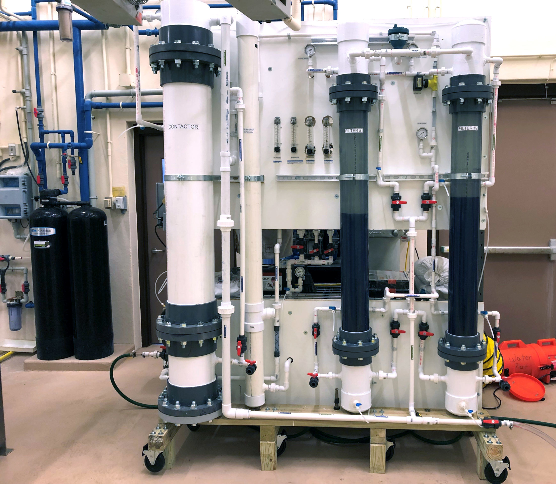
WSB is currently conducting water treatment pilot studies in communities with elevated nitrate and ammonia levels. A pilot study allows cities to gain understanding of the treatment requirements for a specific source water and contaminant. Bench-scale testing is commonly performed prior to and during the pilot phase to analyze on-site water quality and to determine the design parameters and unit processes needed for the pilot study. A successful pilot test provides real world data to better estimate system sizing and long-term operation costs. This can reduce the risk of purchasing and installing a full-scale treatment system before it is verified in pilot-scale.

WSB provides bench-scale and pilot testing services that include conventional oxidation/filtration, biological filtration, adsorption, and other processes that simulate the larger scale applications being considered for a new water treatment facility or an upgrade to an existing facility. Groundwater and surface water contaminants that can be piloted include, but are not limited to, iron, manganese, ammonia, nitrates, perfluorochemicals (PFCs), arsenic, radium, total organic carbon, turbidity, suspended solids, viruses, and bacteria.
From designing water treatment facilities to performing comprehensive water studies, our engineers, hydrogeologists, and scientists partner with communities to identify unique solutions that provide safe and clean drinking water for years to come. Visit our website to learn more about WSB’s drinking water services and related projects.
Following comprehensive plan development, communities in the 7-County Metro are expected to update their zoning ordinance.
By Molly Just, Senior Planner, WSB
Zoning is an important tool to promote and manage growth and to help residents and businesses manage expectations about what they, and their neighbors, can do with their property. Without updating the zoning ordinance many planning goals may not be attainable. Read this article for more reasons about why updating your zoning ordinance is essential.
Ensure your zoning regulations are up-to-date by following these simple steps.

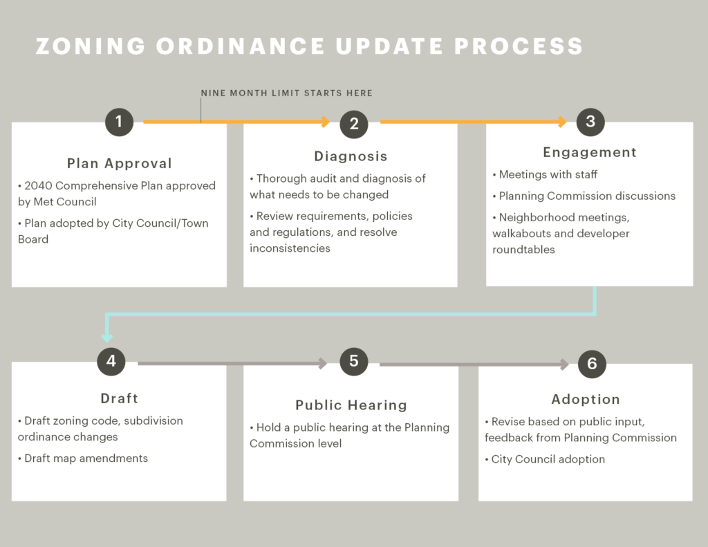
9-month clock starts. State statute and the Metropolitan Council require that “official controls” be updated within nine months of Comprehensive Plan Adoption. This includes zoning text, zoning map and subdivision ordinance.
- Plan approval – Your 2040 Comprehensive Plan is approved by the Metropolitan Council and adopted by the City Council or Town Board.
- Diagnosis – The process of updating the ordinance should begin with a thorough audit and diagnosis of what needs to be changed. Potential things to look for include: changes to existing district densities and lot requirements to conform with Comprehensive Plan densities; zoning map changes to conform with the Future Land Use Plan; text changes based on Plan goals; incentives consistent with housing and economic development policies; updates to outdated regulations; resolving inconsistencies; updates to minimize non-conformities.
- Engagement – Hold meetings to identity issues and potential map changes. Re-engage comprehensive plan stakeholders as allies in support of implementation.
- Draft – Be sure to draft any zoning code and subdivision ordinance changes, and map amendments that apply.
- Public hearing – Once your zoning update plan is drafted, hold a public hearing for the Planning Commission to discuss further.
- Adoption – Revise your draft per the feedback received from the Planning Commission and submit to the City Council for plan adoption.
Communities should also plan to implement and educate during the planning process to ensure a successful outcome.
Plan to implement. Keep track of zoning items during the comprehensive plan update process and in the final year of planning, incorporate an implementation line item into next year’s budget. It takes zoning to implement many of the land use and housing goals set forth in the comprehensive plan.
Plan to educate. What is zoning? What can and cannot be achieved through zoning? Plan to keep a list of policy issues that need to be addressed separately, such as property maintenance.
Learn more about how WSB can assist your city with comprehensive planning and zoning services.
By Shelly Hanson, Sr. Project Manager and Charlie Wild, IT Application Administrator, WSB
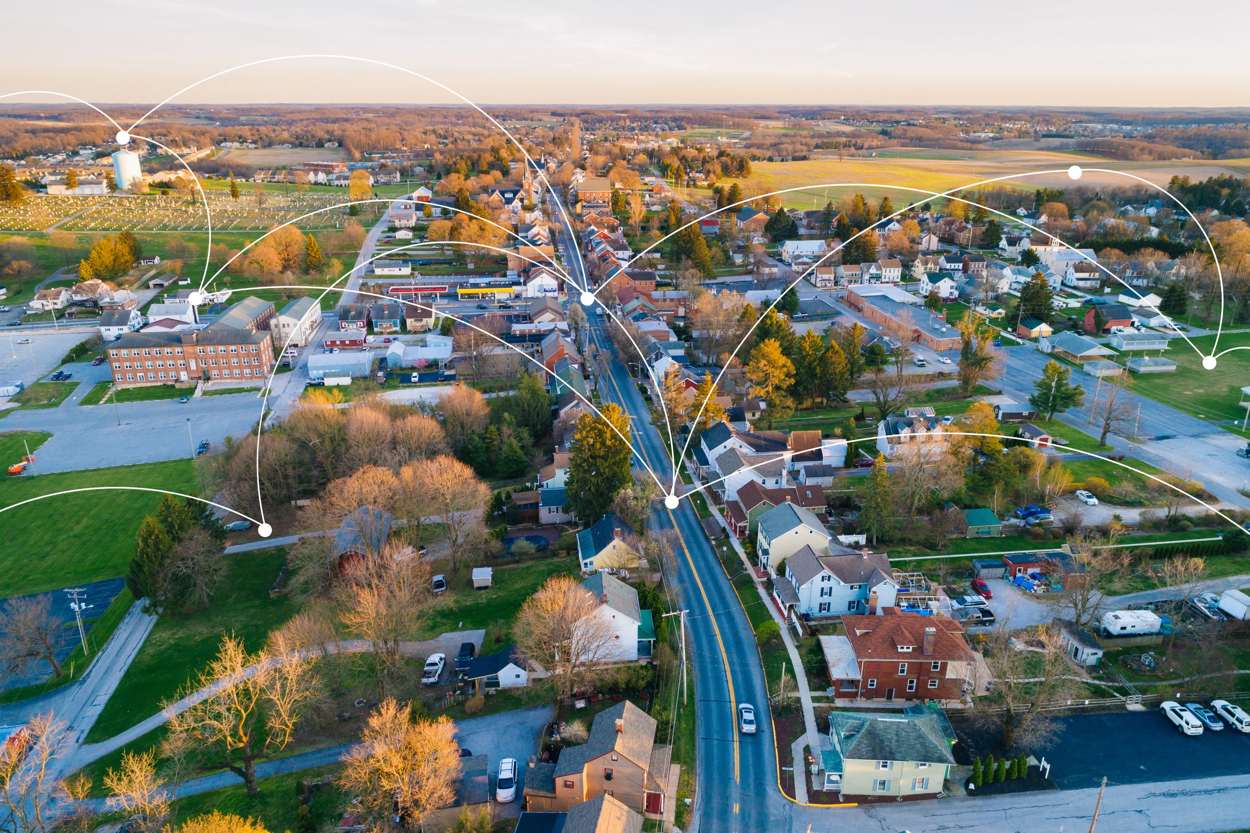
At one point, the idea of wirelessly connected, data-driven communities seemed futuristic and aspirational, like an episode of “The Jetsons.” But with advances in technology and consumer demand, this trend toward technology-enabled, efficient cities is happening all around us.
While major metropolitan areas like Chicago, San Francisco, and New York City are well-known for their “smart city” initiatives, communities of any size can take steps to use technology to improve city services, operations, policymaking, and public engagement.

Recently, many Minnesota cities have been working to expand their broadband networks, develop stormwater systems, manage energy performance, and initiate other smart city projects.
Definition of a smart city
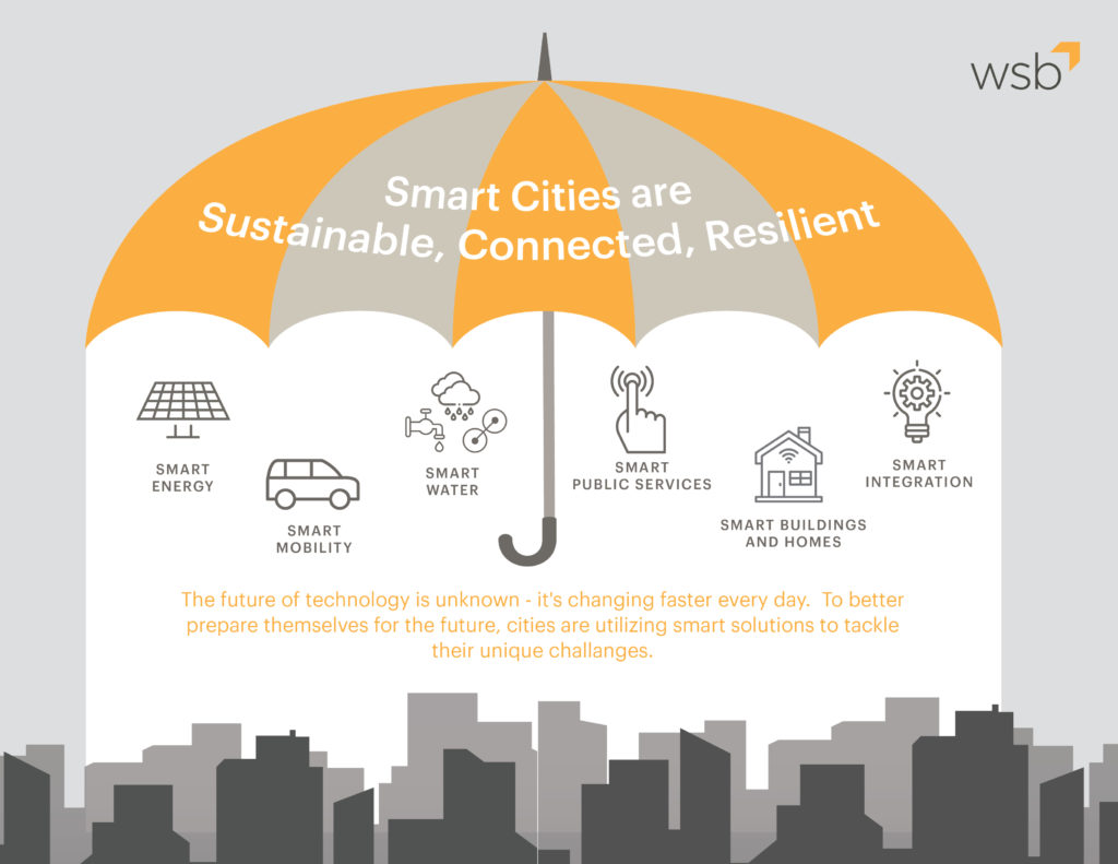
While there are many ways to define a smart city, we group smart city initiatives into these six categories:
- Mobility: Scooters, public transit, vehicles, and anything that moves people, goods, or services
- Water: Wastewater and stormwater facilities
- Public services: Traffic management, permitting, GIS applications
- Homes and building: “Internet of things” technology in homes, offices, and public buildings (heating and cooling, lights, security)
- Energy: Utilities, fleet management, efficiency
- Integration: Powered by data and seamlessly connected broadband networks, applications
In many cases, cities already have elements of this public infrastructure running through their communities and are on the path toward becoming a smarter city.
Achieving goals
It’s important to note that cities aren’t using these tools for accolades. Technology and data can help provide smart solutions that improve the quality of life in a city and return tax dollars into the system. Ultimately, the goal of implementing these strategies is to deliver better outcomes for the community while using fewer resources. Smart city approaches can also help communities reach broader goals like advancing equity, improving policymaking, or decreasing their environmental footprint. A tangible example of this is crime rates. In Philadelphia, the Police Department launched a “Smart Policing Initiative” using data, GIS mapping, and predictive analysis to see where crime is occurring most in the city.
The analysis allows the city to devote more resources to crime hot spots and improve response times. The city’s high crime areas have seen reductions in the crime rate since implementing these practices.
Disadvantages to consider
While it’s easy to see how data improved public life in the Philadelphia Police Department example, there are also drawbacks to consider. Smart cities are powered by data, and residents may be wary about sharing personal information with their government. Communities that use this technology must take steps to ensure privacy and prevent companies from profiting off their citizens’ data.
Another risk is cyberattacks. Now that many cities have made large-scale investments in digital technology infrastructure, predators have found opportunities to wreak havoc on city systems.
In Baltimore, attackers recently targeted the city’s computer-aided dispatch system, and first responders were unable to access it for 17 hours. A 2018 ransomware attack of Atlanta’s software applications disrupted five of 13 city departments and cost more than $12 million.
Smart cities must invest in the security of these critical infrastructure systems to ensure reliable and secure systems that the public can trust.
Money-saving initiatives
Although smart city initiatives may carry an upfront cost in some cases, they can save the city money in the long run. For example, San Diego leaders expanded upon money-saving efforts that are helping to make their city smarter.
What began as an initiative to use energy-efficient LED bulbs in streetlights has evolved into the deployment of the world’s largest smart city sensor platform. Controlled by remotes, this digital infrastructure allows the city to dim the streetlights during certain hours of the day, resulting in further energy and cost savings.
Becoming a smart city
Throughout the United States as smart city approaches become more common, cities are becoming more equipped to manage risks and use advances in technology to build better communities.
If your community is ready to get smart, public engagement can help you identify priority areas and set goals. Start a conversation in your city about the challenges you’re facing and how information and communications technology can help solve those challenges.
This article was originally published in the League of Minnesota Cities Winter 2020 magazine.
By Bart Fischer, Senior Public Administrator, WSB
As New Year’s Day begins to fade and we launch full steam into 2020, I take the opportunity to reflect on my time as a City Administrator in cities both large and small as well as discuss with colleagues those things administrators & managers should be mindful of at the start of each year. The following are five areas of importance that municipal executives should consider.
Strategic & Comprehensive Plan
Most organizations have a strategic or comprehensive plan. These can be extensive and far reaching with a mission, values, goals, and implementation strategies set by the council, board, staff, and strategic stakeholders, or they can simply be a short list of priorities the council has established. If a community or organization does not have clear direction, the city administrator should first consider finding the best way to accomplish setting a clear direction. This is something that the Mayor of Oakdale and I made a priority, especially when new councilmembers and staff were introduced into the organization.
Once in place, it is the role of the administrator and manager to implement the plan. At the beginning of each year, one should consider how the plan for the previous year has gone, how and what the organization will need to implement the current year’s plan and start looking toward the creation and implementation of next year’s plan.
The beginning of each new year is an opportunity to reflect upon the past, evaluate the present, and prepare for the future.
New Councilmembers
The beginning of a new year often brings changes to the council and board. New members can feel excitement for their new role as well an overwhelming feeling of uncertainty. It is imperative that administrators and managers help guide and assist newly elected officials toward success in their new role. Remembering that this could mean different things to each person and building a relationship with individuals is the key to deciphering how best to connect and communicate with them.
Provide the opportunity for success by connecting with each individual and guiding them toward team, organizational, and personal achievement.
Budget Process
As with strategic planning, the beginning of the year is the time to start laying the groundwork for the next budget. Budgeting is truly a year-round process. Once the annual budget is adopted in December, there is a short break and the process begins again early in the year. Utilizing the strategic and comprehensive plans in planning and crafting the budget process for the year is imperative. These documents provide the priorities of the council and board, and identify investments being considered. During my time in Oakdale, the finance director and I would meet with each department head to strategize how best to incorporate the short-term needs of each department with the long-term goals of the council.
Ensure successful budget preparation by planning and crafting a framework for the process and incorporating strategic & comprehensive plans and goals.
Legislative Session & Priorities
With each new year comes a new Legislative Session and the opportunity for municipalities to advocate on behalf of priorities and projects of importance. Having a relationship and building a connection with the Senators and House Members that represent your area is vital. Being able to work with them toward the passage of those priorities and projects is essential. They want to work on behalf of their constituents, so help them by having a list of priorities ready that they will advocate for. Another valuable resource in this area is the League of Minnesota Cities (LMC). Work with the LMC on your list and how to advocate with your Legislators. Throughout my career, I have been part of the LMC’s policy committee process. Consider taking advantage of this opportunity to have a voice in the legislative process for city issues.
Having a relationship and connection with your state elected officials, the LMC, and a list of priorities ready for them to advocate on your behalf is an important piece of the annual thought process for an administrator and manager.
Relationships & Connections
At the beginning of each year, take stock of and lean into those connections and relationships that will be vital to the success of the organization and you as a professional. These might include connecting with county or surrounding municipal partners, key business or non-profit community contacts, state or federal elected officials, professional organizations such as the LMC, Association of Minnesota Counties, or the Minnesota City/County Managers Association. And do not forget your family, friends, and neighbors who are invaluable in keeping you grounded and connected. There have been many times when I have taken the opportunity to “bounce” thoughts and ideas off friends and neighbors to gather feedback even if they will not be the ones directly affected.
The value of connections and relationships at the professional and personal levels cannot be overstated. Be strategic about fostering these relationships now for a successful year.
Conclusion
Creating plans, budgets, legislative priorities, integrating new councilmembers, and leaning into relationships & connections is an ongoing process; however, taking the opportunity to focus on them at the beginning of each year is an important aspect of municipal leadership and management.
What kind of things do you find essential to focus on in the first quarter of the year? Comment below or message me to learn more about how WSB is helping communities achieve their vision and goals.
Bart has been a City Administrator/Manager in the public sector for over 16 years. He is a strategic leader known for relationship development and connecting people around common themes and goals. Bart’s experience lies in leading and creating an organizational culture of collaboration where the whole becomes greater than the sum of its parts.

By Jeff Sandberg, Sr. Project Manager, WSB
WSB’s Renewable Energy Solar team continues to innovate in the industry and expand our expertise. Most recently we developed a system to quickly and efficiently analyze and compare solar site grading costs. Even a 6” cut or fill across a large site can result in substantial costs making a site less attractive, or impractical, for a developer. Analyzing rows and rows of solar panels conventionally has been tedious and time consuming. Our new, automated CAD processes makes the analysis more efficient and cost-effective.
Methodology

The automated processes uses Civil3D. It allows the user to input tolerances from different panel types and desired racking lengths to generate a proposed grading surface. The system produces a thematic mapping of grading cut and fill quantities for areas within the array footprint on a micro level.
Analysis & Results
As solar developers know, site grading costs can make or break a project. Being able to quickly and efficiently apply this technology to small and large sites allows a developer to compare, evaluate and determine which sites are most cost-effective from a grading standpoint. We can further refine array layouts to efficiently and cost-effectively fit within the site terrain, minimizing the amount of site grading required.
Similar technology takes structural pile plans and produces a plan and point file of X, Y, and Z coordinates. That information can be downloaded to the surveyor, in the field, to pinpoint the exact location and elevation of each individual pile in a project, anything from 1 MWac sites to 500 MWac sites and larger.
Geography
As a national company, WSB can apply this process to any site around the country. Our Renewable Energy team has worked on renewable energy projects across the country and can provide a full set of services for solar projects; services include, but are not limited to, Critical Issues Analysis (CIA), Engineering and Site Planning Approvals, Construction Surveying, and Geotechnical Services.
What’s next?
WSB continues to develop techniques and solutions to ensure the success of client projects. From Site Selection software to automated Micro-Grading Analysis, WSB continues to innovate and lead the Renewables market.

Jeff is a licensed Civil Engineer and Senior Project Manager at WSB. He has over 26 years of engineering experience in the areas of municipal, commercial development, and consulting engineering. Jeff has worked with many municipalities and has a wealth of experience in working with local, State, and Federal permitting authorities.
By Dan Pfeiffer, Director of Public Engagement, WSB
As many states across the country issue stay-at-home or shelter-in-place orders, our communities are still forging ahead behind the scenes with many infrastructure projects that are essential to our lives and economic health when we move beyond Covid-19. Many of these infrastructure projects rely on public engagement efforts to help guide decision-making and gain valuable feedback. Delaying project progress by canceling engagement activities is not an option when timelines and construction need to continue forward or when working in areas with shorter construction seasons.
There isn’t a one size fits all solution when determining ways to effectively engage with stakeholders. When typical engagement methods of in-person, small group and stakeholder relationships are not possible, staying connected to the public is still possible and effective.
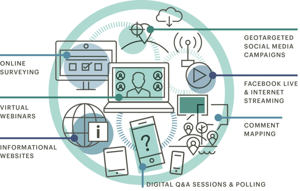
Digital and Virtual Engagement Methods
Connecting with audiences virtually offers a more flexible audience who can engage where and when it’s convenient, but standing out amongst the noise and distractions can be challenging. It’s important to capture their attention right away since they are a mouse-click or new link away from not being engaged. Some effective tools include:

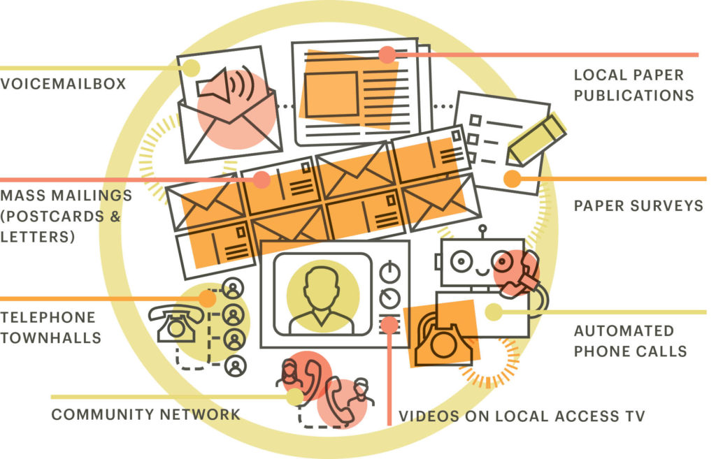
Engagement Methods When Barriers Exist
Barriers to participation in a digital environment exist. Access to internet, internet connection speed and computer literacy are all challenges that communities may face. When engagement is needed in communities that lack internet, cell service or other technology barriers, finding ways to connect with stakeholders requires some creativity. Some effective tools include:


Dan has more than ten years’ experience leading teams, as a team leader and operations assistant in the Army, and Minnesota Army National Guard and over eight years in public engagement. He has completed the International Association of Public Participation’s Foundations in Public Participation, the National Transit Institute’s Public Involvement in Transportation Decision-making courses.