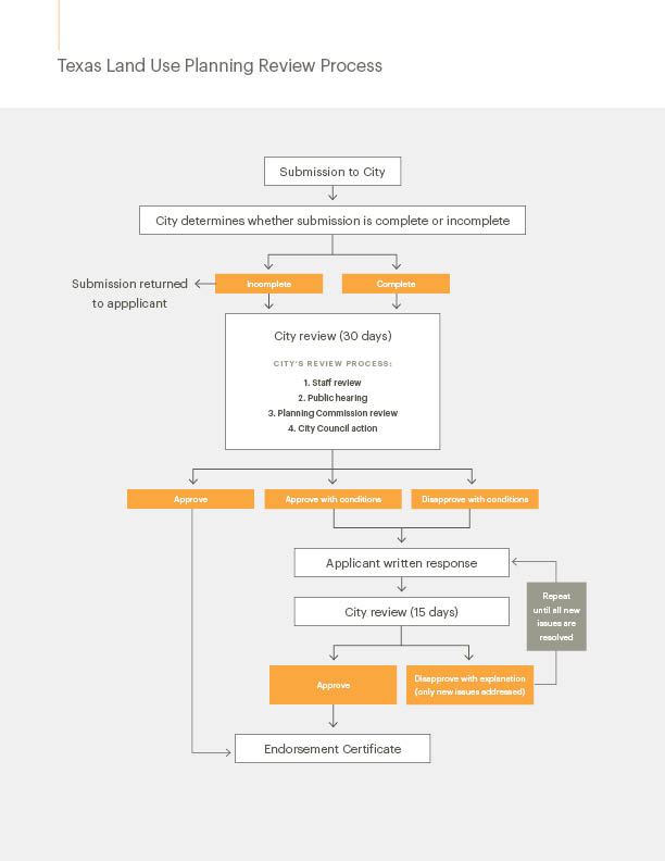
As of September 1, Texas has made several changes to the land use planning review process. Specifically, the site plan and subdivision platting approval processes have been shortened to 30 days. The chart to the right demonstrates the revised work flow and timelines used in order to compile with the new planning review process. This new schedule is increasing pressure on local municipalities who are likely feeling pressure to comply with the new application process.
Our community planning team is experienced with navigating legislative
and ordinance process changes that create tight deadlines. We have spent years leading
clients through city internal reviews and staff capacity issues. By assisting
with ordinance and procedural changes, tracking applications, handling
communications, and ensuring that all statutory requirements are met, we help our
clients meet the needs of their communities. Our team uses an interactive and
quality control approach to account for every detail to ensure our clients’
success and the smooth operation of their Planning Department.
Client communities can relax and feel confident that their boards, councils and commissions have all the information they need to make educated decisions during the changing legislative landscape and the entire planning review process.
So, your comprehensive plan is done – and everyone is breathing a big sigh of relief. Now what?
A community’s comprehensive plan includes recommendations on
land use, housing, and other areas that are described and enforced by that
city’s zoning ordinance and subdivision ordinance. Without updating the zoning
ordinance many planning goals may not be attainable. Zoning is important to
promote and manage growth and to help residents and businesses manage
expectations about what they and their neighbors can do with their property. Simply
put, you can’t attain the development goals established in a comprehensive plan
without a zoning ordinance.
A sense of relief and accomplishment at the end of the comprehensive
planning process is understandable; it can take years to update a comprehensive
plan. As a former local government planner, I have been asked many times if a
plan will just “sit on the shelf.” This often stems from a lack of ability to
build the plan. Zoning means different things to different stakeholders. For
developers, zoning is a building tool. For residents, it is a tool used for
protection from the unknown. For local government, it is a tool to promote the
prosperity, health, and welfare of the whole community. For planners, zoning is
a tool to achieve the plan goals. Turning a comprehensive plan into a reality
can be largely based on the zoning ordinance. An update to the zoning ordinance
should be incorporated when updating a comprehensive plan.
Here are four reasons to update your zoning ordinance:
An update leads to increased buy-in from elected officials and community stakeholders. Planning is a visionary process. If stakeholders know that the zoning comes next, they may be more likely to participate and stay involved. The zoning ordinance puts plans into action.
It helps ensure the zoning work will be completed and budgeted for in advance of planning fatigue that can overwhelm the late phases of updating the comprehensive plan.
The comprehensive plan visioning may be stronger with the knowledge that zoning should occur immediately following completion. The comp plan will be more targeted to the conditions of the community and supported by stakeholders and elected officials. In other words, visions are rightsized to the community.
The plan visions may be sooner realized. Oftentimes planning fatigue and competition for staff time and resources result in zoning updates being pushed off for months or years, potentially resulting in legal challenges or extended project timelines.
And beyond just planning for the zoning update, here are six
reasons to update your zoning ordinance:
Legal protection. Zoning decisions that have no basis in the comprehensive plan are more successfully challenged in court. There must be a rational basis for zoning decisions and requirements. Additionally, cities in the Twin Cities metropolitan area must comply with the Metropolitan Land Planning Act which imposes certain mandatory zoning and regulatory requirements and requires that zoning directives harmonize with and not contradict the comprehensive plan.
To reflect federal and state law pertaining to land use and zoning. For example, how we regulate non-conformities has changed in Minnesota, with local authority over non-conformities weakening. Also, legal decisions regarding signage impact how local government reviews sign applications.
To incorporate plain language and resolve internal conflicts that are the result of decades of incremental updates. The use of plain and clear language to define uses and terms strengthens the legal standing of ordinance interpretations.
To address confusing concepts that have led to inconsistent application of code. Modern zoning codes use graphics to illustrate concepts such as setbacks, lot coverage, and floor area ratio.
To adapt to societal changes that conflict with narrow use categories and single-use zoning, such as allowing home offices, businesses, accessory units, and accessory structures within homes and on single-family lots.
To incorporate best practices in land use and development that focus on how a building fits into its context and ways to mitigate use conflicts rather than narrowly legislate use of private property.
Although, there are many factors that determine how quickly
a comprehensive plan can become a reality, zoning is certainly not a factor to
discard.
The Fallon Avenue Overpass project recently received an honorable mention for this year’s 2019 Minnesota Chapter APWA Project of the Year Awards. The APWA Awards program recognizes excellence in public works. We were honored to partner with the city of Monticello on a project that connects the community.
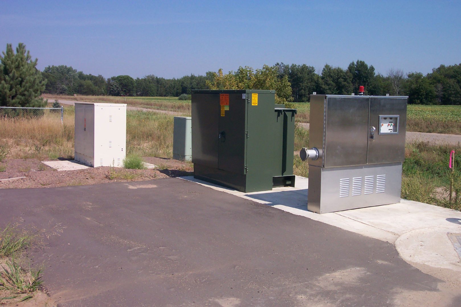
As infrastructure ages, you will need to prioritize which items to fix first. You need to determine which items to do this year and which items can wait for future plans. How do you know when it is time to put a lift station at the top of the list? Below are 5 signs that your lift station is nearing the end of their usable life cycle.
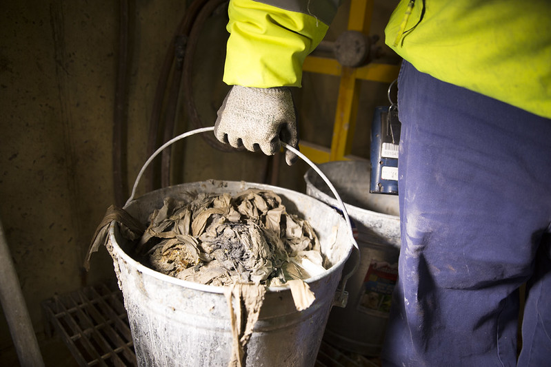
1. Clogged Pumps – Have your maintenance crews been spending an inordinate amount of time and resources addressing clogged pumps? Rags, sanitary products, and many other items find their way into your city’s sanitary sewer, but cannot be passed by the old style impellers. It might be time to upgrade your pumps to modern non-clog impellers to address this maintenance nightmare.
2. Increased Pump Runtimes – Over time, pumps lose their efficiency causing them to generate less flow at lower velocities. This can cause solids to settle in the forcemain and exacerbate the pump inefficiencies. Compare your electricity bills over time. If the number of kilowatt hours used has gone up, it might be time to dig into the issue.
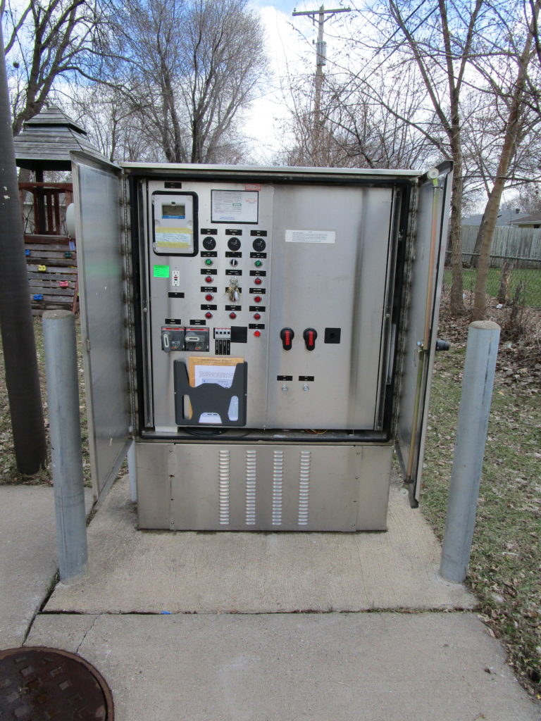
3. Electrical & Communication Failures – Old starters, leaking mechanical seals, electrical service changes: these items can cause tripped circuit breakers and blown fuses. If your SCADA system isn’t communicating these failures to maintenance staff, you might find out from an angry resident with sewage backup in their basement. Electrical and communication upgrades will help your staff maintain real-time status updates and put your mind at ease.
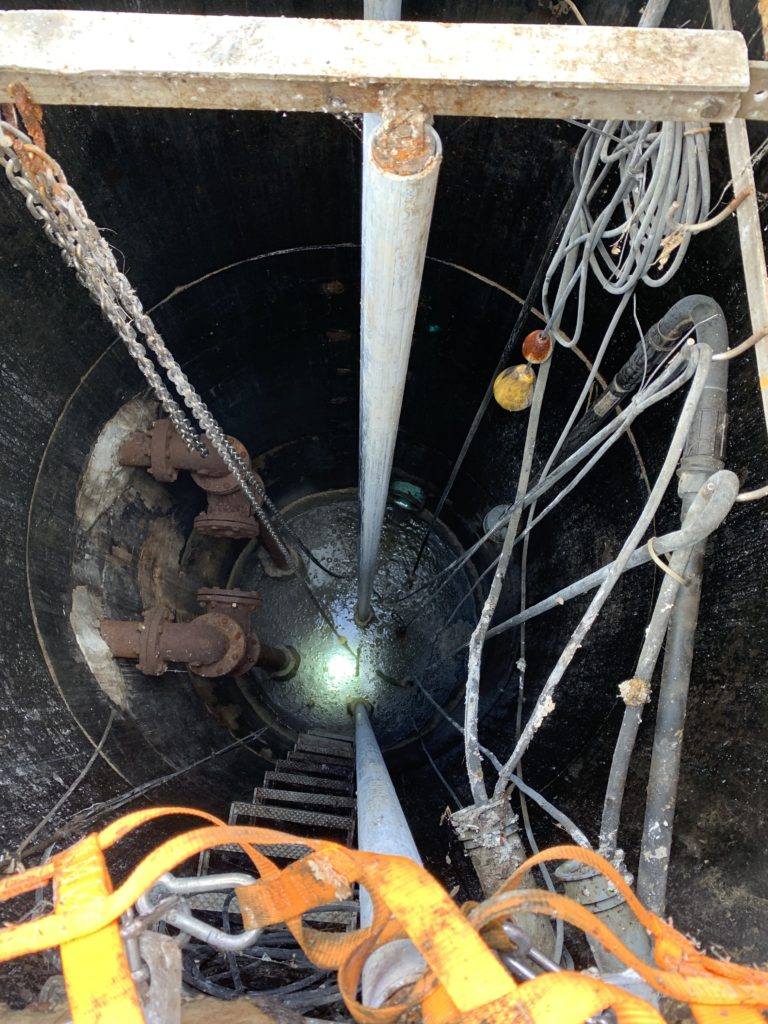
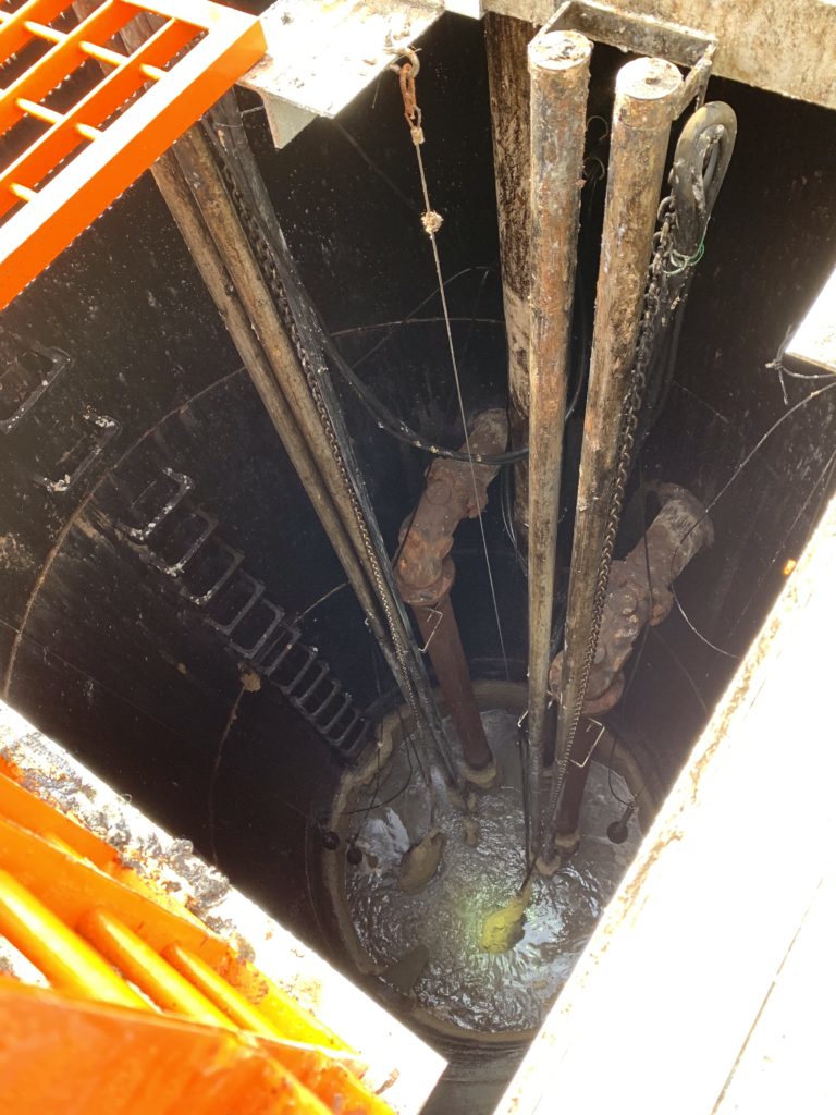
4. Degraded Concrete, Piping & Equipment – Sanitary sewage can generate corrosive hydrogen sulfide (H2S) gas that chews up the lift station concrete, pump rails, piping, hatches, and valves. Ensuring proper pump cycles and providing mixing to break up gas producing materials in the lift station can help reduce gas generation, but it may also be necessary to coat the concrete with a corrosion resistant barrier and replace lift station equipment with more robust materials. Have the field crew take photos for you to review.
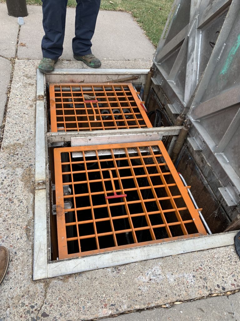
5. Safety – Are your lift station hatches equipped with fall protection? Are your workers using tripods with harnesses for lift station access, or are they relying on deteriorated manhole steps? Review the safety features of your lift stations and make sure your crew has the right equipment to do their job safely. Lift stations are a very hazardous environment, but simple safety features and protocols can make all the difference.
If you are experiencing any of these issues or want more information, we can help.
Road reconstruction projects
affect residents of all cities, from large metropolitan areas to small rural centers.
While residents are very familiar with the sight of bright orange cones and
excavating machines that are shown for a few months in the summer, few know the
full amount of work that goes into improving roads and public utilities the
rest of the year. Here is a season by season breakdown of how a road
reconstruction project comes to life:
Summer/Fall
The summer/fall season is when work on a specific project typically begins for the upcoming construction season, with the start of preliminary design. Depending on the size and complexity of the project, preliminary design can begin months or even years earlier than this time frame.
The preliminary design begins by collecting extensive information on the existing conditions of the public infrastructure in the project area. This can be done through a topographic survey of the area, taking geotechnical readings on the materials in the area, and even reviewing asset management systems or old plan sets for the project area.
Based on the information gathered, the project team (typically consisting of transportation and municipal engineers) can identify improvements needed within the project area. The team then provides a preliminary overview of proposed improvements to the project owners, private utility companies such as gas or electric that could be impacted, residents, business owners and other stakeholders in the project area. At this point, public engagement becomes critical to connect with the owners, companies, and residents to solicit feedback on the proposed improvements and gather additional information on existing conditions. This feedback can be achieved through neighborhood meetings, showcasing visualizations, and conducting community surveys.
After gathering
feedback, the project team presents the proposed infrastructure improvements along
with estimates on costs and schedule to the project owners, and, if the project
is still supported, begins final design.
Fall/Winter
The fall/winter season is dedicated to final design of the project. The team (supported by site & landscape designers, water resource engineers and wastewater engineers) completes final design documents that specialists in infrastructure construction techniques will use build the project. These documents will complete the city’s vision for the project while ensuring it is properly engineered and safe for residents. The design includes not only the pavement that residents drive on, but also all of the public utilities in the project area, such as storm sewer, sanitary sewer and watermain.
During this time, the project will also be reviewed by permitting agencies that have jurisdiction over certain aspects of the project. These agencies, such as a county or state transportation agency, may have jurisdiction over neighboring roads. Other agencies, like a state departments of natural resources, may review the project for environmental regulations within the project area.
Once the plans and specifications are complete, the project team will share the finished design documents with the project owner. The project is then authorized to be bid for construction.
Winter/Spring
The spring season is
used to bid the project and prepare for construction. After the project is authorized
to be bid, a notice goes out to contractors notifying them of the project and
providing them access to the plans and specifications. If a contractor is
interested in constructing the project, they submit a set of documents to the
project owner. These documents include insurance information, proof of bonds,
and their bid of how much they believe it will cost to construct the project.
At an arranged time, a contractor will be selected from those that submitted a
bid.
Once a contractor has been selected, project management and construction administration begins. Preliminary construction meetings are held with the project owners, the project team, and other stakeholders, to prepare for the upcoming construction of the project.
Spring/Summer
After the preliminary and final designs are complete, construction -the most visible stage of a project – can begin during the spring/summer season. During this time, the project team monitors contractor progress on the project, and ensures that the construction is being done according to the plans and specifications that were prepared in the fall/winter. This monitoring consists of a variety of activities that include construction material testing, environmental compliance, and more.
Because the winter season is often the longest in the Midwest, the time frame for construction is extremely short. To protect the final product, some projects require contractors to wait until after winter to finish minor paving and restoration work during the following spring/summer season.
Once all of the work is complete and accepted by the project owner, the contract is finalized and closed out. Usually a maintenance period is required of the contractor, during which time they are responsible to address any workmanship or materials defects which are identified following close out.
At this point, the project is considered complete. The project owner is responsible for ongoing maintenance and repair of the infrastructure through their Public Works Department. The new seasonal cycle begins with the next project that was prioritized or identified within that community’s Capital Improvement Plan or similar planning document. Learn about how WSB can assist your community with any or all of these project cycles by visiting https://www.wsbeng.com/expertise/community/ or clicking on any of the linked services above.
Brandon is a Graduate Engineer with WSB and serves as the assistant city engineer for the City of Sunfish Lake, MN. He is experienced with reviewing developer and residential land development plans and management of cities’ Municipal State Aid Systems (MSAS) through the Minnesota Department of Transportation (MnDOT).
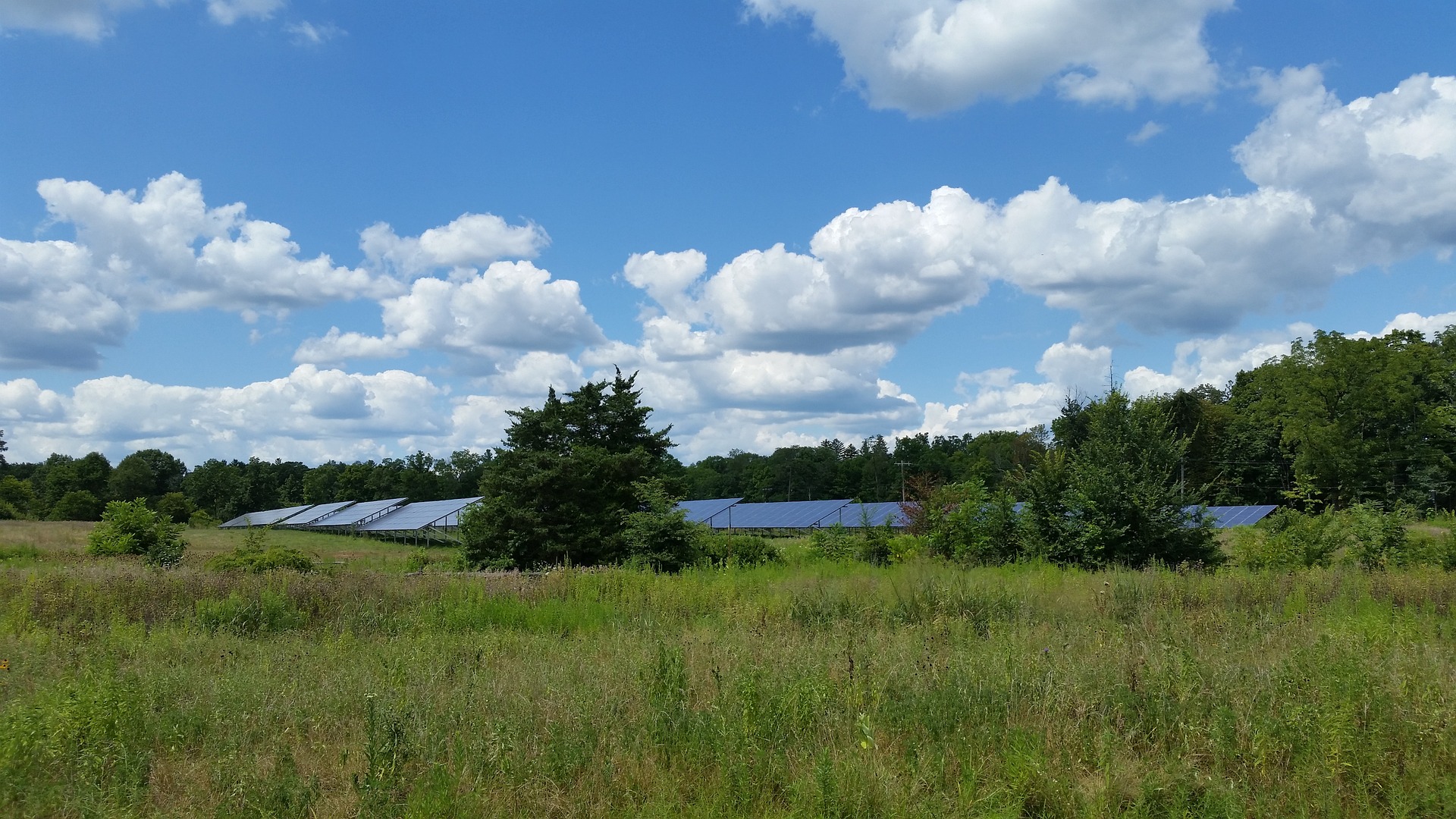
Solar production in Minnesota has seen dramatic increases in the past few years and continues to grow across the state. With this rapid growth comes challenges about how to regulate the installation of panels at a local level. According to the Solar Energy Industries Association (SEIA), Minnesota has already invested $1.9 billion on solar and additional growth is projected at 834 megawatts over the next five years. The installations of solar “farms”, vast arrays of solar panels, can be seen throughout the state and can generate up to a megawatt of electricity each. Development of these sites often requires large, vacant parcels which may also support natural habitats such as wetlands.
The development application process for these solar farms can be challenging for municipalities, especially those who act as the local government unit (LGU) for the Wetland Conservation Act (WCA). Developers must work collaboratively with LGUs to demonstrate a sequencing process that shows how their projects are avoiding, minimizing, and if necessary, replacing unavoidable wetland impacts. Under the WCA rule, the installation of posts and pilings from solar panels has traditionally not been considered a wetland impact if they do not significantly alter the wetland function and value. But, as the solar industry grows, LGUs have had questions about whether the installation of solar panels may lead to loss in wetland quality over time which would be a violation of WCA. A strong measure of wetland quality comes from the diversity of the plants within the wetland, factors like shading from panels and disturbances from construction may lead to conversion of the wetland vegetative community, and subsequently, the wetland quality. Loss of wetlands and wetland quality has overlapping effects on drinking water, lake and stream health, native wildlife, soil heath, and pollinators, all of which are important to our Minnesota ecosystems.
So why does this affect you? Many municipalities act as the
LGU responsible for implementing WCA. LGUs, alongside other regulating
agencies, have been struggling to make impact determinations for sites that
install panels in wetlands because there is little data available that
addresses the future outcomes of these natural areas. There is a growing need
for baseline data about how the quality of wetland vegetation changes
throughout the solar development process. If data were available, LGUs could
use these as a basis for making determinations.
Having baseline data about wetland vegetative quality under
solar panels is beneficial to both regulators and developers. Regulators will
have a scientific basis for making wetland impact determinations within their
jurisdiction and developers will see more consistency across municipalities
during the permitting process. We may see that wetland quality improves under
solar panels in certain circumstances through the planting of native vegetation
upon completion of development. In other scenarios, wetland quality may
decrease if the existing wetland was of higher quality prior to development.
WSB has started an exciting initiative to collect this baseline data at various solar sites in Minnesota. In 2019, environmental scientists at WSB surveyed wetland vegetation under existing or planned solar panels at four solar farms in varying stages of development. Additional data collection at these sites is planned for the summer of 2020. WSB is in the process of developing a Legislative-Citizen Commission on Minnesota Resources (LCCMR) grant application to expand this research in 2021 to more sites across the state and to include other metrics that may influence vegetation such as fixed-tilt or tracker panel types. Support of this research from municipalities will be important for the LCCMR application process and we encourage you to join us in the process through letters of support, in-kind hours, monetary support, or providing access to solar farms within your area. It is an exciting time in the renewable energy industry and WSB is committed to helping advance the clean energy market in a way that is sustainable to our Minnesota environment that we all cherish.
Roxy is an environmental scientist and certified wetland delineator. She has a master’s degree in ecology and is a Certified Associate Ecologist. She has completed numerous wetland delineations and has experience with wetland monitoring, ecological restoration design, environmental site assessments, field research, biological surveys, ArcGIS mapping, and GPS Trimble.
The City of Sandstone has received a $900,000 grant from the Greater Minnesota Regional Parks and Trails Commission.
The grant funding will be used to implement the first phase of the Robinson Park master plan. Robinson Park is a 65-acre city owned, historic park in Sandstone, Minnesota. Phase one of development will focus on building infrastructure with improved circulation and amenities, preserving historical elements and future development planning. The Robinson Park master plan strengthens the connectivity of the City of Sandstone, and highlights the unique traits and recreational activities that support its regional significance.
We believe in helping to build the workforce of the future.
WSB recently launched a series of collectible career cards to introduce young boys and girls to the extraordinary world of engineering and STEM career possibilities. Each career card offers a glimpse into the lives of six characters; Edie the Engineer, Sam the Scientist, Sophie the Surveyor, Patrick the Planner, Izzy the Inspector, and Erik the Engineer. Edie and her friends have unique traits and career paths but they all share a common goal that drives them to do their best: The future is ours for the making.
“I am excited to tell you about some of my friends. Years ago, we had big dreams for the future. Our entire team at WSB once started off as curious kids with different interests and skills. We’ve all taken unique journeys, but our paths have led us here – where we work together to build and protect many of the places you visit every day. We’re excited to share our experiences with you and can’t wait to see the path you take. Maybe someday you’ll join us too.” – Edie, WSB Engineer
Alison Harwood, Director of Natural Resources, WSB
As someone who has been on both the regulator and applicant side of the table, I understand that wetland permitting can seem like a complicated task, involving multiple review agencies and months of careful planning. I’ve witnessed frustrated project developers after growing impatient with the process, and concerned regulators who feared the appropriate steps to minimize impacts were not taken. However, if anticipated correctly, the permitting process can be smooth and painless.
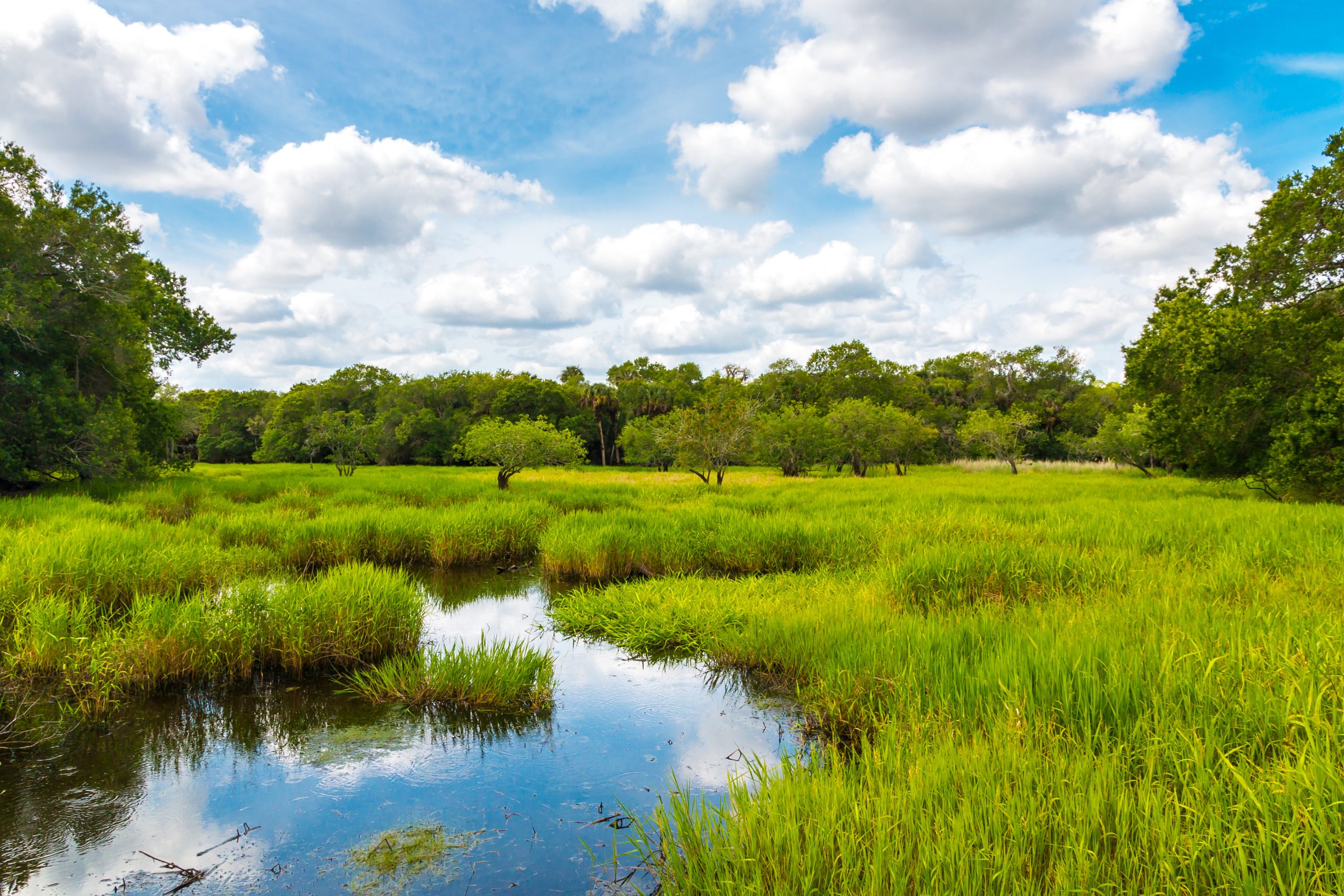
As we approach growing season, it is helpful to understand the project development steps for areas that feature wetlands – even if you don’t expect to impact them.
Identify wetlands.
This should be one of the first steps taken during project planning. A desktop-level delineation can be completed anytime by a wetland professional and is used to determine the potential for wetlands on the project site.
Do not assume your site does not have wetlands.
Depending on the results of the review, an onsite wetland delineation may be needed, which can only be completed during specific times of the year (i.e. growing season). Missing this window can cause delays in your project or force you to make design assumptions based on inaccurate data, which can increase the risk for redesign once field data is available.
From the beginning of a delineation to having approved boundaries can take several weeks or months, so advanced planning is essential if the project development indicates a shorter construction timeline. Assigning a trained wetland delineator is important during this step to ensure project boundaries are accurately identified and reported to local reviewing agencies. Mismanagement at this stage can result in extra work and time delays. Once the boundary data is collected, project developers can update the design plan and determine if wetland impacts will occur.
Examine potential impacts early.
Wetland impact approvals should always be obtained before you begin local project planning (i.e. plat approval) and identifying potential impacts early in design is key. This ensures that wetland regulation agencies are afforded the opportunity to review site plans and suggest ways to minimize impact and reduce the developer’s risk of costly design changes or permit denial.
Contact local wetland regulation agencies.
If impacts are expected, it’s a good idea at this point to inform the local wetland regulation agencies and plan a pre-application meeting. There are several agencies that regulate wetlands and keeping all informed is vital to ensure the permitting process stays on track. The most common agencies that are involved include the Wetland Conservation Act (WCA) Local Government Unit (LGU), US Army Corps of Engineers (USACE), Department of Natural Resources (DNR), and in some areas of the state, Watershed Districts (WD) or Watershed Management Organizations (WMO). Learn more about these wetland regulation agencies.
The amount of impact proposed for a project can affect the length of the review process. The following approval timelines can be used as a guide:
Agency
Permit Type
Days to Approval
WCA LGU
Wetland Impact Replacement Plan
60 days
DNR
Public Waters Permit
60 days
USACE*
Nationwide or General Permit (<0.5 acre)
60 – 90 days
Letter of Permission (0.5 – 3 acres)
4 – 9 months
Individual Permit (> 3 acres)
9 – 24 months
*Permit thresholds reported are for non-transportation projects.
Approvals through Watershed Districts Management Organizations vary, so project developers should refer to local guidelines for application and review timelines.
Often, the reviews described above are independent of each other. Approvals from one agency (ie: WCA LGU) does not eliminate the need for approvals from other agencies (ie: DNR). While the agencies may communicate with each other, developers are ultimately responsible for ensuring permit applications are received by each individual agency.
Below is a general timeline of project tasks that should be completed prior to getting approval by local agencies.
Task
Completion in Months (Prior to Local Plan Approval)
Wetland Delineation
8 months prior
Delineation Approval
6 months prior
Permit Pre-Application Meeting
5 months prior
Permit Submittal*
4 months prior
Permit Approval
1 month prior
* Assumes USACE General or Nationwide Permit.
Local ordinances should also be reviewed to ensure that all water resource-related requirements are being met. For example, some cities have wetland buffer setbacks that must be incorporated into the project design.
With proper planning, the wetland permitting process can be smooth and transparent. A little work in the beginning to identify the potential for wetlands can save the project manager from redesign and time delays that derail project progress.