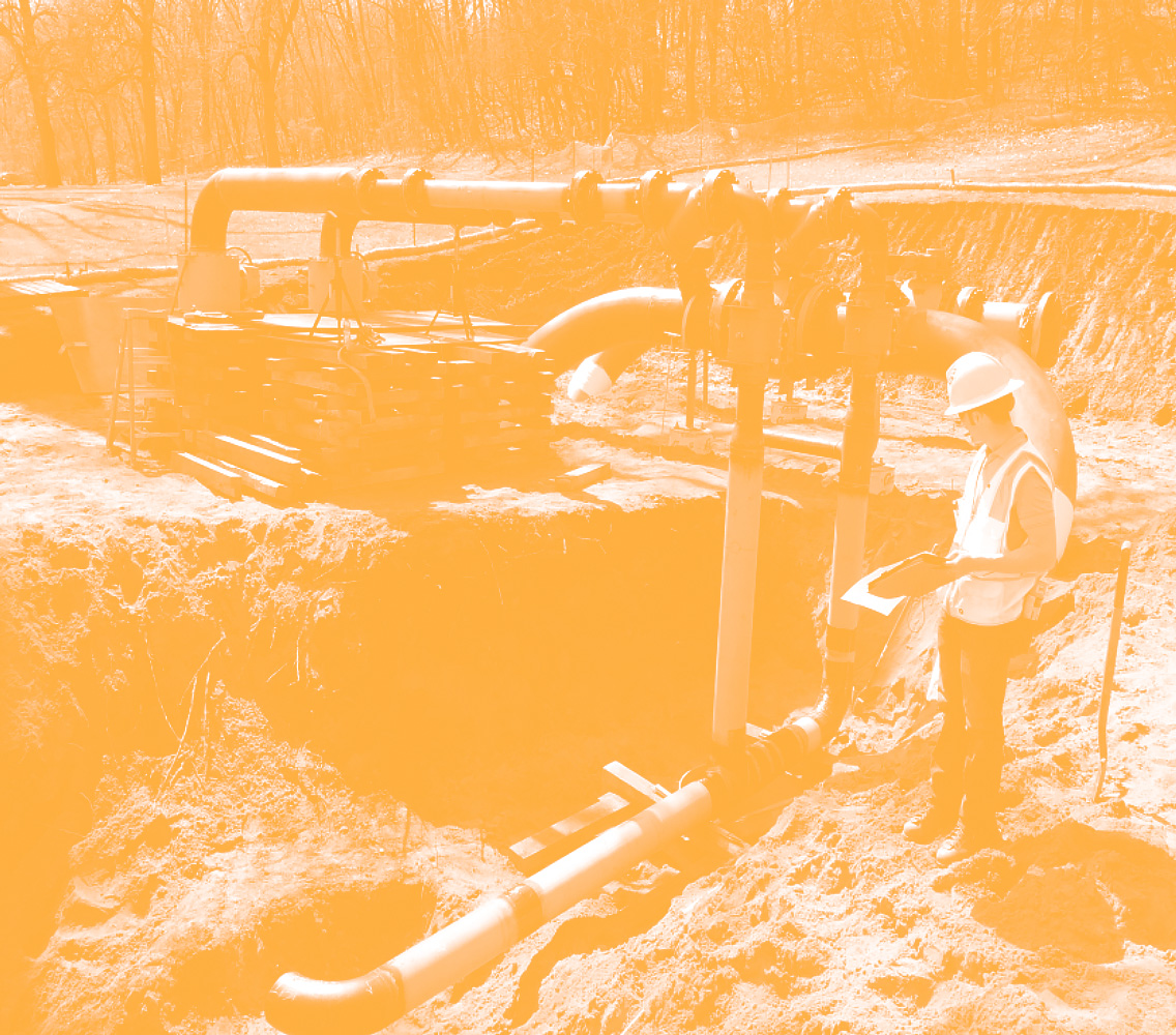
by Shannon McGrath, Director of Asset Management Planning, WSB
The state of Minnesota’s 2022 infrastructure report card was released earlier this year by the American Society of Civil Engineers and the state of our infrastructure is not great. Within the report card, the Minnesota Department of Transportation (MnDOT) was commended for their approach to employing asset management strategies to support infrastructure needs across the state. Collectively, there are opportunities to improve infrastructure at the state and local level through the use of a comprehensive asset management program, but knowing where to start can be overwhelming.
Understanding Infrastructure Asset Management
Asset management is defined many ways. In this context, infrastructure assets should be thought of as any asset used by the public. Roads, bridges, culverts, dams, pipes, and buildings are just a few examples of public infrastructure.
From there, the approach is to develop planning and strategy to minimize total cost of ownership, increase reliability and resiliency, and meet a desired level of service.
Implementing Asset Management into Community Planning
Planning for and implementing comprehensive asset management plans and programs should be thought of as a multi-step process that includes the following:
Defining vision and objectives
Collecting and managing inventory and condition data
Conducting risk analysis
Developing performance measures and targets
Completing a performance gap analysis
Planning for life cycle management, financial, and investment strategies
Implementing technologies to meet an organization’s goal
Asset owners can start in several places, but it’s important to take a thorough, thoughtful look at all assets and plan for how to best allocate funds and time. That means taking a step back to look at the bigger picture of your desired level of service and how to achieve it both efficiently and effectively.
Scalable Solutions
Asset management is a spectrum and can be scaled to any type of asset and any size community or organization. Different communities are at different levels of maturity in planning, but it’s important to recognize a current state and where improvements can be made.
Furthermore, by facilitating discussions holistically and cross-departmentally, rather than driving asset management through a single area, the idea and importance of it can be adopted into the culture. Emerging trends like more efficient technology and tools to capture, store, and analyze data are also driving more informed decision making and helping drive better planning for communities and organizations of all sizes.
Shannon has spent over a decade advancing asset management at local, state, and national levels by serving on asset management committees, advisory panels, and project management teams. While working at MnDOT, Shannon directed the agency-wide asset management planning including projects, research, policy, innovation, strategic planning, and implementation in collaboration with internal and external stakeholders.
Last year’s $1.2 trillion infrastructure funding package is a once-in-a-generation investment into our nation’s infrastructure. Because there is such a large influx of dollars for communities in every corner of our country, this is also a once-in-a-generation opportunity for city planners to make strategic investments in projects that improve communities’ livability, development, sustainability, and more.
City planners may think that this bill has little to do with their daily activities because of the bill’s infrastructure focus. This is not necessarily true and now is the time for planners to think outside the box and help their communities take advantage of this historic funding. Here are some thoughts to consider.
Explore and update your comprehensive plan.
City Planners are the keepers of a community’s comprehensive plan and are often responsible for the implementation of this document, which usually contains chapters on transportation, water/wastewater, sanitary sewer, and sustainability. Now is the time to take a deep dive into your plan and think about what items are on your wish list. This may include projects that have previously lacked funding or need to be bumped higher in your priority list. With so much funding available, don’t be afraid to think big.
Now is also the time to think about master plans. If you have been waiting to do a master plan on a specific area of your community due to time or budget constraints, the new bill can help fund some of your implementation measures.
Collaboration is key.
Additionally, now is a great time for city planners and engineers to come together and assist each other in the completion of city-wide projects. Interdepartmental cooperation can strengthen relationships and provide amazing learning opportunities, and planners can often assist in helping do research, writing grants, and more.
Make sure your city ordinances are up to date.
Federal funding is helping spur infrastructure investments in areas like electric vehicle (EV) charging infrastructure, broadband, and more. If your community’s ordinances are not up to date, you may miss out on key funding opportunities, so now is the time to examine your local laws and work with the city council and planning commission to make changes as needed. City planners may also need to examine their staffing levels and hire to help facilitate and manage some of these investments.
How WSB can help.
Whether it’s taking a look at your ordinances, creating a community sustainability plan, applying for grant funding, or planning and designing infrastructure projects – WSB can work hand-in-hand with city planners to take advantage of the federal infrastructure funding.
City planners are advocates for their community and its residents, and WSB can help ensure your community is competitive when pursuing infrastructure dollars to advance your priorities.
Lori has more than 25 years of experience working in a municipal planning department, having worked her way up through the planning department at the City of Blaine to become their city planner. She has worked in all aspects of city planning activities including project management, site plan and application review, public participation and long range planning.
Funding for the ‘Safe Streets for All’ (SS4A) program is now available thanks to the $1.2 trillion Infrastructure Bill passed in Washington last November. The SS4A Program aims to improve road safety by significantly reducing or eliminating roadway fatalities. This program could help your community make strategic planning, infrastructure and safety investments to improve the lives of residents.
The notification of funding for SS4A, as well as the application process, went live in May of this year, and the deadline to apply is September 15, 2022. The first round of funding will make $1 billion available to communities, with more rounds expected to be available annually through 2026.
Who Qualifies?
The grant program is targeted for local, tribal, and regional entities. States, including DOTs are not eligible. However, applicants should consider coordinating with state agencies as appropriate.
This program is structured with equity in mind, to ensure equitable investment in safety needs of underserved communities. To this end, 40 percent of the SS4A funding is intended to go to low income and underserved communities. This includes rural areas to address disproportionality high fatality rates. Rural communities, especially if have lower income levels or experience persistent poverty/inequality, may benefit from SS4A funding.
Partnership is Important
By partnering with other communities, or applying for funds to address multi-community or regional safety issues, applications are more likely to receive approval and receive larger awards. The grants cover up to 80% of plans for projects and recipients are expected to match at least 20% on their own from non-federal sources; which is another reason cross-entity partnerships are beneficial. Identifying and collaborating with partners for larger, strategic projects can create a greater advantage to receive funding.
Two Application Categories
Communities can apply for funding under one of two categories: action plan grants or implementation plan grants.
Action plans are created to study and understand what safety issues exist and what strategies would best address safety issues. The award amount for an action plan, based on cost assessments, is between $200k and $1 million.
Implementation grants are for the actual project design and construction to make safety improvements to infrastructure. The possible award amounts are between $5 million and $30 million for approved projects.
Applicants may only apply for one grant type – an action plan or an implementation grant. Receiving a grant to prepare an action plan grant will not preclude applying for and receiving an implementation grant in future rounds of funding.
The SS4A program will not fund:
Projects where the primary purpose isn’t safety
Projects focused on non-roadway modes of transportation
Capital projects to construct new roads
Projects to expand capacity or improve mobility for motorists
Maintenance activities
How WSB Can Help
Is your community looking at how SS4A funding can help support safety-related projects? WSB can help determine if your proposed plan or project would be eligible; identify partnership and collaboration opportunities; help write applications; and answer any questions you may have about the process.
The federal infrastructure bill provides once in a generation funding for critical infrastructure needs and can greatly help enhance rural community infrastructure.
Mary has 20 years of progressively complex transportation planning and project management experience, gained from working on a variety of transportation projects for modes including roads/bridge, transit, and trails. Several these projects have included environmental documentation considerations – either pre-NEPA, or through NEPA and/or MEPA processes.
By Jason Daugherty, Director of Safety and Risk Services, WSB
Between the increased number of travelers and the many road construction projects underway this summer, this time of year is one of the most dangerous times to be on the roads. According to the United States Department of Transportation, there were over five million crashes in 2020 alone and as the country moves into a post-pandemic landscape, that number is anticipated to increase.
As a Director of Safety and Risk Services at WSB, it’s my job to ensure that we’re doing everything we can to keep drivers, passengers and road crews safe when moving through a zone where our surveyors and engineers are working, ensuring everything from signage and lights to proper barricading is in order. There are plenty of steps drivers can take to ensure the safety of those around you as you hit the road for summer travel.
Make sure your vehicle can go the distance.
Swimsuit? Check. Sunscreen? Double check. You may have nailed your packing list, but your vehicle needs just as much attention. Make sure your tire pressure and tread are up to par, and that your spare tire is looking good too. Don’t forget to keep a break-down/emergency kit handy as well. This includes a jack and tools for any flats or blow outs that may occur.
Plan ahead.
Knowing whether there is road construction on your route is important. Check with your local Department of Transportation or city website for project updates, detours and road closures in your travel area.
Stay alert.
Don’t count on coffee to keep you vigilant while driving. You may be itching to get to your destination, but make sure you take regular breaks and get at least eight hours of sleep before hitting the road.
Adjust your speed.
Speed is the number one cause of accidents and fatalities in construction zones. Move over for parked emergency or maintenance vehicles, and slow down to 20-miles-per-hour when passing.
Practice defensive driving.
It may take a bit of a driver’s ed refresh, but defensive driving is key. Accidents in construction zones are often a result of drivers having little or no reaction time, leading to rear-end collisions. Avoid distractions, cell phones, passengers, or anything that is taking your attention away from the road. Allow plenty of stopping distance between your vehicle and the vehicle in front of you, a minimum of two car lengths.
Do NOT drive impaired.
It seems obvious but driving while under the influence is a leading cause of death in construction zones, second only to speed. If you choose to indulge, be sure to have a designated driver.
As we all look forward to summer travel, keep these tips in mind. This simple list could be the difference between getting to your destination safely, and not getting there at all.
Jason Daugherty is the Director of Safety and Risk Services at WSB and has been a safety specialist and safety manager for over 20 years in construction, pipeline, aviation, DOT, environmental, and incident/accident investigation. Jason served as the emergency response officer/safety specialist for the State of New Mexico responding to, supervising, investigation and remediating incidents related to Occupational Safety and Health.
Over the past few decades many populations of pollinating species (such as butterflies and bees) in the U.S. have declined significantly due to invasive pests and diseases, pesticides, herbicides, loss of habitat, and climate change. Due to these declines, efforts are being made to conserve, restore, and maintain habitats that are valuable to pollinators. These efforts include the University of Illinois-Chicago (UIC) led Candidate Conservation Agreement with Assurances (CCAA) for the monarch butterfly (Danaus plexippus) and the CCAA/Safe Harbor Agreement (SHA) for bumble bees that is currently in development.
Monarch Candidate Conservation Agreement with Assurances (CCAA)
The Monarch CCAA was finalized in April 2020. Since then participation and interest in the program from the energy and transportation sectors has grown with 20 energy and 15 transportation applicants throughout the U.S., thus far.
The Monarch CCAA program has been very successful. More than 815,000 adopted acres have been committed, of which more than 692,000 acres are under an active CCAA; far surpassing the adopted acres target of 215,000 acres.
If you are interested in applying for the Monarch CCAA, please note that a decision regarding the status of the monarch is expected in 2024. If the monarch is listed as threatened or endangered, no new Monarch CCAA applications will be accepted following its listing.
Bumble Bee CCAA/Safe Harbor Agreement (SHA)
Building on the success of the Monarch CCAA, the UIC and USFWS are exploring the creation of a companion agreement aimed at conserving habitats for six listed or petitioned for listing bumble bee species in North America. The Bumble Bee CCAA/SHA may be extended to cover six additional species in the future.
The proposed Bumble Bee CCAA/SHA would provide similar protections as those in the Monarch CCAA, thereunder an approved CCAA/SHA would allow for incidental take of species covered under the agreement for 25 years. With the updated USFWS rusty-patched bumble bee guidance and rulings of listing status for many bee species expected in 2024, the protection of incidental take permit would be valuable. Also, if the program is successful, some bumble bee species may not need to be listed.
There are 49 bumble bee species in the U.S. Since 2017, two have been listed as federally endangered. Most recently, four have been federally petitioned to be listed, five are at risk, and one was considered unwarranted for listing although it has experienced significant population declines. These 12 species comprise approximately 25 percent of the bumble bee species in the U.S. (Table 1). Species that are at risk, but not currently petitioned to be listed may be petitioned in the future if their populations continue to decline.
Table 1. Bumble bee species being considered for coverage under the Bumble Bee CCAA/SHA and their respective ranges in the United States.
Species
Status
Range
Rusty patched bumble bee Bombus affinis
Federally endangered
From Minnesota to Missouri and to the east coast.
Franklin’s bumble bee B. franklini
Federally endangered
California and Oregon.
American bumble bee B. pennsylvanicus
Federally petitioned
Most of lower 48 states. Assumed to be extirpated from Oregon and Washington.
Variable cuckoo bumble bee B. variabilis
Federally petitioned
From the Midwest to the east coast and Colorado and Arizona.
Western bumble bee B. occidentalis
Federally petitioned
Western U.S.
Suckley’s cuckoo bumble bee B. suckleyi
Federally petitioned
Most of western U.S. and Alaska.
Yellow bumble bee B. fervidus
At risk, but not petitioned for listing
Western, Midwestern, and north-eastern portions of the U.S.
Cuckoo bumble bee B. bohemicus (formerly ashtoni)
At risk, but not petitioned for listing
Northern half of the lower U.S. and Alaska.
Obscure bumble bee B. caliginosus
At risk, but not petitioned for listing
California, Oregon, and Washington.
Southern plains bumble bee B. fraternus
At risk, but not petitioned for listing
East of the Rocky Mountains through the Great Plains region and east to New Jersey and central Florida.
Crotch’s bumble bee B. crotchii
At risk, but not petitioned for listing
California.
Yellow-banded bumble bee B. terricola
Not warranted
Current range is not known. Most recent records are from Wisconsin and Pennsylvania. Possibly extirpated from other states where it historically occurred.
Source: Nationwide CCAA for Monarch Butterfly (February 2022) Proposal for a Bumble Bee-Focused Combined Conservation Agreement.
Similarities and Differences between Monarch CCAA and Bumble Bee CCAA/SHA
Where Bumble Bee CCAA/SHA adopted acres overlap with Monarch CCAA adopted acres, the following measures are likely to overlap: the implementation and verification of conservation measures used, targeted herbicide application, timed mowing, and idle-habitat set-asides. Additional measures that will likely be required for these areas include the use of bee-preferred seed mixes, invasive species prevention, and the avoidance of commercial bee management.
Further comparisons between the Monarch CCAA and the Bumble Bee CCAA/SHA are provided in Table 2.
Table 2. Comparison of various aspects between the Monarch CCAA and Bumble Bee CCAA/SHA.
Aspect
Monarch CCAA
Bumble Bee CCAA/SHA
Enrollment
Enrolled acres, including adopted acres.
Commitment areas near known locations.
Tracking net benefit
Track conservation measures and adopted acres.
Verify conservation measures used in mapped commitment areas.
Monitoring
Assess milkweed and nectar plant presence.
Assess flowering plant cover and diversity.
Reporting
Annual report describing sum of adopted acres, implementation, monitoring, changes, and challenges.
Will be like the Monarch CCAA except for sum of commitment acres. Tracking will be simplified, monitoring protocol will be different, and reporting will be separate.
Section 7 compliance
Tiered approach to verify that actions avoid and minimize take to avoid impacting other listed species.
Maintain consistency with the Monarch CCAA. Currently exploring additional Section 7 consultation for listed species.
Source: Nationwide CCAA for Monarch Butterfly (February 2022) Proposal for a Bumble Bee-Focused Combined Conservation Agreement.
Looking for more information?
Interested in learning more or getting involved in these programs? WSB natural resources staff are actively involved in these programs and have helped multiple entities through the Monarch CCAA application process and beyond.
Design work is taking place this year on an exciting project that aims to help people connect with the Mississippi River and nature.
Mississippi Gateway Regional Park, operated by Three Rivers Park District, includes 160 acres of parkland on the western shore of the Mississippi River in the City of Brooklyn Park. Coon Rapids Dam has spanned the river at the location for more than a century; in 1969, Northern States Power Co. gave the dam and 225 acres of surrounding land to what became Three Rivers Park District to establish a regional park on the Mississippi. Three Rivers operates the park on the west side of the river; Anoka County Parks and Recreation owns and operates Coon Rapids Dam Regional Park on the eastern side of the river in the City of Coon Rapids.
For five decades, the park has been a staple in the community, attracting visitors from across the Twin Cities region. Although the park is one of the most unique in the Three Rivers Park District system, it had not undergone significant investment in several years. To revitalize the park and to build better connections with the surrounding communities, in 2017 Three Rivers Park District embarked on developing a new vision for the park.
Nestled just across the road from the park is the city of Brooklyn Park’s Environmental Nature Area, a space full of opportunities to connect with nature. With the parks located adjacent to each other and only separated by West River Road, Brooklyn Park and Three Rivers Park District realized that they could provide better service to residents and park guests by working together.
The agencies developed a joint park master plan to avoid duplication and to provide a greater array of offerings for the public. Combining the park with the nature area would allow for a broader recreational experience for users. The planning process purposefully targeted equity markets that have historically been underrepresented in the visitor base for nature-based parks: minorities, non-English speaking households, new immigrants, low-income households, and people ages 45+. Throughout the master planning process, the project team engaged community residents in many ways – at community events, cultural gatherings and through user groups. The public identified features and amenities that became the basis of the vision for the park. This process made it possible for the park to truly reflect the priorities and values of the people who use it, and the resulting master plan described how together the two parks could be combined to create Mississippi Gateway Regional Park. In December 2020, Three Rivers and the City of Brooklyn Park formalized their partnership by approving a cooperative agreement to design, construct and operate Mississippi Gateway Regional Park.
“This project is the most significant capital investment in a park in the Park District’s history, and it fits perfectly with Three Rivers Park District’s vision that every person can connect with nature every day,” said Three Rivers Park District Commissioner Jennifer DeJournett, whose district includes the park. “Mississippi Gateway will welcome all individuals, whether they’re new to Minnesota or have been here for generations and will offer free and affordable programs to encourage everyone to explore the outdoors.”
With a comprehensive redesign of both areas, and a number of planned new features, the new park was born. Mississippi Gateway Regional Park will bring the vision to life: to connect the community, families, and residents to nature. To develop a strong vision that would cement this iconic park’s legacy, Three Rivers Park District and the city of Brooklyn Park consulted with WSB, a Twin-Cities headquartered design and consulting firm. Through a robust public engagement plan, master planning and design services, a vision and strategy to update the park for current and future generations to enjoy was created.
Connecting New Audiences with Nature
At the heart of this project are people. The goal is that people of all abilities and cultures have access to a fun, welcoming park where they can connect with and explore nature and the river in many ways. The location of Mississippi Gateway Regional Park provides a unique natural environment within the diverse, urban area where it lies. For children and adults alike, parks are a place to learn, exercise, grow and celebrate all Minnesota has to offer.
A major natural feature of the park is the Mississippi River and the unique landscape and habitats that surround it. People may come to the park for a variety of reasons, but all are drawn to the beauty and power of the mighty Mississippi that forms the natural eastern border of the park.
The park means something different to every user, and it will remain a significant landmark that is safe, accessible, convenient, unique and fun for those looking to experience the beauty and wonder of nature and the Mississippi close to where they live.
Commissioner DeJournett added, “We anticipate that the new Mississippi Gateway Regional Park will be a jewel of both the Three Rivers and Brooklyn Park systems and will be a favorite place for residents of the Twin Cities Metro Area as well as visitors from Greater Minnesota and around the country to connect with the Mighty Mississippi and enjoy the outdoors.”
What’s Coming to Mississippi Gateway Regional Park
Meaningful updates and one-of-a-kind experiences will attract visitors and provide significant benefit to the community and region. A new Gateway Center building will offer exhibit areas with learning opportunities focused on the Mississippi River and the park, classroom areas for school groups and park programming, and a space for equipment rentals, allowing further exploration of the park through the use of snowshoes, skis or bikes. A treetop trail, which will be an elevated walkway through the canopies of existing mature trees, will be developed near the Gateway Center. In addition, a nature-themed play tower and nature play nodes will connect to the treetop trail to create exciting play opportunities for all abilities. During the design process, staff from Three Rivers and WSB are engaging with students from Champlin-Brooklyn Park Academy for Math and Environmental Sciences to garner students’ input on the design of the nature play features. A “Mini-Mississippi” interactive water feature will provide a unique opportunity for users to access a stream channel, get their feet wet and manipulate the flow of water to further understand the dynamics of a river. These elements will provide unique perspectives, hands-on experiences, and exciting play opportunities for everyone to explore nature.
Beyond the core development area, Mississippi Gateway Regional Park will provide enhanced trails, gathering places and shelters, nature connection nodes and additional accessible fishing opportunities along the edge of the river. The western part of the park will also include a reservable shelter, playground, off-leash dog area, and an enhanced archery range.
Even with all the planned renovations, keeping a natural feeling in the park is still an achievable goal. The focus will remain on creating accessible opportunities to connect with the natural environment. Native plantings will be included with the restoration efforts throughout the park, while other proposed elements will be nestled within the existing vegetation and terrain.
Throughout the master planning, schematic design and design development phases of the project, the design team was careful to provide solutions that are equally engaging in all seasons of the year. The treetop trail and other trails are designed for year-round use, while cross-country ski and snowshoe trails also weave throughout the landscape.
This is an exciting project that will continue to connect the community with nature. The project is currently transitioning into the construction document phase of design, with a grand opening targeted for 2026. Mississippi Gateway Regional Park will be an inviting, welcoming and vibrant place for everyone to discover nature and the Mississippi River.
Jeff is a landscape architect with over 21 years of professional experience. He has worked on projects of various scales and scope both in private and public sectors. He has significant experience as a project manager directing installations and overseeing project implementation. His experience has led to creative design solutions which acknowledge varied user perspectives by collaborating with private developers, landowners, and business owners, as well as municipal staff. He embraces collaboration to ultimately bring the original vision into functional reality.
Here in Minnesota, we’re proud to be the land of 10,000 lakes. We have deep ties to water – from its significant cultural importance to native tribal communities to the “Up North” summer tradition of boating, fishing, swimming, and enjoying lake life.
But no matter if you’re in Minnesota or anywhere across the country, the health of our waters – from drinking water to recreational water – is critical to our environment, to wildlife, and to ensure that we can enjoy our time on the water today and preserve it for future generations.
What are Recreational Waters?
People tend to have different ideas when defining recreational waters. Some instantly think of swimming, while others jump to fishing, kayaking, or boating. Recreational waters can include rivers, lakes, streams, and wetlands.
When the government talks about waters, they designate them into categories including drinking water, agriculture, industrial, or navigational use. Within each designated use area, there are water quality standards, which can be measured numerically or narratively, that determine whether the water is fit for its designated use or impaired.
Monitoring Water Quality
Entities at all levels manage and maintain our waters, from federal and state agencies to municipal governments, to non-profit organizations, to local groups like residential lake associations.
When evaluating a body of water’s quality for its intended use there are three main categories that can characterize the water: the water’s chemical, physical, and biological characteristics. Cities or other local entities checking water quality typically focus on measuring phosphorous, chlorophyll-a, and secchi depth since there are numerical standards developed for comparison as well as other indices which can provide additional understanding of the quality of a specific body of water with regard to these chemical characteristics.
From there, it is determined if a water body is impaired and what remedies need to be applied.
Issues Facing Recreational Waters
There are a number of issues that can impact the health of our waters. Some are man-made, and others are caused by climate and weather changes.
For those on the lake this summer, algae blooms are often one issue that pops up when the weather gets warm. Algae blooms occur when there is an elevated concentration of phosphorus. Too much algae can reduce water visibility and quality. Furthermore, when blue-green algae becomes too concentrated in lakes, it can be toxic to humans, dogs, and other animals.
Invasive species are also an issue for recreational waters, and are often caused by people moving plants, dirt, and/or animals into new habitats. Zebra mussels have proven to be a problem when they colonize the bottom of lakes. Their sharp shells can puncture skin and are a risk to those swimming. Phragmites australis, one of the most invasive plant species in North America, can grow tall in shallow waters, interrupting kayaking and other water activities.
Climate change, and more extreme weather events, can also impact the health of water. High rainfall, for example, can elevate a water body to unsafe levels, flooding local communities, damaging properties, or making the water body unsafe for swimming, boating, and other activities due to contaminants in run off.
How Partnership & Collaboration Will Help Protect Recreational Waters
With so many different entities, government organizations, and nonprofits working to protect and monitor our waters, partnership is key. Greater collaboration can better protect our waters and help meet water quality goals that benefit everyone. Many grant funding opportunities exist to aid entities and partnerships interesting in improving and addressing water quality and conservation.
Only one percent of Earth’s water is fresh and available to humans, making it an incredibly precious resource. We must all work together to protect it, so we can enjoy it today and for generations to come.
Havranek has nearly 20 years of experience in the natural resources field. Prior to his time at WSB, Tony helped develop federal policies with the U.S. Fish and Wildlife Service and worked with tribal communities throughout the Midwest on their natural resources needs. He is recognized throughout the industry for his forestry, water quality, fisheries, aquatic and terrestrial vegetation, wetlands and wildlife expertise.
By Do Nam, Director of Traffic Modeling and Technology, WSB
The number of U.S. traffic deaths has been steadily increasing. According to the National Highway Traffic Safety Administration, vehicle fatality rates increased by 10.5 percent up to 42,915 last year, making it the highest number killed on U.S. roads in a single year since 2005.
The use of traffic modeling combined with cutting edge technology to mitigating risk, reducing traffic accidents, better protecting motorists and pedestrians, and analyzing ways to reverse the deadly trend of motor vehicle crashes.
Trends, Statistics & Human Factors
Reports over the past two years have shown a significant increase in traffic fatalities across the nation. Much of this is attributed human factors like increased risk taking, which appears to have become more common in response to the pandemic.
In 2020, when COVID-19 hit, the average vehicle miles traveled (VMT) decreased because much of the population was working from home and going out less. However, nationwide fatalities still increased from 36,355 in 2019 to 38,824 in 2020, and then up to 42,195 in 2021. With less traffic on the roads, many drivers were driving faster than the posted speed limit leading to more high-speed crashes. Furthermore, pedestrian, bicyclist, and motorcyclist fatalities were the highest they had been since 1989, 1987, and 1975 respectively.
The number of alcohol-related crashes also increased, which could be attributed to people consuming more alcohol to manage the social and economic stress brought on by the pandemic.
Improved vehicle designs, seat belts, air bags, and new technologies like blind spot warning and automatic emergency braking systems have contributed to reduced vehicle fatalities over time, but cell phones and other distractions have caused those trends to reverse over the past decade.
How Artificial Intelligence Improves Traffic Safety
New emerging artificial intelligence (AI) programs assist engineers in collecting data, mapping out problematic traffic patterns, and predicting the likelihood of crashes. By using drones and traffic cameras to capture data from video, engineers use AI technology to track the movement of individual vehicles, bikes, motorcycles, and even pedestrians.
AI also allows us to better analyze traffic flow, determining work zone movements, space gaps between vehicles, and movements of heavy semi-trucks. Such advanced technology makes our analysis more informed and accurate. Through the use of data, we improve the flow of traffic, increase safety measures for drivers and construction workers, and predict where infrastructure changes are needed for more efficient and safer roads.
Do has been a civil engineer in the transportation field for over 25 years. His experience includes modeling, operational analysis, design and Intelligent Transportation Systems (ITS) of large-scale transportation projects in both the United States and Qatar. Do has successfully managed over 30 major transportation and research projects utilizing traditional macroscopic travel demand forecasting modeling and state-of-the-art microscopic traffic simulation modeling techniques.
By Ryan Spencer, Director of Environmental Investigation and Remediation and Jeffery Rice, Sr Project Manager, WSB
Community leaders are always searching for ways to expand their city’s tax base, add jobs, build housing, and develop sites in ways that benefit residents and the community. Brownfields – previously developed sites that are no longer in use – are underutilized spaces that present real opportunity for economic, social, and environmental revitalization. Passed late last year, the federal infrastructure bill allocates $1.5 billion in new funding that can go toward revitalizing brownfields, providing meaningful opportunities for communities across the nation.
Whether a community is urban or rural, there is new funding available that can help revitalize and redevelop brownfields in a way that meets community needs, spurs growth, and reflects the priorities of residents.
But where to start, and how to tap into opportunities to revitalize brownfields? Here are some ways to start.
Evaluating Site Assessment & Cleanup
There are two basic categories that a brownfield falls into to qualify for grant funding. The first is an environmental assessment and the second is for site cleanup.
Communities must perform an environmental assessment (also called environmental due diligence) to determine if a site is contaminated and what kinds of contamination are present. This includes performing a Phase I Environmental Site Assessment (ESA) to identify recognized environmental conditions (RECs) and other potential hazards. If RECs are identified, then a follow-up Phase II ESA is recommended which includes advancing environmental borings and the collection of soil, soil vapor, and groundwater samples for chemical analysis. If historical buildings or other improvements are present at a site, sampling to determine the presence of asbestos, lead-based paint, or other regulated materials must be completed prior to demolition or renovation. The environmental assessment phase is useful to determine the scope/magnitude of cleanup or soil management necessary for redevelopment.
After a thorough environmental assessment is complete, the next stage uses grants to help fund site cleanup to spur redevelopment. A response action plan (RAP) is required for most cleanup grant applications. The RAP summarizes known types and locations of contamination at the site and outlines the response action methods and protocols that will be used to protect human health and the environment during redevelopment. For most projects, the goal is to manage the contamination encountered during redevelopment, not to clean up the site completely which typically is not feasible or practical.
Identifying Opportunities and Risk
Local government must be able to identify the value in brownfield assessment and clean up, obtain and maintain community buy-in for the investment, and find willing developers that are interested in working on redeveloping brownfield sites.
While some communities can be risk adverse on brownfields, the upside can be significant. Underutilized parts of a community can be revitalized to provide more low-income housing, grow the tax base, improve neighborhoods, and more.
The infrastructure bill was designed to reduce barriers to brownfield redevelopment and spur more economic and environmental development.
Collaborating with Partners
Partnerships in revitalizing brownfield sites can help position a project for success. Support from local leaders and city council, engagement with community stakeholders, and partnerships with developers interested in working on the project can all help build momentum for a project and improve its value.
Part of securing funding for brownfield projects is telling the story of how the change will revitalize and improve a community and explain how it has strong support within the community. This is especially important in the cleanup phase of the project.
How WSB Can Help
Brownfield assessment, cleanup, and revitalization involves many steps, but WSB works with communities and can help leaders navigate the process. That assistance can include environmental assessment services, assistance with grant applications and securing funding sources, community engagement, helping with project readiness, brownfield revitalization planning and design, and more.
Brownfield revitalization is a big investment that can pay off in big ways for communities, and the federal infrastructure bill provides additional funding to help jumpstart, assess, and cleanup sites across the country. The professionals at WSB are here to help you identify, apply for, and utilize money from the Infrastructure bill to help your community grow through revitalizing compromised land.
Ryan Spencer is Director of Environmental Investigation and Remediation. His expertise extends to Phase I & II Environmental Site Assessments, construction soil screening and documentation, contamination disposal and other hazardous material mitigation. He consults closely with both public organizations and private developers on their environmental needs.
Jeffrey has over 20 years of environmental experience including due diligence, asbestos and regulated material assessments/removal oversight and construction monitoring for response action plan/construction contingency plan implementation projects. He has provided a range of environmental services for commercial and industrial sites as well as municipal and state roadway and highway improvements projects.
By James Lowe, Director of Municipal Services, WSB
Climate change and other social, economic, and environmental concerns have made headlines in recent years. As such, there is a renewed public interest regarding the effects that large infrastructure projects have on communities and the environment. This is especially true in states like Texas, where governments and communities must manage environmental compliance during rapid population growth and an increasing number of new infrastructure projects.
There are many laws and regulations that require local, city, county, state, and federal government projects to identify potential impacts that their actions may have on the environment. Environmental planners and professionals play a key role in identifying the applicable laws, assessing any impacts, and ensuring that the public is well informed on those actions.
Rapid development and an influx of technology manufacturers and developers in Texas will result in more strain on existing state, county, and municipal infrastructure. These entities will look to the consulting community for solutions to help mitigate and balance the environmental impacts associated with population growth and infrastructure improvements.
What is Environmental Compliance?
Environmental compliance, in its basic sense, is ensuring a project is meeting the requirements of laws, regulations, and codes designed to protect the environment. This basic statement is not complex; however, environmental compliance requirements for a particular project are determined by the regulatory agencies involved and the location and scope of the project. The laws, regulations, and codes cover a wide assortment of items, such as those related to cultural resources, water resources, threatened and endangered species, as well as potential impacts to low income and minority populations.
Recent Trends in Environmental Compliance
Given the rapid growth in Texas, increased development and projects are inevitable. Navigating the necessary compliance for that growth often causes confusion, especially with recent changes in regulations and guidance. In an environmental study, in which time is money, oversight can cause delay. Delay can easily be avoided with early recognition of constraints and coordination with applicable agencies. Adherence to regulations and exhibiting good stewardship of the environment we all share, benefits projects in the long run. Close coordination with environmental planners, design engineers, client staff, and stakeholders early and throughout project development help to avoid costly redesign work. Likewise, it can help mitigate potential schedule delays through early identification of issues and development of solutions.
Working with the Experts
It is often confusing and daunting for government entities, local communities, and private developers to manage environmental compliance during rapid population growth. Here at WSB, we work hand in hand with clients to help them identify environmental constraints and the options available to advance their project. Clients look to our expertise to develop solutions that address rapid growth and navigate the environmental compliance landscape to advance project delivery.
James is the director of municipal services for our Texas offices. He has over 20 years of experience with environmental and municipal services. In his role, he develops strategies to elevate and grow clients, pursues key municipal projects, and hires talent in regions and municipalities across Texas with significant growth opportunities. He serves as a technical resource for Transportation Planning and NEPA/Environmental pursuits and projects.