March 8, 2024 By: Rebecca Haug, Sr. Project Manager, WSB
The amount of waste in communities continues to increase. Many community members aren’t aware of where our waste goes. In a majority of the states our waste fills up landfills, taking valuable land space and requiring extensive engineering and monitoring to protect our environment. Both landfills and waste to energy facilities are used at the same time to reduce the use of landfills. Waste to energy facilities are costly to run and necessitate careful air quality monitoring to protect public health.
To reduce cost and risk, increase operational efficiencies, and be a strong community leader, WSB is conscious of the waste that is generated every day, and we work with clients on waste reduction strategies. We are taking the opportunity to look at how we contribute to food, paper, plastic, and other wastes. To improve on waste management, we are focusing on pragmatic changes and also encourage community members to do what they can. There are various tactics to make a difference in the amount of waste we generate. Below are a few that can make an impactful difference for events and operations:
Rethink if you need to purchase an item in the first place. Is there something you could repurpose or re-use?
Think upstream and design the event, process, system, or product for recycling and re-use downstream. If you buy or design something differently, how can it be repurposed down the road instead of ending up in a landfill?
Buy second-hand items.
Participate in local organics composting program to keep food waste out of landfills and allow it to be turned back into a soil amendment. Check with your community about these programs.
Store leftovers in reusable containers to reduce waste.
Bring a waste free lunch to work by purchasing in bulk and putting foods in reusable containers.
Work with local vendors and caterers to reduce disposables and increase re-usable food service, catering and event supplies.
Say no to plastic straws when eating out, this helps environmental waste.
Buy in bulk to reduce purchasing products with a lot of packaging. Excessive packaging fills up landfills and is harmful to earth’s ecosystems.
Recycle plastic bags to reduce waste of resources and landfill.
There are many other programs and initiatives to advance strategic, comprehensive community goals that are the focus of WSB’s services to write Climate and Sustainability Plans. Many cities where we live, and work have these plans in place written by consultants like WSB and other firms; participating in your local community to advance the waste and climate portions of the City plans will offer another avenue to engage with local leaders. There are many more areas where you can reduce waste. The Environmental Protection Agency provides more ideas here: Reducing Waste: What You Can Do | US EPA
We can all make a difference and reduce our waste generation by making changes, big or small. We encourage everyone to try a few this year. If your business is interested in learning about the ways we’ve helped our clients with waste reduction strategies, please contact us.
Rebecca is a senior project manager in the water resources field with over 25 years of experience. She has worked closely with water resources issues at the county, city, and watershed district level. She has managed stormwater management relating to MS4 permitting, wetlands, floodplain, and drainage.
July 18, 2023 By Brian Bourassa, VP of Corporate Development
Investing in the vitality of the city of Lino Lakes, Minnesota.
At WSB, we use the term infrastructure broadly to define the places, spaces and systems that support our lives. As important as infrastructure is to our way of life, we don’t often think about it until something goes wrong. We’ve been privileged to support communities across the U.S. with their infrastructure needs. The scale of the projects may vary, but the impact is always significant.
For the last several decades, the city of Lino Lakes, just north of the Minneapolis-St. Paul metro, has been investing in their infrastructure across the community. In the end, it’s not one single project that has helped to build a vibrant community, but rather the collective investment in varying infrastructure. These investments have played a vital role in spurring development and progress within the city.
1. Biological Water Treatment Plant
The city is currently planning to construct a water treatment plant due to some of the city wells having manganese levels above the recommended guidelines. A biological treatment approach is unique because it relies on natural microbial activity to remove contaminants rather than chemicals, an environmentally sustainable strategy.
2. West Shadow Lake Drive
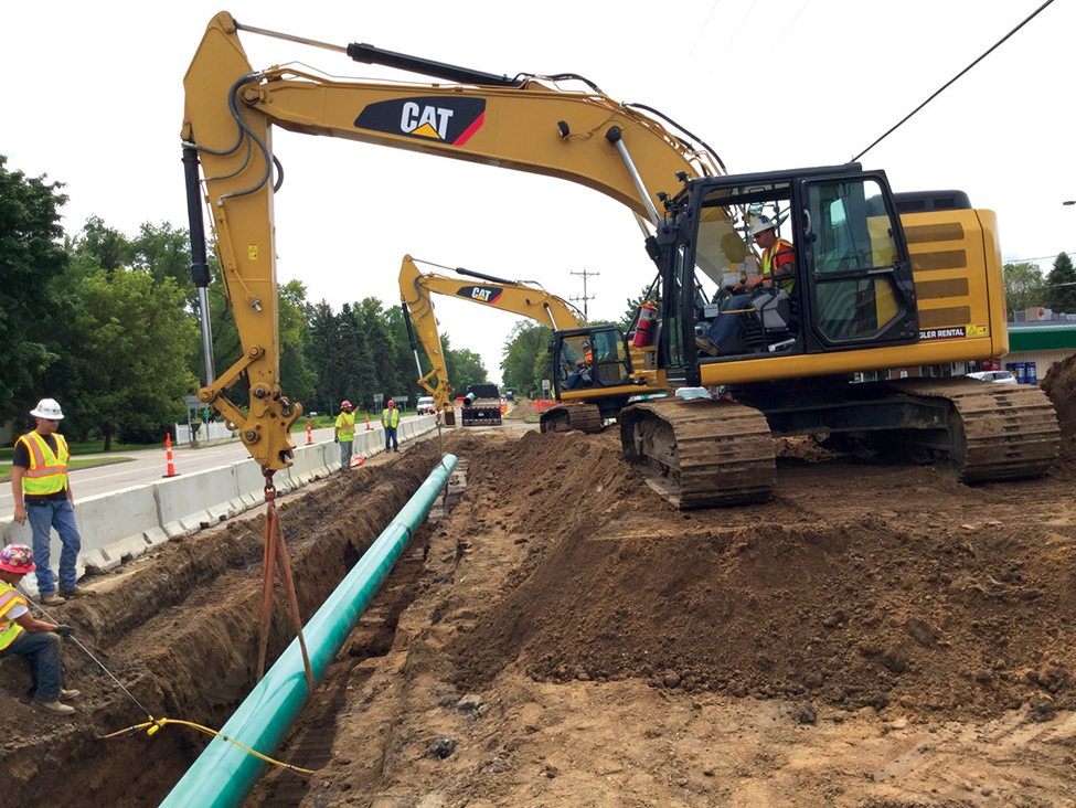
West Shadow Lake Drive is a residential street that was plagued by potholes, had no sewer or water, and faced challenges from high groundwater levels due to its proximity to Reshanau Lake. As part of the city’s pavement management program, the road was removed and replaced to support the city’s roadway infrastructure and sanitary sewer, watermain and storm sewer infrastructure was also installed. In addition, environmental work and wetland enhancements occurred throughout the area.
3. 12th Avenue Trail Project
The 12th Avenue Trail connection was identified as a priority in the city’s Comprehensive Parks and Trails System Capital Improvement Plan due to the lack of trail connection along 12th Avenue. Prior to project completion, the busy rural road was narrow with unsafe conditions for pedestrians and cyclists. The project resulted in increased safety and a more bikeable, accessible community.
4. Master Plan and Comprehensive Stormwater Management Plan
Located in the northeast corner of Lino Lakes is a 1300-acre greenfield area that is prime for development opportunities. WSB was contracted to develop a master plan, comprehensive stormwater management plan and update the Alternative Urban Areawide Review (AUAR) for the area. Development opportunities will include residential, industrial and commercial that will spur economic activity in the area.
5. The Rookery Activity Center
When the local YMCA closed in 2020 it left a hole in the community. The city of Lino Lakes took action to reinvigorate the space. To establish itself as a new asset within the community, the building needed an overhaul, not just in amenities and programming, but also the brand. WSB worked with the city to develop a story, identity and brand assets.
6. Tower Park
Tower Park is located on a 60-acre piece of land that was purchased by the city over 20 years ago. The city council felt strongly about developing the space into a destination recreation area for the community. WSB provided the park master plan and phase 1 design support. Tower Park is now home to some of the city’s most popular pickleball and tennis courts. The project was completed last year.
7. Birch Street Roundabouts
Birch Street is a heavily traveled roadway through the city with frequent accidents occurring due to the number of entrances to the high-speed roadway. There were safety concerns from residents and a nearby school. To help alleviate the number of accidents and increase safety, several roundabouts, medians, crosswalks and safety signage were added.
8. Gateways to the City – Placemaking
Lino Lakes is a proud community and wants to enhance their welcoming presence by creating placemaking monuments at city entrances. The project is still under development, but once complete, the entrances will offer a ‘front door’ to the city and will invite visitors and residents to step inside and explore the community.
9. Feasibility Study – Lake Amelia Subwatershed
A 255-acre subwatershed of Lake Amelia is currently undergoing a feasibility study to address existing stormwater management concerns and anticipated future land use changes to the area. The short-term phase includes solutions to address flooding concerns. The long-term phase proposes more holistic improvements to the corridor that that would occur alongside its eventual development. The study will help guide future planning in the area and will ensure that the area is prime for development.
10. Shenandoah Park Improvements
In partnership with the Rice Creek Watershed District, the city is exploring multiple improvements to the Shenandoah Park area to improve water quality, ensure its habitat is supported, and create a destination for park users. WSB is currently exploring water quality improvement options, wetland restoration, flood retention and greenway spaces to support the goals of the watershed district and the city.
Brian has more than 25 years of experience in the civil engineering field and has worked extensively in both the public and private market sectors. This experience has provided Brian with a broad engineering background, and has allowed him to develop a strong understanding of both public financing and private business perspectives. Brian’s lasting client relationships are a testament to the focus he places on developing creative solutions and providing over-the-top customer service.
WSB understands the importance of creating and maintaining healthy environments for residents and wildlife. While “No Mow May” is a well-intentioned campaign to improve the pollinator population, there are some more effective ways to protect natural habitats that cities and residents should be aware of and consider. There are several drawbacks that cities and residents should be aware of.
There are some pitfalls of “No Mow May” and several alternatives to protect pollinators:
The research study that was the driving force behind the No Mow May was actually redacted because of inaccurate information about its effectiveness in attracting and protecting bees. Therefore, the effectiveness of this campaign on pollinators needs to be investigated.
Not mowing the lawn may also create more trouble for the natural habitat by the growth of Kentucky Blue grass weeds, which are undesirable for healthy, thriving lawns.
Residents participating in No Mow May, may create a few headaches for neighbors and cities if they continue the no-mow theme into June. Not mowing the lawn throughout the summer could result in breeding grounds for mosquitoes, complaints from other residents in the neighborhood, and fines from the city for ordinance violations.
Instead of participating in No Mow May, cities should educate the public on appropriately re-landscaping their yards to be more pollinator friendly. Planting flowers and other plants that are native to the region in gardens or open spaces attract native bees and pollinator species to the area.
Cities should encourage the reduction of chemical products on residents’ lawns. Overusing chemicals on lawns can kill off beneficial insects, contaminate soil and water, reduce food sources for pollinators, and increase susceptibility to disease.
Use a public awareness campaign to remind residents of the enforcement of ordinances and communicate the facts versus myths of No Mow May. Additionally, ensure that city staff in publicly facing customer service roles are prepared to share this with residents who may inquire.
Cities and residents who want to do more to support their local habitats should learn about the many ways to help and be aware of catchy tactics that might actually do more harm than good. With sustainability as a core tenet of WSB’s work, WSB helps cities incorporate native landscapes into public spaces that cut down on maintenance costs and help the environment.
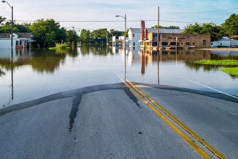
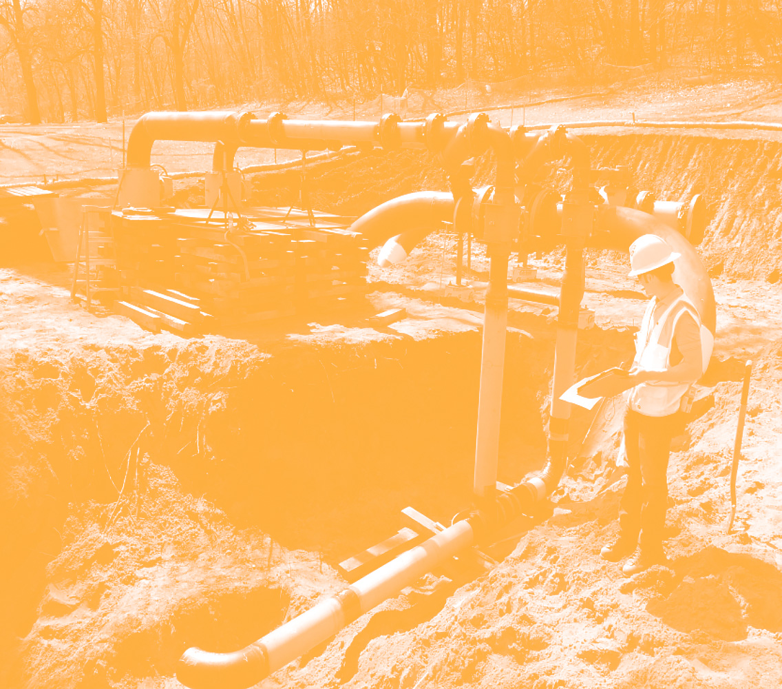
Hurricanes, flash floods, landslides, or any other form of severe weather can affect the environment by causing things like cracks and leaks in existing pipeline infrastructure. These issues can impact owners, managers, and workers of midstream transmission pipelines if they aren’t proactive in dealing with issues that may arise.
As part of the Pipeline and Hazardous Materials Safety Administration’s (PHSMA) final rule Repair Criteria, Integrity Management Improvements, Cathodic Protection, Management of Change, and Other Related Amendments (RIN2), PHMSA amended section 192.613 Continuing Surveillance to align with requirements previously added to the liquids rule. The new language seeks to decrease environmental issues by incentivizing proactive planning to protect and fix infrastructure in a timely manner after weather disasters.
WSB has a team of experts in geohazard risk assessment who can help companies navigate the murky waters of regulation and policy surrounding RIN2.
Policy Change
Extreme weather has been a contributing factor to several pipeline failures. PHMSA has issued Advisory Bulletins in 2015, 2016, 2019, and 2022 to communicate the potential that severe weather has to negatively impact pipeline integrity. PHSMA has amended 192.613 to require pipeline operators to inspect their potentially damaged infrastructure within 72 hours of a severe weather occurrence. If an issue is found during inspection, the operator is required to take the steps necessary to address the problem area.
PHMSA has defined extreme weather or natural disaster as any event that has the likelihood of damaging pipeline facilities. This includes soil movement around the pipelines, landslides, floods, earthquakes, and named hurricanes and tropical storms. Because storms of differing magnitudes will cause different outcomes in every landscape (e.g., even a small precipitation event may cause a landslide if the slope is unstable), this introduces a fair degree of uncertainty for operators. This regulatory and operational uncertainty can be difficult for companies to navigate, which is why a proactive approach to extreme weather management is important.
The rule goes into effect on May 24, 2023. After petitions by several industry agencies (AGA, API, and INGAA), PHMSA has decided to refrain from taking enforcement action on the severe weather inspections and other requirements from the effective date until February 24, 2024, for pipelines installed or repaired prior to August 24, 2022. We do recommend that operators take advantage of this extension now, PHMSA has the right to revoke this discretion at any time.
Geohazard Risk Assessment and Severe Weather Monitoring
We recommend companies proactively incorporate severe weather planning into their current geohazard risk assessment plan. It is vital that operators know their system, have identified where potential issues could occur, and have a plan in place to act within 72 hours of a hazardous event.
Having a scientific rationale and process in place within your geohazard risk assessment plan will go a long way when severe weather events happen.
What WSB Can Do
This rule is important to protect the environment, people, and property within the natural gas industry. The best approach to ambiguity and unknowns surrounding this policy change is being proactive. While there are no easy or one-size-fits all answers, there are geohazard risk assessment experts at WSB that are available to provide geohazard management assistance for operators.
WSB can also provide coaching and planning when it comes to combining a company’s geohazard program with a severe weather monitoring system.
Pipeline Safety & Integrity, as Related to Geohazard Risk
On May 26, 2022, the Pipeline and Hazardous Materials Safety Administration (PHMSA) issued an updated advisory bulletin (Docket No. PHMSA-2022-0063) to remind owners and operators of gas and hazardous liquid pipelines about the potential for damage and safety-related issues caused by geologic hazards (geohazards), including earth movements and climate-related hazards. Geohazards are naturally occurring and dynamic processes, capable of causing widespread damage, loss of property and/or injury and loss of life.
Earth movement hazards include slope instability, subsidence, frost heave, soil settlement, erosion, scour, and earthquakes. The causative factors of earth movements are myriad and complex but rooted in the understanding of regional geology, environmental conditions, and human influence. Earth movements can be exacerbated by local surface conditions (variable, steep, and rugged terrain), changing subsurface conditions, and climate-related hazards (e.g. heavy rainfall, flooding, washouts, weakened or unstable soil). It is important to understand that natural geohazards rarely occur in isolation but instead as hazard cascades: events that precipitates another, increasing resultant risks and consequences. Thus, it is imperative to consider and examine all possible geohazard factors when determining risk.
As outlined in 49 CFE 192.103 and 49 CFR 195.110, gas and hazardous liquid pipelines must be designed to withstand external loads, including those imposed by geohazards. In addition, PHMSA requires operators to take preventative and mitigative measures to avoid pipeline failure and consequences, such as those caused by geohazards (49 CFR 192.935 and 49 CFR 195.452). Additionally, integrity requirements pursuant to geohazards can be found under 49 CFR 192.917 and 49 CFR 195.452.
To ensure pipeline safety and integrity against geohazards, operators should consider taking the following actions:
Identify areas surrounding the pipeline which may be prone to earth movement and other geohazards. For each identified location, plans should be developed, with the assistance of geotechnical engineers, outlining design, construction, and monitoring procedures, based on site-specific hazards.
Monitor environmental conditions and changing weather patterns. Note, soil stability can be adversely impacted by changing weather patterns; evaluate soil and surface materials regularly.
Mitigation measures should be designed and implemented, as need be, based on site-specific conditions.
Due to the complexity and variability of geohazards, WSB’s Energy Sciences team recommends comprehensive geohazard risk assessments be performed for energy pipelines on five-year schedules. Our team of scientists and risk assessment specialists can help you identify, mitigate, and manage geohazard risks through services tailored to meet regulatory requirements and individual risk profiles.
Design work is taking place this year on an exciting project that aims to help people connect with the Mississippi River and nature.
Mississippi Gateway Regional Park, operated by Three Rivers Park District, includes 160 acres of parkland on the western shore of the Mississippi River in the City of Brooklyn Park. Coon Rapids Dam has spanned the river at the location for more than a century; in 1969, Northern States Power Co. gave the dam and 225 acres of surrounding land to what became Three Rivers Park District to establish a regional park on the Mississippi. Three Rivers operates the park on the west side of the river; Anoka County Parks and Recreation owns and operates Coon Rapids Dam Regional Park on the eastern side of the river in the City of Coon Rapids.
For five decades, the park has been a staple in the community, attracting visitors from across the Twin Cities region. Although the park is one of the most unique in the Three Rivers Park District system, it had not undergone significant investment in several years. To revitalize the park and to build better connections with the surrounding communities, in 2017 Three Rivers Park District embarked on developing a new vision for the park.
Nestled just across the road from the park is the city of Brooklyn Park’s Environmental Nature Area, a space full of opportunities to connect with nature. With the parks located adjacent to each other and only separated by West River Road, Brooklyn Park and Three Rivers Park District realized that they could provide better service to residents and park guests by working together.
The agencies developed a joint park master plan to avoid duplication and to provide a greater array of offerings for the public. Combining the park with the nature area would allow for a broader recreational experience for users. The planning process purposefully targeted equity markets that have historically been underrepresented in the visitor base for nature-based parks: minorities, non-English speaking households, new immigrants, low-income households, and people ages 45+. Throughout the master planning process, the project team engaged community residents in many ways – at community events, cultural gatherings and through user groups. The public identified features and amenities that became the basis of the vision for the park. This process made it possible for the park to truly reflect the priorities and values of the people who use it, and the resulting master plan described how together the two parks could be combined to create Mississippi Gateway Regional Park. In December 2020, Three Rivers and the City of Brooklyn Park formalized their partnership by approving a cooperative agreement to design, construct and operate Mississippi Gateway Regional Park.
“This project is the most significant capital investment in a park in the Park District’s history, and it fits perfectly with Three Rivers Park District’s vision that every person can connect with nature every day,” said Three Rivers Park District Commissioner Jennifer DeJournett, whose district includes the park. “Mississippi Gateway will welcome all individuals, whether they’re new to Minnesota or have been here for generations and will offer free and affordable programs to encourage everyone to explore the outdoors.”
With a comprehensive redesign of both areas, and a number of planned new features, the new park was born. Mississippi Gateway Regional Park will bring the vision to life: to connect the community, families, and residents to nature. To develop a strong vision that would cement this iconic park’s legacy, Three Rivers Park District and the city of Brooklyn Park consulted with WSB, a Twin-Cities headquartered design and consulting firm. Through a robust public engagement plan, master planning and design services, a vision and strategy to update the park for current and future generations to enjoy was created.
Connecting New Audiences with Nature
At the heart of this project are people. The goal is that people of all abilities and cultures have access to a fun, welcoming park where they can connect with and explore nature and the river in many ways. The location of Mississippi Gateway Regional Park provides a unique natural environment within the diverse, urban area where it lies. For children and adults alike, parks are a place to learn, exercise, grow and celebrate all Minnesota has to offer.
A major natural feature of the park is the Mississippi River and the unique landscape and habitats that surround it. People may come to the park for a variety of reasons, but all are drawn to the beauty and power of the mighty Mississippi that forms the natural eastern border of the park.
The park means something different to every user, and it will remain a significant landmark that is safe, accessible, convenient, unique and fun for those looking to experience the beauty and wonder of nature and the Mississippi close to where they live.
Commissioner DeJournett added, “We anticipate that the new Mississippi Gateway Regional Park will be a jewel of both the Three Rivers and Brooklyn Park systems and will be a favorite place for residents of the Twin Cities Metro Area as well as visitors from Greater Minnesota and around the country to connect with the Mighty Mississippi and enjoy the outdoors.”
What’s Coming to Mississippi Gateway Regional Park
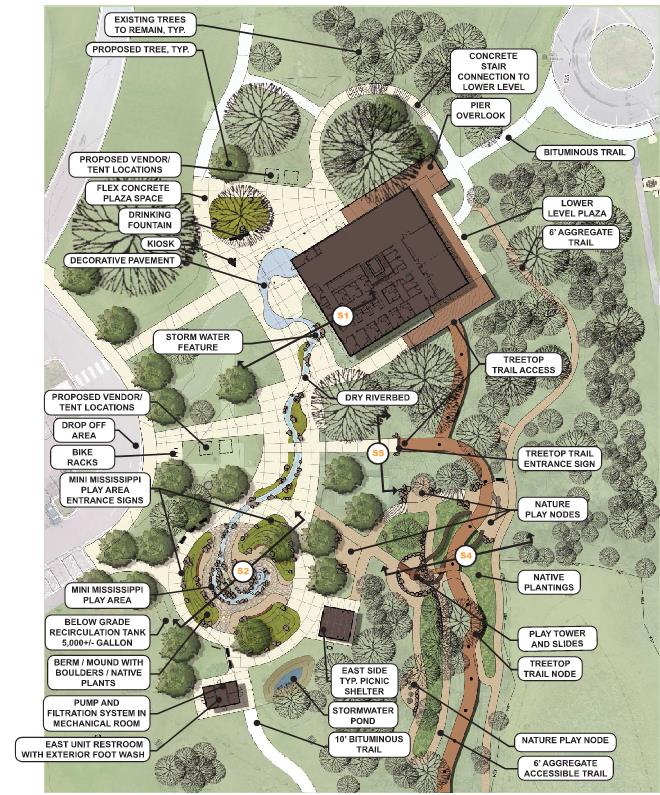
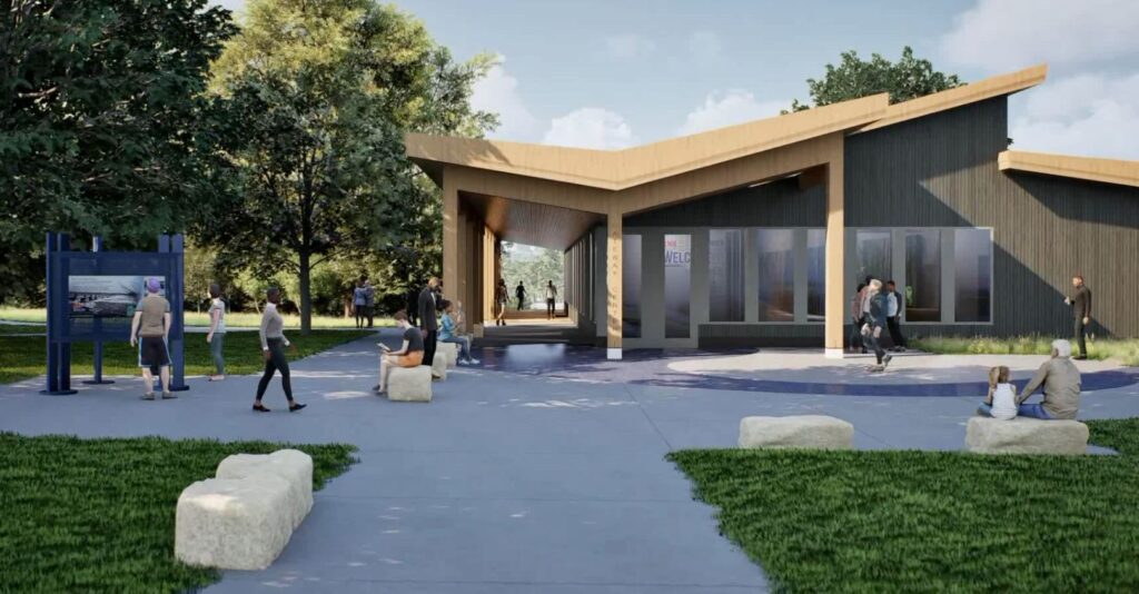
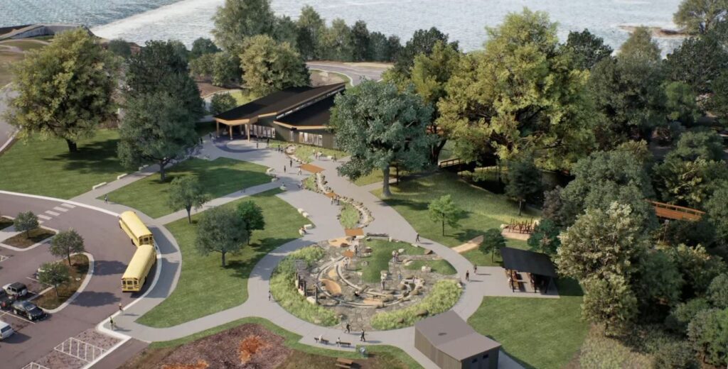
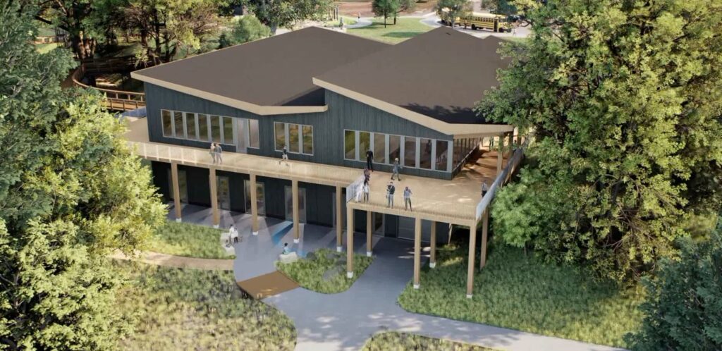
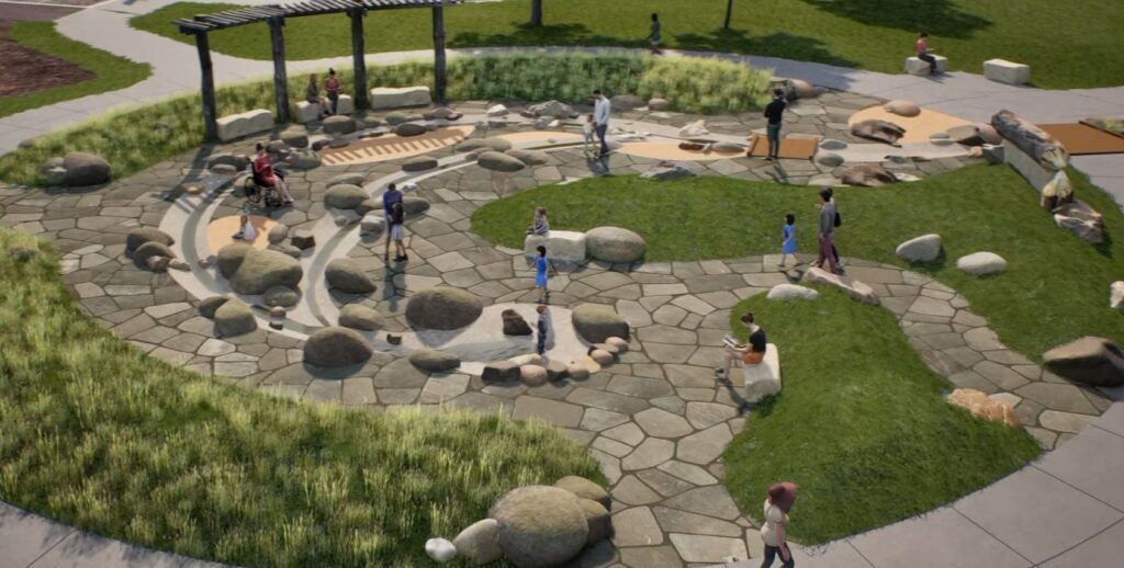
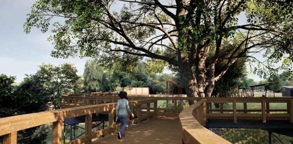
Meaningful updates and one-of-a-kind experiences will attract visitors and provide significant benefit to the community and region. A new Gateway Center building will offer exhibit areas with learning opportunities focused on the Mississippi River and the park, classroom areas for school groups and park programming, and a space for equipment rentals, allowing further exploration of the park through the use of snowshoes, skis or bikes. A treetop trail, which will be an elevated walkway through the canopies of existing mature trees, will be developed near the Gateway Center. In addition, a nature-themed play tower and nature play nodes will connect to the treetop trail to create exciting play opportunities for all abilities. During the design process, staff from Three Rivers and WSB are engaging with students from Champlin-Brooklyn Park Academy for Math and Environmental Sciences to garner students’ input on the design of the nature play features. A “Mini-Mississippi” interactive water feature will provide a unique opportunity for users to access a stream channel, get their feet wet and manipulate the flow of water to further understand the dynamics of a river. These elements will provide unique perspectives, hands-on experiences, and exciting play opportunities for everyone to explore nature.
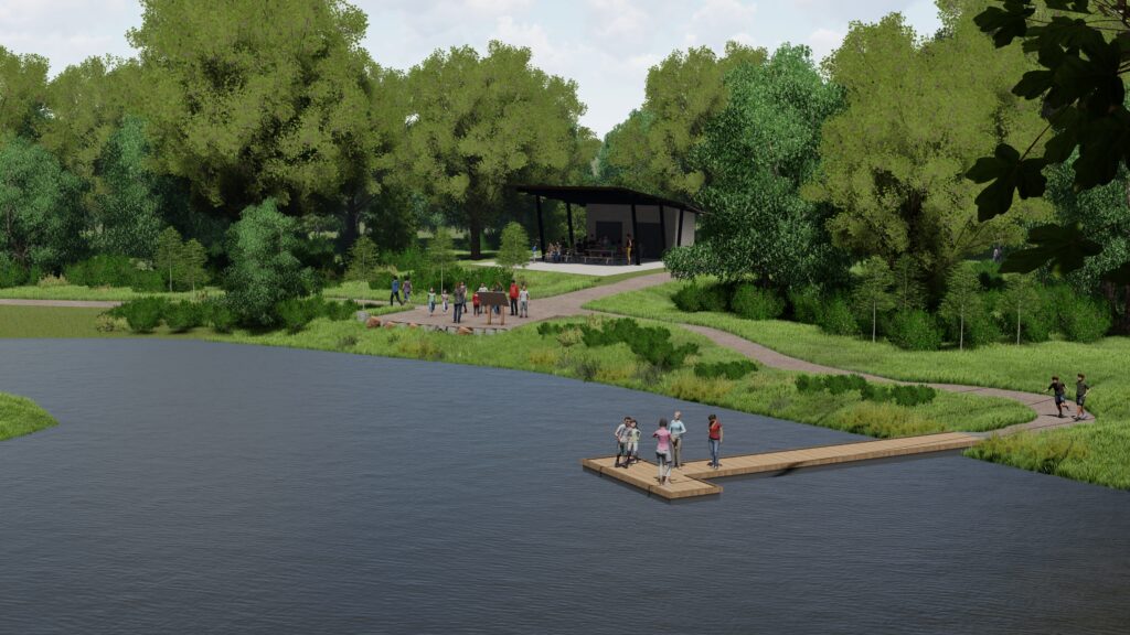
Beyond the core development area, Mississippi Gateway Regional Park will provide enhanced trails, gathering places and shelters, nature connection nodes and additional accessible fishing opportunities along the edge of the river. The western part of the park will also include a reservable shelter, playground, off-leash dog area, and an enhanced archery range.
Even with all the planned renovations, keeping a natural feeling in the park is still an achievable goal. The focus will remain on creating accessible opportunities to connect with the natural environment. Native plantings will be included with the restoration efforts throughout the park, while other proposed elements will be nestled within the existing vegetation and terrain.
Throughout the master planning, schematic design and design development phases of the project, the design team was careful to provide solutions that are equally engaging in all seasons of the year. The treetop trail and other trails are designed for year-round use, while cross-country ski and snowshoe trails also weave throughout the landscape.
This is an exciting project that will continue to connect the community with nature. The project is currently transitioning into the construction document phase of design, with a grand opening targeted for 2026. Mississippi Gateway Regional Park will be an inviting, welcoming and vibrant place for everyone to discover nature and the Mississippi River.
Jeff is a landscape architect with over 21 years of professional experience. He has worked on projects of various scales and scope both in private and public sectors. He has significant experience as a project manager directing installations and overseeing project implementation. His experience has led to creative design solutions which acknowledge varied user perspectives by collaborating with private developers, landowners, and business owners, as well as municipal staff. He embraces collaboration to ultimately bring the original vision into functional reality.
By James Lowe, Director of Municipal Services, WSB
Climate change and other social, economic, and environmental concerns have made headlines in recent years. As such, there is a renewed public interest regarding the effects that large infrastructure projects have on communities and the environment. This is especially true in states like Texas, where governments and communities must manage environmental compliance during rapid population growth and an increasing number of new infrastructure projects.
There are many laws and regulations that require local, city, county, state, and federal government projects to identify potential impacts that their actions may have on the environment. Environmental planners and professionals play a key role in identifying the applicable laws, assessing any impacts, and ensuring that the public is well informed on those actions.
Rapid development and an influx of technology manufacturers and developers in Texas will result in more strain on existing state, county, and municipal infrastructure. These entities will look to the consulting community for solutions to help mitigate and balance the environmental impacts associated with population growth and infrastructure improvements.
What is Environmental Compliance?
Environmental compliance, in its basic sense, is ensuring a project is meeting the requirements of laws, regulations, and codes designed to protect the environment. This basic statement is not complex; however, environmental compliance requirements for a particular project are determined by the regulatory agencies involved and the location and scope of the project. The laws, regulations, and codes cover a wide assortment of items, such as those related to cultural resources, water resources, threatened and endangered species, as well as potential impacts to low income and minority populations.
Recent Trends in Environmental Compliance
Given the rapid growth in Texas, increased development and projects are inevitable. Navigating the necessary compliance for that growth often causes confusion, especially with recent changes in regulations and guidance. In an environmental study, in which time is money, oversight can cause delay. Delay can easily be avoided with early recognition of constraints and coordination with applicable agencies. Adherence to regulations and exhibiting good stewardship of the environment we all share, benefits projects in the long run. Close coordination with environmental planners, design engineers, client staff, and stakeholders early and throughout project development help to avoid costly redesign work. Likewise, it can help mitigate potential schedule delays through early identification of issues and development of solutions.
Working with the Experts
It is often confusing and daunting for government entities, local communities, and private developers to manage environmental compliance during rapid population growth. Here at WSB, we work hand in hand with clients to help them identify environmental constraints and the options available to advance their project. Clients look to our expertise to develop solutions that address rapid growth and navigate the environmental compliance landscape to advance project delivery.
James is the director of municipal services for our Texas offices. He has over 20 years of experience with environmental and municipal services. In his role, he develops strategies to elevate and grow clients, pursues key municipal projects, and hires talent in regions and municipalities across Texas with significant growth opportunities. He serves as a technical resource for Transportation Planning and NEPA/Environmental pursuits and projects.
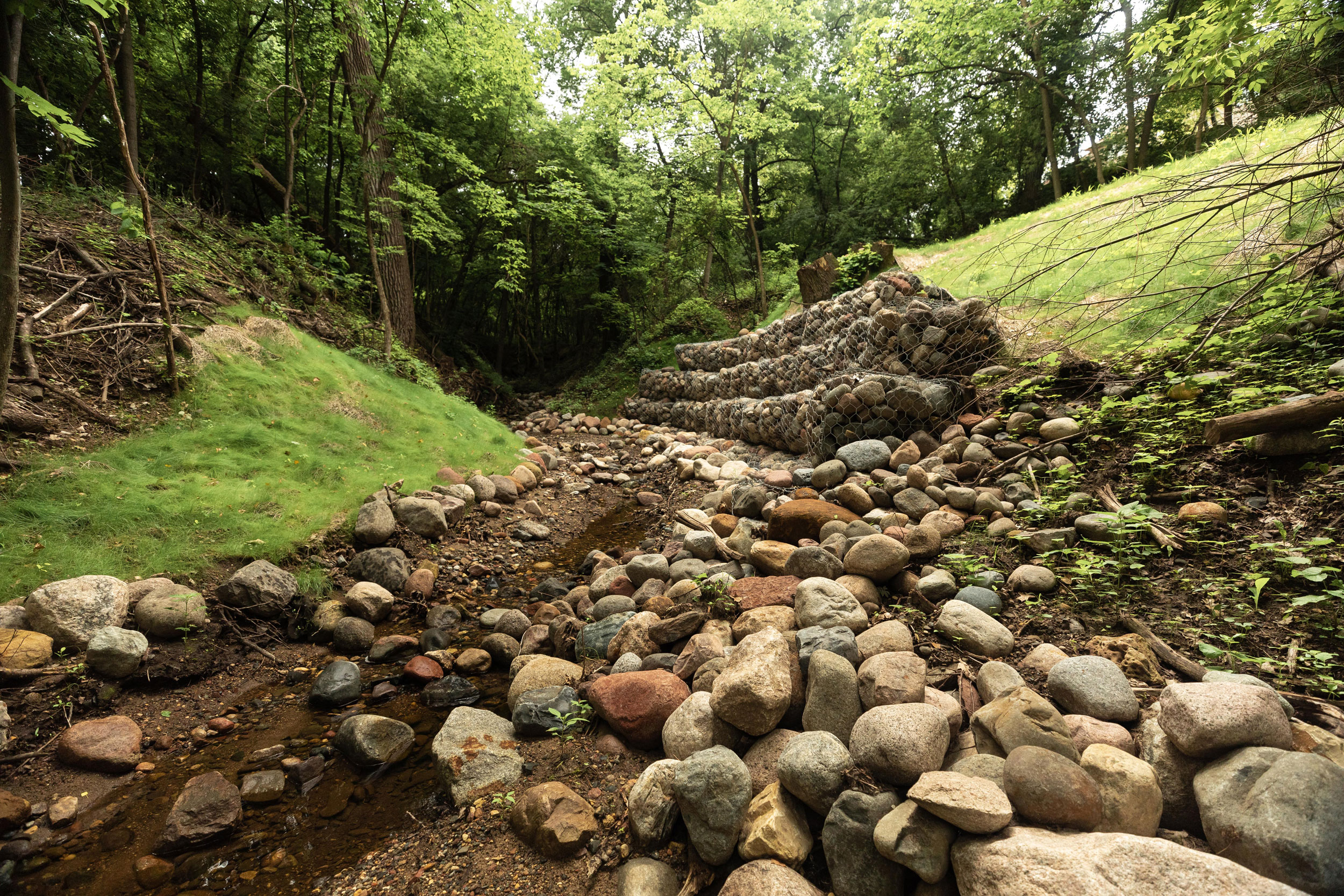
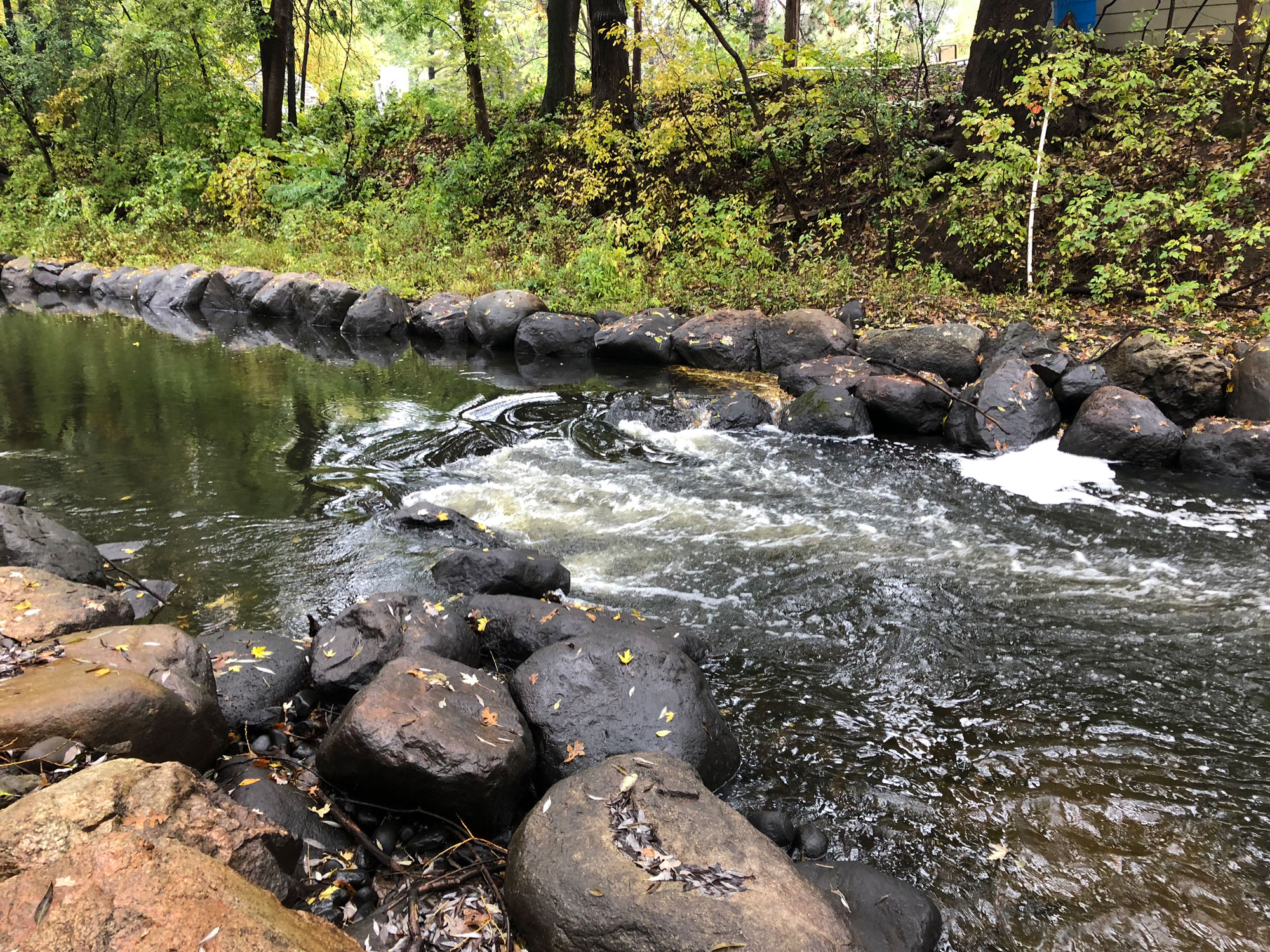
Investment today in ecological restoration will go a long way to improving resiliency and preserving the quality of our water, natural habitats and communities, and the federal infrastructure bill opened an unprecedented amount of dollars for ecological restoration projects. This funding is a game changer, especially for communities who are advancing needed projects but faced funding barriers.
How can communities tap into this new funding for ecological restoration? Here are a few ideas.
Exploring Projects and Opportunities
There are two basic pools that ecological restoration projects fall into as communities explore infrastructure funding for their projects. The first is a project that may have been in the works or shelved due to the large scope and/or lack of funding. The other is a project that may be unique or did not fit into a traditional grant funding but can help innovate ecological restoration and deliver meaningful results. Especially for emerging issues and advancing new, innovative ways to tackle problems, federal infrastructure funding could help advance those types of projects.
Communities should think through priority projects that deliver results and help meet their goals.
Data, Data, & More Data
No community will receive funding without data that clearly lays out the depth of a problem and how to address it.
For example, a community may notice and share anecdotally that a prairie landscape is seeing fewer songbirds than in years past, but that’s not enough for a grant. A bird survey and vegetation assessment are necessary to gather data and lay out measurable goals.
Communities need data to drive smart objectives. Developing a methodology, data sets, and clear goals, a community can craft a project that measures progress over time whether a forest, lake, wetland, or prairie ecological restoration project.
Realize Community Value
Ecological restoration can become bigger and more expensive to fix the longer an issue is ignored. Plus, communities lose the value of space, or don’t realize the full benefits of a healthy natural community, if it is not properly cared for.
Communicating the value to not only the landscape and inhabiting wildlife, but the greater community and its residents can help build momentum for your project.
How WSB Can Help
Sometimes it’s difficult to know where to start. WSB helps clients throughout the process, whether it’s building the tools to gather needed data, providing a link between funding sources and project proposals, navigating and addressing community stakeholder engagement, or creating and designing project ideas to address an identified issue.
At the end of the day, the funding passed in the federal infrastructure bill is changing the game and we have a meaningful opportunity to stem the tide of ecological degradation and make big investments in our communities.
Tony Havranek has nearly 20 years of experience in the natural resources field. Prior to his time at WSB, Tony helped develop federal policies with the U.S. Fish and Wildlife Service and worked with tribal communities throughout the Midwest on their natural resources needs. He is recognized throughout the industry for his forestry, water quality, fisheries, aquatic and terrestrial vegetation, wetlands and wildlife expertise.
With more and more businesses setting comprehensive sustainability goals that include net-zero carbon emissions, many are unsure what is the best way to achieve those goals or what renewable energy investment will be most effective. Sustainability investment should be data driven and can be done in a way that both protects the environment and a business’ bottom line.
WSB and iD8 have partnered to create a new one-of-a-kind analysis – Renewable Energy Match – that provides clients with a full understanding of renewable energy options, and comprehensive data analysis to drive financial-based decision-making. It goes beyond traditional energy evaluation by combining economic data with place-based environmental information.
Explore clean energy options that meet your needs.
Many companies exploring clean energy solutions often first look to solar and wind energy. Those are excellent renewable energy sources, but there is also untapped potential in sources like hydrogen, geothermal energy, and renewable natural gas.
Every organization has different needs when it comes to renewable energy, so a plan that is customized to individual needs, takes into account location, and is driven by thorough research and data is critical.
How Renewable Energy Match works.
Most companies base their renewable energy decisions off financial feasibility. WSB has taken that concept further and developed a 4-phase approach to determine which renewable energy option is best for each specific client. The process includes:
First-order feasibility study This first step provides a high-level geospatial analysis of the area the client is operating within to determine what resources are available for renewable energy production. It includes iD8 financial assessments for each energy form and an overall optimization for each energy. A risk assessment of external factors that could influence the performance of energy sources is also part of this phase.
Strategic Planning This stage provides a deeper exploration of local energy resources that are available, as well as their acquisition costs, parcel ownership, local energy grids, climate analysis, and more.
Final Design & Regulatory Planning Once the strategic plan is complete, infrastructure planning and design, environmental and resource assessments, and land permitting can begin.
Energy implementation The final phase is to begin energy production and implementation at the selected facility.
Who can benefit from Renewable Energy Match?
There are many types of businesses and organizations that can benefit from Renewable Energy Match including companies with net-zero goals, businesses with multiple facilities or campuses, universities, utilities, and companies looked to expand their energy renewable energy portfolios..
This one-of-a-kind analysis allows clients to strategically explore the costs, sources, and options around renewable energy on a digital platform, and advance investments that will best meet the needs of a client from both an economic and sustainability perspective.
Want to learn more about Renewable Energy Match? Check out our website to explore more, contact a WSB expert, or schedule a demo.
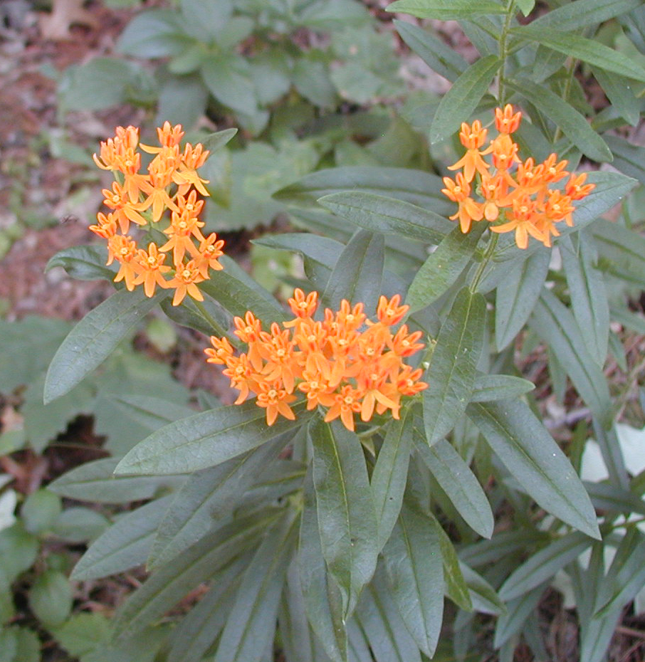
The United States Fish and Wildlife Service (USFWS) recently announced their decision to list the monarch butterfly under the Endangered Species act is “warranted but precluded”. The USFWS will not issue a proposed rule to list the monarch officially until 2024 due to insufficient funding and personnel. The listing will be evaluated annually to determine its eligibility and listing decision may be expedited under a new administration.
What does the USFWS decision mean?
The “warranted but precluded” decision means that the USFWS has determined the monarch butterfly meets the definition of a threatened or endangered species, but the agency lacks the resources to take further action to list the species at this time.
Since monarch butterflies still face threats and decline, there is a strong likelihood that monarch conservationists will challenge and litigate the decision.
If litigation occurs, the USFWS could be ordered to prioritize the listing prior to 2024. This could result in a listing of the species within a short timeframe. If this occurs, partners enrolled in the Candidate Conservation Agreement for Monarch Butterfly on Energy and Transportation Lands (CCAA) are protected against regulatory actions that may occur following the listing decision.
Why is the CCAA important?
By enrolling in the CCAA, partners will be protected against any regulatory actions that may result from future listing. Enrollment avoids risks to planned projects that may impact monarchs and their habitat by giving assurance that no additional regulatory requirements will be imposed by the USFWS beyond the terms of the CCAA agreement.
The conservation efforts of enrolled partners will help to save the monarch species. This decision means that monarch butterflies are in trouble and unless the species experiences dramatic improvements in the next few years, a future listing of this species is certain.
Enrollment in the CCAA demonstrates the partner’s commitment to conservation of this species.
Roxy is an environmental scientist and certified wetland delineator. She has a master’s degree in ecology and is a Certified Associate Ecologist. She has completed numerous wetland delineations and has experience with wetland monitoring, ecological restoration design, environmental site assessments, field research, biological surveys, ArcGIS mapping, and GPS Trimble.