By Jeff Feulner Senior Landscape Architect, WSB

Originally published in the Minnesota Recreation & Parks Magazine Summer 2022 issue

Design work is taking place this year on an exciting project that aims to help people connect with the Mississippi River and nature.

Mississippi Gateway Regional Park, operated by Three Rivers Park District, includes 160 acres of parkland on the western shore of the Mississippi River in the City of Brooklyn Park. Coon Rapids Dam has spanned the river at the location for more than a century; in 1969, Northern States Power Co. gave the dam and 225 acres of surrounding land to what became Three Rivers Park District to establish a regional park on the Mississippi. Three Rivers operates the park on the west side of the river; Anoka County Parks and Recreation owns and operates Coon Rapids Dam Regional Park on the eastern side of the river in the City of Coon Rapids.

For five decades, the park has been a staple in the community, attracting visitors from across the Twin Cities region. Although the park is one of the most unique in the Three Rivers Park District system, it had not undergone significant investment in several years. To revitalize the park and to build better connections with the surrounding communities, in 2017 Three Rivers Park District embarked on developing a new vision for the park.

Nestled just across the road from the park is the city of Brooklyn Park’s Environmental Nature Area, a space full of opportunities to connect with nature. With the parks located adjacent to each other and only separated by West River Road, Brooklyn Park and Three Rivers Park District realized that they could provide better service to residents and park guests by working together.

The agencies developed a joint park master plan to avoid duplication and to provide a greater array of offerings for the public. Combining the park with the nature area would allow for a broader recreational experience for users. The planning process purposefully targeted equity markets that have historically been underrepresented in the visitor base for nature-based parks: minorities, non-English speaking households, new immigrants, low-income households, and people ages 45+. Throughout the master planning process, the project team engaged community residents in many ways – at community events, cultural gatherings and through user groups. The public identified features and amenities that became the basis of the vision for the park. This process made it possible for the park to truly reflect the priorities and values of the people who use it, and the resulting master plan described how together the two parks could be combined to create Mississippi Gateway Regional Park. In December 2020, Three Rivers and the City of Brooklyn Park formalized their partnership by approving a cooperative agreement to design, construct and operate Mississippi Gateway Regional Park.

“This project is the most significant capital investment in a park in the Park District’s history, and it fits perfectly with Three Rivers Park District’s vision that every person can connect with nature every day,” said Three Rivers Park District Commissioner Jennifer DeJournett, whose district includes the park. “Mississippi Gateway will welcome all individuals, whether they’re new to Minnesota or have been here for generations and will offer free and affordable programs to encourage everyone to explore the outdoors.”

With a comprehensive redesign of both areas, and a number of planned new features, the new park was born. Mississippi Gateway Regional Park will bring the vision to life: to connect the community, families, and residents to nature. To develop a strong vision that would cement this iconic park’s legacy, Three Rivers Park District and the city of Brooklyn Park consulted with WSB, a Twin-Cities headquartered design and consulting firm. Through a robust public engagement plan, master planning and design services, a vision and strategy to update the park for current and future generations to enjoy was created.
Connecting New Audiences with Nature

At the heart of this project are people. The goal is that people of all abilities and cultures have access to a fun, welcoming park where they can connect with and explore nature and the river in many ways. The location of Mississippi Gateway Regional Park provides a unique natural environment within the diverse, urban area where it lies. For children and adults alike, parks are a place to learn, exercise, grow and celebrate all Minnesota has to offer. 

A major natural feature of the park is the Mississippi River and the unique landscape and habitats that surround it. People may come to the park for a variety of reasons, but all are drawn to the beauty and power of the mighty Mississippi that forms the natural eastern border of the park.

The park means something different to every user, and it will remain a significant landmark that is safe, accessible, convenient, unique and fun for those looking to experience the beauty and wonder of nature and the Mississippi close to where they live. 

Commissioner DeJournett added, “We anticipate that the new Mississippi Gateway Regional Park will be a jewel of both the Three Rivers and Brooklyn Park systems and will be a favorite place for residents of the Twin Cities Metro Area as well as visitors from Greater Minnesota and around the country to connect with the Mighty Mississippi and enjoy the outdoors.”

What’s Coming to Mississippi Gateway Regional Park 

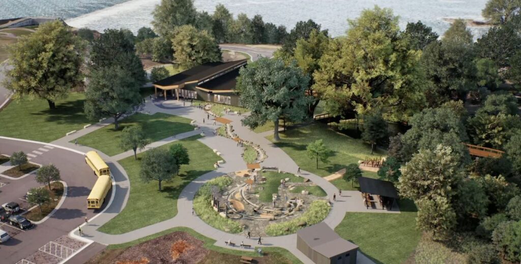
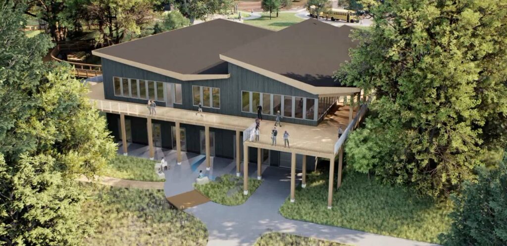
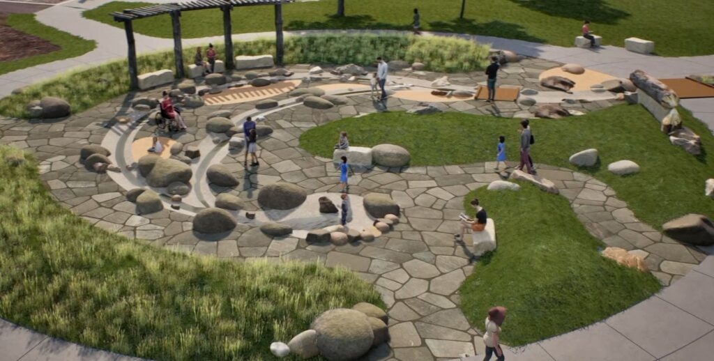
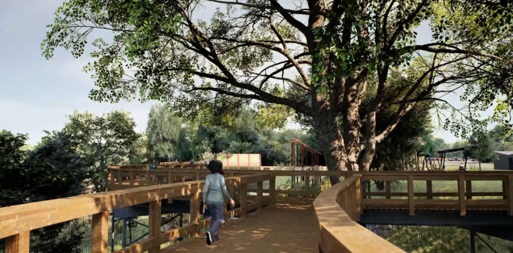
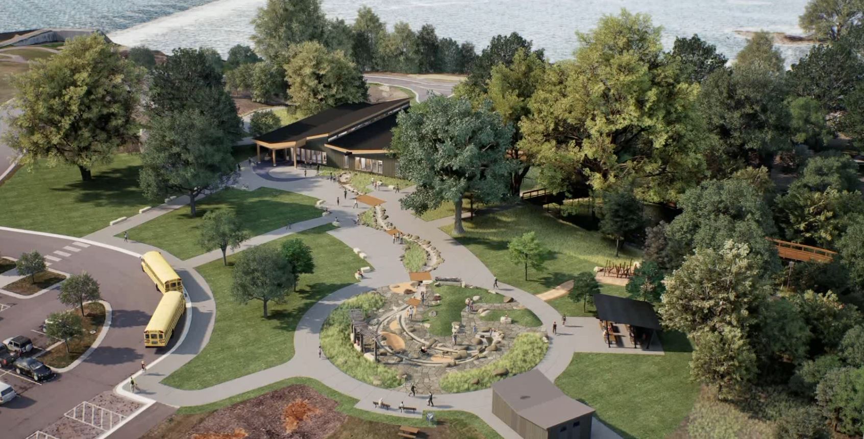
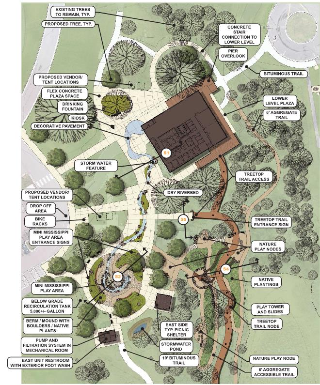
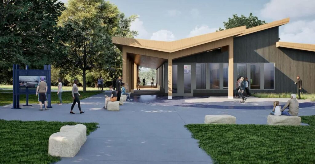
Meaningful updates and one-of-a-kind experiences will attract visitors and provide significant benefit to the community and region. A new Gateway Center building will offer exhibit areas with learning opportunities focused on the Mississippi River and the park, classroom areas for school groups and park programming, and a space for equipment rentals, allowing further exploration of the park through the use of snowshoes, skis or bikes.  A treetop trail, which will be an elevated walkway through the canopies of existing mature trees, will be developed near the Gateway Center. In addition, a nature-themed play tower and nature play nodes will connect to the treetop trail to create exciting play opportunities for all abilities. During the design process, staff from Three Rivers and WSB are engaging with students from Champlin-Brooklyn Park Academy for Math and Environmental Sciences to garner students’ input on the design of the nature play features. A “Mini-Mississippi” interactive water feature will provide a unique opportunity for users to access a stream channel, get their feet wet and manipulate the flow of water to further understand the dynamics of a river. These elements will provide unique perspectives, hands-on experiences, and exciting play opportunities for everyone to explore nature.

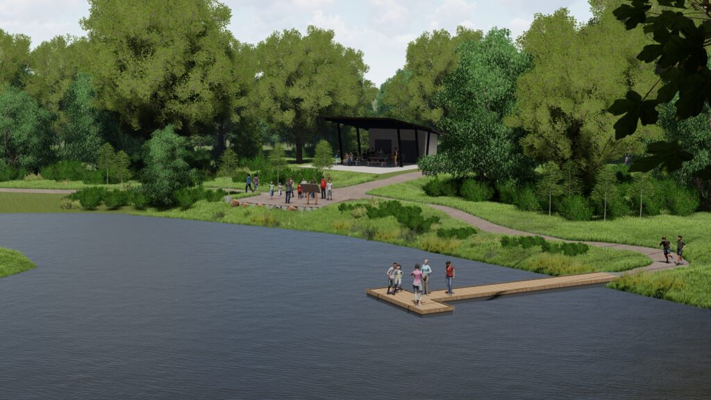
Beyond the core development area, Mississippi Gateway Regional Park will provide enhanced trails, gathering places and shelters, nature connection nodes and additional accessible fishing opportunities along the edge of the river. The western part of the park will also include a reservable shelter, playground, off-leash dog area, and an enhanced archery range. 

Even with all the planned renovations, keeping a natural feeling in the park is still an achievable goal. The focus will remain on creating accessible opportunities to connect with the natural environment. Native plantings will be included with the restoration efforts throughout the park, while other proposed elements will be nestled within the existing vegetation and terrain. 

Throughout the master planning, schematic design and design development phases of the project, the design team was careful to provide solutions that are equally engaging in all seasons of the year. The treetop trail and other trails are designed for year-round use, while cross-country ski and snowshoe trails also weave throughout the landscape.

This is an exciting project that will continue to connect the community with nature. The project is currently transitioning into the construction document phase of design, with a grand opening targeted for 2026. Mississippi Gateway Regional Park will be an inviting, welcoming and vibrant place for everyone to discover nature and the Mississippi River. 

Jeff is a landscape architect with over 21 years of professional experience. He has worked on projects of various scales and scope both in private and public sectors. He has significant experience as a project manager directing installations and overseeing project implementation. His experience has led to creative design solutions which acknowledge varied user perspectives by collaborating with private developers, landowners, and business owners, as well as municipal staff. He embraces collaboration to ultimately bring the original vision into functional reality.

[email protected]om | 612.328.6682

By James Lowe, Director of Municipal Services, WSB

Climate change and other social, economic, and environmental concerns have made headlines in recent years. As such, there is a renewed public interest regarding the effects that large infrastructure projects have on communities and the environment. This is especially true in states like Texas, where governments and communities must manage environmental compliance during rapid population growth and an increasing number of new infrastructure projects.

There are many laws and regulations that require local, city, county, state, and federal government projects to identify potential impacts that their actions may have on the environment. Environmental planners and professionals play a key role in identifying the applicable laws, assessing any impacts, and ensuring that the public is well informed on those actions.

Rapid development and an influx of technology manufacturers and developers in Texas will result in more strain on existing state, county, and municipal infrastructure. These entities will look to the consulting community for solutions to help mitigate and balance the environmental impacts associated with population growth and infrastructure improvements.

What is Environmental Compliance?

Environmental compliance, in its basic sense, is ensuring a project is meeting the requirements of laws, regulations, and codes designed to protect the environment. This basic statement is not complex; however, environmental compliance requirements for a particular project are determined by the regulatory agencies involved and the location and scope of the project. The laws, regulations, and codes cover a wide assortment of items, such as those related to cultural resources, water resources, threatened and endangered species, as well as potential impacts to low income and minority populations.

Recent Trends in Environmental Compliance

Given the rapid growth in Texas, increased development and projects are inevitable. Navigating the necessary compliance for that growth often causes confusion, especially with recent changes in regulations and guidance. In an environmental study, in which time is money, oversight can cause delay. Delay can easily be avoided with early recognition of constraints and coordination with applicable agencies. Adherence to regulations and exhibiting good stewardship of the environment we all share, benefits projects in the long run. Close coordination with environmental planners, design engineers, client staff, and stakeholders early and throughout project development help to avoid costly redesign work. Likewise, it can help mitigate potential schedule delays through early identification of issues and development of solutions.

Working with the Experts

It is often confusing and daunting for government entities, local communities, and private developers to manage environmental compliance during rapid population growth. Here at WSB, we work hand in hand with clients to help them identify environmental constraints and the options available to advance their project. Clients look to our expertise to develop solutions that address rapid growth and navigate the environmental compliance landscape to advance project delivery.

James is the director of municipal services for our Texas offices. He has over 20 years of experience with environmental and municipal services. In his role, he develops strategies to elevate and grow clients, pursues key municipal projects, and hires talent in regions and municipalities across Texas with significant growth opportunities. He serves as a technical resource for Transportation Planning and NEPA/Environmental pursuits and projects.

[email protected] | 936.329.1967

environmental compliance during rapid population growth

An ounce of prevention is worth a pound of cure.

By Tony Havranek, Director of Fisheries, WSB

Investment today in ecological restoration will go a long way to improving resiliency and preserving the quality of our water, natural habitats and communities, and the federal infrastructure bill opened an unprecedented amount of dollars for ecological restoration projects. This funding is a game changer, especially for communities who are advancing needed projects but faced funding barriers.

How can communities tap into this new funding for ecological restoration? Here are a few ideas.

Exploring Projects and Opportunities

There are two basic pools that ecological restoration projects fall into as communities explore infrastructure funding for their projects. The first is a project that may have been in the works or shelved due to the large scope and/or lack of funding. The other is a project that may be unique or did not fit into a traditional grant funding but can help innovate ecological restoration and deliver meaningful results. Especially for emerging issues and advancing new, innovative ways to tackle problems, federal infrastructure funding could help advance those types of projects.

Communities should think through priority projects that deliver results and help meet their goals.

Data, Data, & More Data

No community will receive funding without data that clearly lays out the depth of a problem and how to address it.

For example, a community may notice and share anecdotally that a prairie landscape is seeing fewer songbirds than in years past, but that’s not enough for a grant. A bird survey and vegetation assessment are necessary to gather data and lay out measurable goals.

Communities need data to drive smart objectives. Developing a methodology, data sets, and clear goals, a community can craft a project that measures progress over time whether a forest, lake, wetland, or prairie ecological restoration project.

Realize Community Value

Ecological restoration can become bigger and more expensive to fix the longer an issue is ignored. Plus, communities lose the value of space, or don’t realize the full benefits of a healthy natural community, if it is not properly cared for.

Communicating the value to not only the landscape and inhabiting wildlife, but the greater community and its residents can help build momentum for your project.

How WSB Can Help

Sometimes it’s difficult to know where to start. WSB helps clients throughout the process, whether it’s building the tools to gather needed data, providing a link between funding sources and project proposals, navigating and addressing community stakeholder engagement, or creating and designing project ideas to address an identified issue.

At the end of the day, the funding passed in the federal infrastructure bill is changing the game and we have a meaningful opportunity to stem the tide of ecological degradation and make big investments in our communities.

Tony Havranek has nearly 20 years of experience in the natural resources field. Prior to his time at WSB, Tony helped develop federal policies with the U.S. Fish and Wildlife Service and worked with tribal communities throughout the Midwest on their natural resources needs. He is recognized throughout the industry for his forestry, water quality, fisheries, aquatic and terrestrial vegetation, wetlands and wildlife expertise.

[email protected] | 651.286.8473

With more and more businesses setting comprehensive sustainability goals that include net-zero carbon emissions, many are unsure what is the best way to achieve those goals or what renewable energy investment will be most effective. Sustainability investment should be data driven and can be done in a way that both protects the environment and a business’ bottom line. 

WSB and iD8 have partnered to create a new one-of-a-kind analysis – Renewable Energy Match – that provides clients with a full understanding of renewable energy options, and comprehensive data analysis to drive financial-based decision-making. It goes beyond traditional energy evaluation by combining economic data with place-based environmental information.

Explore clean energy options that meet your needs.

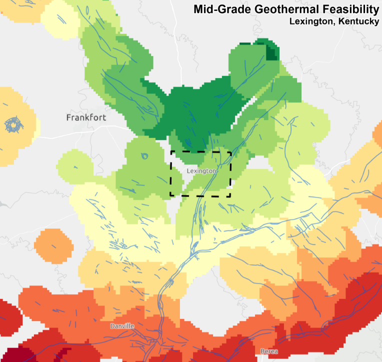
Many companies exploring clean energy solutions often first look to solar and wind energy. Those are excellent renewable energy sources, but there is also untapped potential in sources like hydrogen, geothermal energy, and renewable natural gas. 

Every organization has different needs when it comes to renewable energy, so a plan that is customized to individual needs, takes into account location, and is driven by thorough research and data is critical. 

How Renewable Energy Match works.

Most companies base their renewable energy decisions off financial feasibility. WSB has taken that concept further and developed a 4-phase approach to determine which renewable energy option is best for each specific client. The process includes:

  1. First-order feasibility study This first step provides a high-level geospatial analysis of the area the client is operating within to determine what resources are available for renewable energy production. It includes iD8 financial assessments for each energy form and an overall optimization for each energy.  A risk assessment of external factors that could influence the performance of energy sources is also part of this phase. 
  2. Strategic Planning This stage provides a deeper exploration of local energy resources that are available, as well as their acquisition costs, parcel ownership, local energy grids, climate analysis, and more. 
  3. Final Design & Regulatory Planning Once the strategic plan is complete, infrastructure planning and design, environmental and resource assessments, and land permitting can begin.
  4. Energy implementation The final phase is to begin energy production and implementation at the selected facility. 

Who can benefit from Renewable Energy Match?

There are many types of businesses and organizations that can benefit from Renewable Energy Match including companies with net-zero goals, businesses with multiple facilities or campuses, universities, utilities, and companies looked to expand their energy renewable energy portfolios..

This one-of-a-kind analysis allows clients to strategically explore the costs, sources, and options around renewable energy on a digital platform, and advance investments that will best meet the needs of a client from both an economic and sustainability perspective. 

Want to learn more about Renewable Energy Match? Check out our website to explore more, contact a WSB expert, or schedule a demo.

By Roxy Robertson, Environmental Scientist, WSB

The United States Fish and Wildlife Service (USFWS) recently announced their decision to list the monarch butterfly under the Endangered Species act is “warranted but precluded”. The USFWS will not issue a proposed rule to list the monarch officially until 2024 due to insufficient funding and personnel. The listing will be evaluated annually to determine its eligibility and listing decision may be expedited under a new administration.

What does the USFWS decision mean?
  • The “warranted but precluded” decision means that the USFWS has determined the monarch butterfly meets the definition of a threatened or endangered species, but the agency lacks the resources to take further action to list the species at this time.
  • Since monarch butterflies still face threats and decline, there is a strong likelihood that monarch conservationists will challenge and litigate the decision.
  • If litigation occurs, the USFWS could be ordered to prioritize the listing prior to 2024. This could result in a listing of the species within a short timeframe. If this occurs, partners enrolled in the Candidate Conservation Agreement for Monarch Butterfly on Energy and Transportation Lands (CCAA) are protected against regulatory actions that may occur following the listing decision.
Why is the CCAA important?
  • By enrolling in the CCAA, partners will be protected against any regulatory actions that may result from future listing. Enrollment avoids risks to planned projects that may impact monarchs and their habitat by giving assurance that no additional regulatory requirements will be imposed by the USFWS beyond the terms of the CCAA agreement.
  • The conservation efforts of enrolled partners will help to save the monarch species. This decision means that monarch butterflies are in trouble and unless the species experiences dramatic improvements in the next few years, a future listing of this species is certain.
  • Enrollment in the CCAA demonstrates the partner’s commitment to conservation of this species.

Learn more about the Candidate Conservation Agreement and how the listing decision will impact right of way on energy and transportation lands. 

Roxy is an environmental scientist and certified wetland delineator. She has a master’s degree in ecology and is a Certified Associate Ecologist. She has completed numerous wetland delineations and has experience with wetland monitoring, ecological restoration design, environmental site assessments, field research, biological surveys, ArcGIS mapping, and GPS Trimble.

[email protected] | 763.762.2844

By Alison Harwood, Director of Natural Resources, WSB

The U.S. Fish and Wildlife Service (USFWS) is investigating threats to the monarch butterfly. The monarch is being considered to join the list of species registered under the Endangered Species Act. The listing decision is expected to occur in December. If listed, projects and activities that involve impacts to the monarch or their habitat could face delays as a result of required USFWS consultation. To avoid potential delays, transportation and energy groups are enrolling in the Candidate Conservation Agreement with Assurances (CCAA) program. The CCAA allows transportation and energy groups nationwide to gain protections for certain covered activities by implementing conservation measures to sustain a viable habitat for monarchs, within the right of way on energy and transportation lands. Enrolling in the program can help these groups avoid costly project delays.

Protecting our environment allows us to work with nature, not against it.

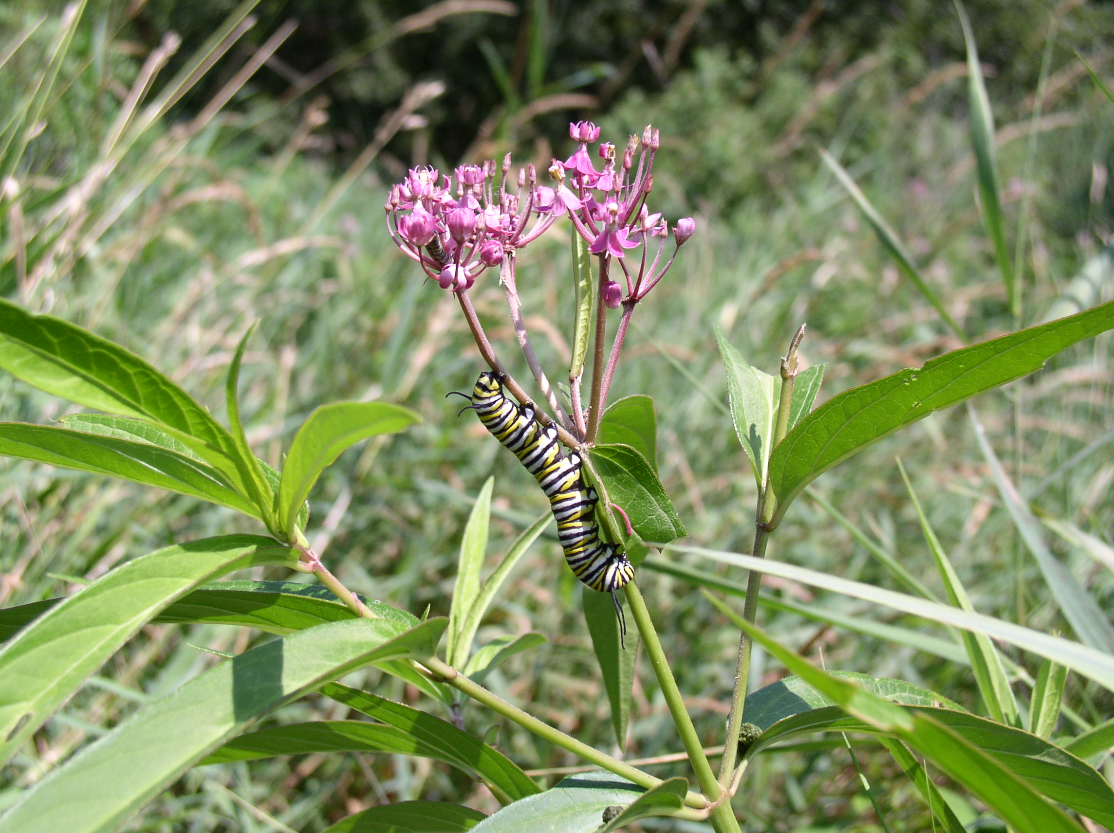
The monarch butterfly is a beautiful sight, with its brilliant red-orange wings, black veined exterior and white spotting. However, this attractive pollinator is not something to take for granted. The monarch is a vital species in our planet’s ecosystem and contributes to the environment through pollination and as an important food source for birds, small animals and other insects.

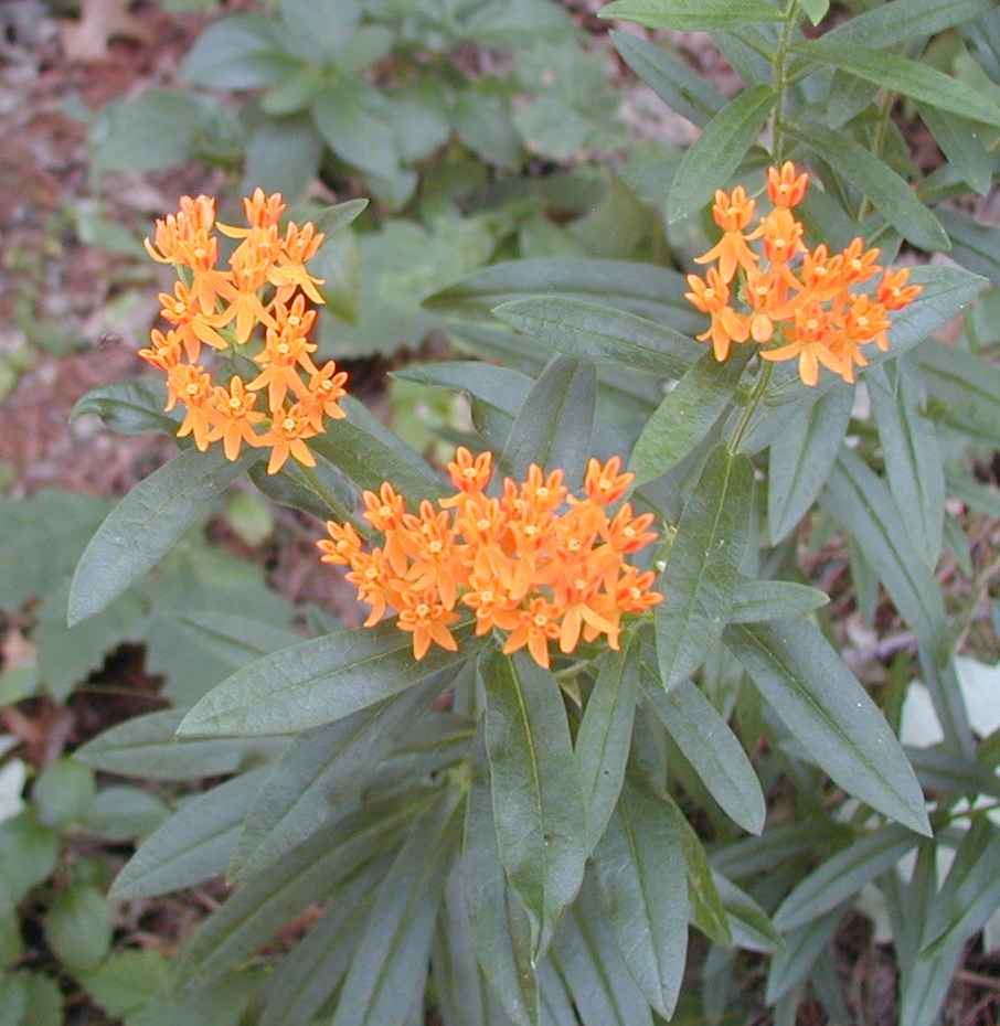
Preserving and monitoring butterfly habitat within right of way segments is a top priority for the CCAA and affiliated members. In Minnesota, any stretch of right of way along the road is commonly identified as habitat; except for urban areas that contain no vegetation. This habitat supports milkweed and a variety of blooming nectar plants that monarchs regularly frequent. Before forming a chrysalis, the monarch caterpillar relies on milkweed as its primary food source. Without it, the larva cannot develop into a butterfly.

Monarch habitats are threatened by activities such as mowing, spraying, or grading. If listed and without proper permitting, any damage to monarch habitat as a result of these activities is in direct violation of the Endangered Species Act. Entities in violation of the Endangered Species Act may be fined and unable to continue their project work until proper permitting has been processed and approved.

Morrison County puts conservation measures in place.

WSB recognizes the importance of maintaining, improving and creating a viable habitat. Our Natural Resources team recently partnered with the Morrison County Highway Department to help them determine which segments of right of way require conservation measures. As part of the conservation study, our environmental scientists will calculate and analyze the total acreage of right of way and provide recommendations on conservation best practices (as indicated per the CCAA) such as guidelines for mowing. The CCAA requires each County transportation group to implement conservation measures on five percent of the total right of way area. An approved list of management practices is covered in the agreement for communities to review.

The CCAA program is open for enrollment until the effective listing date (anticipated as December 2021 or January 2022). Members can apply for the program and receive coverage before the ruling is made. Interested entities can only join the CCAA prior to the listing date.

By maintaining, improving and creating a safe habitat, monarchs will have the environment they need to survive and thrive for generations to come.

To learn more about the CCAA and how to enroll, visit their website.

By Zach Kolsum, Environmental Compliance Specialist, WSB

Conducting inspections on infrastructure projects can be daunting, especially when they require extensive reporting and legwork to comply with local, state and federal regulations. Fortunately, there are technological tools available to assist environmental compliance and construction inspection, which streamline the arduous process of data collection and reporting for clients. Using standardized software, WSB provides the necessary equipment and materials to conduct a variety of inspections, enhanced reporting and automated data collection.

Enhanced reporting

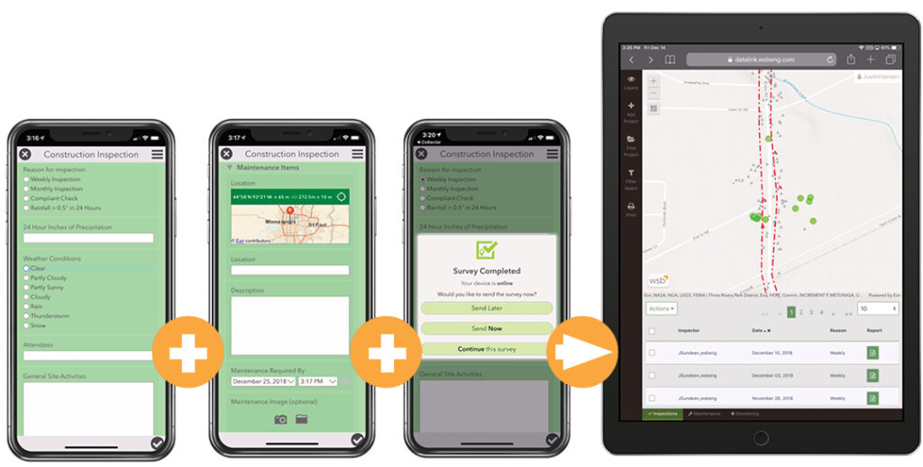
Electronic inspections offer an effective way for teams to visualize the work being done onsite. Data is collected and compiledusing a software application to generate a list of report leads. Project partners can share critical information instantly using the visual media tool.

Share project information quickly

Depending on the project, problems that arise during inspection can be costly and take valuable time away from clients and shareholders as they work to find a solution. WSB provides automated reporting and digital photo sharing with the click of a button to the entire project team. Reporting is tracked through an online database and clients can save documents and project findings in the application archive. Sharing project reporting instantly between team members is an easy way to monitor and ensure work is progressing on schedule.

Manage your data

Leveraging the use of mobile devices for inspection improves the effectiveness of field data collection by integrating mapping and field technologies into a single workflow. This methodology also minimizes the possibility of human error which increases the quality of data overall. Collected information is analyzed using a powerful search engine that identifies trends and future forecasting.

Use Datafi for Environmental Compliance inspection

WSB’s Environmental Compliance and GIS groups worked together to develop Datafi, a mobile-friendly mapping and workflow tool to improve the environmental compliance inspection process. Datafi is a field-to-office data management solution that has allowed multiple groups within WSB to actively and efficiently inspect numerous project sites to ensure compliance. Datafi is used on small and large-scale projects including housing and land developments. Our team of inspectors have benefited from Datafi’s enhanced reporting, efficiency and improved data management in the field.

As tedious as documentation management may feel at times, it is an essential part of any program development. Discovering new ways to refine processes is paramount for keeping information as reliable and accessible as possible. We believe utilizing technology allows project teams to focus more heavily on the technical aspects of the work and bringing their client’s vision to life.

Zach is an Environmental Compliance Specialist dedicated to improving his community. He has a strong understanding of federal and state regulations, providing technical, administrative, and operational support for a variety of clients concerning NPDES regulations (MS4, construction, industrial permitting) and compliance with the Clean Water Act. Zach is committed to improving his community through environmental and conservation services, including soil erosion and stormwater management.

[email protected] / 612.201.6809

Alison Harwood, WSB

When beginning the development of a wind farm, it’s not just the physical design of a property you should consider, but the environmental factors as well.

Consider the eagles before development

As environmental scientists, our role is to inform our clients about the risks to natural resources and wildlife; in particular, avian life. Using information about the natural environment, we can provide recommendations to our clients for ideal locations to construct potential wind turbines. Wind energy infrastructure can pose a great risk to birds and eagles and our research helps protect them from turbine injuries and/or fatalities. If an eagle is killed or injured by a windmill, the wind farm owner may be in violation of a federal law and face a penalty.

Wind farm eagle surveys

WSB has recently been collecting data about the presence of golden and bald eagles at a wind farm project in Montana. In recent surveys, golden eagles have been observed at the 6,000-acre site and are potentially at-risk from the wind farm development. Golden and bald eagles are protected by the Bald and Golden Eagle Act created in 1940 (and expanded to include goldens in 1962). When protected species are found to be present on a development site, an extensive two-year study, data analysis and risk calculations must be considered prior to development.

WSB understands and adheres to the recommendations and guidance of the region 6 USFWS and the 2013 Eagle Conservation Plan Guidance when conducting site assessments for eagle use at potential wind farm locations.

Two-year data collection

This past September, we began a two-year process of raptor point count surveys to study eagle land and air usage at the wind farm site. Our environmental scientists visit Montana monthly to collect data regarding eagle activity at the site location. Field work during these evaluations includes visual eagle activity surveys, eagle nest surveys, and eagle prey abundance observation that can be used to identify the impacts of a wind farm on avian life.

We compile and record information about the weather conditions, species sitings, eagle flight paths, eagle behavior, and age class. Our scientists are not only measuring avian activity but also noting whether eagle prey, such as antelope and prairie dogs, are present. We then analyze, compile, and summarize the data for our clients. At the end of the two-year study, all data will be analyzed forecasting the potential risk to eagles from wind farm development. If risk levels are high, the client can apply for an eagle take permit through the United States Fish and Wildlife Service (USFWS) and develop an Eagle Conservation Plan for the site.

Eagle safety is our top priority

Not all wind farms require an extensive two-year study as each potential site is different. If protected species, such as eagles, or species of concern aren’t present or observed at the site, the above approach may not be required. When risk levels for harming avian and raptor life are low, the process of wind farm development and construction can be streamlined.

This renewable energy source poses less risk to birds and wildlife than other energy sources, but it’s important to take the necessary precautions before development begins. Our environmental scientists evaluate conservation risks and make evidence-based recommendations for research, best management practices and siting locations that protect avian species with a low amount of risk. The goal for wind farm development is to help our clients develop renewable energy resources while reducing impacts to wildlife.

Environmental Scientist, Jordan Wein explains how tracking the activity of raptors can support wind farm development and minimize the risk to raptors and other birds.

App-based storm water asset management program helps streamline inspections.

By Bill Alms, Project Manager, WSB

Changing permit requirements throughout the country for municipal separate storm sewer systems (MS4) prompted Minneapolis-based design and consulting firm WSB to develop a web-based application for tracking inspection and maintenance of storm water best management practices (BMPs). Launched in 2013, the application has helped dozens of communities meet National Pollutant Discharge Elimination System (NPDES) permit requirements and prioritize maintenance needs for aging storm water infrastructure.

When the Minnesota Pollution Control Agency (MPCA) first introduced a new MS4 permit that required operators to have a standard procedure for annual inspections and maintenance, many communities felt overwhelmed. “We were hearing from municipal clients that there just wasn’t a good practice in place for wrapping your head around these systems,” said Jake Newhall, a water resources project manager at WSB. “Some systems have upward of 1,000 ponds and other BMPs. Communities didn’t have the resources available to inspect every asset.”

Utilizing Geographic Information System (GIS) data, the team at WSB developed an application to prioritize annual storm water BMP inspection and maintenance activities called the Storm Water Asset Management Program, or SWAMP. Specifically, the app provides an easily accessible BMP inventory, tracks and prioritizes annual inspections and maintenance and addresses the NPDES annual reporting requirement.

Nationally, the list of impaired waters steadily grows. In Minnesota alone, the MPCA recently added more than 500 waterbodies to the list. The app can be used to track the BMPs’ performance toward water quality improvements upstream of impaired waters, as well as performance related to Total Max Daily Load (TMDL) waste load allocations.

The web-based application utilizes a series of inputs that allow communities to customize their storm water maintenance programs. Since it was developed, national and local MS4 permitting requirements have continued to change. The program easily adapts to help clients meet these new standards, such as a recent requirement for reporting total suspended solids and total phosphorous.

Most communities have readily available data to utilize the program: a pond inventory, subwatershed and storm sewer maps and historic survey information. The result is a user-friendly snapshot of a community’s storm water system maintenance needs, which can be used to help decision-making as well as respond to staff, elected officials and residents.

How the program works:

  • Data collection and application set-up: WSB begins the process by inputting data on all construction as-builts, MS4 ponds, drainage areas, land use maps, field inspection reports, storm sewer maps and BMPs. This data serves as the foundation of the client’s storm water asset management program.
  • Prioritization: Once the data is compiled, the application analyzes BMPs and prioritizes them based on pollutant removal efficiencies, cost-benefit, downstream receiving water, etc.
  • Surveying: Once the priorities are identified, surveying begins. The highest priority BMPs are surveyed to determine if there are maintenance needs. Following the survey, SWAMP is updated to reflect survey information and further calibrate the application.
  • Budgeting: Once a SWAMP action plan is created, a budget can be made. Storm water inspection and maintenance activities can be budgeted based on the community’s capital improvement plan (CIP), making funds readily available for improvements as needed.
  • Construction: With the action plan and budget identified through the app, municipalities can begin hiring contractors or allocating staff to perform construction and maintenance.
  • Updates and tracking: The SWAMP application is updated to reflect the maintenance performed as well as track all historical activities.

WSB meets with multiple communities annually to review their programs and determine upcoming survey and maintenance needs. Prior to the app, clients would have to invest significant dollars in studies and models to prioritize storm water infrastructure needs. By utilizing the information within SWAMP, each client can efficiently prioritize BMP maintenance based on their preferred metrics, such as total cost, cost effectiveness and pollution removal effectiveness.

Many clients report that the program makes it easier to upgrade and maintain their BMPs. The SWAMP action plans for each community also make it easier for staff to address citizen concerns. If a resident wants to know when a pond will be maintained, the staff member or official can point to the framework and showcase how the priority of that pond compares to other assets within the system and when it will be due for maintenance.

“For developed communities, many of these BMPs that were installed in the 70s and 80s after the Clean Water Act are nearing their life expectancy,” said Newhall. “These are assets for the community–reducing pollution and ensuring safe, clean water–and we need to manage the benefits provided by this infrastructure in perpetuity.”

This article was originally published in the February 2020 issue of Storm Water Solutions magazine.

Andi Moffat, Vice President of Environmental Services, WSB

At first glance, reducing the number of bugs, moths, and bees may seem like a good idea to enable people to spend more quality time outdoors. In reality, it’s a major issue that affects everything from local habitat to the agriculture in the United States and around the world. These insects are pollinators and their travel from plant to plant helps to pollinate flowers. These flowers can be native prairie or woodland plants, apples, raspberries, cucumbers, and even hay crops for the livestock industry. So even if thriving wildlife habitat doesn’t peak your interest, being able to put food on the table should.

Between the loss of habitat, use of pesticides, insect disease, and crops designed to kill insects, pollinators are declining. While this may seem like a daunting national challenge to try and tackle, but steps are being taken to bring the message to communities and to take a very local approach– all the way down to individual yards.

At the local level, the State of Minnesota has provided the Board of Water and Soil Resources (BWSR) funding to develop the “Lawns to Legumes” program that focuses on planting residential lawns with native vegetation and pollinator-friendly plants. The goal of this pilot program is to offer cost-share, technical assistance, and planting guides to eligible Minnesota residents to install pollinator-friendly native plantings in their yard.

While individual homeowners can get involved with BWSR, there will also be a call for local partners to create demonstration neighborhoods. Eligible applicants will include cities, counties, and watershed districts. The idea is that by turning the urban lawn desert into small pockets of pollinator friendly gardens, it will have an overall positive impact for these important species.

Learn more about the program or, if you are interested in responding to the RFP that is expected to be released in December, please contact Andi Moffatt at [email protected] 763-287-7196.

Andi is a Vice President with more than 23 years of experience leading people and projects that include planning, environmental, energy, highway, natural resources, construction and development. She oversees our Environmental services and approaches her work with passion and positivity.

WSB Staff working in the lobby of the WSB headquarters.

Discover Our Difference

We partner with our clients and communities to build what’s next in infrastructure – the places, spaces, and systems that support our lives.