By: Jared Langley, Remote Sensing Manager, WSB

The infrastructure industry is undergoing a quiet but powerful transformation. As technology advances and expectations rise, firms are asked to deliver more and with greater precision. Remote sensing has emerged as a key enabler of this shift, offering a new lens through which we can view, understand, and shape the built environment.  

Remote sensing refers to the collection of data about the Earth’s surface from a distance, using technologies such as LiDAR (Light Detection and Ranging), photogrammetry, and UAVs. These tools allow us to capture high-resolution, geospatially accurate information quickly and safely, often over vast or hard-to-reach areas. But the true value lies not just in the data itself but in how that data is interpreted, integrated, and applied across the lifecycle of a project. 

Across all phases, remote sensing is a powerful enabler of smarter, faster, and safer project delivery. It provides timely, high-resolution data that supports early decision-making, enhances design accuracy, streamlines construction oversight, and strengthens long-term asset management. By integrating this technology into every stage of the project lifecycle, teams gain a clearer understanding of site conditions and can respond with greater agility and confidence.  

Choosing to utilize remote sensing is a strategic decision, and selecting a provider backed by full-service engineering expertise unlocks even greater value. When remote sensing is embedded within a multidisciplinary firm, data collection seamlessly aligns with planning, design, and construction workflows. The benefit is a unified team that understands the full project lifecycle and can translate geospatial intelligence into smarter infrastructure solutions from day one. 

1. Accelerated Decision-Making from Day One 

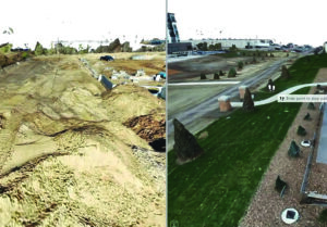
In the planning phase, remote sensing accelerates decision-making by providing rapid, large-area aerial surveys and 3D terrain models. These datasets support feasibility studies, environmental impact assessments, and early alignment planning, helping teams evaluate multiple corridors or sites before committing field crews. This early insight reduces risk, saves time, and ensures that projects begin with a strong foundation of information. 

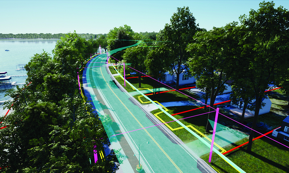
2. Enhanced Design Accuracy and Real-World Context 

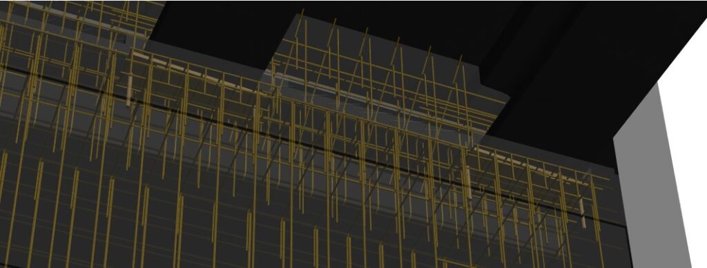
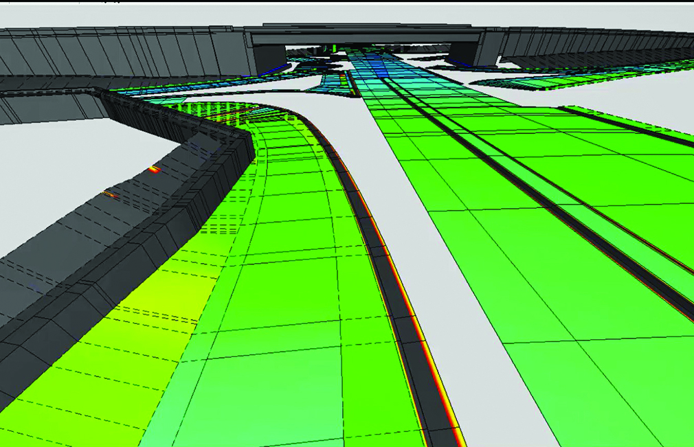
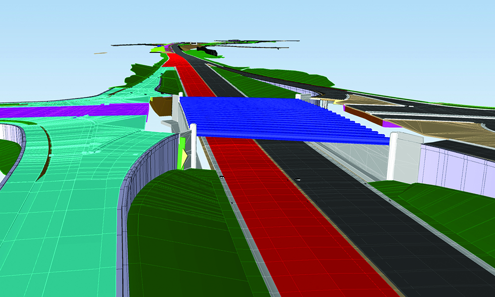
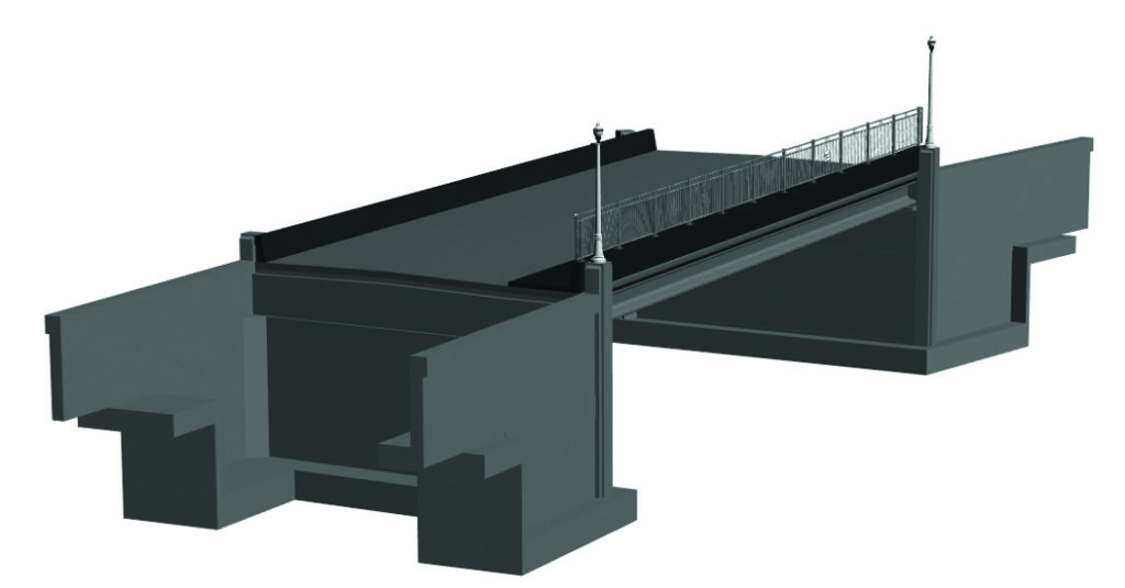
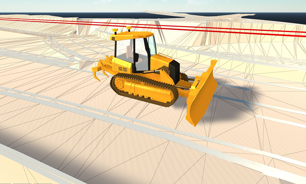
As projects move into design, remote sensing continues to add value. High-density point clouds and digital twins offer engineers a detailed, real-world context for their work. The result is more accurate designs, fewer surprises in the field, and a smoother path from concept to construction. 

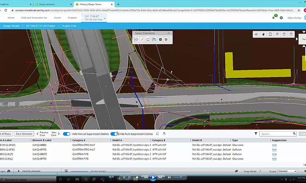
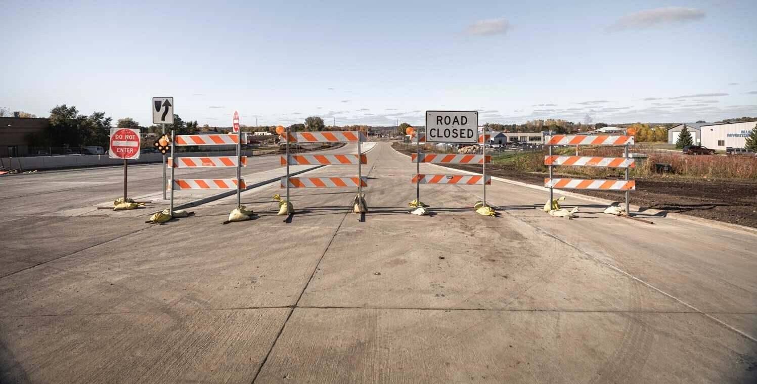
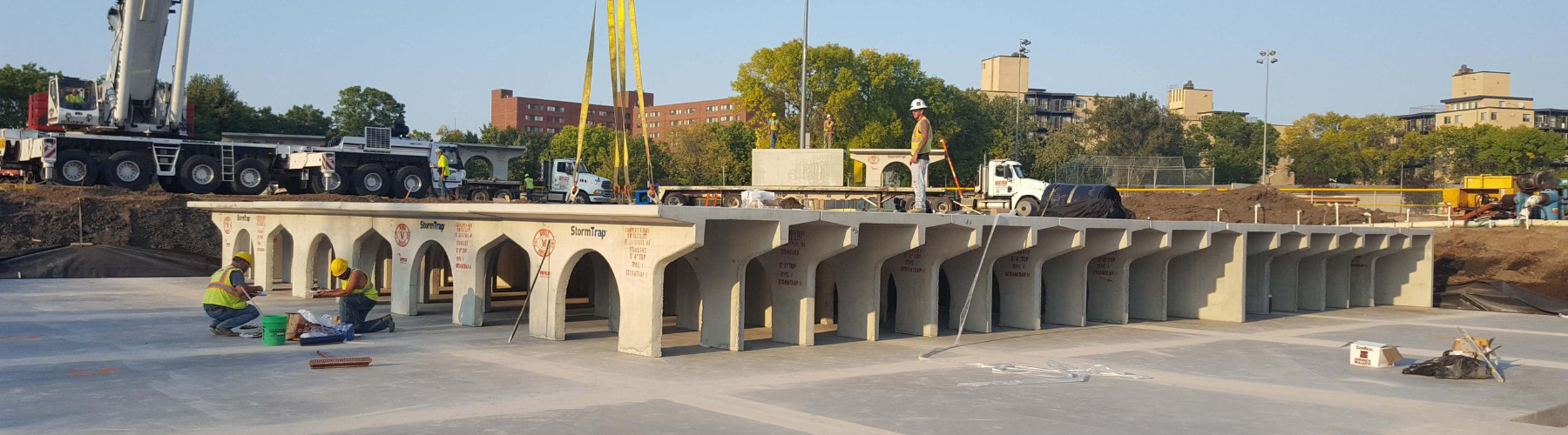
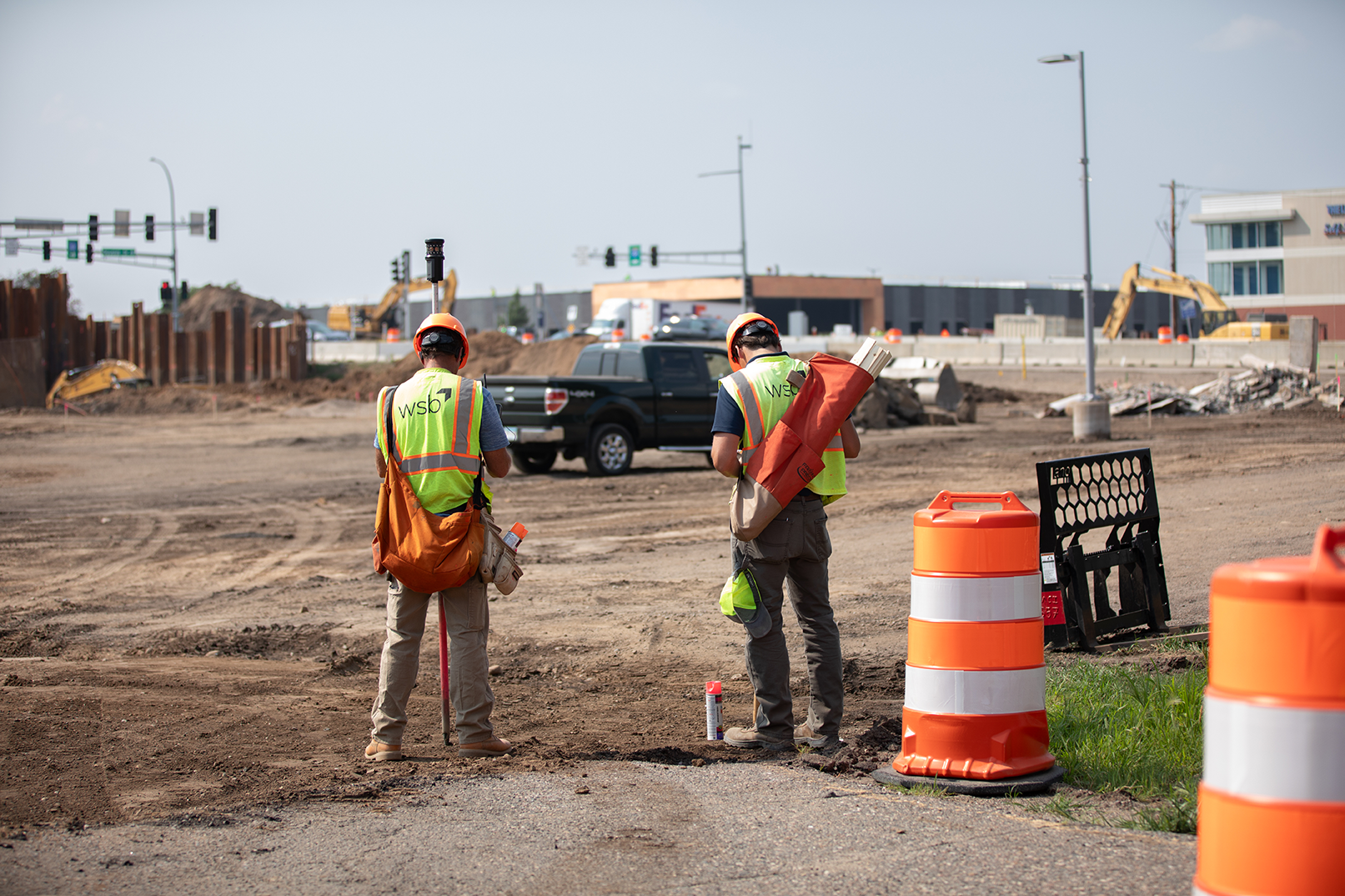
3. Transparent Construction Oversight and Documentation 

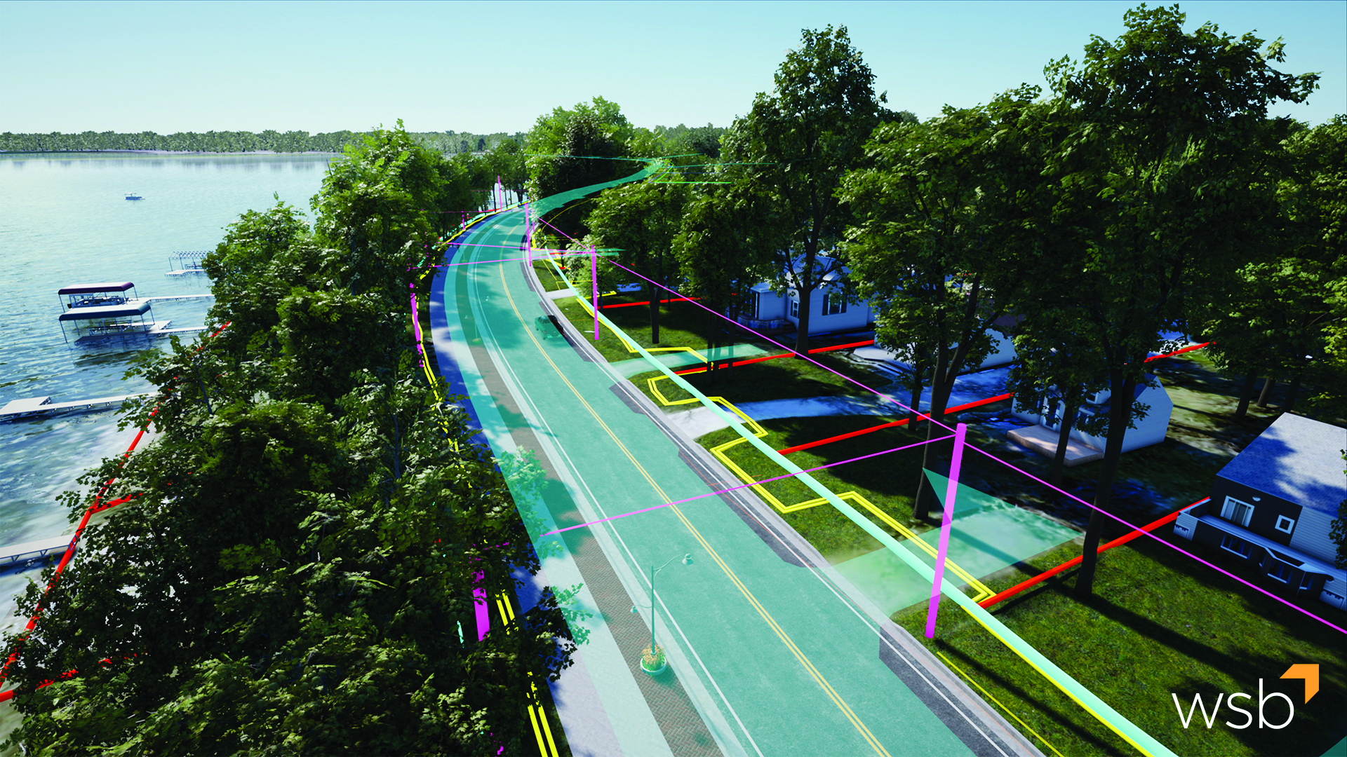
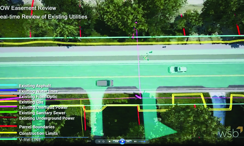
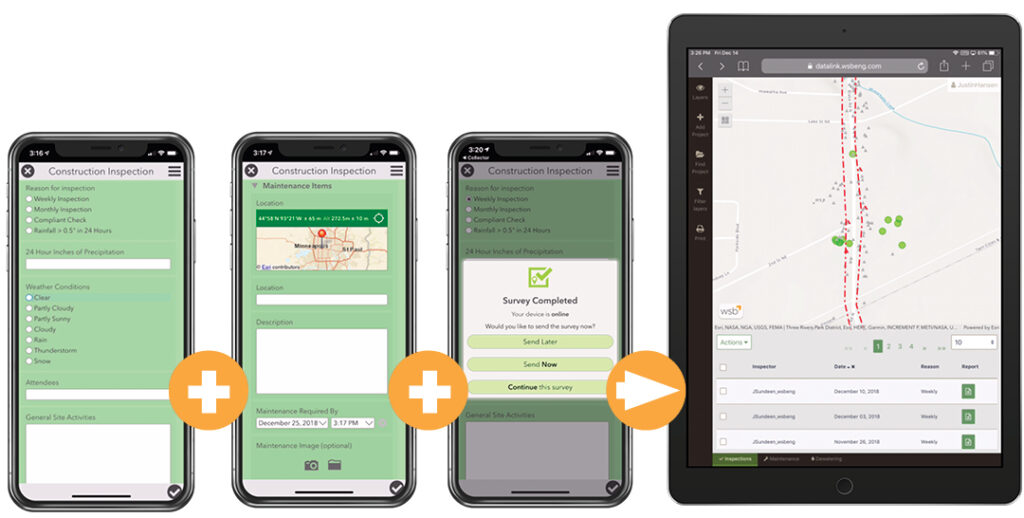
Remote sensing enhances surveying, too. Mobile and aerial LiDAR, combined with UAV-based imagery, allow survey teams to collect data more efficiently and with greater detail. During construction, remote sensing introduces a new level of objectivity and transparency. UAV flights generate dated, auditable orthomosaics and 3D models that document site conditions over time. These records support pay applications, earthwork validation, and compliance checks, reducing disputes and building trust among stakeholders.  

4. Smarter Project Delivery 

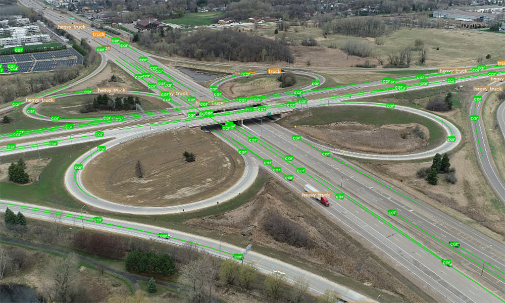
Digital construction management is another area where remote sensing plays a critical role. By feeding real-world conditions into digital platforms, we enable 4D scheduling, model-to-field alignment, and continuous validation. This creates a closed-loop system where design, construction, and reality are always in sync, ensuring that what’s built matches what was planned. 

The industry is evolving, and so are the expectations placed on engineering and consulting firms. Clients want faster turnaround times, scalable solutions, and GIS-ready deliverables. Remote sensing helps meet these demands by accelerating data collection, minimizing field risk, and enabling customized analysis. Firms with internal remote sensing capabilities are better positioned to respond to these needs and anticipate the requirements of future contracts.  


How WSB Can Help

At WSB, our remote sensing team works hand-in-hand with planners, engineers, surveyors, and construction managers. This integrated approach ensures that high-resolution data is not only collected but transformed into actionable insights. It’s a model that enhances accuracy, streamlines workflows, and delivers better outcomes for clients across all markets. 

Remote sensing is more than a tool, it’s a catalyst for smarter, more efficient infrastructure delivery. And when paired with the depth and breadth of a full-service firm, it becomes a powerful differentiator. As the industry continues to evolve, WSB remains committed to leading with innovation, insight, and integrated expertise. 

Portrait of Jared Langley

Jared Langley serves as Remote Sensing Manager in WSB’s Survey department, based in Fargo, ND. With expertise in aerial mapping and geospatial technologies, Jared leads initiatives that integrate advanced remote sensing solutions into surveying workflows. He oversees specialized programs, including UAS operations, and collaborates on projects involving end-user licensing and AI-driven mapping tools. His leadership ensures innovative approaches to data acquisition and analysis for infrastructure and environmental projects

701.302.0320

By moving beyond outdated tools, we can foster more meaningful connections, better demonstrate our capabilities, and evolve with the needs of our clients.

October 3, 2024
By Val Brennan, Director of Marketing, WSB

Published by Zweig in the September issue of The Zweig Letter. TZL 1552 (web) (flippingbook.com)

In the dynamic realm of the architecture, engineering, and construction industry, marketing strategies are pivotal for securing client trust and business sustainability. However, traditional methods such as the one-pager are rapidly losing their effectiveness. The one pager, once a staple in marketing toolkits, now represents an outdated approach that can potentially limit a firm’s market perception and success.

The service-first conundrum. For decades, one-pagers have been the go-to marketing material, typically leading with a detailed list of services. This method, while straightforward, inherently restricts a firm’s narrative to a narrow scope. Clients, especially in the AEC sector, look for partners, not just service providers. When we lead with services, we risk being pigeonholed, recognized only for specific capabilities rather than as a comprehensive solution provider. This not only diminishes our appeal but also caps our potential engagements.

A crutch for the sales-averse. Sales is an art, particularly in technical fields where the nuances of services are complex and varied. The reliance on one-pagers has inadvertently become a security blanket for those uncomfortable with direct selling. This trend is counterproductive. While a one-pager can neatly summarize a service, it cannot replace the human element crucial in sales – empathy, adaptability, and the ability to engage. By over-relying on these documents, we prevent our staff from fully developing these essential skills, ultimately impacting our firm’s ability to connect and resonate with potential clients.

Misaligned meeting approaches. The most strategic error with one-pagers is their tendency to dictate the flow of client meetings. Successful client interactions are not about inundating prospects with prepackaged information but about listening – understanding their challenges and tailoring our dialogue to address these issues. A one-pager encourages a monologue when the need of the hour is a dialogue. It is imperative that we shift our approach to one that prioritizes listening, thus fostering a more consultative and client-centric relationship.

A strategic shift in approach. Transitioning from the one-pager mentality involves a strategic overhaul. We start by setting clear goals and identifying our target audiences. From there, we develop key messages that resonate deeply with these groups. Only then do we select the appropriate tactics. This comprehensive strategy allows us to utilize the full spectrum of marketing and sales tools at our disposal, effectively moving our clients and prospects to action. By adopting this holistic approach, we ensure that all communications are purpose-driven and tailored, maximizing impact and engagement.

Let the one-pager die. The death of the one-pager is not an end but a beginning – an opportunity to innovate our approach to marketing and client engagement in the AEC industry. By moving beyond these outdated tools, we can foster more meaningful connections, demonstrate our full spectrum of capabilities, and, most importantly, evolve alongside the needs of our clients.

“For decades, one-pagers have been the go-to marketing material, typically leading with a detailed list of services. This method, while straightforward, inherently restricts a firm’s narrative to a narrow scope. Clients, especially in the AEC sector, look for partners, not just service providers.”

In the era of holistic service and partnership, listening and personalized engagement are the keys to unlocking true business potential.

Portrait of Val Brennan

Val, Director of Marketing at WSB, brings over 15 years of experience in shaping and executing comprehensive marketing and communications strategies. Her expertise lies in her ability to develop strategic plans that resonate across the company. Renowned for her authentic and user-centric approach, Val collaborates effectively with clients to elevate brand experiences and boost service performance. She consistently sets benchmarks in strategic communications, with a meticulous attention to detail that ensures every initiative connects deeply with its intended audience.

612.916.1002

January 11, 2023

The Foundation of Digital Delivery

Geospatial data is information that involves large sets of data gathered from a variety of diverse sources based on location. In the Architecture, Engineering and Construction (AEC) Industry, we depend on geospatial data to build and design infrastructure. Strong data is the foundation of any digital delivery project. Capturing geospatial data for infrastructure projects is the first step in the digital delivery workflow.

The five ways we gather thousands of accurate data points to improve design methods and increase speed and accuracy.

Reality Capture for 4D / 5D

High resolution drones capture thousands of photos that overlap at different angles to create a geospatially accurate reality capture of an entire site. The reality capture contains accurate lengths, depths, and heights.  To increase accuracy, the geospatial data is tied to survey ground control points.  Once the data is processed, it can be input into many different design software, serving as the first step in digital delivery.

Interior/Indoor Scanning

Using a tripod and LIDAR scanner, we collect thousands of data points. The scanner is moved around to cover the entire area, capturing points along the way, and is then uploaded into BIM software. This information can be used to create a robust asset management system.

WSB 360 – Google Street View

WSB 360º captures high-resolution 360º imagery that is used to detect and map a variety of assets as they exist today. Google imagery is often missing or out-of-date. By driving a street or an alley, data is gathered within minutes and uploaded to Google Maps and StreetView.  This technology is also used to capture, map, and classify road assets including hydrants, signs, power poles, and streetlights.

Traditional Surveying

Traditional surveying is performed by survey crews using tools to make measurements. Some refer to this as the most accurate form of data collection because of the boots on the ground element. There are proven methods of verifying accuracy and conventional survey has been performed for hundreds of years.

Conventional Drone | 2D & 3D Reality Captures

With conventional drone data, we create 2D and 3D high-resolution imagery. This data serves as the foundation for 3D and 2D reality captures. 3D reality captures are developed when elevations are needed for digital design. 2D reality captures are developed when elevation isn’t necessary. In the past, satellite imagery was relied upon, which was often inaccurate and outdated. Through conventional drones, we can document a site accurately, in-depth, and within minutes.

January 11, 2023
By John Bradford, Sr Project Manager, WSB

From electronically monitoring water pumps to installing GPS trackers on city snowplows, many cities are embracing technologies and tools to become a smart city. Communities across the country are advancing initiatives that make their cities more efficient, while protecting resources and public dollars. 

What opportunities are out there, and what does being a smart city mean? Let’s break it down. 

What Does It Mean to Be a Smart City? 

There is no one definition of smart city, but there are a few ways to approach the concept and adopt smart city initiatives that meet the needs of your community. 

The first is to consider policies and tools that benefit the public. How can smart cities improve health metrics, the way that residents interact with one another, or best utilize community resources? There are numerous technologies and innovative ideas that can improve the lives of citizens and benefit overall public wellbeing. 

The next area to think about is data systems, and how you can track information to improve the efficiency and life of equipment. Thorough asset management means understanding that infrastructure and equipment not only require preventative maintenance, but predictive management as well. New technologies can help cities understand when certain equipment needs to be repaired or adjusted, extending its life, and helping communities more effectively plan for capital improvements. Furthermore, for communities with sustainability plans, it’s important to understand how sustainability, asset management, and smart cities all connect. 

Next, when thinking about smart cities, it is critical to map how using technology can more effectively utilize resources. For example, many northern cities are installing GPS tracking devices on city snowplows and making traffic light modifications that allow the plows to make it through green lights instead of having to stop. This improves the efficiency of snow removal, better utilizes community resources, and positively benefits public safety by clearing roads more quickly and effectively. Another example is having occupancy sensors installed at community parks and playgrounds to track usage and the best allocation of resources. 

What it means to be a smart city can mean something different to each community, so it’s important to think about what works best for your community. 

What are the Biggest Opportunities and Challenges?

Smart cities are the future, and can help communities save money, direct resources more efficiently, and better connect and communicate with residents. The opportunities are endless, so communities need to look at places where they can find the greatest value and potential. 

But because there is no one definition of what a smart city means, many communities can feel pressure to do too much, or fail to see how the small technological investments and changes they are making fit into the big picture of a smart city. 

Furthermore, as every community faces limited budgets and funding priorities, understanding where smart city investments make the most sense and will have the biggest impact is key. Also looking at opportunities to expand funding resources is critical. WSB helps many communities with identifying and applying for grants. 

Where to Start?

Where do you start on the road to becoming a smart city? It’s important to think both big picture and in detail. 

Start by defining your goals. Is it improving the efficiency of public works? Is it better communication with residents and the public? And how do these goals tie into your city’s larger strategic plan? 

At WSB, we help communities navigate big ideas and in-depth planning. If you’re not sure where to start or have ideas, I encourage you to reach out for an exploration conversation. There are so many amazing new tools, technologies, and opportunities out there – and smart cities can help build a better future for all of us. Look to us this year to continue to share articles on the ways that technology can help improve your community.

John has worked in the private and public sectors for 29 years and has worked with the cities of Hopkins, Woodbury and Bloomington. His experience includes policy development, capital improvement planning, infrastructure planning, comprehensive planning, site master planning, facility expansion projects, and interagency partnership agreements, labor contract negotiations, and culture change management.

[email protected] | 952.210.8280

Introducing Digital Plus

The future of project delivery

Beyond paperless

For many years, the AEC industry has been embracing advancements in the way we deliver projects. Paperless plans were the first step in this process. Fast forwarding to today, paperless plans have evolved one step further. People often refer to any digital plan set as paperless, but at WSB, we take our designs one step beyond paperless by creating 100% models. 100% models mean the entire project is created and designed in 3D.

100% models house data and design information from the entire project lifecycle, leaving owners and contractors with an accurate, detailed, data-based model to support asset management needs well into the future.

The development of DigitalPlus

WSB is committed to leading our industry in the use of cutting-edge tools to work smarter.  As a firm, we’ve been at the leading edge of digital delivery efforts for many years.  Our approach is unique and one that has been internationally recognized as a best practice in digital project delivery.  To help tell this story, we created DigitalPlus. 

DigitalPlus is the future of digital delivery. Through a combination of cutting-edge tools, expertise and a commitment to innovation, we are shaping the way our industry delivers projects. We believe in advanced project delivery, and we know how to apply the right technology and expertise to support our infrastructure needs. Through DigitalPlus, we are setting new standards, developing best practices and changing our industry’s approach to multidimensional digital design.

Why DigitalPlus

As engineers, we are motivated by the opportunities to design infrastructure projects that support our communities. The infrastructure around us has a significant impact on our daily lives. From drafting plan sets to public meetings, we live in the details and embrace the full process.  We also embrace the advancements in our industry and how we can leverage technology to deliver better projects for our clients.


The benefits

  • Improve Quality
  • Sustainability
  • Enhanced Scheduling
  • Better Managed Risk
  • Relationship Management (Contractors | Owners)
  • Improve Cost
  • Increase Collaboration and Communication

What is DigitalPlus

A combination of expertise and cutting-edge tools.

Data Collection

Data is the foundation of any good project. We use several traditional data collection methods to gather data points that help paint a picture of the world around us. Good data is vital to the DigitalPlus process.

3D Design

Designing in 3D allows us to develop the project while providing a complete and accurate picture of the final product, significantly improving project outcomes.

4D / 5D

4D/5D modeling improves accuracy and efficiency by adding time and cost functions into design. The true power lies in the way a model can be used during preliminary design, final design and throughout construction.

Asset Management

Asset Management is the collection of an agency’s infrastructure assets and includes a plan for managing assets over the infrastructure’s lifespan. Through digital twins, assets can be managed virtually and accurately.

Utility Coordination

Digital delivery aids utility coordination by translating utility information into a 3D environment that can be compared with the design to identity and mitigate conflicts.

Visualization

Real-time 3D visualization has completely transformed site-specific review and public engagement efforts. Visualizations allow for active participation regardless of project scope and size.

Traffic Operations

Through simulation technology and trip-origin destination data, roadway designs are now guided by real-time and historical mobility movement data.

Integrated Project Delivery

A process, rather than a project that all starts with an idea. Through a combination of expertise and cutting-edge tools, land developers and owners identify opportunities and challenges before a project begins.

Machine Control Modeling

Using 3D models and GPS data, machine control modeling allows earthwork machinery to be accurately positioned. Design surfaces, grades and alignments are directly imported into construction equipment, resulting in increased accuracy and timelines.


To learn more, visit: www.wsbdigitalplus.com

Five years ago, Bret Weiss, WSB’s President & CEO, walked into an all-staff meeting and said, “Beginning now, we are a technology firm.” Today, this statement rings true. WSB is still a design and consulting firm dedicated to building the places, spaces and systems that support our lives, but in everything we do, we look through a technology lens.   

In this Q&A, Weiss discusses WSB’s commitment to innovation and why he embraced disruption early on.

Why technology?

In many industries, technology has drastically impacted processes, deliverables and has had significant impacts on cost, quality and speed to market.  The AEC space is no different.  There are both tangible and intangible benefits to use new tools and technology that produce real results and help us meet our client demands. Many in our industry are comfortable with how we have always done it and I saw software solutions as an opportunity to differentiate our firm.  We have always tried to think like successful businesses outside our industry and want to be on the leading edge. Our commitment to advanced technology and project delivery will continue to further set us apart. There are countless internal staff and external client benefits that come from driving technological advancement for the industry.  We felt like a strong base in technology was the perfect place to position WSB.

“Beginning now, we are a technology firm.”

Bret Weiss
What type of reaction did you get from staff after you stated that WSB was a technology firm?

There were varied responses – some confusion, a lot of excitement and many questions. Obviously, we’re still a design and consulting firm, but it’s the way we deliver our projects that’s different and creating real impact.  We wanted to drive that home for staff.  The use, development and adoption of technology is a priority for our firm. Change can be hard for any industry.  A bold introduction was necessary.  Like with any change, there was some hesitancy in adjusting what’s already working, but the benefits speak for themselves, and it’s been something staff and clients have grown increasingly excited about.

You’ve been vocal about the importance of embracing change. How do you know when a change is the right one?

There is always a certain amount of risk associated with change and we are constantly evaluating any potential risk to our company, staff, and clients.  With any change, you will encounter resistance and may experience a slow transition, but that’s where we weigh the benefits of change.  Our culture is built on curiosity and experimentation with new ideas but is balanced with a swift evaluation of what has potential and what won’t meet our expectations.

My goal is to lead WSB to deliver better projects for our clients and the communities we serve. Any change that supports these efforts is something we’re willing to explore. We have a strong leadership team that is committed to new solutions, and we are committed to developing partnerships to help us on this journey.

We want to help build better infrastructure through streamlined approaches that are mutually beneficial for all parties. Whether it’s safer infrastructure, working conditions or cost savings and better schedules, the benefits must outweigh the risk.  We constantly review how technology could advance WSB and our deliverables, which is well worth the risk and has allowed us to grow in new areas of our industry.

When did you know WSB’s commitment to technology was going to be successful?

Our staff have always embraced curiosity and our business has been built on thinking differently.  There were a lot of milestones that helped build our momentum.  We hired new staff to grow our expertise, we collaborated with strategic partners, and we worked closely with clients who shared a vision for advancing our industry and leading digital delivery efforts. 

There are so many examples of where we have succeeded with developing, using and enhancing technology. The success we have had has spread throughout WSB and all our staff understand the importance of using technology to advance our clients goals. I’m excited about the progress we’ve made, but I’m looking forward to what’s next in our digital evolution.

As vice president, Kaiyala will work across divisions and regions to support the firm’s growing project controls team and digital delivery efforts.

Andy Kaiyala

Engineering and consulting firm WSB announced today that Andy Kaiyala has joined the organization as their vice president of construction technology and controls. Kaiyala will oversee WSB’s project controls team and will support the firm’s advancement of digital delivery in the contractor market across regions and divisions.

The role was developed in response to the growing availability of project delivery methods, including Construction Manager/General Contractor (CMGC) and progressive design build.

“The entire AEC Industry is recognizing the value of a more transparent process that is being driven by digital delivery,” said Jon Chiglo, chief operating officer at WSB. “With Andy’s expertise, WSB will guide our clients through a process that mitigates risk and reduces conflict for all stakeholders throughout the project.”

Kaiyala was most recently with The Lane Construction Corporation, a construction engineering company specializing in large, complex civil infrastructure, where he served as the vice president of bid development. In this role, he oversaw bid development from coast to coast. Throughout his 20+ year career, Kaiyala has gained insight from working for contractors, managed field operations, oversaw contract negotiations and led client engagement.

“WSB is uniquely committed to advancing innovation while understanding that a highly skilled, qualified individual is still needed to properly employ technology,” said Kaiyala. “The beauty of digital delivery is that it’s inherently transparent. The momentum in our industry will continue to advance and will result in many benefits for contractors, owners and engineers.

Kaiyala will support WSB’s construction division that offers many services including design-build, alternative project delivery, contractor modeling, pavement management and surveying.

By Andi Moffatt, Vice President of Environmental Services, WSB

As the COVID-19 pandemic began to spread through the country, WSB was called on by the Minnesota State Emergency Operations Center (SEOC) to assist in COVID-19 testing logistics. As project managers in the AEC industry, our team is used to working under pressure – and this task was no exception. We welcomed the chance to assist the state in testing Minnesotans and to do our part in preventing the spread of COVID-19.

A LARGE EFFORT THAT SPANNED ACROSS THE STATE.

The size and scale of this project was enormous. Representatives from the state, cities, counties, local public health organizations and staff at the vaccination and testing venues came together as a coalition to get this project off the ground and operational. To support these efforts, several WSB team members from across the company stepped in to assist on the emergency contract to set-up and manage the logistics of the state’s no barrier COVID-19 testing sites. We provided project management, IT, site mapping and drone photography, visual documentation and information gathering, and general logistics on behalf of the state.

GETTING MINNESOTANS VACCINATED.

As vaccines became available throughout the state, the SEOC asked WSB to manage the logistics associated with COVID-19 vaccine sites. We continue to work behind the scenes to help Minnesotans get vaccinated.

TACKLING CHALLENGES HEAD ON.

This project has been rewarding for many of us at WSB. It reinforces our commitment to supporting our communities and the challenges they face, no matter what they may be. Internally, we’ve also reminded ourselves that nothing is too big for us to tackle together and that we will work across departments, teams and offices to deliver for our clients.

“We are honored to have been able to play a role in such a dedicated, committed and passionate network across the state,” said Andi Moffatt, vice president of environmental services. “Public health is a priority, and we will continue to work with the state and our local communities to help deliver this critical support.”

Andi is a Vice President with more than 23 years of experience leading people and projects that include planning, environmental, energy, highway, natural resources, construction and development. She oversees our Environmental services and approaches her work with passion and positivity.

[email protected] | 763.287.7196

By Do Nam, Sr. Traffic Operations Engineer, WSB

Construction operations on roadways disrupt normal traffic flow and generate undesirable delay. As traffic continues to increase throughout many metro areas, the Federal Highway Administration has been encouraging DOTs to be more proactive in their maintenance of traffic during construction. 

Good construction staging provides safe and efficient traffic operations throughout a project to minimize impacts on the community during construction. WSB has begun development of traffic models that simulate the flow of traffic under different staging scenarios. These traffic simulation models consider all available routes, how construction will impact these routes and how much additional time this will add for commuters. These models are being used to determine if there are improvements that need to be made on any surrounding routes to allow for better operations throughout construction.

This new approach is more proactive than past construction staging methods and is based upon data. By modeling actual construction conditions, we’re able to pinpoint where potential challenges may occur during construction and how to avoid them. Below is a list of potential benefits of construction staging and maintenance of traffic modeling using traffic simulation.

The benefits of advanced traffic simulation for construction staging and maintenance of traffic

  1. By understanding what the impacts to the community are, we can be more proactive in mitigating them.
  2. If we better understand what routes traffic will use, we can ensure that traffic controls are set up to accommodate additional traffic volumes.
  3. Limit changes can be evaluated.
  4. Informs decisions on critical maintenance items.
  5. Provides a public engagement tool for cities and residents.

Through advanced traffic simulation technology, we’ve been able to enhance construction staging plans resulting in better projects.

Do has been a civil engineer in the transportation field for over 25 years. His experience includes modeling, operational analysis, design and Intelligent Transportation Systems (ITS) of large-scale transportation projects in both the United States and Qatar. Do has successfully managed over 30 major transportation and research projects utilizing traditional macroscopic travel demand forecasting modeling and state-of-the-art microscopic traffic simulation modeling techniques.

[email protected] | 763.760.8090

By Zach Kolsum, Environmental Compliance Specialist, WSB

Conducting inspections on infrastructure projects can be daunting, especially when they require extensive reporting and legwork to comply with local, state and federal regulations. Fortunately, there are technological tools available to assist environmental compliance and construction inspection, which streamline the arduous process of data collection and reporting for clients. Using standardized software, WSB provides the necessary equipment and materials to conduct a variety of inspections, enhanced reporting and automated data collection.

Enhanced reporting

Electronic inspections offer an effective way for teams to visualize the work being done onsite. Data is collected and compiledusing a software application to generate a list of report leads. Project partners can share critical information instantly using the visual media tool.

Share project information quickly

Depending on the project, problems that arise during inspection can be costly and take valuable time away from clients and shareholders as they work to find a solution. WSB provides automated reporting and digital photo sharing with the click of a button to the entire project team. Reporting is tracked through an online database and clients can save documents and project findings in the application archive. Sharing project reporting instantly between team members is an easy way to monitor and ensure work is progressing on schedule.

Manage your data

Leveraging the use of mobile devices for inspection improves the effectiveness of field data collection by integrating mapping and field technologies into a single workflow. This methodology also minimizes the possibility of human error which increases the quality of data overall. Collected information is analyzed using a powerful search engine that identifies trends and future forecasting.

Use Datafi for Environmental Compliance inspection

WSB’s Environmental Compliance and GIS groups worked together to develop Datafi, a mobile-friendly mapping and workflow tool to improve the environmental compliance inspection process. Datafi is a field-to-office data management solution that has allowed multiple groups within WSB to actively and efficiently inspect numerous project sites to ensure compliance. Datafi is used on small and large-scale projects including housing and land developments. Our team of inspectors have benefited from Datafi’s enhanced reporting, efficiency and improved data management in the field.

As tedious as documentation management may feel at times, it is an essential part of any program development. Discovering new ways to refine processes is paramount for keeping information as reliable and accessible as possible. We believe utilizing technology allows project teams to focus more heavily on the technical aspects of the work and bringing their client’s vision to life.

Zach is an Environmental Compliance Specialist dedicated to improving his community. He has a strong understanding of federal and state regulations, providing technical, administrative, and operational support for a variety of clients concerning NPDES regulations (MS4, construction, industrial permitting) and compliance with the Clean Water Act. Zach is committed to improving his community through environmental and conservation services, including soil erosion and stormwater management.

[email protected] / 612.201.6809

WSB Staff working in the lobby of the WSB headquarters.

Discover Our Difference

We partner with our clients and communities to build what’s next in infrastructure – the places, spaces, and systems that support our lives.