Transforming Hillcrest into The Heights

December 18, 2023

By Bob Barth, Director of Land Development, WSB

A visionary redevelopment project in St. Paul. 

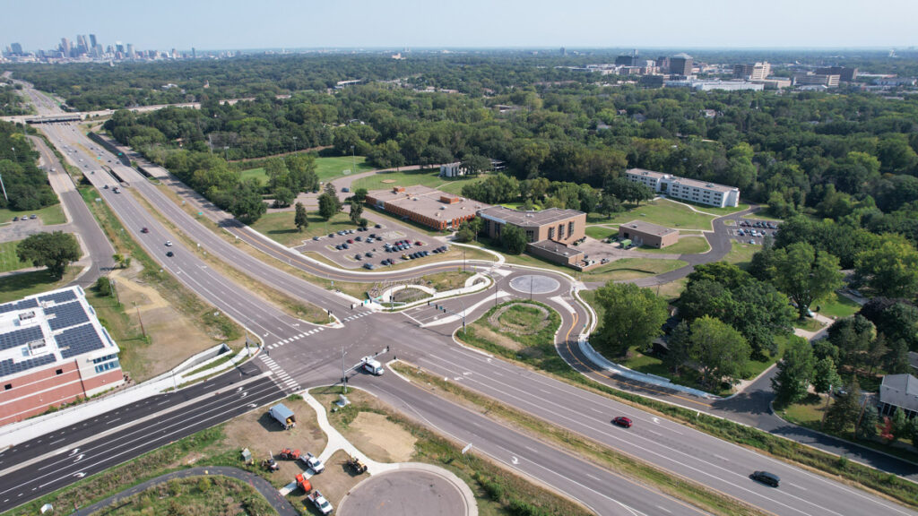
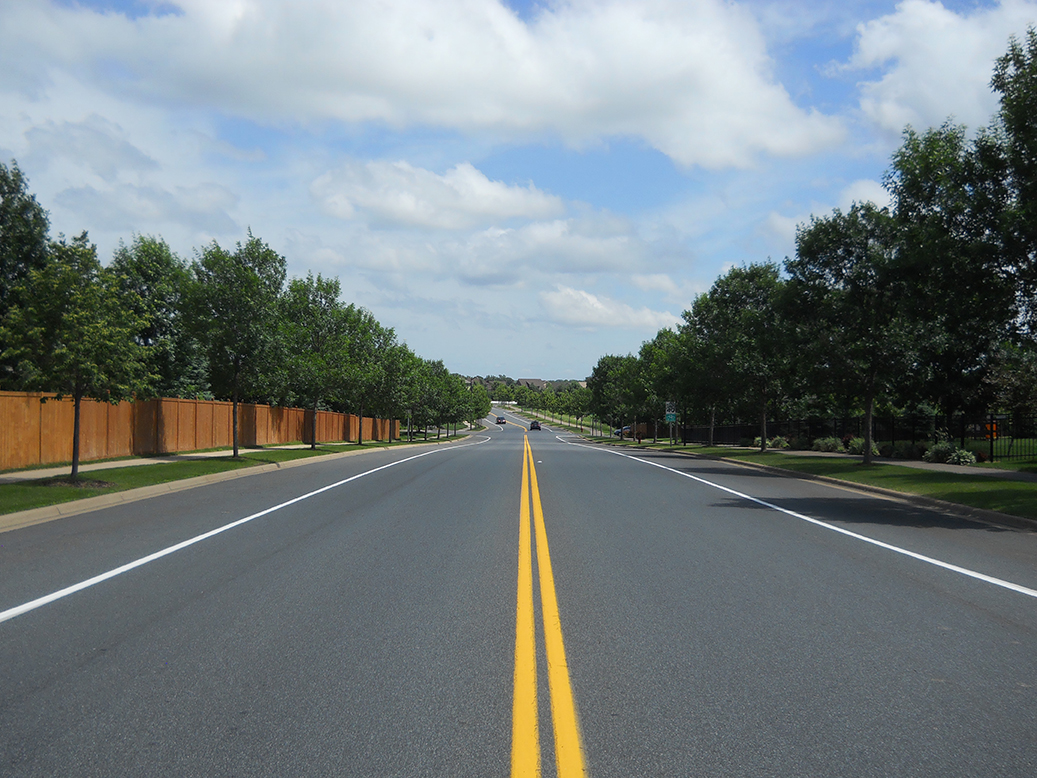
When the Saint Paul Port Authority saw an opportunity to purchase the Hillcrest Golf Course in 2019, they sought WSB’s infrastructure planning and design experience to breathe new life into the 112-acre property on Saint Paul’s east side. Four years later, this unique project is under construction and promises new jobs and housing, expands the local tax base, achieves multiple green outcomes, and interweaves publicly accessible open space into its employment and residential settings.  

The Challenges & Opportunities of the Project 

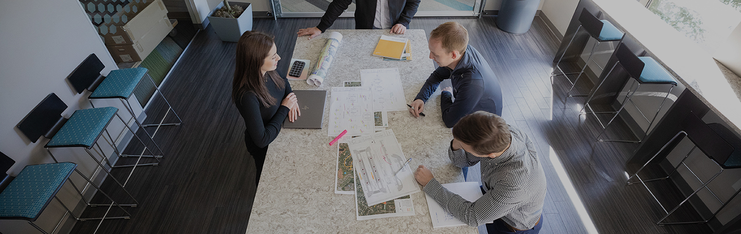
The Hillcrest transformation into the Heights can be mapped across several stages: pre-purchase due diligence, master planning, design and construction. We joined forces with the Saint Paul Authority and other partners for landscape and sustainability to tackle these phases head-on, understanding the complexities of the project, as well as the great value it will bring to the community upon completion.  

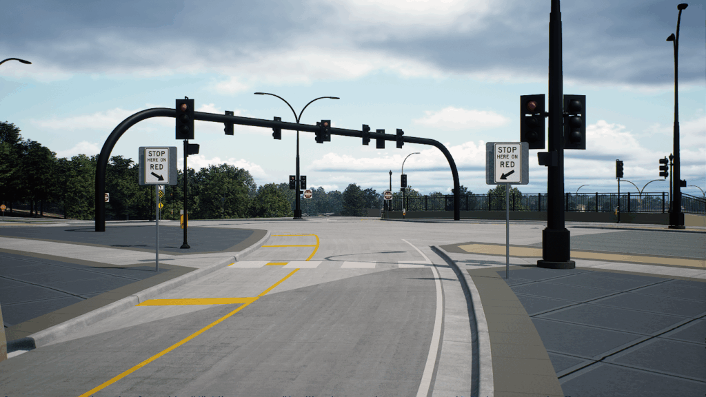
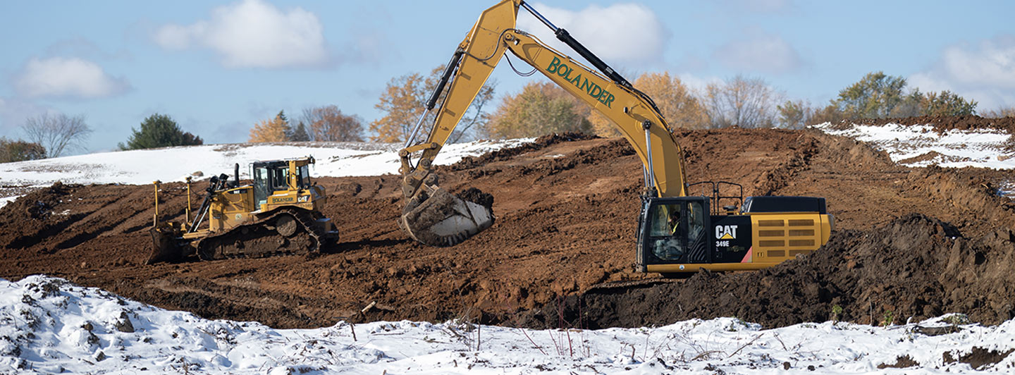
One problem that had to be mitigated was mercury contamination on the site, due to chemicals used on the property when it was a golf course. Also, the property’s uniquely hilly terrain had to be adapted to industrial development, new roads and infrastructure. Remediation plans to clean up the site and ensure the design accounts for the landscape were critical for this project. 

Crafting Community Space 

At the heart of this redevelopment lies the aspiration to create a space accessible to the public – one boasting open spaces, park-like areas and captivating public art displays. The idea is that no matter where someone is, people are close to nature. 

There will be one million square feet of industrial space and one thousand new housing units, driving economic prosperity and diversity in the area. This a public project, and at its heart, it is focused on the greater needs of the community and how to develop a project that brings critically needed housing, jobs and opportunities for the east side’s residents and its emerging young workforce. 

An Accelerated Timeline for Community Need 

Originally slated as a decade-long endeavor, the Heights redevelopment project gained momentum due to overwhelming demands and protentional to uplift the area. Substantial completion is expected in 2025, with full project completion in 2026. 

A Chance for Change 

Our firm’s involvement in this transformative venture was no accident. The choice was driven by a deep-rooted experience in working with project partners like the City of St. Paul and Ramsey County, and a shared commitment to projects that elevate diversity and prosperity. With a profound understanding of the region’s pulse and a dedication to inclusivity, WSB was proud to be a partner to turn the Heights vision into reality.  

Forging a Brighter Future, Together 

As Hillcrest Golf Course evolves into The Heights, a hub of vibrancy and opportunity, the collaborative efforts of the Saint Paul Port Authority, WSB and other visionary partners amplify the community’s prospects. From navigating complex terrain to envisioning inclusive spaces, this project speaks to a brighter, more sustainable future for the east side of St. Paul – one defined by innovation, diversity, and an unwavering commitment to transformation. 

Bob leads WSB’s Land Development Services. Over his 26-year career, he has worked for both public and private sector clients, beginning as a water resource engineer and evolving into his current land development role. Bob’s current interest and a focus for WSB’s Land Development Group is sustainable redevelopment within urban communities.

[email protected] | 763.231.4876

How design firms are changing the machine control modeling landscape

July 18, 2023
By Jessica Dugger, Contract Support Lead

Disrupting the traditional process

Machine control modeling has been part of the construction industry for over twenty years, but as the industry faces supply chain challenges and a lack of available labor, the need to streamline and create efficiencies is only increasing. As designers, contractors and teams strive to complete projects efficiently and accurately, new innovations and approaches are changing the way the industry is approaching machine control modeling.

In a traditional approach to machine control modeling, a contractor will receive 2D design information that has to be recreated in 3D. Although there are many benefits that result from this process, there is still too much room for human error, a lack of conflict identification and unbalanced earthwork quantities.

From 2D to 3D

As digital delivery methods continue to drive our industry, our goal is to migrate away from having 2D plans for construction.  In many cases, working off a 2D plan and a 3D model can be controversial, causes confusion and is contradictory.  A deep understanding of the needs of contractors, owners and designers allows us to develop one true source of design information in a 3D model that streamlines the process. Through cutting-edge tools combined with our expertise, we develop a 3D model that is useable in the field for grading model systems.  This is just one of the many construction benefits of developing a single source of truth in a 3D model.  The 3D model serves as the foundation for all information needed to deliver a project because of its accuracy and end user capabilities.

The top  ways design firms are changing the way contractors approach machine control.

Custom Machine Control Files

Contractors have unique needs. They rely on accurate models because it replicates exactly what needs to be built. To support this, we develop custom machine control files that eliminate contractor conversions and modifications. These custom files are usable in Trimble, TopCon and LEICA contractor systems.

Validation of the 3D design on both sides

The use of a 3D model allows for the validation of information within the design platform and the contractor platform (TBC, Magnet) eliminating the need to rerun earthwork. A high-quality 3D model improves project outcomes. Oftentimes, owners will use a 3D design model instead of a standard design model because of the significant benefits. In any construction project, expectations of a contractor are high. A 3D model ensures accuracy and eliminates construction failure or a perception of cut corners from the owner.

Identify errors immediately

When contractors work directly with a team that has a deep understanding of design and field needs, the process is significantly streamlined and more accurate. Once a 3D model is created, errors are identified even after the bid process, providing a more accurate building process before construction even begins.

Relying on models to guide the project

Layout models match grading models. With one mode, there are less surprises in the field. A model also reduces the manhours and survey supplies needed. In the past, a surveyor would layout ‘whiskers’ every 50-feet. A model eliminates this need, resulting in smoother roads and less cording. In addition, communicating with an owner becomes easier.  Owners want to see the completed surface model look exactly like the design.  A 3D model aids in communication and collaboration.

Reduce costs and staff

With greater confidence in grading model accuracy, the changing landscape of operator ability won’t have an impact on projects.  There is less skill required when working with one true source of information. Additionally, with a high-quality 3D model, there is a less likely chance that work progress will not match up. Using this advanced design technology prevents accusations of poor construction, also eliminating the possibility of additional costs to fix issues forced onto the contractor. 

Increase sustainability

Exact quantities and information results in the reduction of materials. Contractors are reliant on a 3D model because they are paid based on the volume of materials calculated by the model. With the model, quantities are precise, eliminating the small extra quantities in the corners that add up quickly. An accurate 3D model prevents an excess or shortage of materials.

Jessica Dugger is a contractor support lead. With over 15 years of experience in both design and construction fields, Jessica has a strong background in the AEC industry. She demonstrates her expertise in many areas including MicroStation, InRoads, Google Earth, Trimble Business Center, Virtual Design, machine control and survey.

[email protected] | 614.214.4226

Geospatial Data

Geospatial Data

January 11, 2023

The Foundation of Digital Delivery

Geospatial data is information that involves large sets of data gathered from a variety of diverse sources based on location. In the Architecture, Engineering and Construction (AEC) Industry, we depend on geospatial data to build and design infrastructure. Strong data is the foundation of any digital delivery project. Capturing geospatial data for infrastructure projects is the first step in the digital delivery workflow.

The five ways we gather thousands of accurate data points to improve design methods and increase speed and accuracy.

Reality Capture for 4D / 5D

High resolution drones capture thousands of photos that overlap at different angles to create a geospatially accurate reality capture of an entire site. The reality capture contains accurate lengths, depths, and heights.  To increase accuracy, the geospatial data is tied to survey ground control points.  Once the data is processed, it can be input into many different design software, serving as the first step in digital delivery.

Interior/Indoor Scanning

Using a tripod and LIDAR scanner, we collect thousands of data points. The scanner is moved around to cover the entire area, capturing points along the way, and is then uploaded into BIM software. This information can be used to create a robust asset management system.

WSB 360 – Google Street View

WSB 360º captures high-resolution 360º imagery that is used to detect and map a variety of assets as they exist today. Google imagery is often missing or out-of-date. By driving a street or an alley, data is gathered within minutes and uploaded to Google Maps and StreetView.  This technology is also used to capture, map, and classify road assets including hydrants, signs, power poles, and streetlights.

Traditional Surveying

Traditional surveying is performed by survey crews using tools to make measurements. Some refer to this as the most accurate form of data collection because of the boots on the ground element. There are proven methods of verifying accuracy and conventional survey has been performed for hundreds of years.

Conventional Drone | 2D & 3D Reality Captures

With conventional drone data, we create 2D and 3D high-resolution imagery. This data serves as the foundation for 3D and 2D reality captures. 3D reality captures are developed when elevations are needed for digital design. 2D reality captures are developed when elevation isn’t necessary. In the past, satellite imagery was relied upon, which was often inaccurate and outdated. Through conventional drones, we can document a site accurately, in-depth, and within minutes.

MnDNR expected to grant $4 million to improve access to parks, lakes, rivers & trails

The Minnesota Department of Natural Resources (DNR) is accepting grant applications for local roadway improvement projects that benefit outdoor recreation and open spaces. The DNR has allocated $4 million to the State Park Road Account Program to improve both public and private access to parks, trails, lakes and rivers. 

A few key things to know about this grant program:

  • Townships, cities and county governments can apply
  • Focused on enhancing county roadway access to state parks, trails, wilderness areas and recreation facilities
  • Consideration is also given to projects that address safety issues to these facilities
  • Local cost sharing and amount of traffic directly related to the site are key selection criteria
  • Roadway construction, right-of-way acquisition and wetland mitigation are eligible activities
  • Applications are due November 1, 2020.

WSB is experienced in assisting, preparing and reviewing project grant applications. In 2019, this program provided $4.8 million in state grants for 10 different projects around the state. This annual program has also funded more than $1 million of campground road improvements for Split Rock Lighthouse State Park. WSB led the roadway design and construction for this project, which is now underway.  

For more information, visit the Minnesota Department of Transportation website or contact Scott Mareck at 320.534.5948 or [email protected].

Five reasons why construction inspection can make (or break) your project

By Eric Breitsprecher, Project Manager, WSB

Construction inspection is essential for successful project delivery. Whether it’s reviewing project specifications on-site or documenting changes to an existing plan, inspection is necessary to meet industry standards for accuracy, quality and to keep construction work on time and within budget.

Here are five reasons to consider construction services on your next project.

Successful delivery is in the details. Reviewing the contract closely and building out the approved project scope ensures each deliverable is accurately executed for the client. Detailed record keeping and photo documentation is important to ensuring a project is delivered to client standards.

Real-time inspections and instant information sharing. Monitoring project information from the field through real-time data collection provides enhanced reporting, faster processing and improved data management. Cutting-edge tools allow for real-time solutions that minimize risk to both clients and the general public. Quick information sharing and communication between the owner and contractor can be critical in addressing urgent problems.

Infrastructure is built to last. Building a strong framework is important for any project. Quality designs support and build safer communities. Throughout the design and constructability review process, quality construction inspection keeps projects on time and on budget.

Avoid future maintenance costs. Construction inspectors oversee the work and are responsible for anticipating risk, communicating with the contractor and documenting progress and possible construction or design issues for the owner.

Streamline inspection processes with GPS Rover. GPS Rover technology can be applied to improve efficiencies and track site coordinates and measurements for any project. By using GPS technology to track quantities, inconsistencies are reduced by transferring recorded field data and displaying on auto-generated plan sheets.

Eric has over 25 years of experience in road and bridge construction contract administration including quality management of bid-build and design-build projects over the past 18 years at MnDOT. He is certified in MnDOT, ACI, and University of Minnesota disciplines including bridge and ADA construction, and erosion control site management. He has managed several types of construction projects for MnDOT and various counties, most notably the 35W bridge replacement project. His commitment to bring all parties into a collective partnering atmosphere has provided resolutions to conflicts and project issues at a great reduction in project delays.

[email protected] | 507.601.7738

5G and Small Cell Infrastructure

The things to know about the world’s newest technology disruptor.

Terms such as 5G and small cell infrastructure are buzz words in today’s ever-changing innovative landscape, but what does that mean for the communities we live and work in?  Federal mandates are constantly being updated and new technology is replacing ‘old’ technology quicker than many can keep track of.  What was once cutting-edge is becoming obsolete faster and faster.  As the world continues to rely on more data, the demand for access to that data continues to grow.  Our technology-reliant world is driving carriers to build more towers and access points throughout the world.  As these initiatives continue to grow, the communities we live and work in are starting to prepare. Small cell infrastructure and 5G preparation can look different depending on the type of community you live in and where you are in the United States.

Here are 10 things to know about small cell infrastructure. 
  1. What exactly is small cell infrastructure? The CTIA, an organization that advocates and represents the U.S. wireless communications industry, defines small cell as: Small radio equipment and antennas that can be placed on structures such as streetlights, the sides of buildings, or poles. They are about the size of a pizza box, and are essential for transmitting data to and from a wireless device.
  2. Today, the United State is at critical mass for data. We play more games, we use more apps and the tools that power our daily lives rely on application-driven data. 5G brings greater speed, lower latency and the ability to connect more devices at once.
  3. Federal mandates surrounding spectrum and capacity availability have been contentious throughout the years as politicians and communities gain more knowledge. The Federal Communications Commission (FCC) has developed a 5G FAST Plan, a comprehensive strategy to facilitate and accelerate the deployment of America’s high-speed internet access.
  4. While other countries around the globe are advancing their technology infrastructure, the United States is taking steps to lead the world in 5G. The FCC is committed to increasing spectrum availability, updating infrastructure policy to encourage the private sector to invest and modernizing outdated regulations that will promote digital opportunities for all Americans.
  5. Have we seen 5G before? Yes, several test markets have activated for large events, especially events that take place on a world-stage. States like California, New York, Colorado, Minnesota and Texas, all of which have high growth rates, have also been investing heavily in small cell infrastructure and 5G technology. Carriers are aggressively rolling this technology out in densely populated areas to more easily distribute data in high deployment areas. Additionally, large corporate headquarters are working closely with carriers to implement related projects and technologies.
  6. Big goals and big legislation are driving the 5G movement. We’re working closely with municipalities throughout the United States to help them understand the processes that will be required and affected by small cell infrastructure. 
  7. Small cell infrastructure is being implemented where the demand is highest. 5G not only increases coverage and speed but most importantly increases capacity, and that’s why carriers are focusing on densely populated areas first. 
  8. 5G will still come from large cellular towers, but small cell infrastructure will be placed to increase capacity and data availability. Tower companies are working closely with carriers to deliver alternative solutions.
  9. In 2017, the first federal mandate was implemented to say that cities around the country cannot say no to 5G infrastructure. The mandate states that cities and communities are not able to prevent 5G from happening, but they are able to set regulations that a carrier must abide by. The question is not whether communities will choose to participate, but rather if they’re prepared for it.
  10. Small cell infrastructure will affect everyone from the most urban environments to rural towns. Cities are developing ordinances to regulate how small cell infrastructure is implemented throughout their communities. Several cities are developing permits, planner reviews and regulations to ensure that small cell infrastructure is structurally sound, aesthetically-pleasing and are protecting historically significant landmarks. 
Municipal Engineer

What does a Municipal Engineer do?

Brandon Movall, Graduate Engineer, WSB

Creating a livable city space for residents to enjoy is no easy feat.

Civil engineers who dedicate their careers to supporting a specific city or municipality are known as municipal engineers. You may only know of one main city engineer in your community. However, there is likely a team of municipal engineers working behind the scenes to ensure all city operations are running smoothly.

Here are five things that municipal engineers do to support your community.

1. Design

One of the most noticeable things that municipal engineers do is design the public infrastructure in a community. Local streets are designed to get you around town. Public utilities are designed to provide drinking water and indoor restrooms to homes and businesses. Trails are designed for recreational enjoyment. Storm sewer systems are designed to properly manage storm water runoff and prevent flooding. All the above and more are designed by municipal engineers.

2. Review

Developers and residents rely on municipal engineers to review developments within their city. Large-scale developments, usually done by a developer for a residential, commercial or industrial area, take thorough reviewing by municipal engineers to ensure the development is compliant with city rules and regulations and adds value to the community. Similarly, residents with plans to modify their land seek approval from municipal engineers to ensure their design and modifications meet community standards and avoid potential issues for neighbors or future residents.

3. Plan

Municipal engineers are always looking to the future. They develop Capital Improvement Plans (CIPs) to identify the most crucial needs of the city and plan for future projects. These plans typically project 5-10 years into the future. Additionally, municipal engineers work with city planners and regulatory agencies to establish comprehensive plans for the community. Most comprehensive city plans typically project 10-20 years into the future.

4. Budget

Managing a city’s infrastructure budget is an essential part of being a municipal engineer. Cities often operate on a limited budget so they must think carefully about where to allocate their spending. Likewise, municipal engineers assist cities with applying for state, regional, and federal funding.

5. Collaborate

Municipal engineers collaborate with invested stakeholders to improve their communities. Through public engagement and speaking with residents, city officials, regional and state agencies, they gather input and analyze the best course of action to create a viable city that works for everyone.

Brandon Movall is a Graduate Engineer on our municipal team with experience in project design and bringing creative solutions to community problems. Learn more about our civil engineering services and recent community projects.