By David Balmos, Vice President and Brad Tiemann, SR Project Manager
Relieving the gridlock.
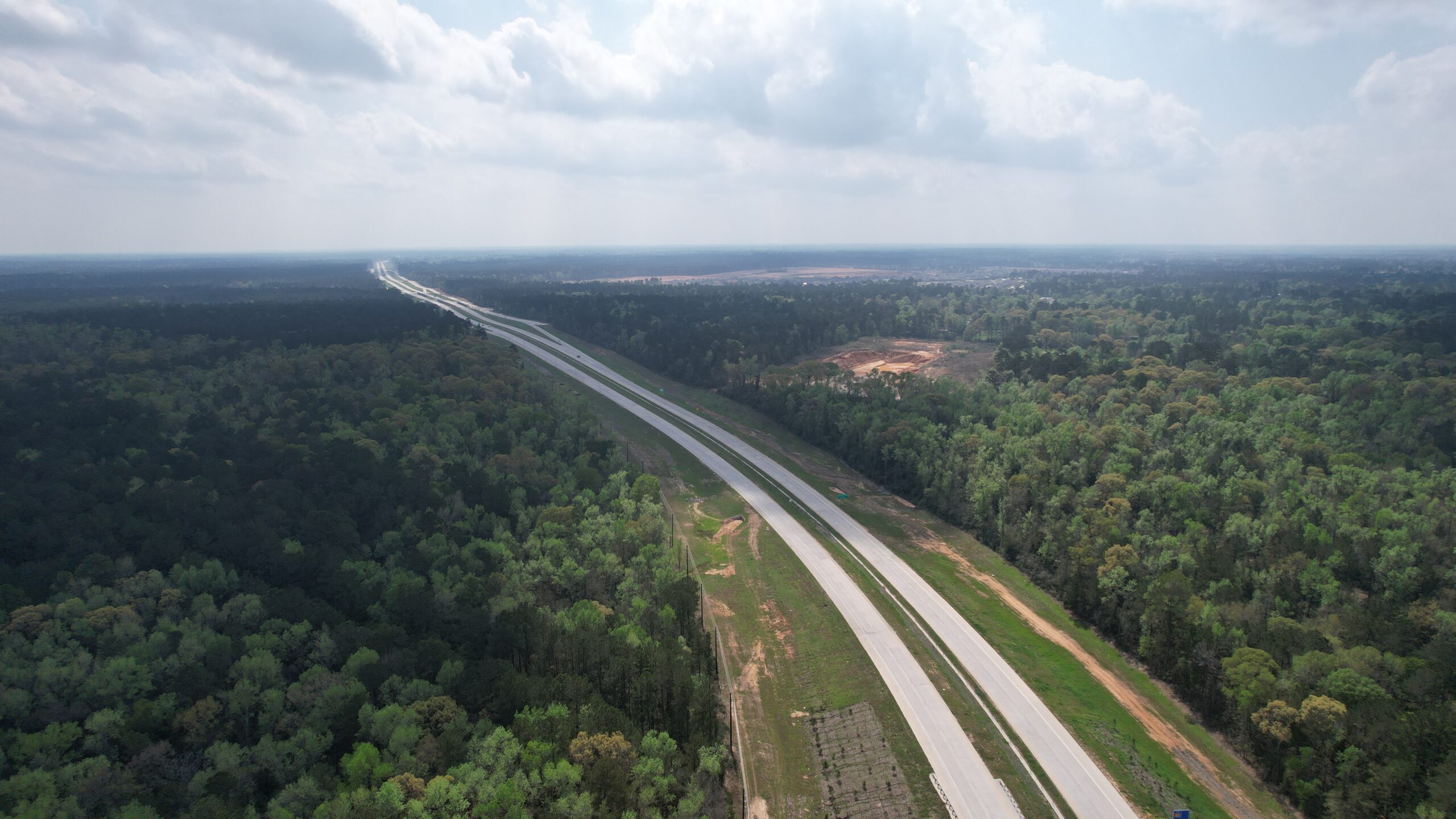
Located in Montgomery County, the 7th fastest growing county in the U.S., is the city of Magnolia, Texas. Well-known for its access to the Texas Piney Woods and sprawling magnolia trees, the city is nestled in the southwest part of the county and is situated along the heavily traveled FM 1488.
For years, the community has been managing severe congestion, safety issues and significant delays at the intersection of FM 1488 and FM 1774. As the city of Magnolia and the surrounding areas continue to experience record growth, the congestion has only worsened. Not only is traffic a concern, but vehicles heading east-west along the corridor need to travel over a railroad, creating another complication.
Solutions to the bottleneck.
Many ideas have been vetted to alleviate the traffic – most of them resulting in substantial impacts to the historic downtown Magnolia. To ensure the community keeps its economic footing, a bypass around the town was proposed. The $114 million Magnolia Relief Route will include five miles of new four-lane roadways that will extend west from FM 1488, cross over a Union Pacific Railroad track, and connect with the Texas 249 tollway.
Accelerating the timeline.
The project has been on the Texas Department of Transportation’s (TxDOT) list for nearly a decade. To accelerate the timeline, WSB is delivering the project through 3D digital delivery. Digital delivery results in efficiencies, and speed that would not be possible through traditional design delivery methods. The timeline from schematic design to final will take less than eight months which will then allow the county and city to have plans finalized when funds become available.
Toll revenue and project funding.
The project will partly be funded through toll revenue from Texas 249, a state-operated toll road. FM 1488 will connect to Texas 249. In Texas, any new facility that brings traffic to the toll road is eligible to be funded out of the toll revenue. Additionally, $10 million was earmarked by Montgomery County as part of the required match in the 2015 road bond. The project is anticipated to be bid in 2024.
Services Provided
Design
Environmental Services
Cost Estimates
Union Pacific Railroad Permitting & Coordination
Surveying
Drainage Studies
By the Numbers
5 miles of new roadway
$114 million project
8 month accelerated timeline
Eliminates 15,000 vehicles each day from crossing the Union Pacific Railroad at-grade crossing.
As Vice President, David will be responsible for driving business and working across many markets in the region including the department of transportation, toll road authorities, county government agencies, transit authorities, port authorities and local municipalities. In addition, David will support projects in the private sector, working closely with land developers, commercial interests, oil and gas and pipeline transport.
Brad is a Senior Project Manager with 30 years of engineering experience in the design, construction and maintenance of transportation facilities. He has led the development, preparation and plan review (QA/QC) of more than 100 separate PS&E packages including urban arterials, municipal streets, rural highways and bridges. He has considerable experience with maintenance and construction for transportation facilities in Texas, and as a recent TxDOT retiree, Brad has a strong understanding of the Texas transportation system.
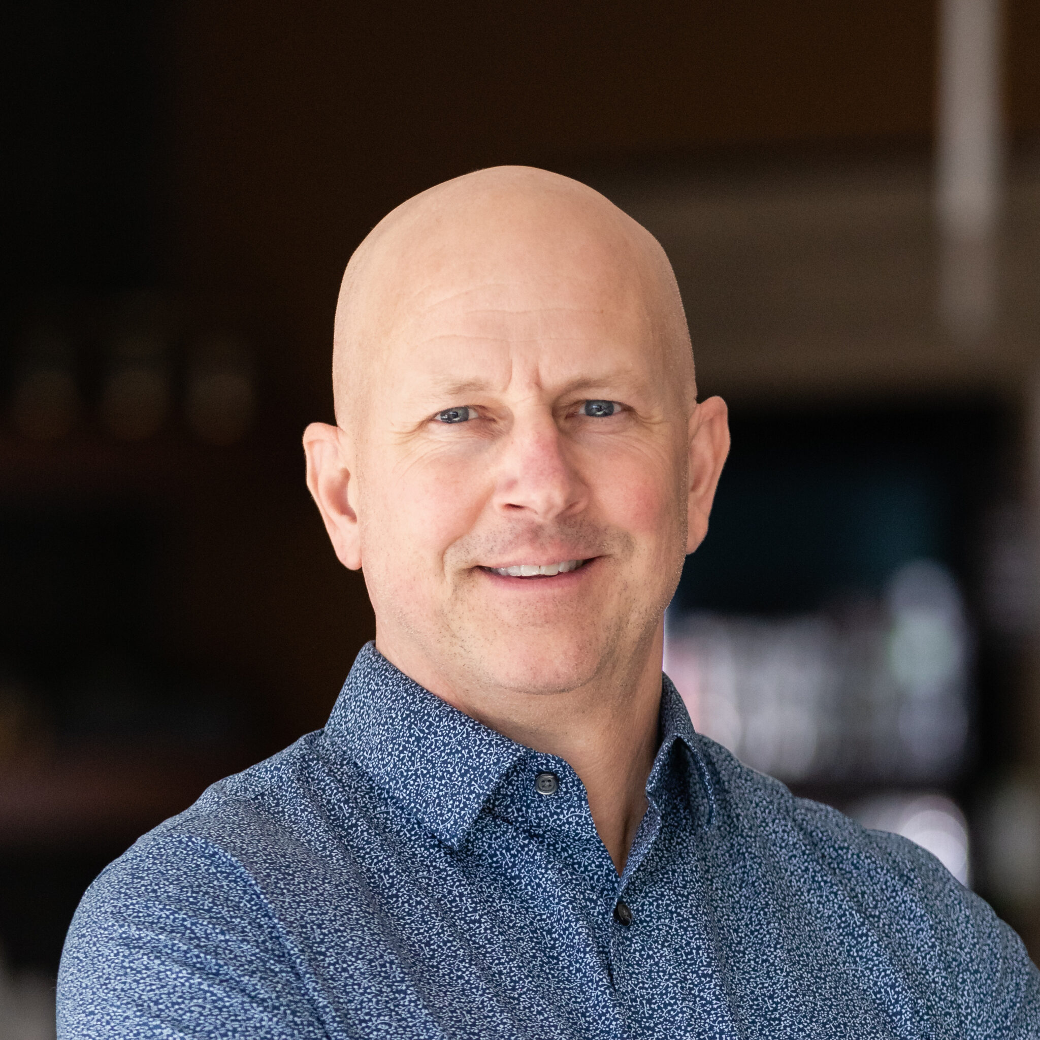
July 18, 2023 By Brian Bourassa, VP of Corporate Development
Investing in the vitality of the city of Lino Lakes, Minnesota.
At WSB, we use the term infrastructure broadly to define the places, spaces and systems that support our lives. As important as infrastructure is to our way of life, we don’t often think about it until something goes wrong. We’ve been privileged to support communities across the U.S. with their infrastructure needs. The scale of the projects may vary, but the impact is always significant.
For the last several decades, the city of Lino Lakes, just north of the Minneapolis-St. Paul metro, has been investing in their infrastructure across the community. In the end, it’s not one single project that has helped to build a vibrant community, but rather the collective investment in varying infrastructure. These investments have played a vital role in spurring development and progress within the city.
1. Biological Water Treatment Plant
The city is currently planning to construct a water treatment plant due to some of the city wells having manganese levels above the recommended guidelines. A biological treatment approach is unique because it relies on natural microbial activity to remove contaminants rather than chemicals, an environmentally sustainable strategy.
2. West Shadow Lake Drive
West Shadow Lake Drive is a residential street that was plagued by potholes, had no sewer or water, and faced challenges from high groundwater levels due to its proximity to Reshanau Lake. As part of the city’s pavement management program, the road was removed and replaced to support the city’s roadway infrastructure and sanitary sewer, watermain and storm sewer infrastructure was also installed. In addition, environmental work and wetland enhancements occurred throughout the area.
3. 12th Avenue Trail Project
The 12th Avenue Trail connection was identified as a priority in the city’s Comprehensive Parks and Trails System Capital Improvement Plan due to the lack of trail connection along 12th Avenue. Prior to project completion, the busy rural road was narrow with unsafe conditions for pedestrians and cyclists. The project resulted in increased safety and a more bikeable, accessible community.
4. Master Plan and Comprehensive Stormwater Management Plan
Located in the northeast corner of Lino Lakes is a 1300-acre greenfield area that is prime for development opportunities. WSB was contracted to develop a master plan, comprehensive stormwater management plan and update the Alternative Urban Areawide Review (AUAR) for the area. Development opportunities will include residential, industrial and commercial that will spur economic activity in the area.
5. The Rookery Activity Center
When the local YMCA closed in 2020 it left a hole in the community. The city of Lino Lakes took action to reinvigorate the space. To establish itself as a new asset within the community, the building needed an overhaul, not just in amenities and programming, but also the brand. WSB worked with the city to develop a story, identity and brand assets.
6. Tower Park
Tower Park is located on a 60-acre piece of land that was purchased by the city over 20 years ago. The city council felt strongly about developing the space into a destination recreation area for the community. WSB provided the park master plan and phase 1 design support. Tower Park is now home to some of the city’s most popular pickleball and tennis courts. The project was completed last year.
7. Birch Street Roundabouts
Birch Street is a heavily traveled roadway through the city with frequent accidents occurring due to the number of entrances to the high-speed roadway. There were safety concerns from residents and a nearby school. To help alleviate the number of accidents and increase safety, several roundabouts, medians, crosswalks and safety signage were added.
8. Gateways to the City – Placemaking
Lino Lakes is a proud community and wants to enhance their welcoming presence by creating placemaking monuments at city entrances. The project is still under development, but once complete, the entrances will offer a ‘front door’ to the city and will invite visitors and residents to step inside and explore the community.
9. Feasibility Study – Lake Amelia Subwatershed
A 255-acre subwatershed of Lake Amelia is currently undergoing a feasibility study to address existing stormwater management concerns and anticipated future land use changes to the area. The short-term phase includes solutions to address flooding concerns. The long-term phase proposes more holistic improvements to the corridor that that would occur alongside its eventual development. The study will help guide future planning in the area and will ensure that the area is prime for development.
10. Shenandoah Park Improvements
In partnership with the Rice Creek Watershed District, the city is exploring multiple improvements to the Shenandoah Park area to improve water quality, ensure its habitat is supported, and create a destination for park users. WSB is currently exploring water quality improvement options, wetland restoration, flood retention and greenway spaces to support the goals of the watershed district and the city.
Brian has more than 25 years of experience in the civil engineering field and has worked extensively in both the public and private market sectors. This experience has provided Brian with a broad engineering background, and has allowed him to develop a strong understanding of both public financing and private business perspectives. Brian’s lasting client relationships are a testament to the focus he places on developing creative solutions and providing over-the-top customer service.
Rackley will focus on strengthening business development and project management in the Austin metro and throughout the state of Texas.
July 25, 2023
Austin, Texas, – Design and consulting firm WSB announced today that Jerel Rackley has joined the organization as director of transportation design. Rackley will be based in the firm’s Round Rock office. Here, Rackley will support the firm while focusing on business development and leading project management for projects throughout the state of Texas.
The strategic hiring of Rackley shows the firm’s continued investment in the state of Texas and will help WSB foster current and future client relationships. The addition of Rackley to WSB’s leadership will grow an even stronger presence in the state— allowing the firm to support communities with their infrastructure needs. Rackley is an asset to the firm because of his background in both rural and urban roadway design and his strong bonds with Texas clients.
“Texas transportation has so many markets, and we are looking forward to Jerel’s knowledge and connections to bring WSB into a new space— both geographically as well as different types of projects,” said Rob Bailey, president of transportation in Texas. “We look for talented engineers and strong communicators, but it can be difficult to find both qualities in one person. Jerel is the rare combination of being exceptional at both, and I know he will bring a positive impact to our business.”
Rackley has over 21 years of experience as a roadway design engineer in Texas, specifically in the Austin metro. Some of his recent and most notable projects include the $650 million Oak Hill Parkway project, as well as the I-35 Capital Express South project. Additionally, he has close ties with the Austin District of the Texas Department of Transportation (TxDOT).
“I was drawn to WSB because of the people and their philosophy,” said Rackley. “WSB focuses on innovation and advanced project delivery to best serve clients. We look beyond the horizon and prepare for the future. I admire this about WSB and look forward to supporting the firm and our clients.”
WSB first established an office in Texas in 2017. The firm has since expanded to five offices throughout the state. The Round Rock office is the most recent office expansion, opening in June of 2023.
By Steve Lindsey, Director of Transportation Design, and Janna Rosenthal, Senior Transportation Planner
Central Texas’ population is growing rapidly with several of Austin’s suburbs ranking among the fastest growing cities in the country. Smaller and traditionally more rural communities and counties are seeing residents flock to their towns, driven by a variety of factors. Furthermore, businesses such as Samsung, Apple, and TESLA are heavily investing in the region, and large cities like Austin are continuing to grow.
As communities experience rapid growth, how can they update and adapt their transportation plans to minimize growing pains? How can planners continue to attract and maintain business investment and residents while ensuring that growth doesn’t outpace infrastructure capacity?
WSB’s Texas team is at the forefront of helping counties and communities create and execute comprehensive transportation plans that are flexible, nimble and take a long-term view of community growth and resident needs. Here are some lessons learned in Texas that apply to communities across the country experiencing rapid growth.
What happens when a transportation plan doesn’t meet the needs of a community?
When cities and counties fail to adequately plan for and invest in transportation infrastructure, residents and businesses often experience negative repercussions. Insufficient transportation planning can lead to congestion, decreased mobility and accessibility, safety concerns, and can ultimately hamper further growth and investment in the community.
Community leaders must understand the relationship between transportation infrastructure and economic development and investment. Is there enough housing for workers? Are workers able to easily get to and from work without overly burdensome commutes? Are there public transportation options that meet the needs of residents and businesses? Plans must provide answers to these questions and factor in a variety of needs.
Transportation infrastructure is a major consideration for businesses who are looking to expand or relocate. Investors consider access to markets and local/regional transportation connectivity when deciding on the location of new ventures. When transportation plans fail to meet the needs of a community, they are less likely to attract and retain businesses, investment projects and industrial development. Transportation planning that supports growth means ensuring residents and visitors can travel the community freely, efficiently and safely.
How to craft a transportation plan that has a long-term vision.
Proactive transportation planning is essential to ensure that the community can support growth. Community leaders need to advance comprehensive transportation plans that have a broad, long-term vision for their community over the next several decades, while regularly reevaluating to see where changes need to be made and priorities may have shifted. As population growth and economic development accelerate, it is vital to evaluate the existing transportation infrastructure’s capacity to handle the growing demand. Identifying potential bottlenecks, road networks operating beyond their capacity, and inadequate public transit systems can prompt the need for changes in long-term transportation plans.
Long range transportation plans can also help reduce potential future conflicts. Identifying the location of future roadway corridors and incorporating them into development plans can minimize the need for residential and/or commercial displacements. A prime example of preparing transportation projects for the future is the work done in Williamson County— one of the fastest growing counties in the country. In preparation for population and economic growth, new location routes that are identified in the county’s Long Range Transportation Plan in undeveloped portions of the county are studied and designed. In doing so, the plan accommodates population expansion, allowing for continued growth and minimizing potential future conflicts.
At the end of the day, a plan should build a solid foundation for the future, and be flexible and nimble to accommodate emerging trends.
Understand the value of public engagement.
Not in my backyard! Communities are all too familiar with pushback from residents and local businesses when people feel community plans will negatively impact their home, neighborhood, business, or city. Lack of local connection and public input can worsen these issues when things like new roadways, zoning changes or other transportation investments are advanced. Proactive transportation planning allows for greater public engagement earlier in the process, helping reduce resident push-back in the long-term.
Furthermore, comprehensive planning can also foster better coordination between stakeholders and different areas of local government (like cities and counties), helping make processes run smoother and ensuring transportation visions are aligned and meet the needs of the region.
Plan for emerging technologies.
Booming populations aren’t the only thing that transportation planners are looking at – they are also exploring how emerging technologies will impact their plans. The electrification of vehicles requires planning for a robust and accessible charging infrastructure with strategically located charging stations along major corridors and at key destinations. Furthermore, autonomous vehicles are also an emerging technology that may dominate our roadways in future decades. Planning for emerging technologies and putting the proper infrastructure in place now will put communities ahead of the curve and reduce conflicts in the long-term.
How WSB can help.
WSB’s transportation team has meaningful expertise and can help your city, county or agency achieve its vision. Our experienced staff offers assistance in setting goals, creating and updating transportation plans, corridor planning and implementing transportation plans through roadway design and development.
Steve comes to WSB with over 22 years of experience in all phases of the transportation industry including schematic, environmental, GEC/program management, construction and plans, specification and estimates (PS&E). He has a history working with TxDOT divisions and districts around the state as well as municipal clients in central Texas. As director of transportation based out of Austin, Texas, Steve is helping grow WSB’s transportation practice and solidify WSB as a go-to firm throughout the entire state of Texas.
Janna has 10 years of experience as a transportation planner and is well-versed in the transportation consulting industry. She specializes in freight planning and corridor feasibility studies including developing goals and objectives, screening and evaluating projects, conditions and performance analysis, needs assessments, and stakeholder/public outreach. She routinely works in analyzing large data sets and presenting material in a context that is easily understood and is trained in traffic noise analysis. She supports WSB through her large skill set and knowledge.
The design and consulting firm’s Texas expansion is part of their strategic growth plans.
August 1, 2023
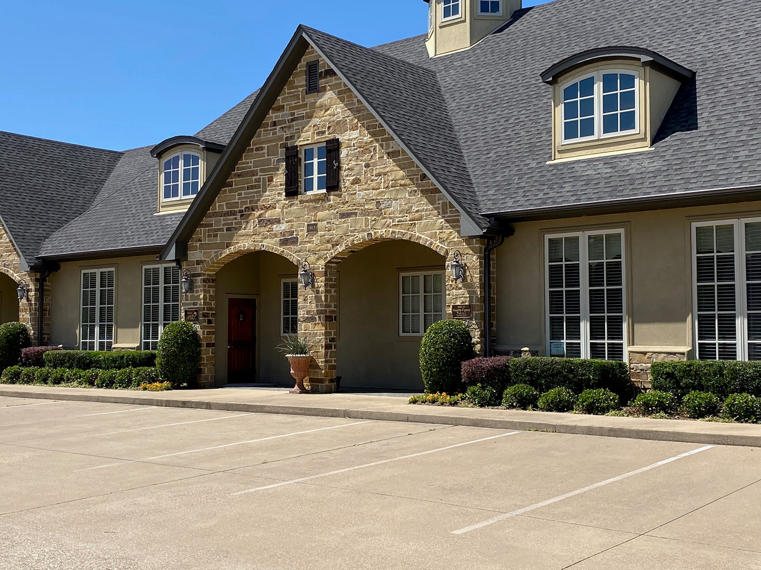
Design and consulting firm WSB, announced today the expansion of their Texas presence with the opening of their new office in Tyler, Texas. The firm has signed a lease for 2,227 square-feet in the Pruitt Place Office at 1015 Pruitt Place, No. 102. This office opening in Tyler signifies a continuation of WSB’s geographic growth strategy.
“We take pride in our developing firm and the expanded growth in the Texas region,” said Jay Kennedy, WSB’s vice president of Texas operations. “Texas has a variety of large infrastructure projects on the horizon. We look forward to the opportunity to support the state’s infrastructure needs in a larger capacity.”
The firm first established a Texas presence in 2017. Six years later, WSB has successfully launched five office spaces in Austin, Dallas, Houston, Round Rock and now Tyler. WSB is a fast-growing firm and will continue to invest in the Texas region.
WSB develops infrastructure across the country in the government, commercial and energy markets. They are a leader in the Architecture, Engineering and Construction (AEC) industry, and continue to serve each project and community through advanced project delivery and innovation.
“With new spaces comes new opportunities,” said Bryan Hodges, director of transportation design in Texas. Hodges is based in the Tyler office and leads the firm’s presence in the Tyler area. “The opening of the Tyler office allows us to further establish our presence in Texas. This additional office provides even more communities and clients with our expertise and innovation to aid their infrastructure projects. With the Tyler office, we can continue to build for the future.”
The firm already has a presence in the Tyler area. Recently, WSB was selected to provide General Engineering and Project Management Services for the City of Tyler Capital Improvement Plan. These projects will include street improvement, traffic engineering and drainage improvements. Additionally, WSB has completed a city-wide traffic-signal inventory.
WSB is a forward-thinking firm that provides engineering, community planning, environmental and construction services. With 17 offices throughout the United States, the firm continues to expand their reach and build what’s next in infrastructure.
August 14, 2023 By Alison Harwood, Director of Natural Resources, Kim Lindquist, Director of Community Planning & Economic Development and Jason Amberg, Director of Landscape Architecture, WSB
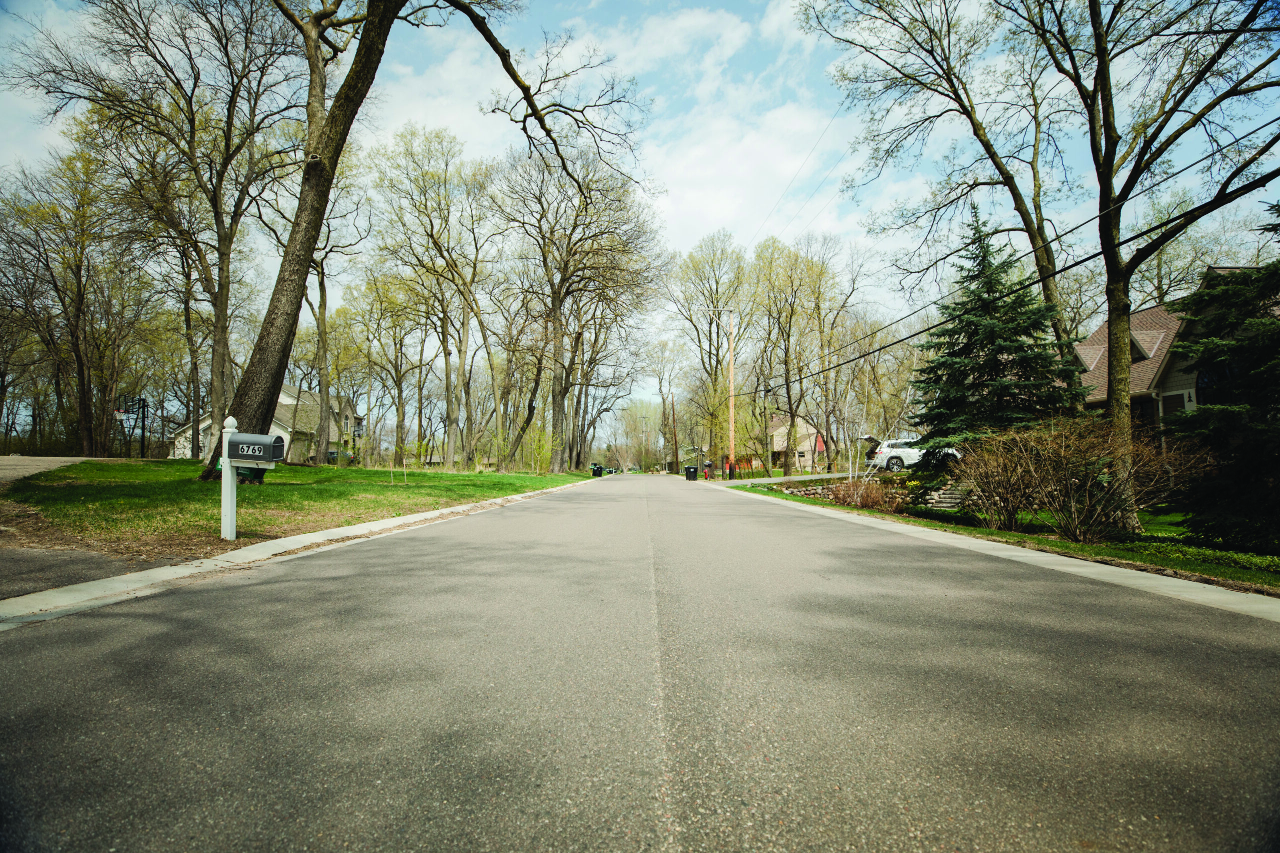
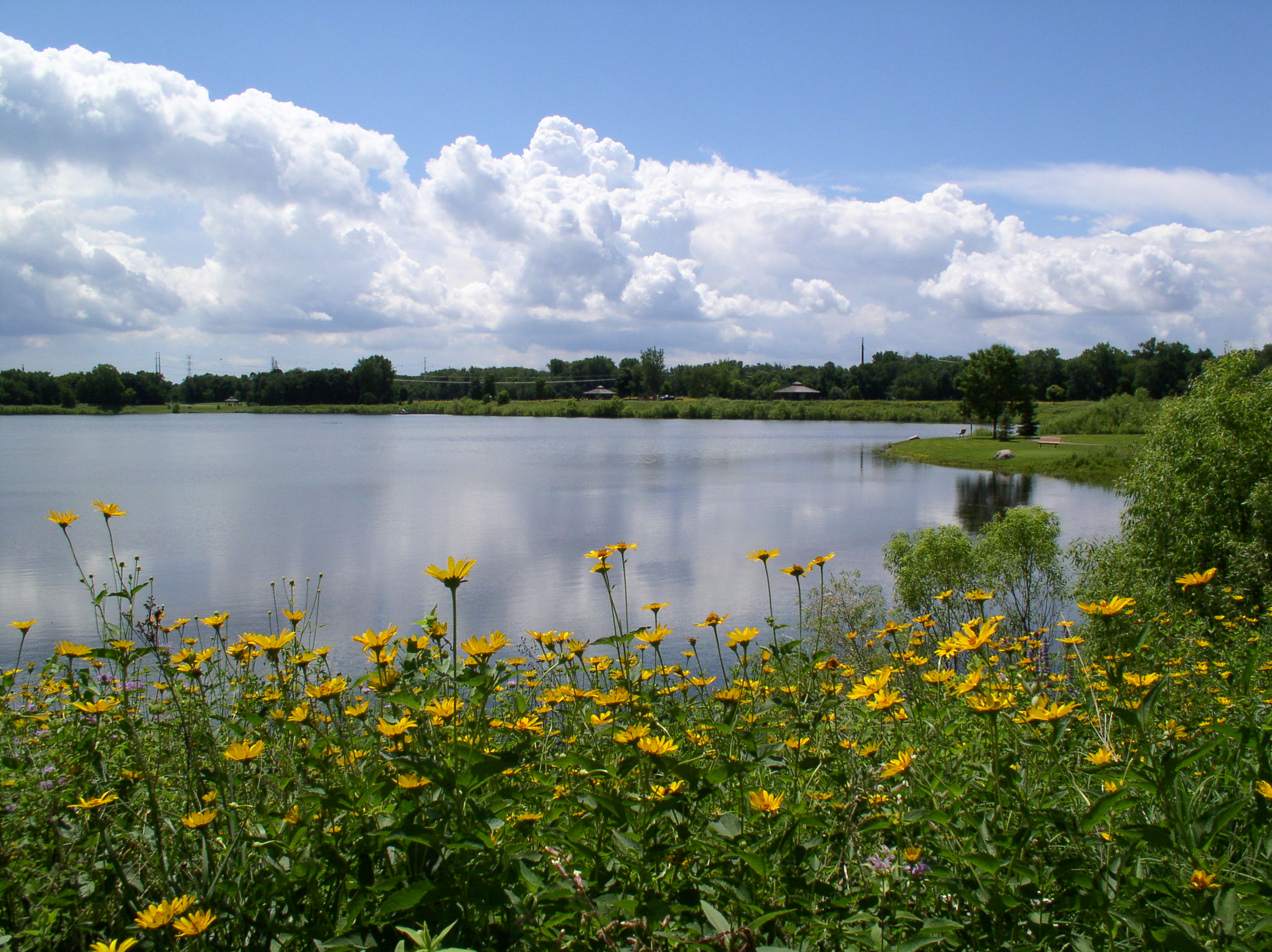
Native landscaping is growing in popularity, from pollinator-friendly plants and prairie grasses to rain gardens. Now the state of Minnesota passed a new law, effective July 1 of this year, that requires municipalities to allow property owners and occupants to install and maintain managed natural landscapes.
What are the pros and cons of this new law, and what does it mean for cities? Here are some things to consider.
What are the benefits of native landscaping?
Native landscaping covers a spectrum of options that includes a variety of landscaping. This could mean including only plant materials that grow naturally within the region to combinations that blend some areas of native plantings with some areas of manicured lawns or ornamental landscapes. Introducing native plant communities can provide critical resources for pollinators and provide a place for certain species to hibernate in winter. Rain gardens can help manage stormwater run-off and reduce chemical runoff.
In addition to the natural benefits, there are economic benefits as well. Native landscaping reduces the need for irrigation and watering as plants are often more drought resistant. There are also cost savings from reduced fertilizer and chemical usage, as well as reduced maintenance costs.
How are native landscapes maintained?
The new Minnesota statute clearly states that native landscapes must be well-maintained, but what does that mean? In the statute, managed natural landscape is defined as a planned, intentional, and maintained planting of native or nonnative grasses, wildflowers, forbs, ferns, shrubs or trees, including but not limited to rain gardens, meadow vegetation and ornamental plants.
When thinking about a traditional manicured lawn, maintenance includes regular mowing throughout the spring and summer, regular watering when it gets dry and the application of fertilizers and herbicides. Then in fall, landscapes are often cleaned to remove dead plants and leaf litter.
For native landscapes, however, there is far less maintenance, and plants often grow quite tall. In fact, the new law allows native grasses to grow taller than 8 inches high. Plus, as the weather turns cold, it’s better to leave the lawn and dead vegetation in place, providing quality habitat for wintering animals and insects.
What does this ordinance mean for local governments across Minnesota?
While many cities have adopted ordinances in the past decade allowing native landscaping, many others have ordinances prohibiting native landscaping or yards to have grass taller than 8 inches. This new state law supersedes local law, and it is important that communities update ordinances to comply with state statute.
Moreover, ordinance changes often take at least 60-90 days, so it’s important to act before next spring when many residents will begin lawn maintenance and planting. This ensures residents have a clear direction from the city.
Managing Public Engagement and Education
With this new law, there are a few issues local communities must navigate to ensure residents feel heard and legal requirements are made clear.
For residents concerned about unkempt lawns or who prefer neighborhoods to have a more manicured look, it’s important to communicate the benefits of native landscaping for the community and residents. Moreover, residents should be educated that while native grass and plants can grow taller than 8 inches, traditional manicured lawns cannot. And whether having natural landscaping or manicured lawns, noxious weeds are not allowed by this law change. Cities can and will still be enforcing unkempt lawns that do not meet state and local law requirements.
Educational community meetings, handouts, guidance on websites, and social media campaigns are all ways that cities can effectively communicate with residents about the new native landscaping laws.
How WSB Can Help
If you’re a city leader who needs help navigating ordinance changes around this new statute, WSB’s team can help.
Our landscaping team can also help clients design and build native landscaping into their public or private spaces, offering solutions that are aesthetically striking, environmentally friendly and economically beneficial.
Native landscaping is growing in popularity, helping bring people and nature closer together.
Alison leads the Natural Resources group. Her experience includes work in the natural resources field, including wetland and avian surveys, permitting, alternatives analysis, and environmental documentation for projects in both the public and private sector.
Kim is a planning professional with over 30 years of experience overseeing a variety of complex planning projects. She has worked in high growth communities with developers and the public on entitlements for residential development and attracting business to the city.
Jason is the Director of Landscape Architecture at WSB with more than 25 years of experience in public space planning and design. From small-scale neighborhood park improvements to comprehensive park and trail system plans, Jason has worked with park boards, municipalities, governing agencies and community residents.
August 14, 2023 By Bill Alms, Project Manager, WSB
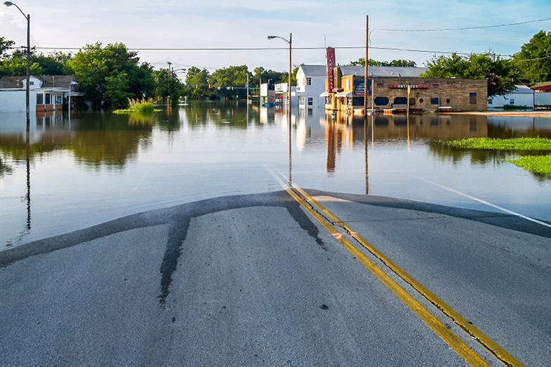
The Midwest is experiencing a drought this summer. High temperatures and scarce precipitation have led many communities to implement watering bans and other solutions to help manage limited water resources.
For community leaders, it’s crucial to recognize that addressing drought and the impacts of climate change is a marathon, and not a sprint. While drought is top of mind for communities right now, it is equally essential to adopt a long-term perspective, and explore investing in systems and infrastructure that will minimize the impacts of drought and flooding in the long term and protect potable water supplies.
How can communities think long-term about water resiliency, reuse systems and planning? Here are some things to consider.
Invest in Resilient Water Systems that Can Handle Climate Extremes
Cycles of drought and flooding are becoming more common as global temperatures rise. Ensuring access to clean, safe water is critical for communities, and that means investing in infrastructure and water reuse systems that are efficient, effective and resilient.
WSB worked with Hugo, Minnesota on a sustainable water reuse strategy more than a decade ago, helping them build resiliency into systems. From reducing potable water use in landscaping, to placing reservoirs in strategic locations to ensure adequate water supply for high use areas, to educating the public on the importance of water conservation and reuse, the city’s water reuse strategy has been successful. It’s also made their water systems less susceptible to drought and climate change.
Communities looking to find similar success should approach water reuse and infrastructure in steps.
Start with a feasibility analysis. Communities should begin with a feasibility analysis to determine areas with the lowest water supply, high water consumption, and inefficiency points. Based on this analysis, authorities can establish priorities, discerning which places require the most water and where there is greatest demand. Facilities like athletic complexes, schools, and manufacturing plants, which consume substantial amounts of water, should be evaluated accordingly. Pairing a usage map with existing sources can help determine how to build a more integrated and efficient system.
Think regionally. It’s important to think regionally when planning for water reuse systems instead of site by site. How far apart are water sources? Where is the greatest consumption? Thinking about how pump systems can serve larger areas, placing retention ponds in strategic locations best suited to collect stormwater, and connecting water sources across a community promotes greater efficiency and benefits the environment, especially under drought conditions.
Understand the value of long-term investments. When investing in more resilient water reuse systems, communities may be deterred by significant upfront costs, but the long-term benefits are significant. Communities should look at water reuse systems like other utilities and how to best maximize return on investment for everything from pumps to irrigation systems, to reservoirs. Adopting large-scale water intake and distribution infrastructure to meet specific needs minimizes water waste, as well as reduces the negative impacts from drought and flooding cycles. Numerous grants and funding sources are available to help design and implement water reuse projects.
Engage residents. Public buy-in for reuse systems is important to foster conservation best practices and reduce the strain on groundwater reservoirs. More efficient systems and incentives for users can also significantly reduce the strain on water supply systems.
Take Advantage of the Drought
In the short term, many water basins are running low or are dry. While this situation poses many problems for communities, and reinforces the importance of resilient water reuse infrastructure, drought also provides an unexpected opportunity for critical maintenance work. Routine maintenance or fixing erosion or failed intakes and outfalls, for example, can be difficult when water levels are normal or high. Low water levels provide a meaningful opportunity to ensure systems are functioning properly, and access equipment that may normally be underwater.
How Can WSB Help?
WSB offers a wide range of services to assist cities and communities in implementing effective water conservation practices, especially in dealing with the challenges posed by aging infrastructure and extreme weather cycles of drought and flooding.
WSB provides tailored solutions for every community, and can help with feasibility analysis, design of reuse systems, public engagement, securing grant funding for projects and more. WSB empowers communities to ensure the longevity and functionality of their water-related assets, fostering sustainable water conservation practices for the future and more resilient systems.
Bill is a project manager in WSB’s Water Resources group providing planning, design and construction management for a wide range of water resource projects. He has experience includes low impact developments utilizing standard and alternative storm water management systems including above and below ground infiltration, filtration and detention systems and rainwater harvesting and reuse.
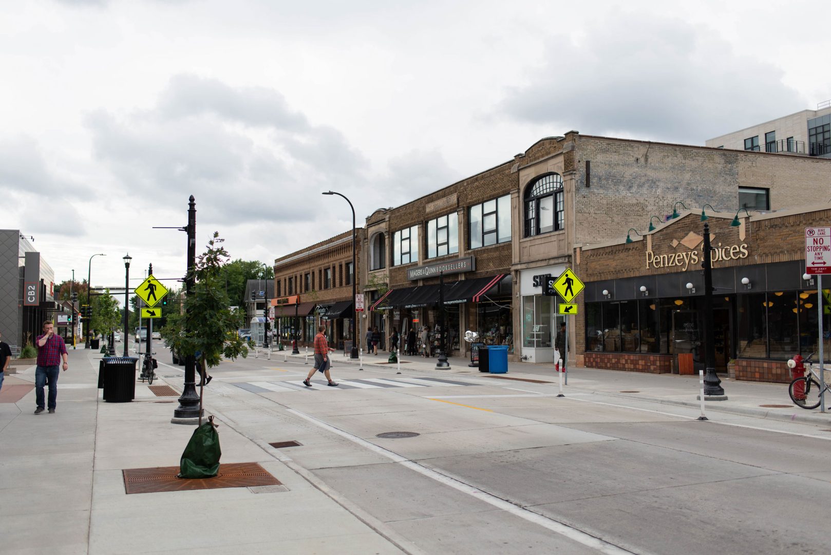
August 14, 2023 By Gus Perron, Project Manager, WSB
In recent years, there has been a distressing increase in pedestrian-vehicle collisions, highlighting the vulnerability of pedestrians on the road. Several reasons have contributed to this surge including the unforeseen impact of COVID-19, which kept people off the roads for extended periods, leading to increased speeds and reduced vigilance. Moreover, distracted driving due to the prevalence of smartphones and electronic devices, impaired driving, speeding and inadequate pedestrian infrastructure have all played a role in pedestrian-related accidents and fatalities.
Combating this concerning trend necessitates a comprehensive approach encompassing awareness campaigns, responsible driving habits, and improved infrastructure to prioritize pedestrian safety and reduce these tragic accidents.
Here are five things communities can do to increase pedestrian safety.
Implement a Complete Streets policy
Communities should consider a Complete Streets transportation policy that prioritizes the safety and accessibility of all road users. That means finding balance and designing streets that cater to pedestrians, cyclists, public transit users and motorists. Complete streets encourage active transportation and promote pedestrian safety. With dedicated bike lanes, well-marked crosswalks and improved transit facilities, the policy fosters a pedestrian-friendly environment while enhancing overall traffic flow. By combining these elements and striking a balance, communities can advance holistic solutions to improve safety for all users.
Protect students with Safe Routes To School
Safe Routes to School is a national program dedicated to enhancing pedestrian safety for students traveling to and from school. By funding and implementing infrastructure improvements and traffic calming measures, Safe Routes to School creates safer pathways, crosswalks and bike lanes for children. Moreover, the program emphasizes educational initiatives to promote road safety awareness and responsible pedestrian behavior. Cities should explore grant funding opportunities for safe routes to school projects.
Adopt a policy on uncontrolled crossings
Uncontrolled crossings, characterized by the absence of stop signs or traffic signals, pose significant safety challenges for pedestrians. To address this issue, it is crucial to develop a comprehensive policy that clearly communicates what a community’s rules and priorities are at these types of crossings. Building local support is essential in gaining traction for the implementation of appropriate measures which could include installing marked crosswalks, warning signs, pedestrian refuge islands, curb extensions (bumpouts) or beacons to enhance pedestrian visibility and safety. By proactively addressing uncontrolled crossings, local authorities can create safer road environments and protect pedestrians and drivers from potential hazards.
Design facilities for pedestrians of all abilities
Ensuring safe and accessible facilities for pedestrians with physical disabilities at crossings is of the utmost importance, a protected civil right. There must be sufficient signal crosswalk times so people with mobility issues can cross safely. Additionally, implementing detectable warning surfaces at curb ramps can serve as tactile indicators for those with vision impairments, alerting pedestrians that the protection of the sidewalk is ending and a crosswalk is beginning. Sidewalks should also be wide enough and without barriers, cracks, large gaps, etc. to ensure they are usable for people with disabilities including wheelchair users.
By incorporating these features, municipalities can enhance pedestrian safety and create a more inclusive and accommodating environment for everyone.
Consider the technology and tools that work best for a crossing
Different types of beacons can serve different types of crossings, so communities should explore what works best. RRFB (Rectangular Rapid Flashing Beacon) warning lights can be installed, requiring pedestrians to push a button to activate flashing lights, alerting vehicles that people are crossing. Alternatively, a Pedestrian Hybrid Beacon, activated by pedestrians, can operate similarly to a traffic light, flashing yellow and red to control traffic flow. Although the Pedestrian Hybrid Beacon may cost more upfront, it becomes more advantageous for pedestrians in areas with higher traffic volume or faster vehicle speeds. By integrating these technologies, communities can improve the overall pedestrian experience and improve safety.
How WSB can help
WSB plays a vital role in enhancing pedestrian safety and accessibility. We can help communities identify funding, develop policies, as well as scope, design, and construct pedestrian infrastructure enhancements. By thoroughly analyzing the impact of traffic solutions for vehicles and pedestrians, including those using mobility devices, they ensure comprehensive and inclusive planning, balancing the needs of pedestrians, bicyclists, and motorists. Drawing from their depth of experience, WSB actively listens to clients’ needs, tailoring individualized plans that address specific community needs. With a keen focus on safety, WSB considers existing speeds, crossing widths and traffic volumes to identify the most effective solutions to mitigate potential fatalities. Leveraging the latest technological tools for data collection, WSB can assess data to identify areas of highest need, allowing for practical and data-driven improvements.
Gus is WSB’s expert in accessible pedestrian and bicycle facilities, with a traffic engineering background which allows him to blend pedestrian accessibility with safety and mobility. He uses best practices to achieve constructable and usable pedestrian facilities for a variety of project scopes across different environments.
The fast-growing design and consulting firm first entered the Houston market in 2019 and will open two additional offices in Texas this year.
WSB, a design and consulting firm, announced today that they have expanded their Houston office to the Energy Tower professional office building on 11700 Katy Freeway. The over 6,000-square-foot expansion represents a continuation of WSB’s geographic growth strategy.
“The Houston community and surrounding areas are investing heavily in their infrastructure and WSB’s offerings are well suited to support these needs,” said David Balmos, WSB’s vice president of strategy. “We’ve seen an increasing interest from our clients and partners in our digital delivery services. Our approach to project delivery is disrupting the industry and the Houston area needs a more innovative approach to infrastructure development. It makes sense to expand our operations and presence in the area.”
WSB, which provides engineering, community planning, environmental and construction services to the public and private sector, established a Houston presence in 2019 through the acquisition of Nathelyne A. Kennedy and Associates (NAK). Since then, the firm has invested heavily in strategic hires and has grown their local expertise substantially.
The counties surrounding the Houston area recently approved more than $3 billion for projects related to infrastructure improvement. As a firm that focuses on providing advanced project delivery for the government, commercial and energy markets, WSB will bring a forwarding-thinking mindset to their client’s project approaches.
“Our expertise, combined with our innovation is what differentiates us from others in the market,” said Jay Kennedy, WSB’s vice president of Texas operations. “We look forward to continuing our strategic expansion plans across the state of Texas through our commitment to building what’s next in infrastructure.”
WSB first entered Texas in 2017 with the establishment of their Austin office. Since then, the firm has established a presence in Dallas and will also open offices in Round Rock and Tyler later this year. The Houston office will support full-service infrastructure needs throughout the state.
Nelson’s background in community enhancing, sustainable solutions will guide the firm’s innovative approach to water/wastewater solutions.
Engineering and consulting firm WSB announced today that Steve Nelson has been promoted to director of water/wastewater. In his new role, Nelson will lead and grow the firm’s water/wastewater team, support business development and lead the firm’s biological filtration and water/wastewater innovation efforts. Nelson joined WSB last year as a senior project manager and since then has worked to elevate the firm’s water/wastewater services throughout Minnesota.
“Steve has over 30 years of water and wastewater industry experience,” said Monica Heil, WSB vice president of municipal services. “His deep understanding for clients’ operational needs is unmatched and his ability to apply his subject matter expertise with our staff will allow us to continue to deliver innovative water and wastewater solutions across all our markets.”
Throughout his tenure, Nelson has led several successful water and wastewater projects and has made several industry contributions. He has led the development of water treatment plant design and renovations, water treatment plant process optimizations, filter maintenance evaluations and biological treatment. He played a leadership role in the Approval of Biological Treatment in Minnesota and helped the Minnesota Department of Health (MDH) develop its protocol for Biological Pilot Testing.
Regarding PFAS contamination, Nelson served as the primary contributing author of the report for the Minnesota Attorney General, for several east metro communities and continues to help communities with PFAS related planning and removal. Nelson served two multi-year terms as the chair for the Minnesota AWWA Research Committee, and currently serves on the AWWA Water Utility Council (WUC).
“WSB is providing industry leadership in customer focused environmentally friendly solutions like softening, biological filtration, and PFAS removal. Such solutions are imperative to protecting our natural resources and supporting sustainable communities,” said Nelson. “The engineering behind water/wastewater will only become more valuable as our communities’ face water related demands. I’m looking forward to taking on a new leadership role at WSB and believe in the firm’s commitment to building what’s next in infrastructure. It’s this kind of approach that will better arm our communities for the future.”
WSB’s water/wastewater services include wastewater treatment facility design, expansion and rehabilitation, water studies, system modeling and analysis and more. More information about WSB’s water and wastewater services can be found here.