Projects
City of Rochester – Redistricting ArcGIS Hub Site Development
Location:
Rochester, MN
Expertise:
Community, Technology
Services:
GIS Services, Public Engagement, Solutions & Applications
The City of Rochester began its redistricting process last year. To increase transparency, interactivity and engagement, Rochester sought to build an Esri ArcGIS Hub site for staff coordination and resident engagement. Given the tight schedule and existing City staff commitments, the City was in need of additional support to see their vision through. The City of Rochester chose WSB to assist with the creation of the ArcGIS Hub redistricting site, curation of the spatial data involved in the project, and coordination on engagement strategies with the community.
As an ArcGIS Hub Specialty Partner with Esri, WSB was able to leverage its expertise to create a successful framework for the Hub site quickly and efficiently. WSB then worked directly with Rochester staff to understand their specific needs and determine how those needs would be translated into action on the site. Rochester and WSB staff worked together to iteratively design the Hub site to effectively communicate Rochester’s redistricting efforts. WSB incorporated innovative approaches to engage the community by offering ways residents could submit feedback digitally through the site. WSB was able to assist the community by leveraging an existing investment in GIS technology to engage the community, coordinate more effectively as an organization, foster transparency and make decisions using data.
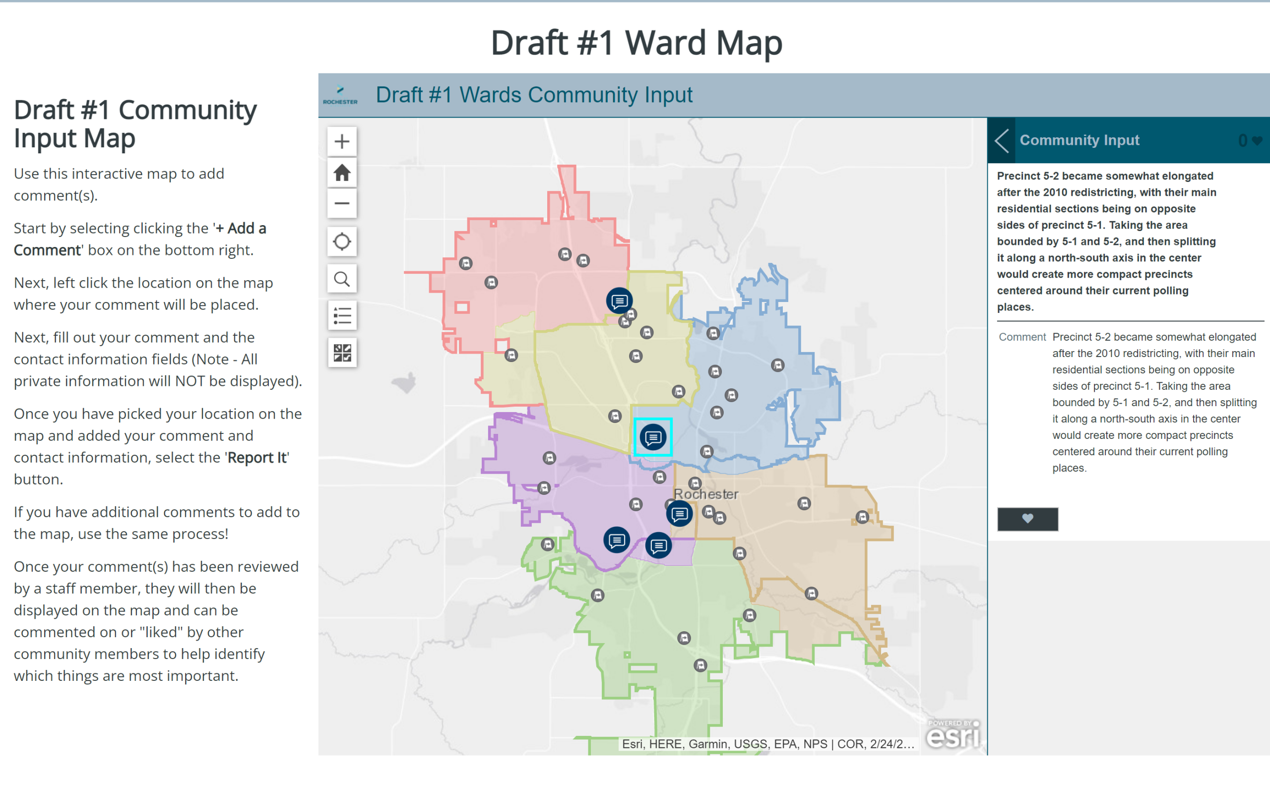
The ArcGIS Hub site was created to give residents background information and facts on the city’s redistricting process. The site allowed city GIS staff to access and display their efforts and progress efficiently and effectively. Additionally, the site’s interactive mapping displayed necessary information and context like census data and historical maps to provide residents with all the information they would need to make informed decisions and opinions.
To engage the residents of Rochester, and allow for two-way communication, the site included community input maps utilizing Esri’s Crowdsource Reporter application. These maps allowed residents to comment and respond to one another and gave the community a voice in the redistricting process. Furthermore, residents were surveyed through the site about their opinions on the redistricting process, using Esri’s Survey123 form-centric solution. Ultimately, the site provided transparency to the residents about the City’s redistricting process and the city was able to make informed decisions while making comments and giving feedback in real time.