Steamline data from anywhere
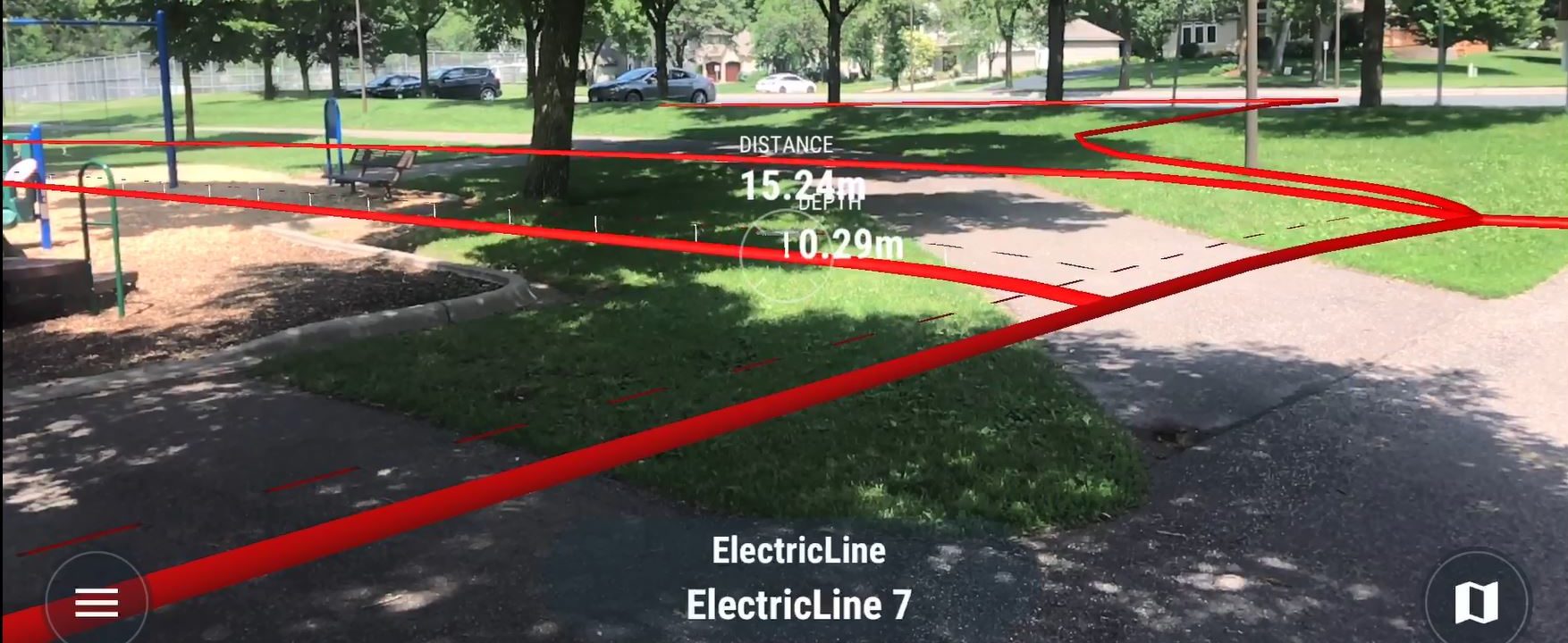
True View is an application that combines Augmented Reality (AR) and GIS to visualize underground utilities, right-of-way boundaries, and building infrastructure. Users can see what lies beneath the pavement and a plot of land through their mobile device screen using traditional Esri GIS data. True View can help solve real world challenges, gain new insights, simplify fieldwork, and increase safety.
Contact Us