Projects
City of Riviera Beach: A Data-Driven Approach to Municipal Management
Location:
Riviera Beach, FL
Expertise:
Technology, Transportation
Services:
GIS Services
To better serve its residents and plan for future growth, the City of Riviera Beach, Florida, partnered with WSB to modernize its infrastructure management. By transitioning from fragmented records to a comprehensive, cloud-based GIS environment, the City now possesses a digital twin of its physical assets, enables smarter budgeting, faster maintenance, and improved public safety.
WSB utilized a multi-modal approach to inventory the City’s vast infrastructure. From stormwater systems to ADA ramps, every asset was mapped using a blend of high-precision GPS, record drawing integration, and visual field verification.
Key Assets Inventoried:
- Transportation: Traffic Signals, Signs, Sidewalks, Curbs, and Pavement Markings
- Infrastructure: Stormwater systems and ADA-compliant ramps
- Greenery: Detailed mapping of median and shoulder landscaping (trees, palms, and shrubs).
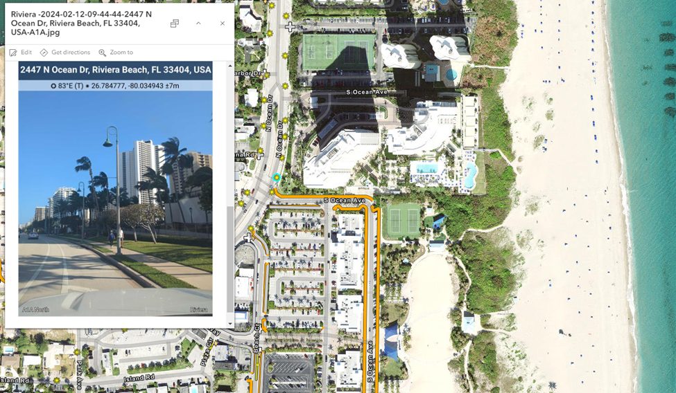
Advanced Tech: 360-degree imagery & QuickCapture
In 2025, the project evolved to include high-speed mobile data acquisition. Using a vehicle-mounted NCTech 360-degree camera and Esri’s QuickCapture, WSB conducted a city-wide ‘windshield survey’ to collect every street sign the city owns and maintains. We used an AI system to provide MUTCD codes and sign descriptions, accurately categorizing regulatory, warning, complementary, and supplemental sign types. High-resolution imagery was also collected, this allows staff to verify asset conditions from their desks, reducing the need for field verification.
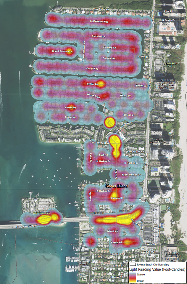
Photometric Heat Mapping
A standout feature of this project was the residential street lighting study. By measuring foot-candle values at ground level, WSB generated Lighting Density Heatmaps. These visualizations (ranging from sparse purple to dense yellow) pinpoint dark spots in the neighborhoods, allowing the city to prioritize new lighting installations where they will have the greatest impact on resident safety and security.
A Centralized Hub: The Experience Builder
To ensure this data remains actionable, WSB developed a fully customized ArcGIS Experience Builder Application. This secure, web-based portal serves as the City’s central command for asset management.
- Office to Field Sync: Real-time access for crews using ArcGIS Field Maps
- PCI Integration: A built-in Pavement Condition Index (PCI) rating for every city-owned street, helping leadership make data-backed decisions on road resurfacing and capital improvements.
By moving beyond static maps int a dynamic GIS ecosystem, the City of Riviera Beach is no longer just reacting to maintenance needs, they are proactively managing their future.