Projects
Owatonna Public Utilities – ArcGIS Enterprise Implementation

Location:
Owatonna, MN
Expertise:
Technology
Services:
GIS Services
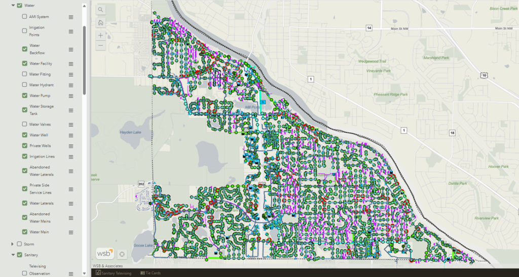
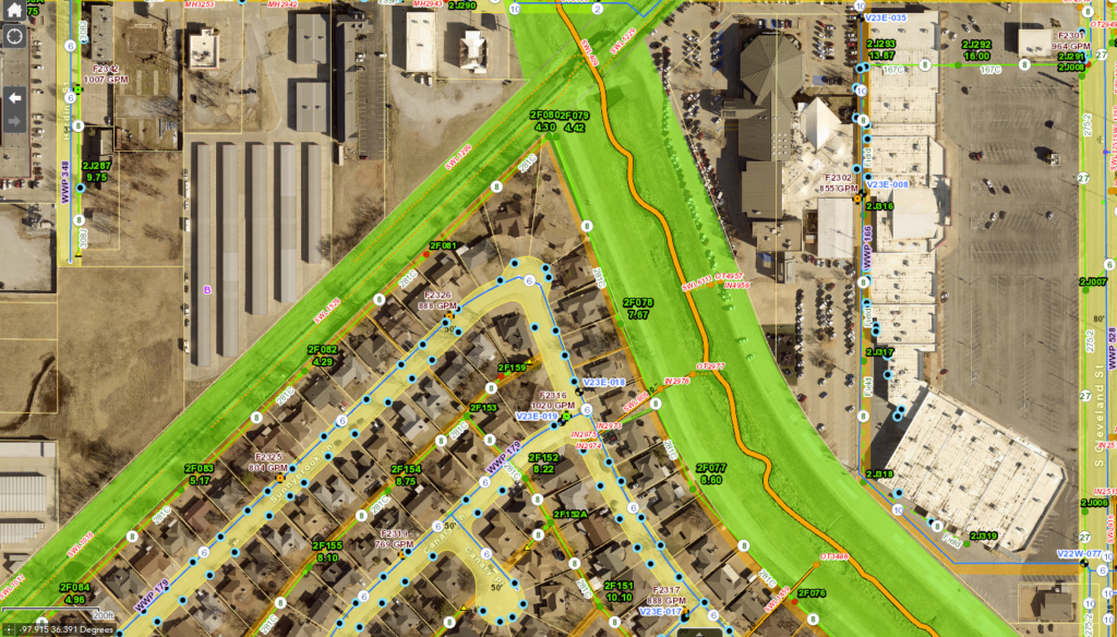
Owatonna Public Utilities (OPU) has a long history of utilizing GIS for its system of record to support its customers and operations. OPU’s GIS staff recognized the need to expand their GIS use beyond just a system of record to a system of engagement. OPU worked with WSB through WSB’s Managed GIS Services program to perform an initial GIS assessment and then develop a Managed GIS Services plan to modernize its approach to GIS.
As part of the process to modernize their GIS, OPU wanted to migrate their existing platform into the latest and most advanced GIS technology called Esri’s ArcGIS Enterprise. ArcGIS Enterprise gives OPU the resources needed to further advance their GIS goals, including a system wide GIS content management platform, resources to expand field operations, and the ability to effectively manage utility outage information. OPU also needed a robust IT infrastructure to build these programs and WSB recommended using Amazon Web Services (AWS). AWS is Amazon’s secure cloud services platform that offers an advanced server environment which ensures reliability, security, and flexibility for future development of network resources.
WSB tailored a plan for OPU which included the migration of their current GIS infrastructure to ArcGIS Enterprise deployed within AWS. WSB worked closely with OPU staff members throughout the project to ensure all stakeholders were involved and overall project success. By working with WSB, OPU has been able to successfully implement its ArcGIS Enterprise platform within a cloud environment, further expand its organizational use of GIS, and leverage new GIS tools and capabilities.