Projects
Century Ave. Small Area Plan
Location:
Mahtomedi, MN
Expertise:
Community, Technology
Services:
City Engineering, Community Planning, Economic Development, GIS Services, Urban Design
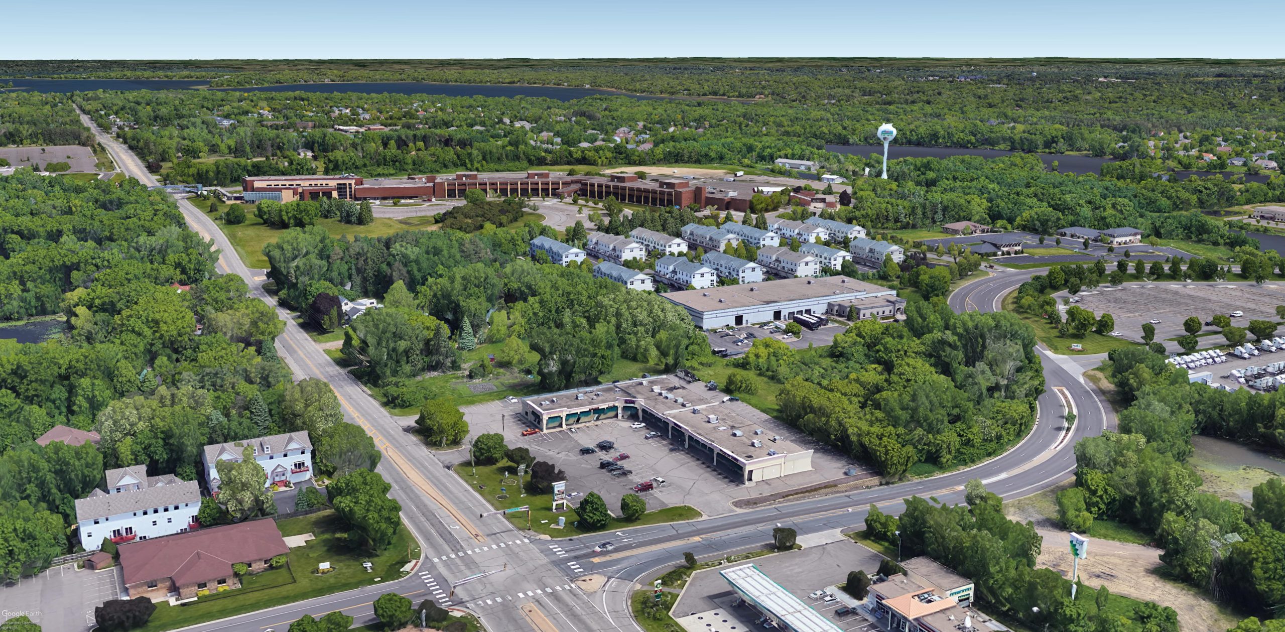
The city of Mahtomedi wanted to create a vision of what the southwestern gateway into the city could become in order to encourage investment and redevelopment of the area. They needed a plan that detailed what the future could look like for land use, infrastructure and economic development.
Existing conditions
Analysis of location, context and current land use.
Historical studies
Review and analysis or previously conducted studies including market feasibility and hotel market studies.
Comprehensive Plan
Review the city’s comprehensive plan.
Analysis
Analyze business area with ESRI’s Business Analyst tool and area development trends using the building permit data for the previous 5 years.
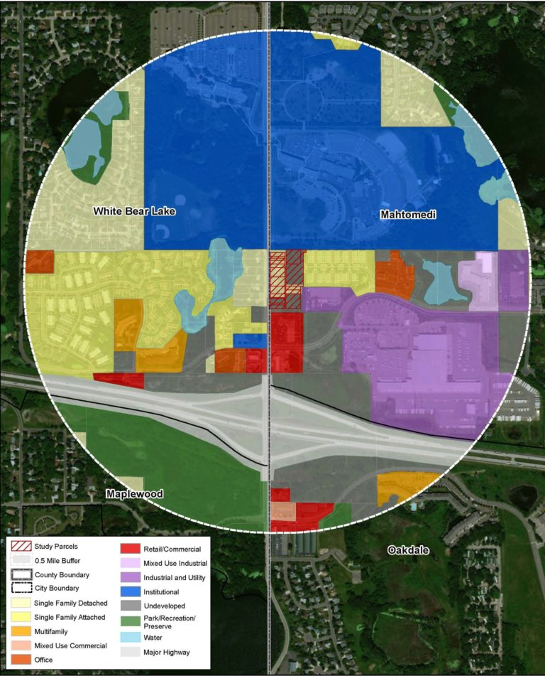
Mapping
Analysis of: City-wide context, study area with acreage and dimensions shown, existing generalized land use within half a mile, current zoning, property values, Century Avenue right-of-way dimensions, land use concept and transportation improvements, and infrastructure (water main, storm sewer, sanitary sewer, storm water basin).
Community Engagement
Conduct interviews with current property owners to gather feedback about future land use plans for the area and how it relates to their property.
Future goals
Goals were created using the comprehensive plan, studies, market analysis and property owner feedback. Goals included: Develop high-density housing including affordable housing units, develop a small mid- to upscale hotel, placement of new buildings close to the right-of-way, designed with connections to a non-motorized trail along Century Ave., consolidation of access points to Century Ave. where possible, and improvements to the segment of Century Avenue that runs through the project site.
Redevelopment concepts
Includes goals based on information from analysis phase like land use and transportation concept showing one potential general layout of the study site, and design concepts that show renderings of the study site for both the short-term and long-term plans.
Implementation
Steps that guide the city to realize the plan including zoning and infrastructure like roadways, water supply and sanitary sewer.
Cost
Detailed infrastructure cost estimates.
The Small Area Plan provides a clear vision of the type, scale, and intensity of development that the city wants in the area. It also includes an assessment of development trends, market forces and demands to ensure that the vision is achievable. The city’s hopes to shift the tax base over time in this area from single-family residential to a mixed-use/commercial area with increased business and activity – this Small Area Plan is the first step.Next