Mapping the future with precision and innovation

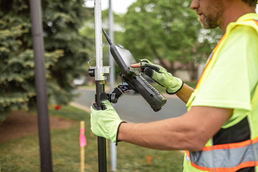
Geospatial technology is revolutionizing how infrastructure is planned, built, and managed. With advanced geospatial services and software solutions, WSB helps clients harness the power of data to drive efficiency, improve decision-making, and optimize project outcomes. From high-definition laser scanning and drone imagery to GIS mapping and asset management, our team delivers cutting-edge solutions that provide a complete, accurate, and actionable picture of any project.

Contact Us
SERVICES

Our experts specialize in

Unmanned Aircraft Systems (UAS) & Drones

We utilize aerial data collection to capture high-resolution imagery and mapping insights for infrastructure, environmental analysis, and asset management.

WSB 360° Imaging & Reality Capture

Our 360° imaging and reality capture solutions provide high-definition, georeferenced visual data for enhanced project planning and asset tracking.

High-Definition Laser Scanning & Indoor Scanning

We deliver precise 3D laser scanning for infrastructure, industrial facilities, and interior spaces, enabling highly accurate digital modeling.

Geographic Information Systems (GIS)

Our GIS services integrate spatial data with advanced analysis tools to support infrastructure planning, environmental assessments, and asset management.

Surveying & Data Collection

We combine traditional surveying with cutting-edge geospatial technology to power accurate and efficient data collection for any project.

Building Information Modeling (BIM)

Our team provides BIM solutions that streamline design, construction, and infrastructure management through intelligent 3D modeling.

Asset Management & Digital Twin Technology

We develop digital twins and data-driven asset management solutions that optimize maintenance, lifecycle planning, and operational efficiency.

Bringing geospatial data to life

The ability to capture, analyze, and visualize geospatial data has never been more powerful. At WSB, we go beyond traditional mapping, using the latest technology to transform raw data into valuable insights. Our team combines aerial imaging, laser scanning, and GIS expertise to help clients gain a deeper understanding of their assets, infrastructure, and project landscapes.

With the right geospatial software solutions, agencies and businesses can streamline workflows, enhance project accuracy, and make data-driven decisions with confidence. Whether mapping transportation networks, conducting environmental analysis, or managing infrastructure assets, our geospatial expertise delivers the clarity and precision needed to move projects forward.

Person working on a laptop in an office environement.

OUR EXPERTISE

Shaping the future of infrastructure

Our teams of experts work together to seamlessly deliver innovative and ground-breaking service. Learn about each of our groups.

People working at a table.

Discover Our Difference

We partner with our clients and communities to build what’s next in infrastructure – the places, spaces, and systems that support our lives.