Projects
AI Sign Detection & Inventory Program (Sam Rayburn Tollway)
Location:
Texas
Expertise:
Technology
Services:
Alternative Project Delivery, GIS Services, Solutions & Applications, Visualizations
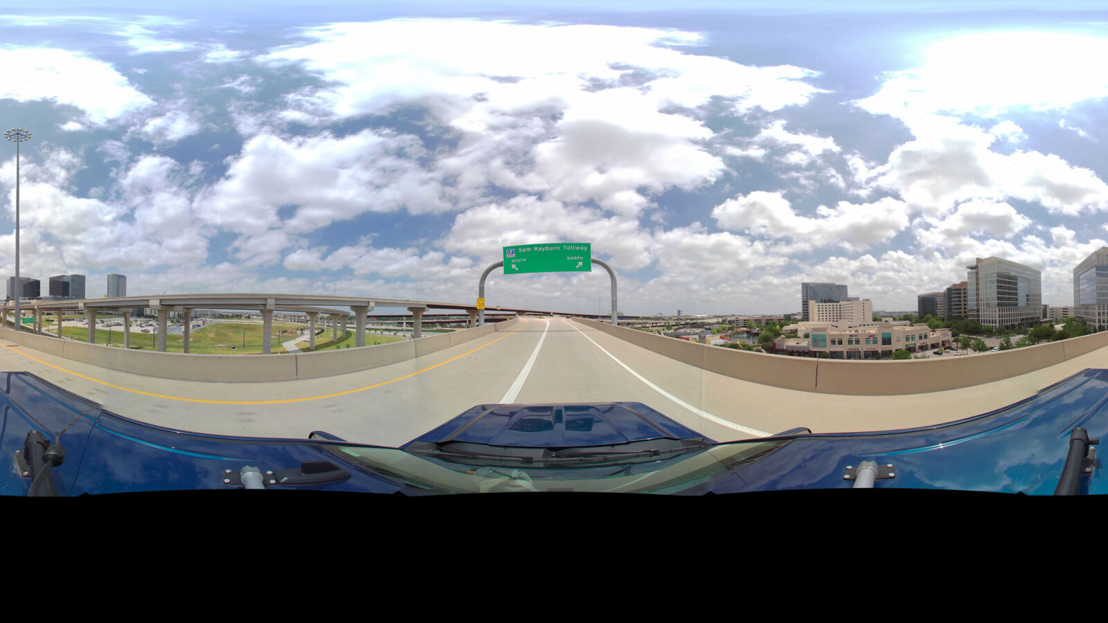
A local Texas engineering firm engaged with the WSB technology team to update a 5-year old sign inventory of the Sam Rayburn Tollway (SRT). This unique 16 mile stretch of road that needed to be inventoried in both directions and included multi-level stacked interchanges, frontage roads, approaches and all on/off ramps. WSB was tasked with capturing the locations of thousands of street signs along this busy and complicated segment of highway as quickly and accurately as possible.
Our WSB 360° team mounted our NCTech Pulsar+ camera and drove every road in the designated area capturing imagery of all roadways and signage. Using a map tracking system of our routes, we were able to post process and coordinate any necessary reshoots in a little over one week.
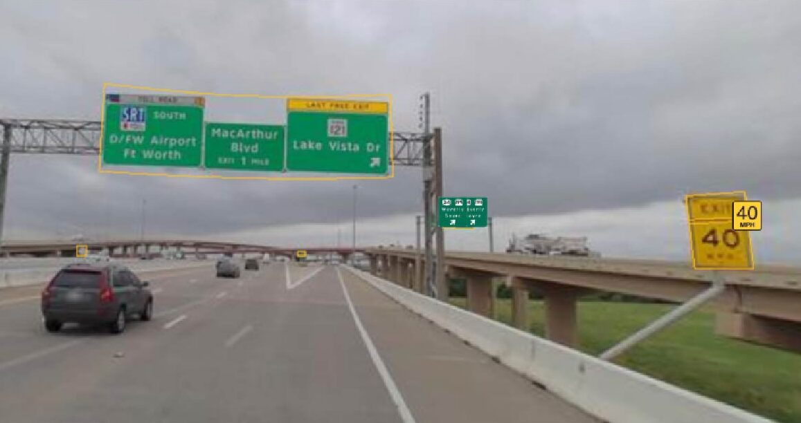
Once all the data was collected, we used an Artificial Intelligence (AI) sign detection and classification program to classify and map the locations of all signs in the area. The AI program used the high precision GNSS/GPS camera recordings to identify the location of the image captures and photogrammetry to document the signs distance. Based on the location, angle and distance data, the system can then accurately map all area signs.
The WSB 360° process allowed us to complete a project, that normally would take months, in 5 weeks with an unprecedented level of accuracy.
- Mapped over 3,000 signs
- Acquired more than 80,000 images
- Horizontal sign location accuracy within 3′ to 5′
- Each sign point contains the 11K high resolution image of the sign