Bad River Watershed-Wide Wetland Functional Assessment

Location

Ashland, WI

Expertise

Environment

Technology

Services

GIS Services

Natural Resources

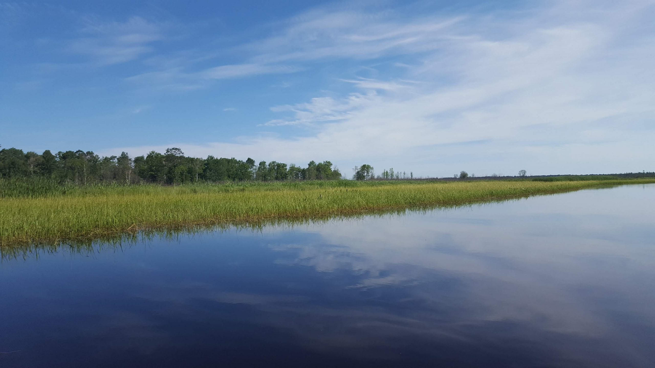
The Mashkiiziibii (Bad River Band of Lake Superior Chippewa) commissioned a project to develop a wetland functional assessment of all the wetland resource within eight priority subwatersheds in northern Wisconsin. WSB assessed over 26,000 acres of wetlands to better understand the role that each wetland played within the watershed. The assessment is being used to help guide protection and restoration opportunities within each watershed based on a watershed wide framework.

The Mashkiiziibii reservation is located on the southern shore of Lake Superior in northern Wisconsin and contains some of the most pristine wetlands in North America. The reservation’s conservation area contains almost 500 miles of rivers and streams, over 30,000 acres of wetlands, 38 miles of Lake Superior shoreline, and the Kakagon Sloughs. The Sloughs is an internationally designated Ramsar site. Ramsar sites are wetland sites designated to be of international ecological importance. The protection and maintenance of each wetland is crucial to the region’s precious ecosystem.

Understanding how each wetland functions is essential to understanding how to protect, restore, and manage it. WSB developed a specific methodology to assess the condition of each of the wetlands, rating them on the condition of the resource. For example, a wetland with an overpopulation of invasive species may receive a worse condition score.

WSB compiled the condition scores into a large database for tribal staff so they would have a quantitative analysis of their wetlands. The data will help guide species management, water quality sampling and studies, and flooding protection for the Tribal staff, all part of the crucial restoration and mitigation efforts to ensure the wetlands are functioning at a high level. Additionally, the methodology will save the Tribal staff time and money because they can now manage their own data.

Wetlands provide many functions, like serving as wildlife habitats and flood retention resources. Wetlands prevent flooding by temporarily storing and slowly releasing stormwater. The areas in and around the Bad River Band reservation experienced flooding in 2018. Interstate Highway 2, which connects much of northern Wisconsin, was washed out. WSB’s assessment provided insights as to how wetland resources may protect against future flooding events, by identified specific wetland basins that provide stormwater retention upstream of Highway 2.

Wetlands offer many benefits to communities when they are well taken care of.

Data from this project will also be used to site wetland mitigation under Section 404 of the Clean Water Act.

KEY HIGHLIGHTS OF THE PROJECT INCLUDE:

Inventory

Built an existing inventory of wetland locations (>15,000 sites) and associated attributes

Evaluation approach

Developed approach to evaluate wetland resources with respect to function and condition

Local knowledge

Integrated local tribal member knowledge to identify rare functions and restoration techniques

Explore more innovative projects.

The world inspires us to challenge the norm and create solutions that lead communities into the future.

Explore Other Projects