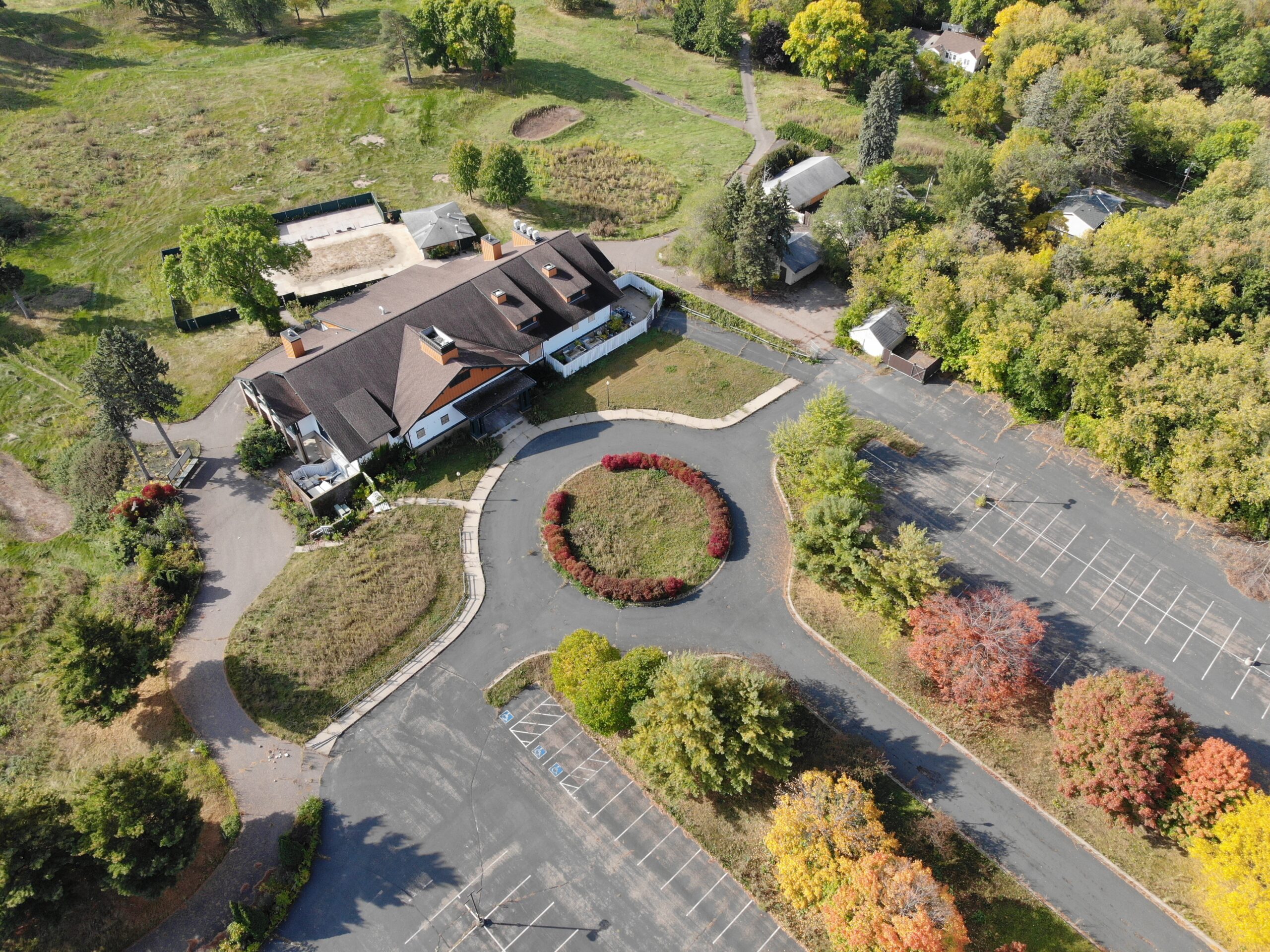
Hillcrest Golf Course Redevelopment

Location

St Paul, MN

Expertise

Community

Construction

Environment

Technology

Services

Contractor Modeling

Economic Development

Investigation & Remediation

Land Development

Visualizations

Water Resources Cameras

Minnesota zip code 55016 is believed to have more young people living in it than nearly any other zip code in the state. This presents an interesting challenge for St Paul’s East Side, how do they generate enough opportunities in the area to encourage these youths to continue living there as they get older and look for ways to support themselves. The Hillcrest Golf Course Redevelopment project is a plan to redevelop a 112-acre golf course in the area with the potential of creating nearly 1,000 jobs.

The project comes with a unique set of challenges. Hillcrest is a hilly area with property lines that include a narrow east-to-west dimension and a long north-to-south one that makes grading for modern, light industrial buildings difficult. The extensive hills include 900,000 cubic yards of soil that will need to be excavated, filled, and moved to properly grade the area. Decades of herbicide and pesticide use have contaminated the topsoil with mercury turning the property into a brownfield which comes with its own challenges. The contamination will need to be sequestered on-site or disposed of in a separate location off-site.

WSB created a 3-dimensional design model to help address technical challenges.
This type of model is helpful in several ways.

  • Allows different scenarios to be modeled quickly and accurately
  • Provides stakeholders with visualization tools, making the design process more collaborative
  • Supports quantity and cost calculations that inform local and state bonding requests
  • Puts the design on a path to full digital plan presentation

Digital models can be invaluable to these types of projects. Rather than the rounds of rounds of revisions that are often required when projects use paper plans, the digital solution expedites the process by allowing more collaboration and real-time adjustments. This approach allowed us to outline a more collaborative design and review process that included stakeholders earlier during the predesign phase. Our team used parametric design software for the rough grading and 3D modeling software for further refining before bringing it all together into Civil 3D to produce the final design. WSB’s innovative use of 3 different software together was instrumental to the success of this project and allowed the project to continue to move forward quickly and efficiently.

The project continues to progress, but to date we have been able to manage schedule and financial risk by leveraging the 3D modeling and involving stakeholders in the entire modeling process. We view this approach as the future of land development.

Explore more innovative projects.

The world inspires us to challenge the norm and create solutions that lead communities into the future.

Explore Other Projects