Projects
Guadalupe-Blanco River Authority – Enterprise GIS & Utility Network Modernization
Location:
Texas
Expertise:
Technology
Services:
GIS Services
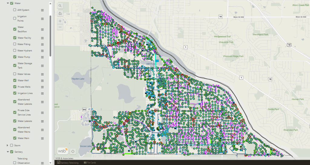
The Guadalupe-Blanco River Authority (GBRA), a regional water utility serving communities across Texas, partnered with WSB to support the continued development and modernization of its Enterprise GIS program. As GBRA expanded its use of GIS to support water infrastructure, land assets, and operational workflows, the agency sought an experienced partner to provide strategic guidance and technical expertise across its evolving Enterprise GIS environment. WSB has worked closely with GBRA to strengthen and expand its ArcGIS Enterprise platform. Early efforts focused on infrastructure planning and migration support as GBRA relocated offices and transitioned its server environment. WSB assisted with planning and implementing improvements to the ArcGIS Enterprise deployment, evaluating server architecture options, and configuring monitoring tools to ensure system reliability and performance.
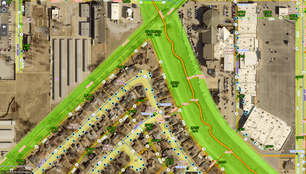
As part of GBRA’s long-term GIS modernization strategy, WSB has also supported the Authority’s transition toward Esri’s Utility Network framework. This work includes planning and technical guidance for migrating linear infrastructure assets into the Utility Network data model and implementing a phased approach to deployment across GBRA’s various standalone utility systems. In addition to Enterprise GIS infrastructure improvements, WSB has helped GBRA improve its data workflows and integrations with other enterprise systems. This includes implementing and optimizing automated workflows using tools such as FME and supporting integrations with business platforms including Microsoft 365 applications, asset management systems, records management systems, and billing platforms. These integrations enable GBRA staff to access and analyze operational data within a geographic context to support planning, engineering, and operational decision-making.
WSB has also assisted GBRA with GIS application development, field data collection workflows, and enhancements to ArcGIS tools such as Field Maps to support field operations staff. Through this work, GBRA has been able to improve the accessibility and usability of GIS data across departments.